


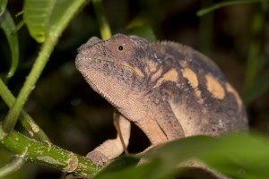
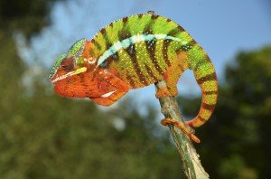
Distribution of the local form Ankarana East
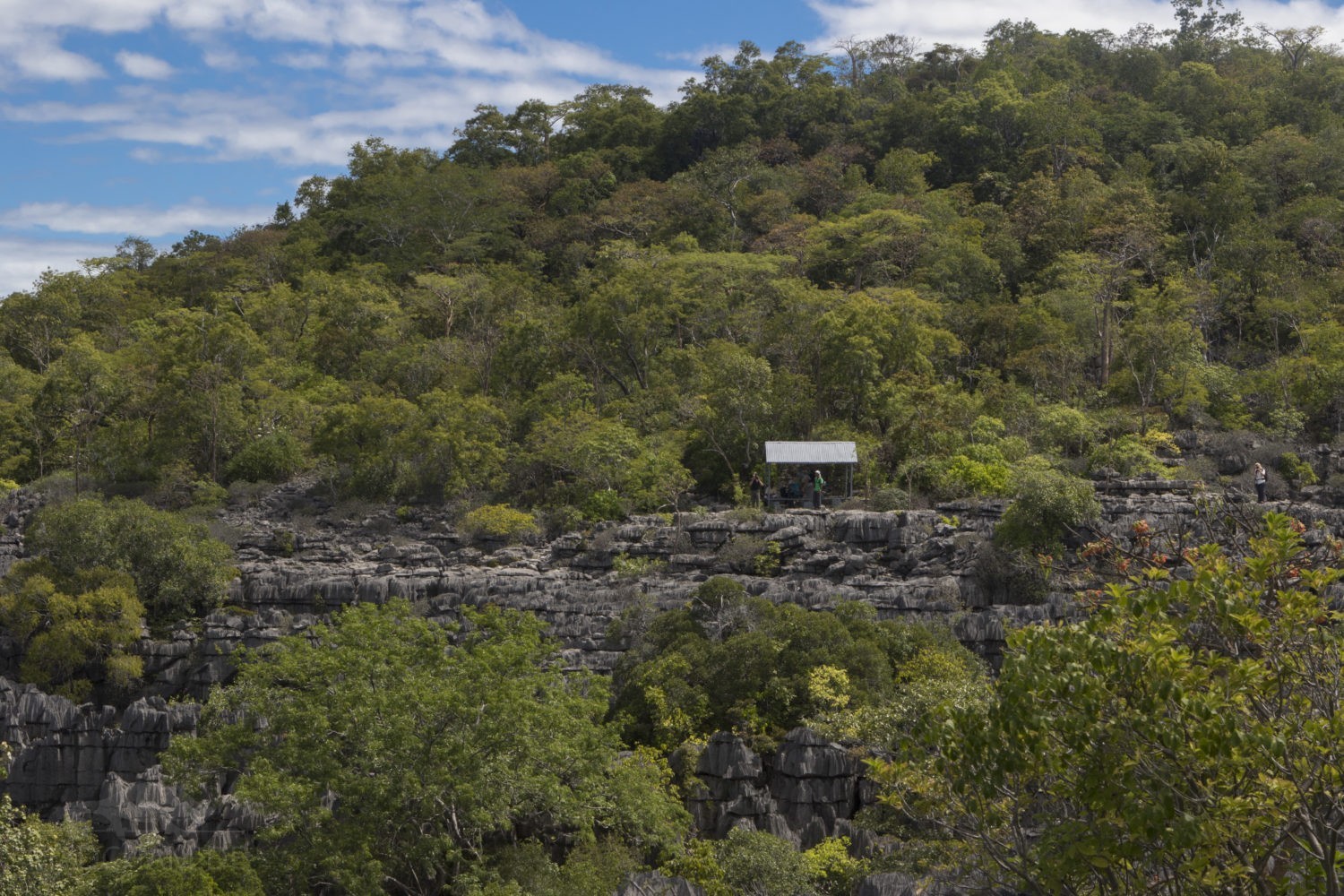
The Ankarana National Park is located in the northwest of Madagascar in the Diana region. By the Tsingys, an impressive needle rock formation, the National Park is divided into two large areas: The east and the west, each with extensive dry forests and small oasis-like forest areas within the Tsingys themselves. Ankarana is now almost entirely surrounded by savannah-like vegetation, in which panther chameleons are hardly ever seen. In the south of Ankarana, the local form of the local panther chameleons is additionally separated by the river Mananjeba from local forms occurring further south. The entrance to the eastern part of Ankarana National Park is located directly on the RN6 in the village of Mahamasina. To find panther chameleons here is very much dependent on the season. During the rainy season, the animals can be found here in secondary vegetation around the hut village as well as in the dry forest itself.
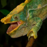
Appearance of the local form:
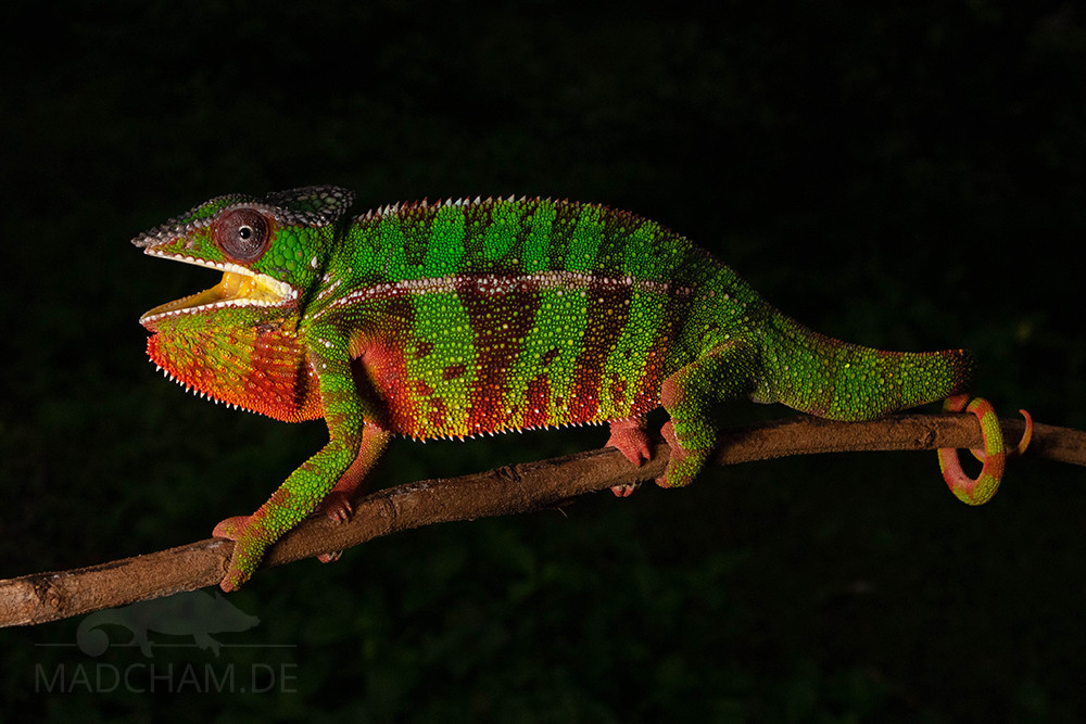
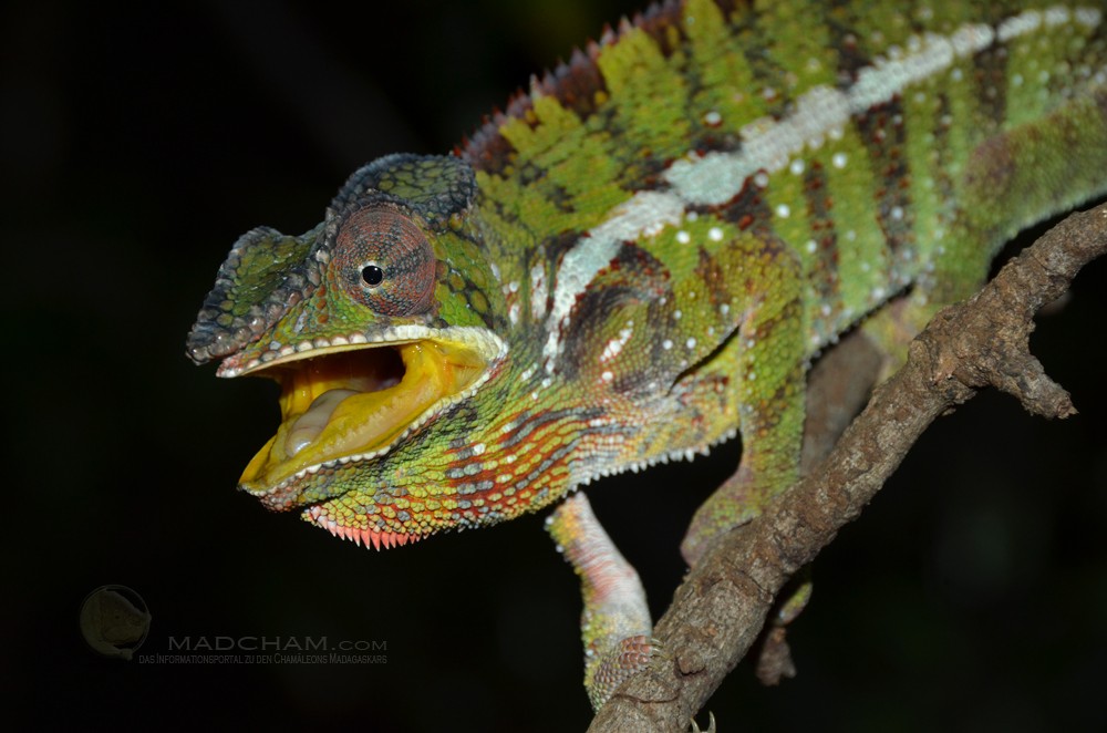
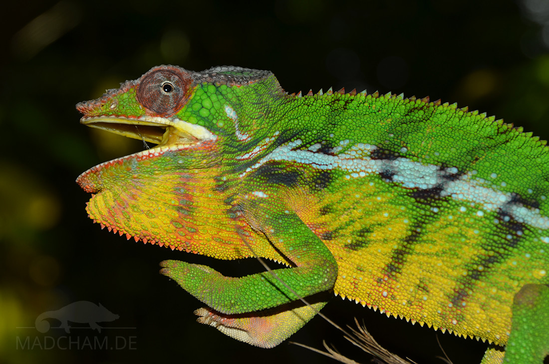
The males of the panther chameleons here usually wear a simple green color dress with dark banding. The eyelids are always red. Under stress, the animals can sometimes show a lot of yellow. Some recently found panther chameleons of this local form also show red markings on arms, legs, and belly.
Weight table
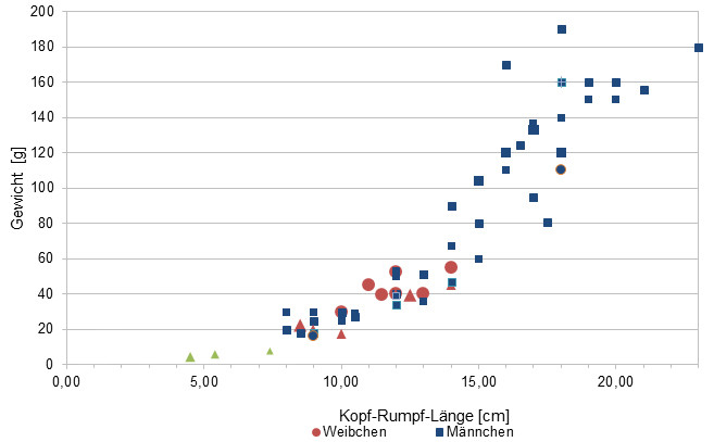
Gewicht = weight in grams, Kopf-Rumpf-Länge = snout-vent-length in cm, Weibchen = females, Männchen = males
Since 2015 we have been measuring the weights of chameleons we have found in Madagascar, as far as the animals (and our scales) are participating. In the long term, an average weight in relation to snout-vent-length (measured from the tip of the nose to the cloaca) for each species should be readable from as many measurements as possible. It is important to know that all weights were measured towards the end of the rainy season (= best food supply), so they are probably maximum weights in Madagascar. Triangular symbols in females do not mean pregnant, round symbols mean pregnant. In the case of Furcifer pardalis, contrary to our original assumption, there have been no serious differences in the ratio of SVL to the weight of the individual local forms.
| Jan | Feb | Mar | Apr | May | Jun | Jul | Aug | Sep | Oct | Nov | Dec | |
| Average temperature | 25 | 25 | 24 | 23 | 20 | 19 | 18 | 19 | 20 | 22 | 23 | 24 |
| Minimum temperature | 21 | 20 | 20 | 19 | 16 | 14 | 14 | 14 | 15 | 17 | 19 | 20 |
| Maximum temperature | 30 | 29 | 28 | 27 | 26 | 24 | 23 | 24 | 25 | 27 | 28 | 29 |
| Rain days | 26 | 24 | 21 | 12 | 8 | 7 | 9 | 9 | 7 | 9 | 13 | 20 |
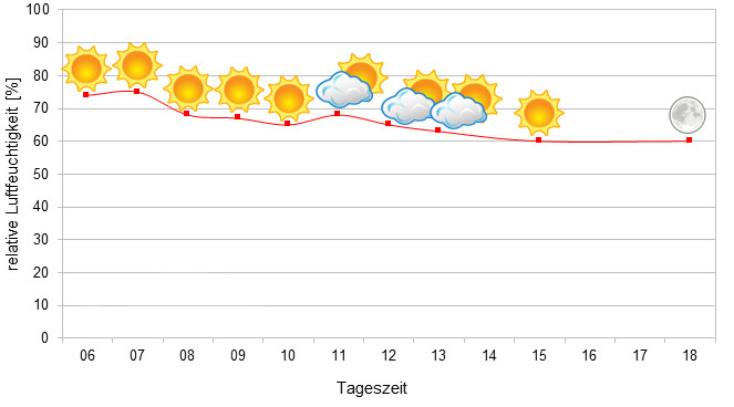
We have collected the data given above over several years with thermometers and hygrometers at the finding places of the chameleons. "Average temperature" means that values of a whole month have been calculated to one average value per month. For example all measured minimum temperature values of February have been calculated to one average minimum temperature for February. In plain language, this means single peak values of a day may be a little higher or lower than the average minimum and maximum temperatures. It is possible that a location has an average maximum temperature of 29°C, but one day during that month it had 33°C or even 35°C there.
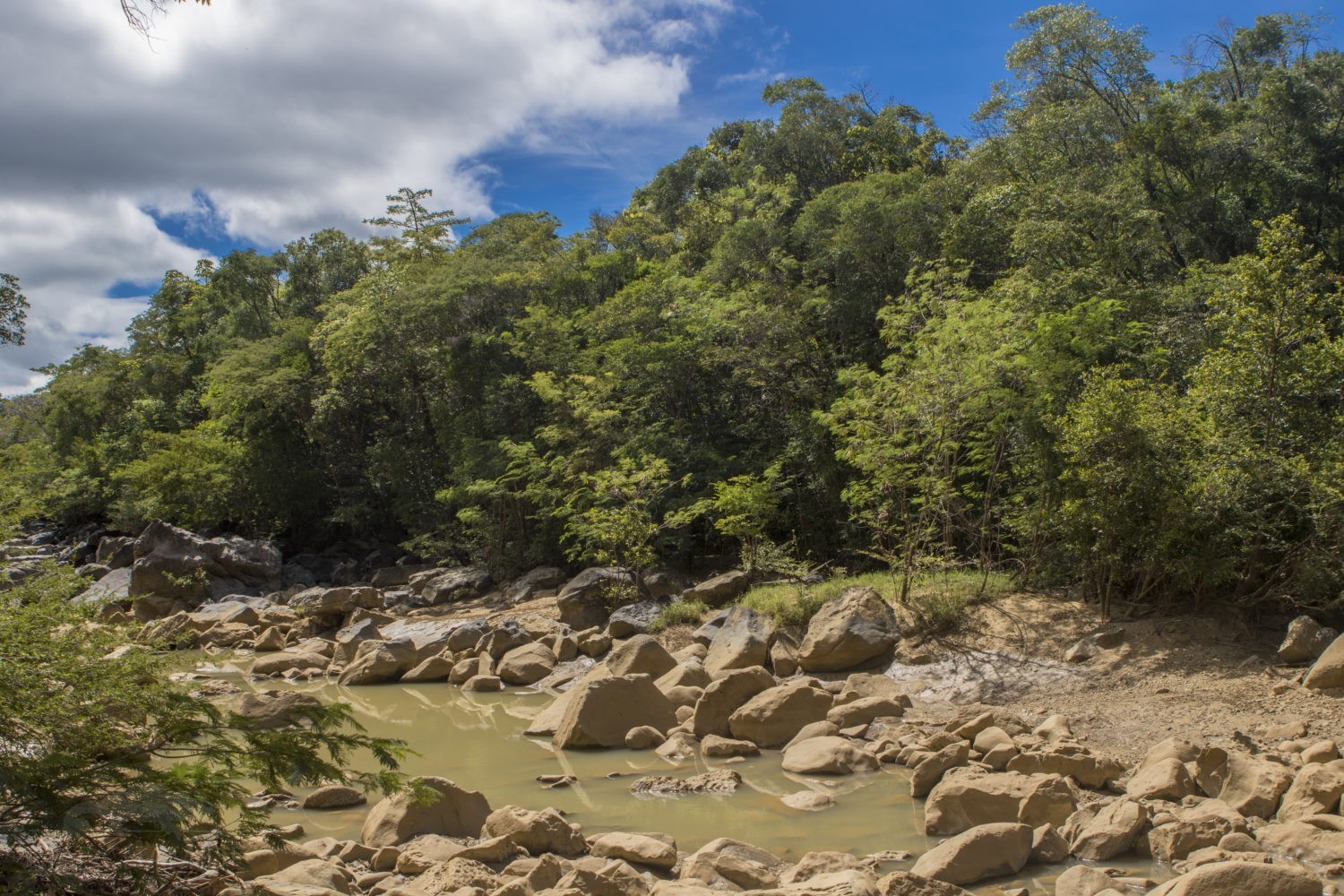
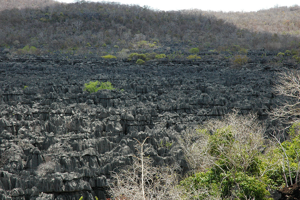
Ankarana is a dry forest divided in two halfs by the famous Tsingys, needle stone rocks. Inside the dry forest, it is very warm during daytime all year long. During rainy season from October to April, temperatures above 30°C are rather usual and it often rains.
During dry season from May to September days are a little cooler, but still very warm. At night, temperatures don't really drop in rainy season, but in dry season temperatures drop to 15°C at night. Dry season, by the way, means really dry in Ankarana: The major part of the trees looses its leaves and there is few precipitation only every couple of days. The rivers that have been torrentially in rainy season, dry up completely only leaving the bare stony river beds.
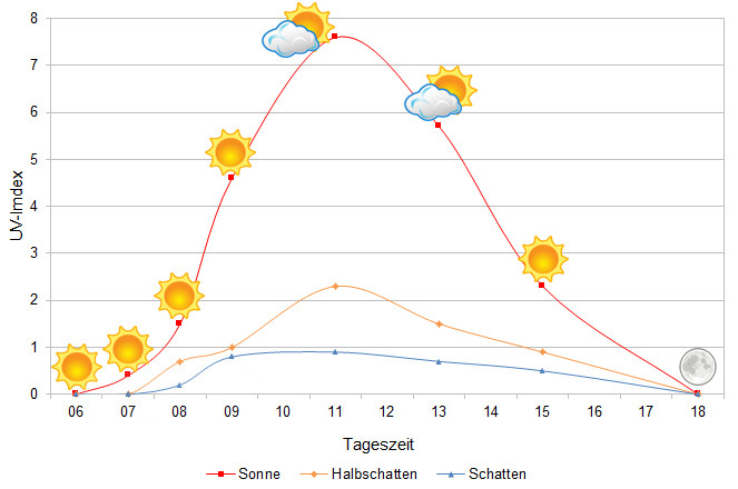
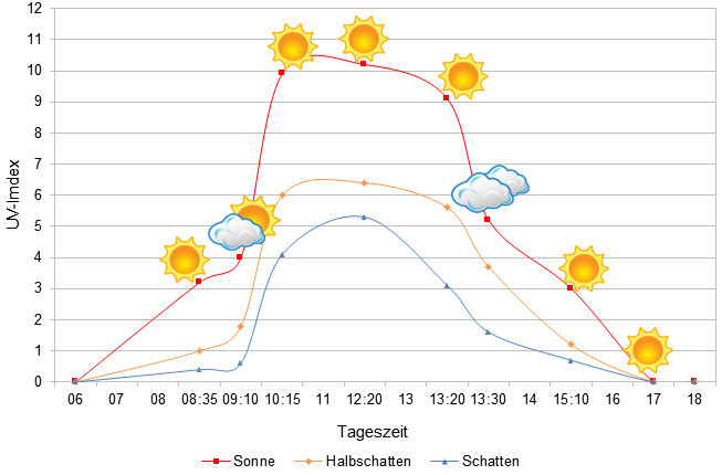
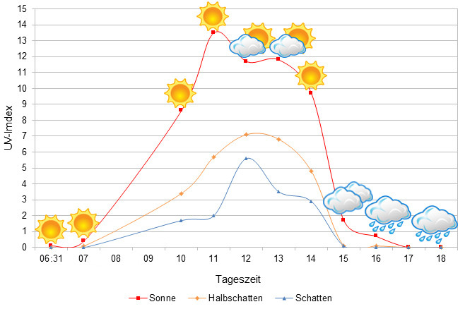
We have measured UVB data with a Solarmeter 6.5 in spring (beginning of April) at the peak of activity of chameleons in Madagascar. We always measured the values that a chameleon could maximally reach in its habitat.
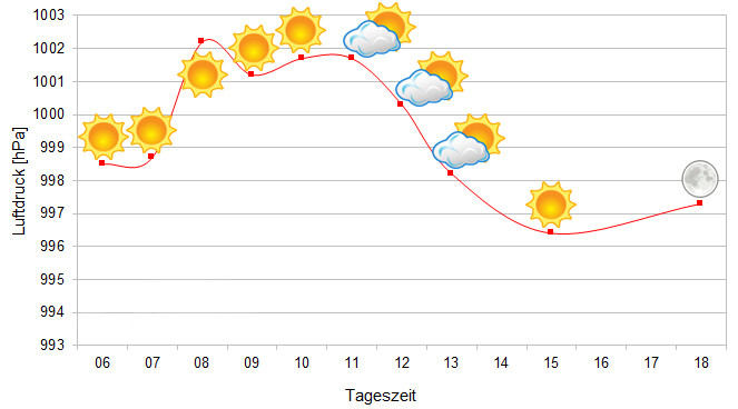
Since 2022, in addition to other climate data, we have also been measuring air pressure at the locations we visit in Madagascar. The following data is from a day during the rainy season. On the X-axis is the time of day or night. In Madagascar, the day begins around 6 am, and night falls as early as 6 pm. The Y-axis shows the atmospheric pressure in hPa.
Habitat:
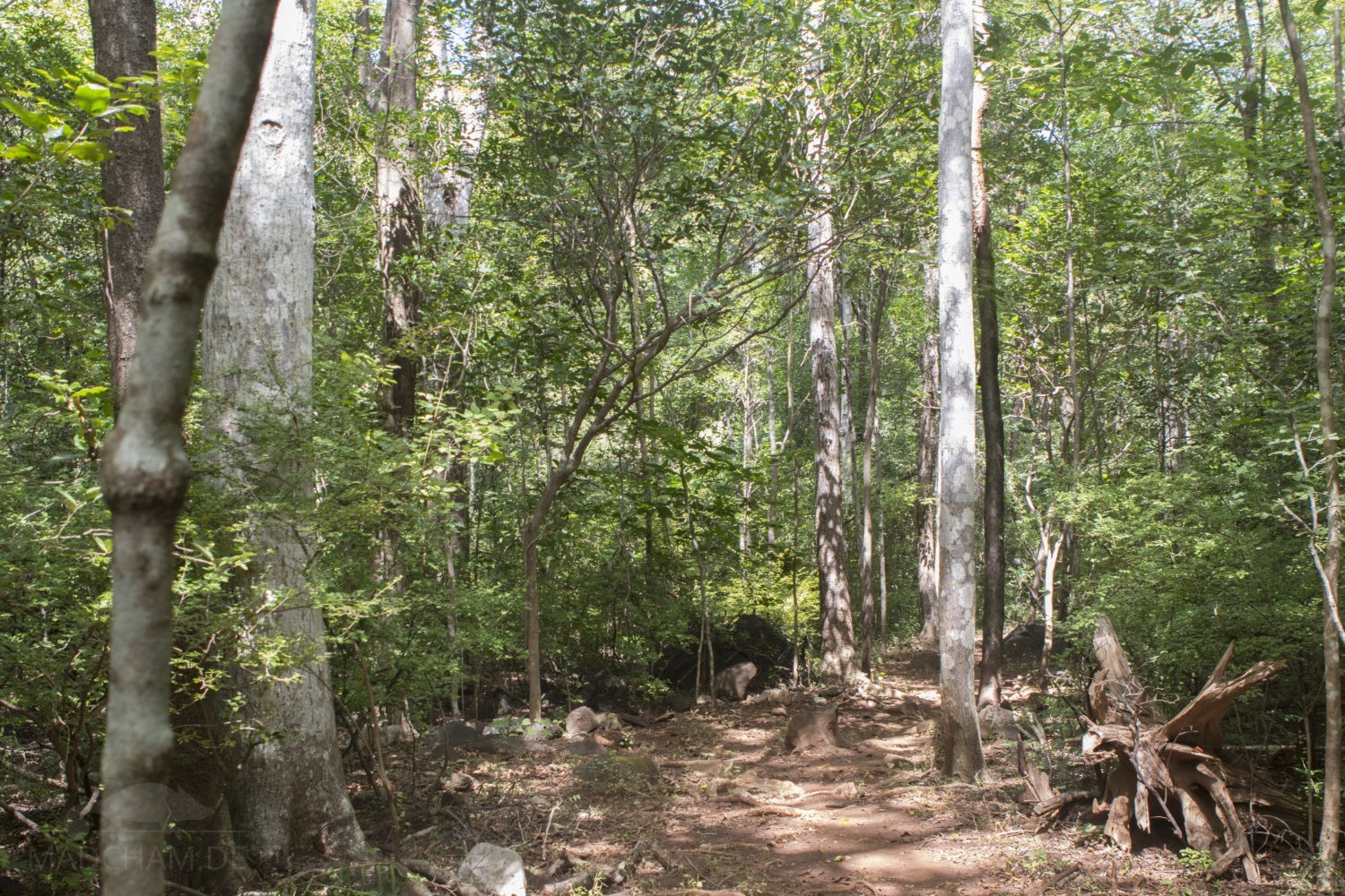
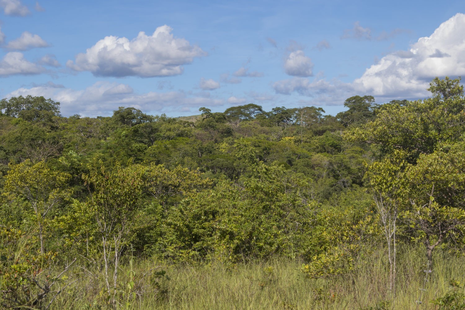
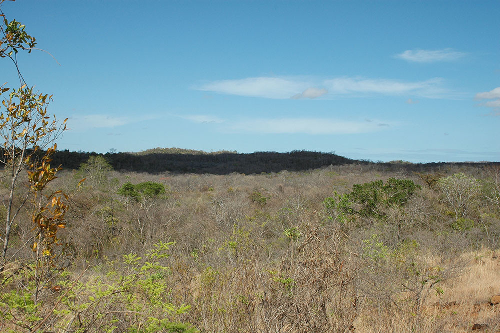
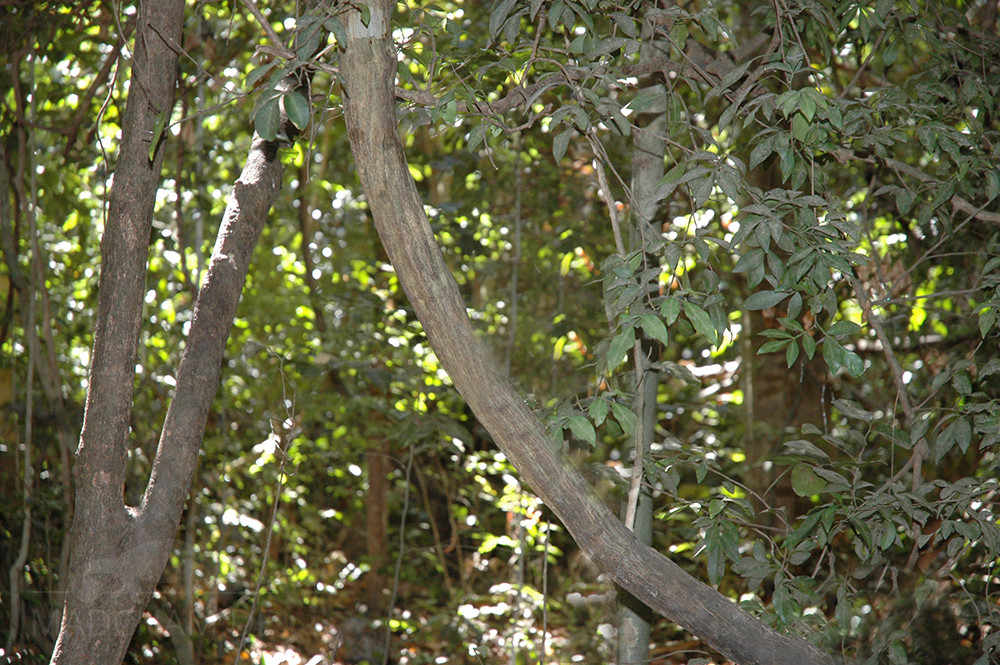
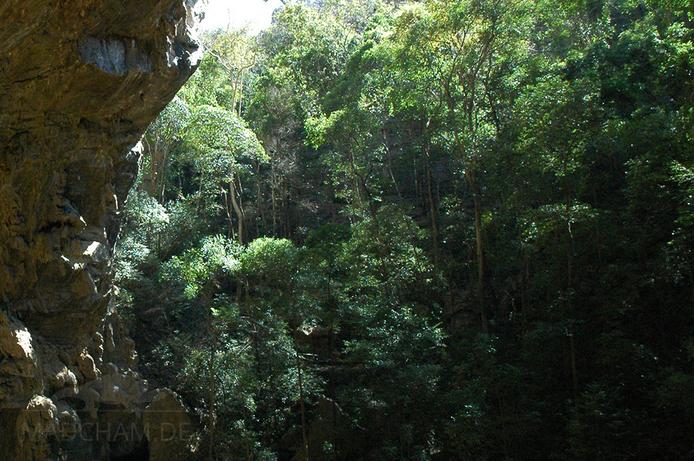
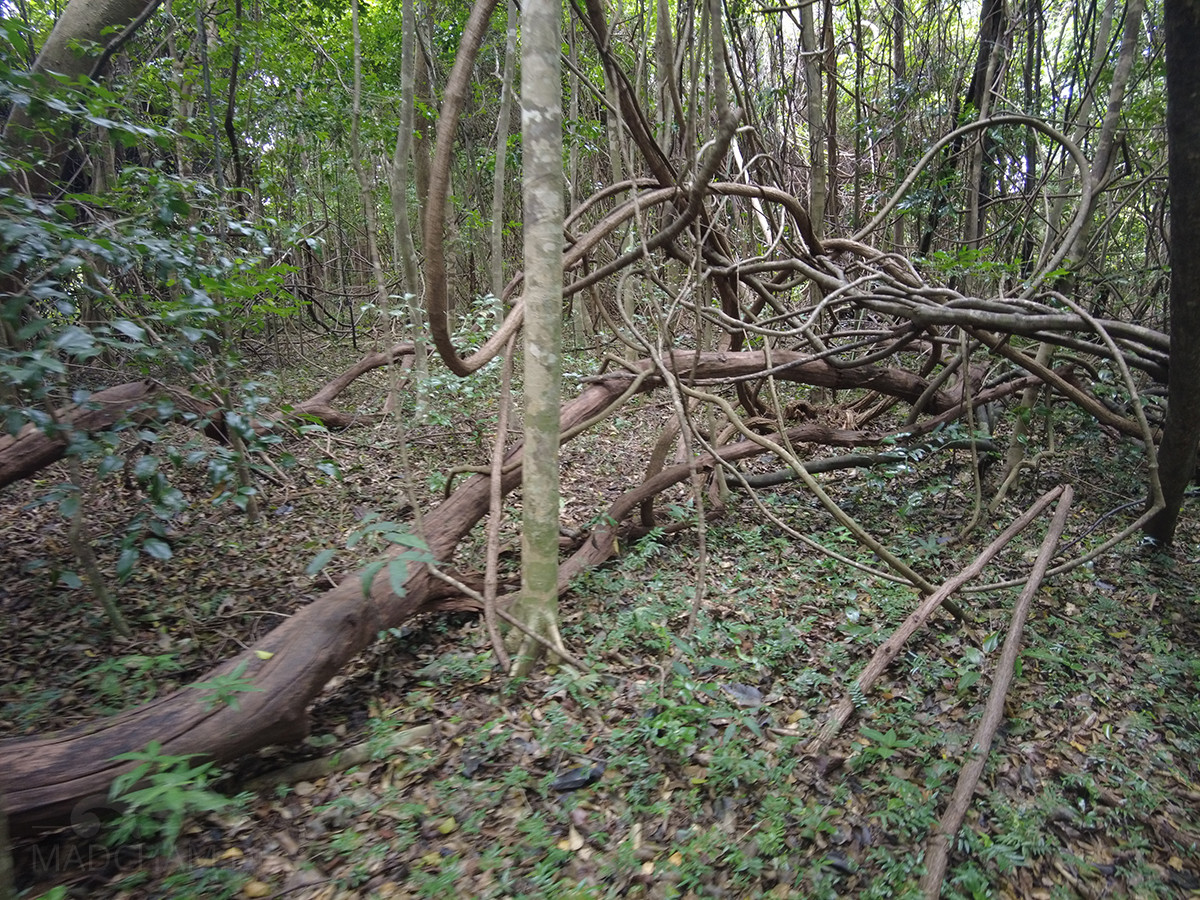
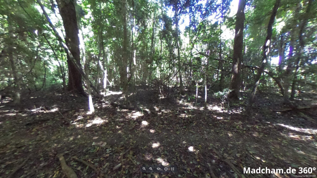
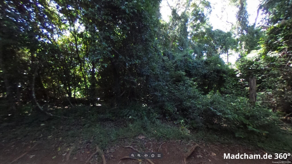
The habitat of panther chameleons here consists of old dry forest with huge trees and very much dense undergrowth. The sandy-laterite soil is covered by foliage. Shrubs consist of endless extremely twined plants that make it difficult to catch sight of an animal inside. Sometimes, panther chameleons come close to the edge of the Tsingys. The following photos show the habitat during the rainy season when everything is green and blooming, but also during the dry season when the fauna almost completely lacks a drop of humidity.
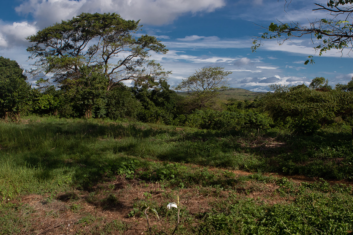
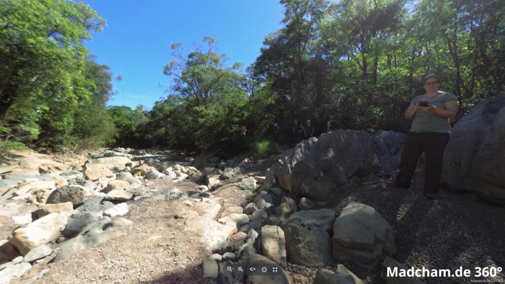
Below you will find some 360° pictures from the dry forest of Ankarana, which we took during the rainy season. If you click on the respective image, the pictures will open in an enlarged view in a separate window. You can use the mouse to rotate in all directions. You also have the option of running the images in full-screen mode. Have fun looking at them!


Das könnte dir auch gefallen


Follow us on Instagram

Most popular articles


Your travel specialist for Madagascar