

Distribution of the local form Nosy Faly:
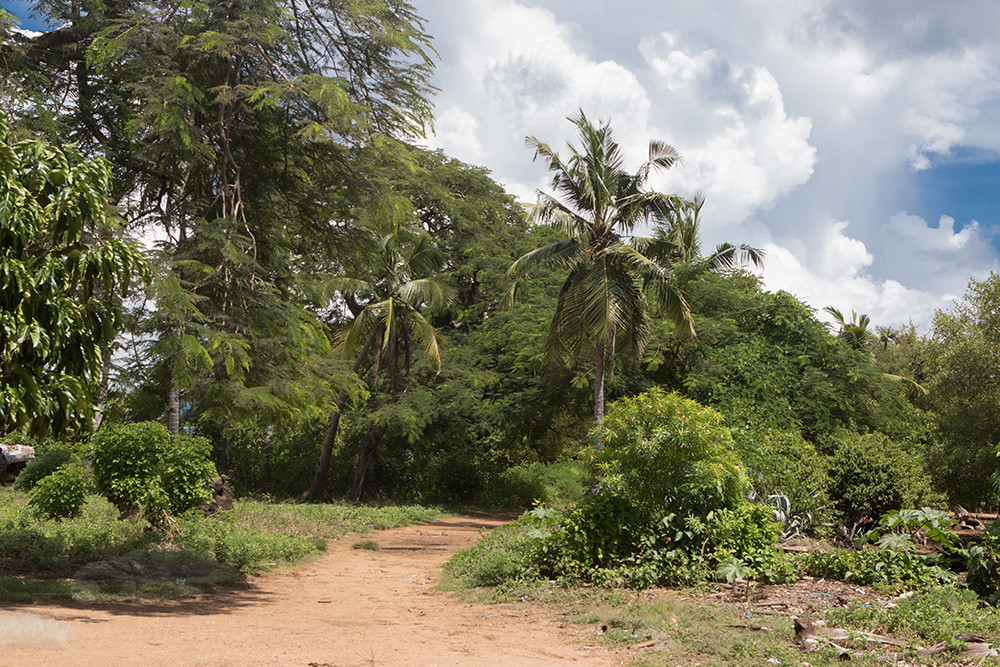
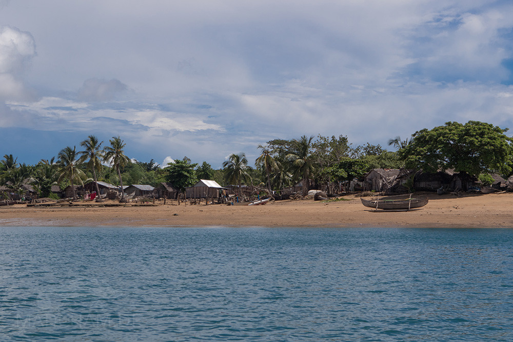
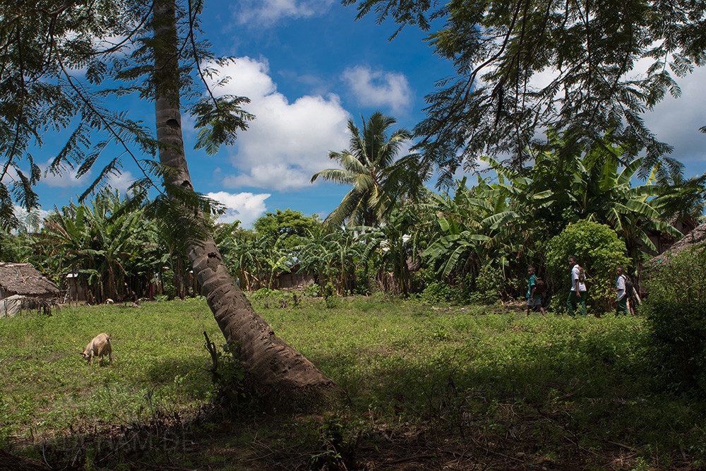
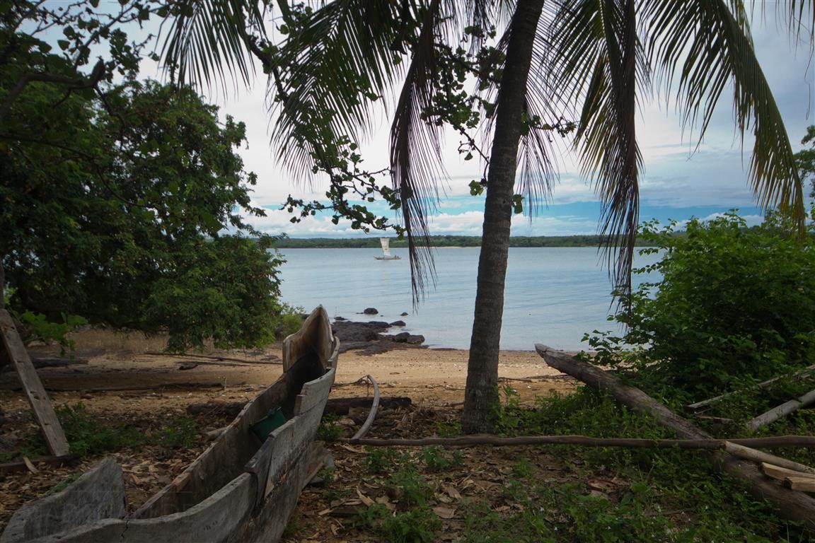
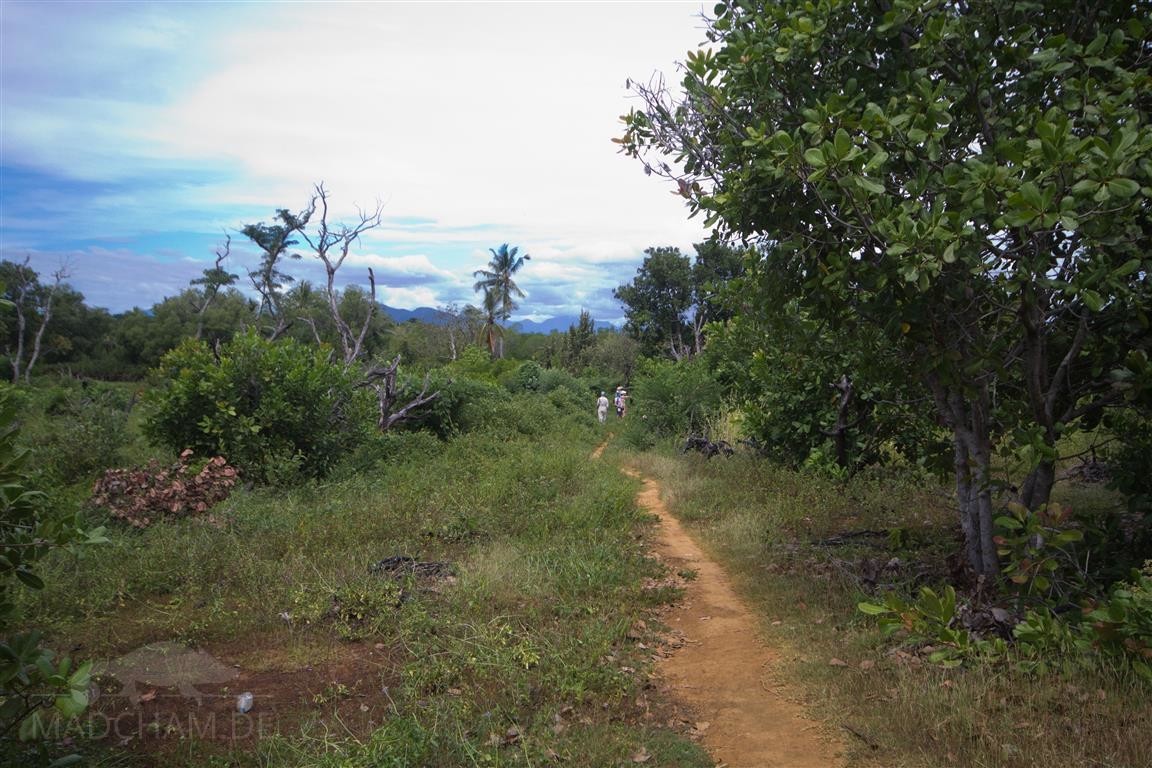
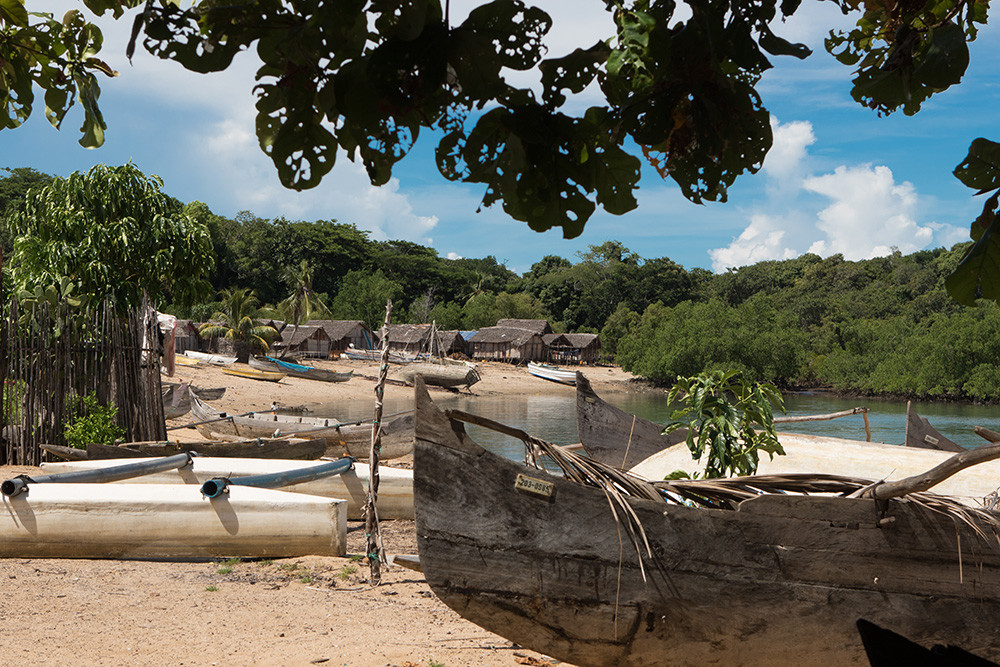
Nosy Faly (translated “happy island”) is situated in the Channel of Mozambique in northwest Madagascar. Actually, it is a peninsula of Diana region, that has contact with the onshore in one small place (it is used as 200 m broad ford). Nevertheless, the island is comfortably only reachable via the sea from Ankify or the surrounding islands. You usually arrive at the only village on the island, Mahambo. People here solely live from fishing and are extremely poor. Nosy Faly itself has small savannahs, steep beaches, much secondary vegetation, and even mangroves. Due to consistent deforestation (especially for wood) almost nothing of the original vegetation is left on the island. Touristically, the island is virtually no man’s land. Since 2015 there is only one small hotel on Nosy Faly.
Appearance of the local form:
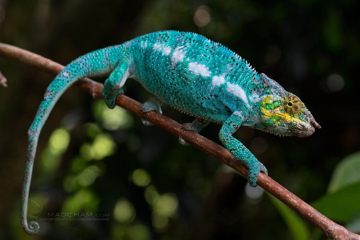
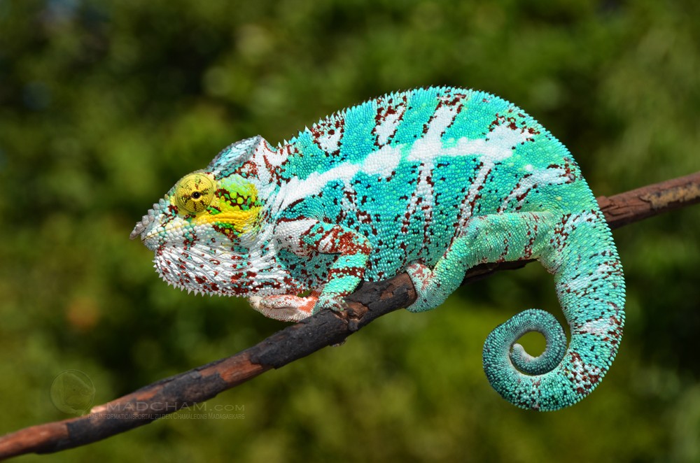
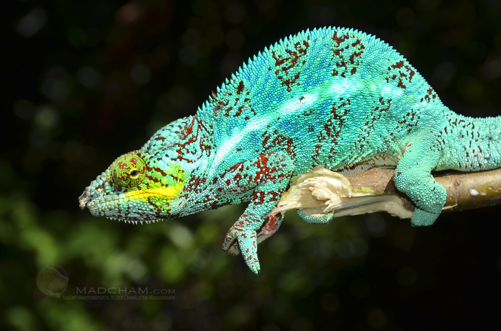
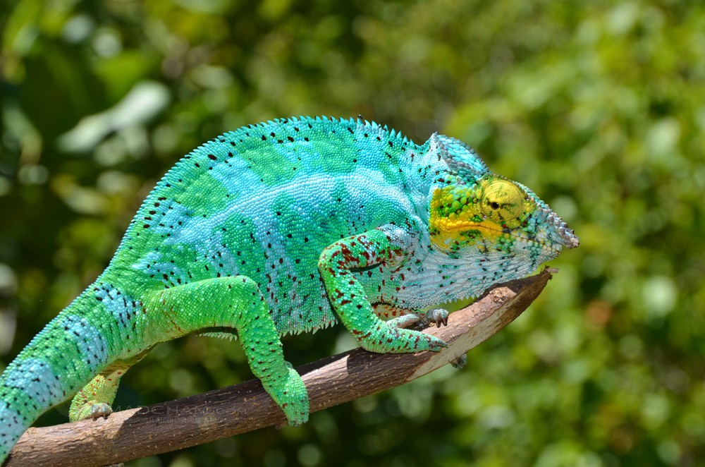
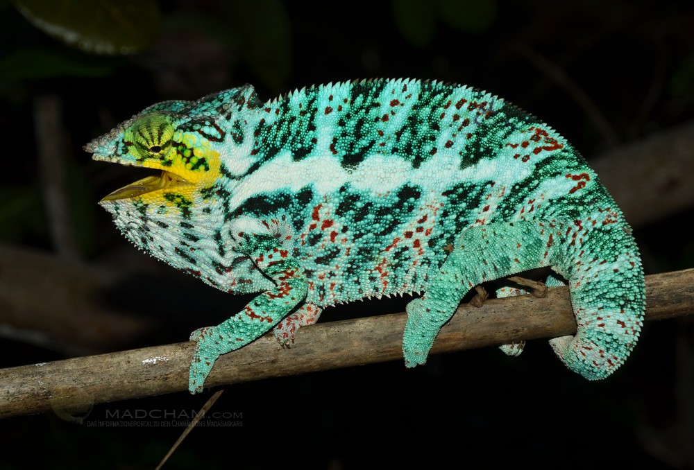
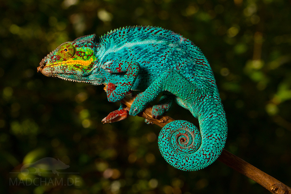
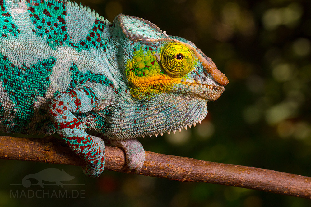
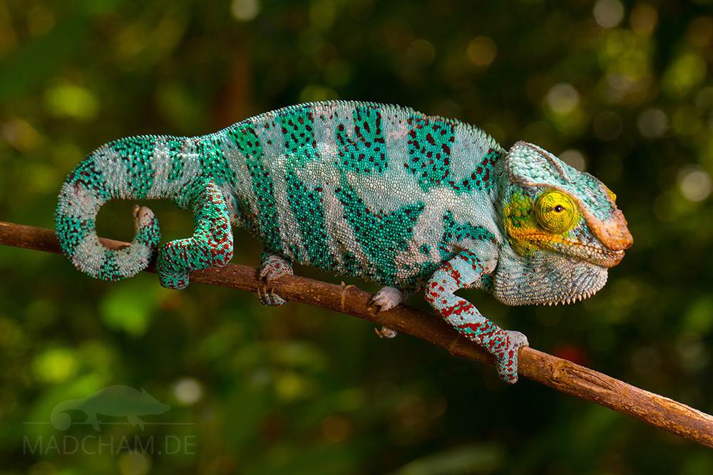
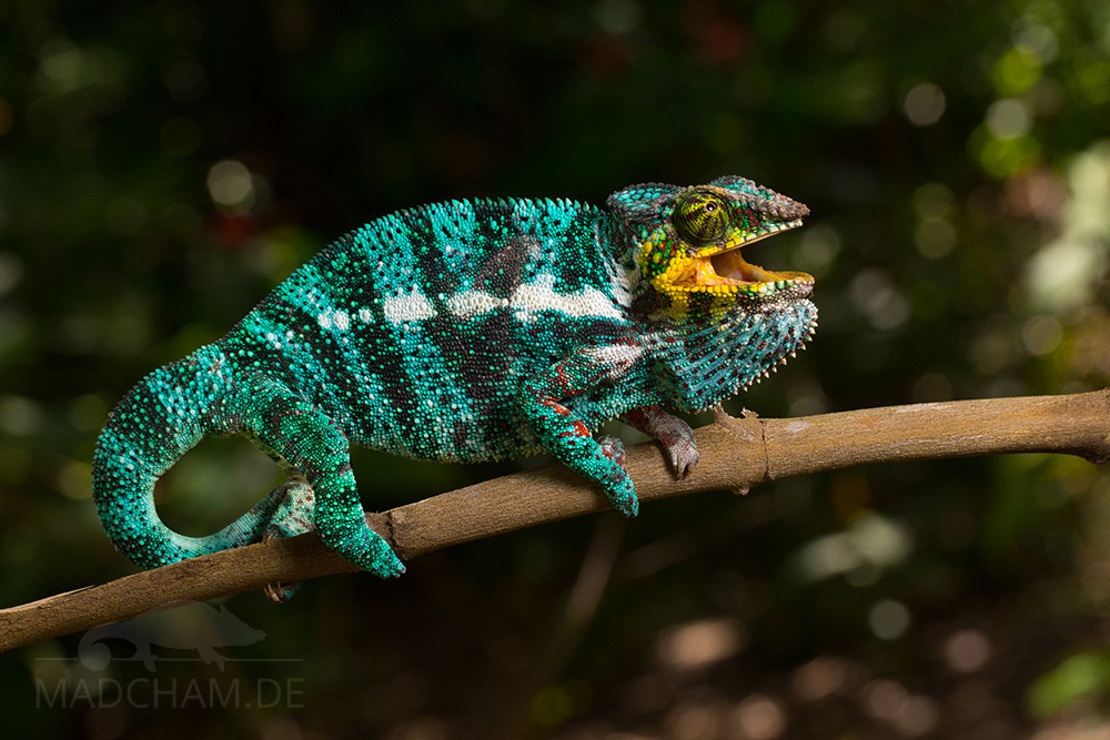
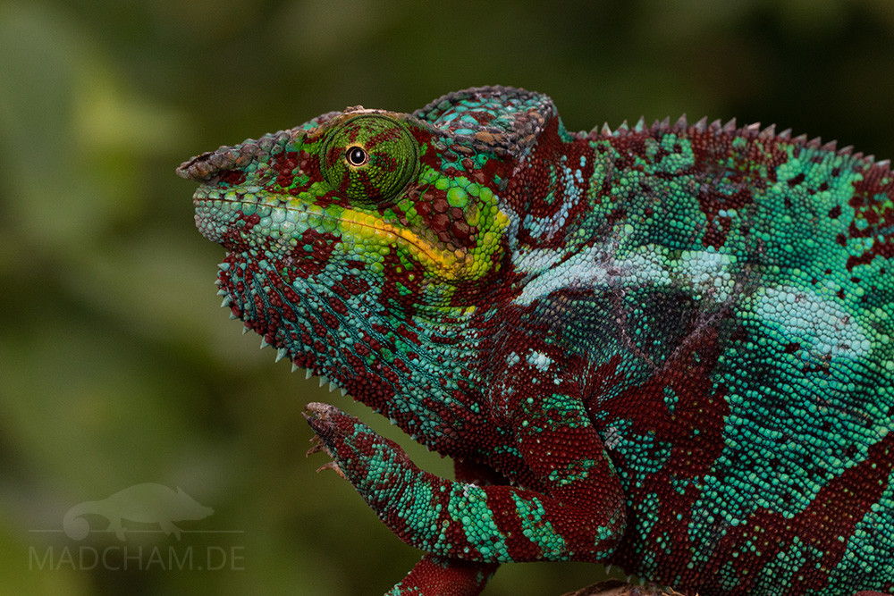
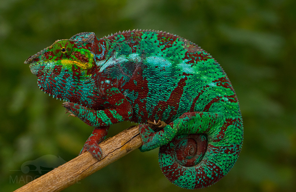
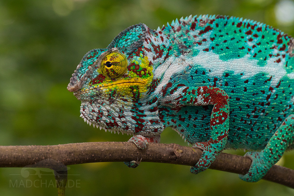
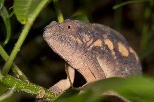
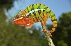
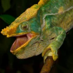
The panther chameleons of Nosy Faly are well known in terraristics and belong to the most exported local forms. The males here are turquoise green or blue with red dotted bands and yellow corners of the mouth. Some males carry a lot of white under the red dots, others barely white, but a very intense red banding. The animals with a particularly high proportion of white are most frequently found in terrariums, as most people find them more attractive than the darker colored island variant – they are therefore collected preferentially for export. Nevertheless, Nosy Faly not only had and still has panther chameleons with a lot of white.
Weight table
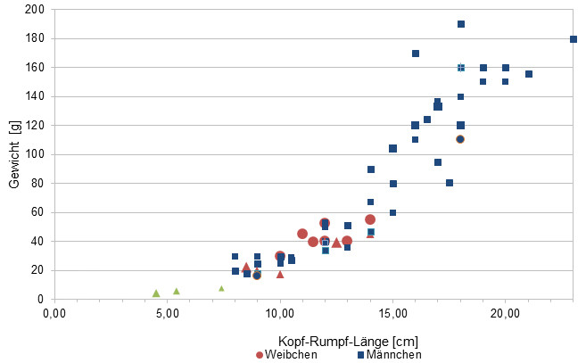
Gewicht = weight in grams, Kopf-Rumpf-Länge = snout-vent-length in cm, Weibchen = females, Männchen = males
Since 2015, we have been measuring the weights of chameleons found by us in Madagascar, as far as the animals (and our scales) participate. In the long term, we aim to obtain an average weight in relation to snout-vent-length (measured from the tip of the nose to the cloaca) for each species from as many measurements as possible. It is important to know that all weights were measured towards the end of the rainy season (= best food supply), so these should be maximum weights on Madagascar. Triangular symbols in females mean not pregnant, round symbols mean pregnant. In Furcifer pardalis, contrary to our original assumption, it has so far turned out that there are no serious differences in the ratio of SVL to weight between the individual local forms.
| Jan | Feb | Mar | Apr | May | Jun | Jul | Aug | Sep | Oct | Nov | Dec | |
| Average temperature | 27 | 27 | 27 | 26 | 25 | 24 | 24 | 25 | 25 | 26 | 27 | 27 |
| Minimum temperature | 23 | 23 | 24 | 23 | 22 | 20 | 20 | 19 | 20 | 22 | 23 | 23 |
| Maximum temperature | 31 | 31 | 31 | 31 | 31 | 29 | 29 | 29 | 30 | 31 | 31 | 31 |
| Rain days | 21 | 19 | 17 | 12 | 8 | 8 | 8 | 8 | 7 | 8 | 11 | 17 |
We have collected the data given above over several years with thermometers and hygrometers at the finding places of the chameleons. "Average temperature" means that values of a whole month have been calculated to one average value per month. For example all measured minimum temperature values of February have been calculated to one average minimum temperature for February. In plain language, this means single peak values of a day may be a little higher or lower than the average minimum and maximum temperatures. It is possible that a location has an average maximum temperature of 29°C, but one day during that month it had 33°C or even 35°C there.
Climate on the islands in front of Madagascar's north west coast is very warm all year long. Temperatures over 30°C are usual. In the night, temperatures hardly drop below 25°C, during rainy season they may drop much lower until 19°C.
Durin rainy season, it rains a lot and very often. From April to October, climate is mainly dry and sunny on the islands, but it still rains shortly on a regular base.
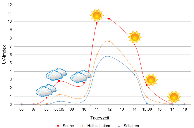
We have measured UVB data with a Solarmeter 6.5 in spring (end of March) at the peak of activity of chameleons in Madagascar. We always measured the values that a chameleon could maximally reach in its habitat.
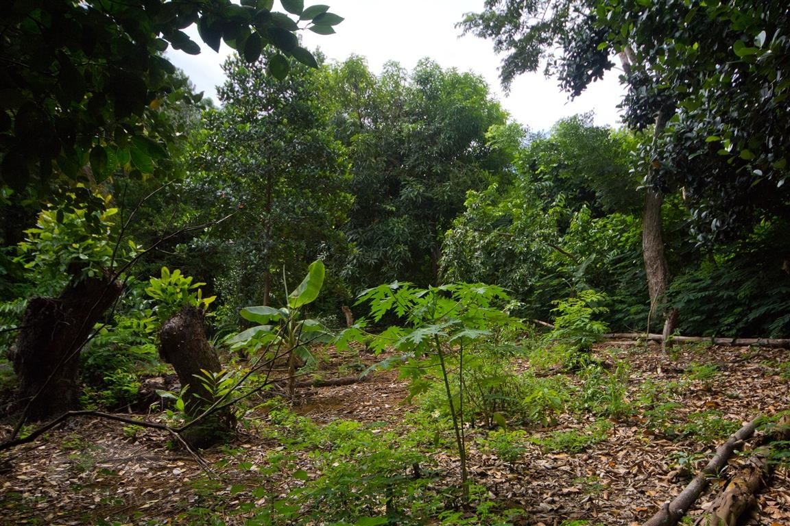
Habitat:
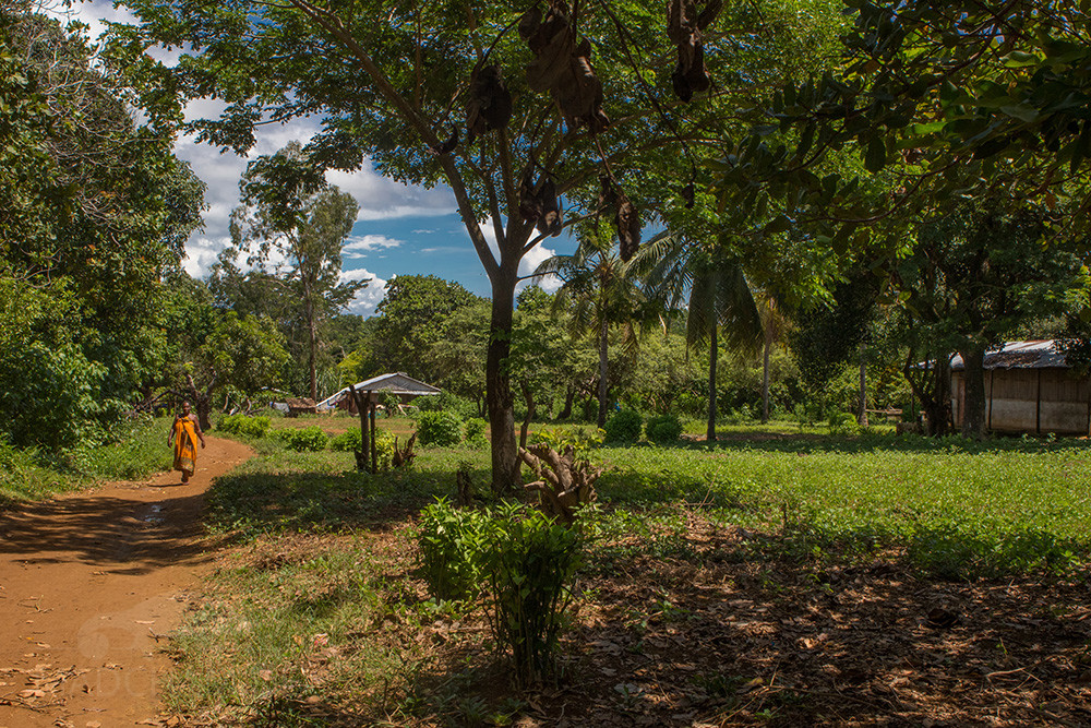
The panther chameleons here live in the remaining trees, shrubs and bushes of the island that have not yet been cleared. Actually, they use every tree that is available and are not very choosy. The soil of Nosy Faly is very sandy, but also earthy and loamy in places.
Below you will find some 360° images of Nosy Faly that we took during the rainy season. All images are from locations where this local form is found. If you click on the respective image, the pictures will open in an enlarged view in a separate window. You can use the mouse to rotate in all directions. It is also possible to view the images in full-screen mode. Have fun looking at them!


Das könnte dir auch gefallen


Follow us on Instagram

Most popular articles


Your travel specialist for Madagascar