
no legal export possible
First description:
Scherz, Köhler, Rakotoarison, Glaw and Vences, 2019 ![]()
Origin of the species name:
Mark D. Scherz and Frank Glaw from the State Zoological Collection Munich (Germany), Jörn Köhler from the Hessisches Landesmuseum Darmstadt (Germany), Miguel Vences from the Zoological Institute of the TU Braunschweig (Germany) and Andolalao Rakotoarison from the University of Antananarivo (Madagascar) named this species after the herpetologist Ted M. Townsend from the University of San Diego (USA). Townsend has already contributed to several scientific publications about Brookesia.
Distribution:
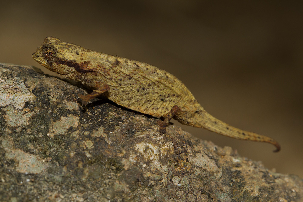
Brookesia tedi occurs sympatrically with Brookesia karchei in Marojejy national park in the northeast of Madagascar. It lives similar to its larger relative at tree roots, in foliage and near mossy stones on the ground. We were able to find Brookesia tedi between Camp Marojejya and Camp Simpona before its actual description. The animals don’t occur lower than 1200 m.
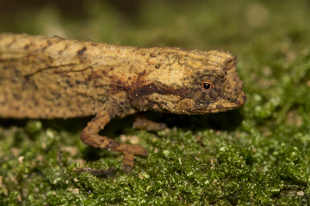
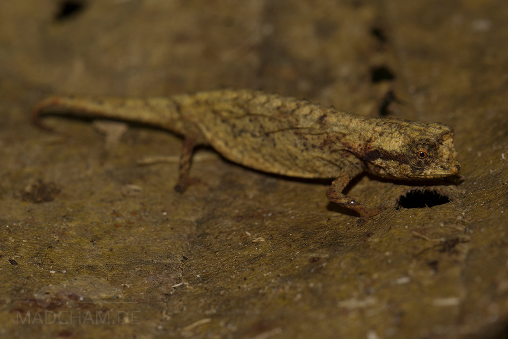
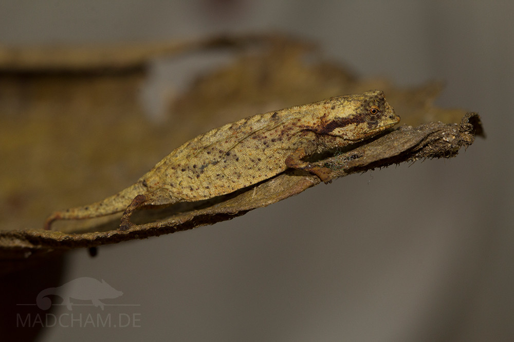
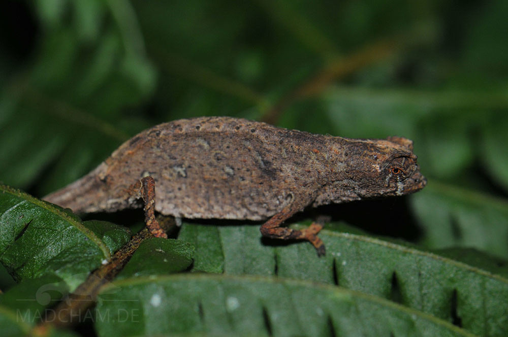
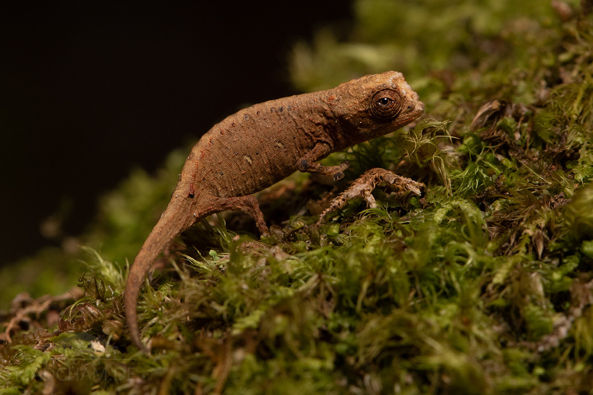
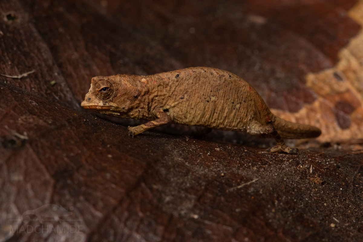
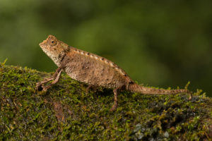
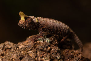
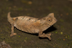
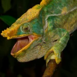
Appearance & size:
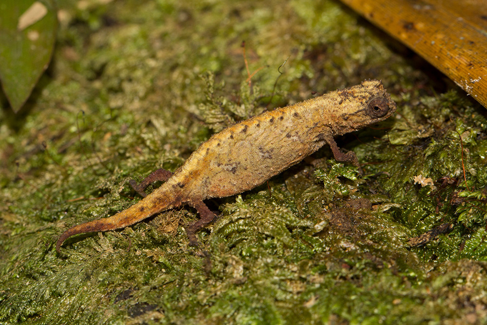
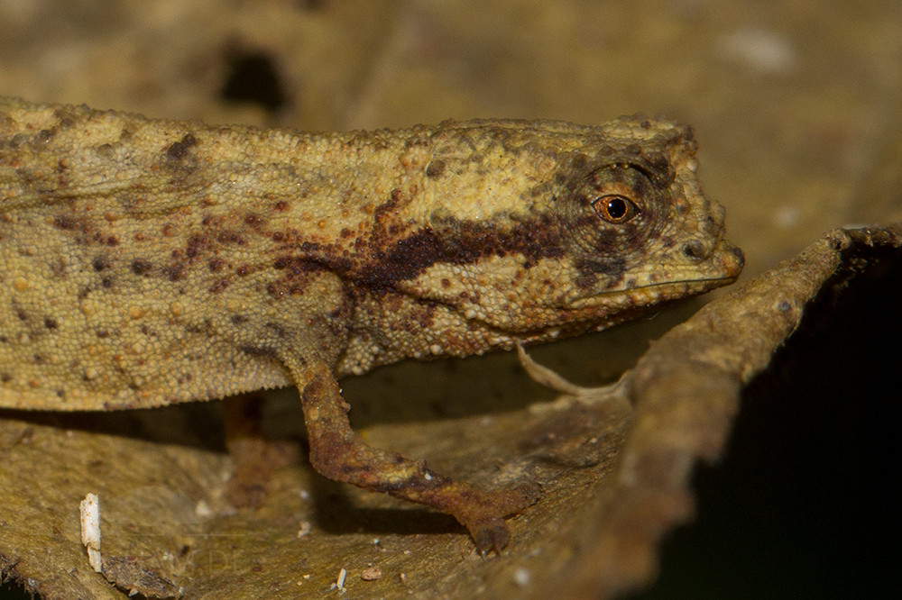
This species remains very small with a total length of just 30 mm. Along the back, the animals carry a row of eight to ten latero-vertebral spines, which do not continue on the tail. They have a characteristic pelvic spine on both sides of the hip. Brookesia tedi is very inconspicuous in color. The body can show different shades of brown and black spots on the body as well as lines behind the eye.
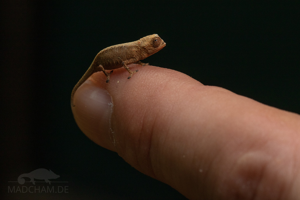
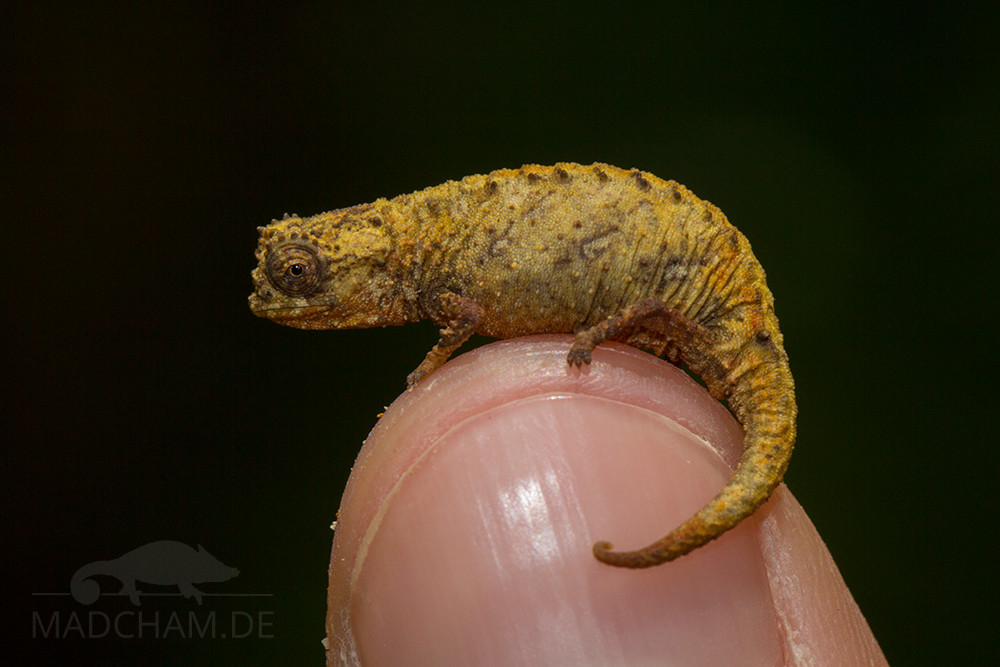
Young Brookesia tedi on a human finger in Marojejy
Brookesia tedi can be distinguished quite well from Brookesia karchei, which occurs in the same habitat and is only slightly larger: Brookesia karchei has clearer supraocular cones, in Brookesia tedi the head shape is rather round, similar to that of Brookesia peryrierasi. Furthermore, B. karchei has spines on the tail, B. tedi does not have these.
Good to know:
This species is part of the minima group, which includes the smallest chameleons of the world.
| Jan | Feb | Mar | Apr | May | Jun | Jul | Aug | Sep | Oct | Nov | Dec | |
| Average temperature | 26 | 26 | 26 | 25 | 25 | 23 | 23 | 22 | 23 | 24 | 25 | 26 |
| Minimum temperature | 24 | 24 | 23 | 23 | 22 | 21 | 20 | 19 | 20 | 21 | 22 | 24 |
| Maximum temperature | 30 | 29 | 29 | 29 | 28 | 27 | 25 | 25 | 25 | 27 | 28 | 30 |
| Rain days | 28 | 23 | 27 | 22 | 24 | 21 | 20 | 18 | 23 | 22 | 16 | 25 |
The data given was measured and collected by us over several years using thermometers and hygrometers directly at the locations where the animals were found. ‘Average temperature’ means that the values of an entire month were calculated to an average value, e.g. all measured minimum values of a month were calculated to an average minimum value for February. In plain language, this means that individual peak values of a day can be significantly higher or lower than the average minimum and maximum values, so it is possible that although the average maximum is 29 degrees, it was 33°C or even 35°C on some days of the month.
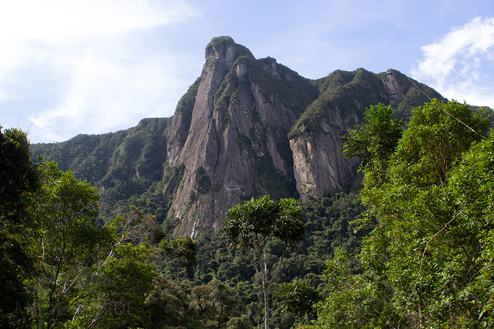
Marojejy mainly consists of rainforest that extends over the eponymic sacred mountain at elevations of 200 to maximally 2100 m above sea level. In the highest areas, climate is cool and vegetation sparse, but most chameleons live in the warmer dense rainforest below. Marojejy has different altitude levels, each with its own species living in its own climate. In the lowest altitude level it is very warm and humid, in the middle and high altitudes it becomes a little cooler, but not less humid.
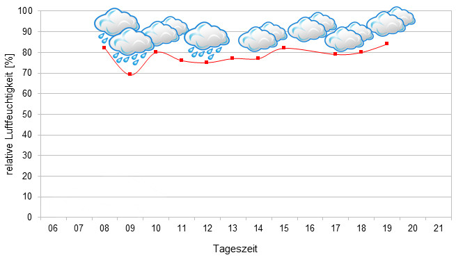
In Marojejy, there is few difference between rainy and dry season. Humidity is always very, very high. In the rainy season, precipitation is more intense with rainfalls that may last for days and sometimes are accompagnied by heavy storms. In the dry season, temperatures are a little lower, but it never becomes really cold. And it still rains almost daily. It really cannot become dry in Marojejy during "dry" season. Humidity is the main key factor of this rainforest. In 2022, we measured relative humidity on various days during the rainy season, and the data can be found below.
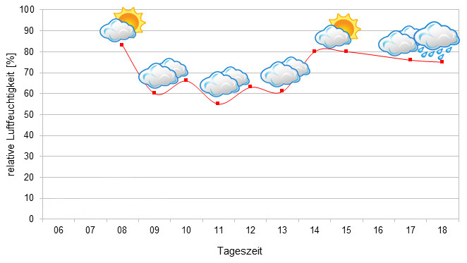
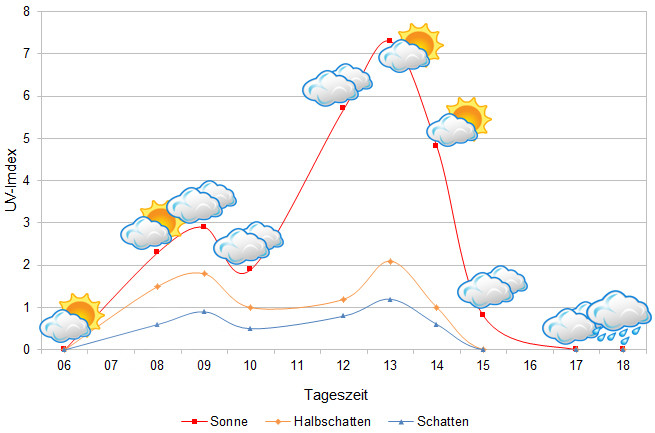
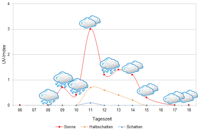
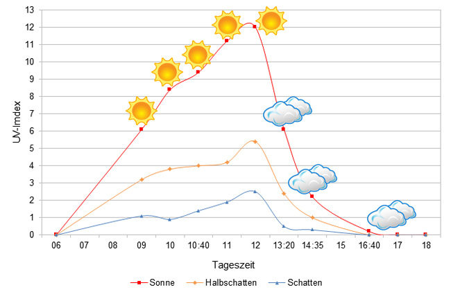
Tageszeit = day time, Sonne = sun, Halbschatten = half shade, Schatten = shade
We have measured UVB data with a Solarmeter 6.5 in spring (end of March until beginning of April) at the peak of activity of chameleons in Madagascar. We always measured the values that a chameleon could maximally reach in its habitat.
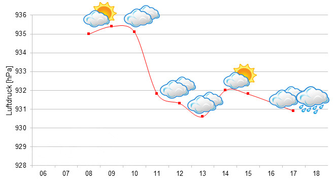
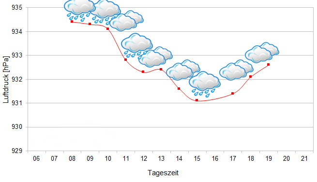
Since 2022, in addition to other climate data, we have been measuring air pressure at the locations we visit in Madagascar. The following data is from different days during the rainy season. On the X-axis is the time of day or night. In Madagascar, the day begins around 6 a.m., and night falls at 6 p.m. The Y-axis shows the atmospheric pressure in hPa.
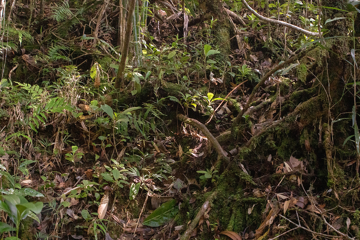
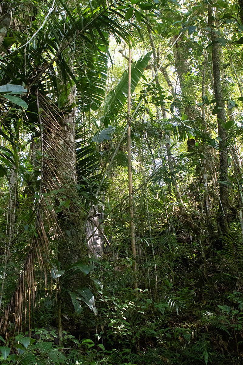
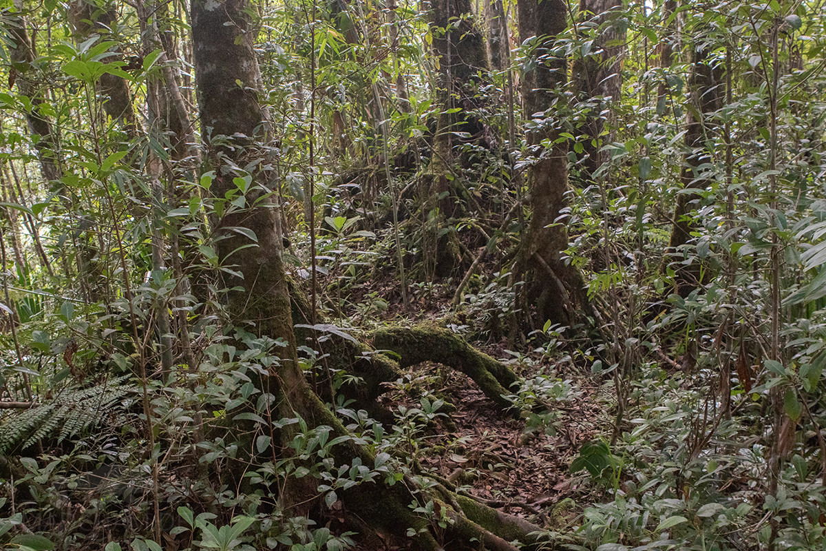
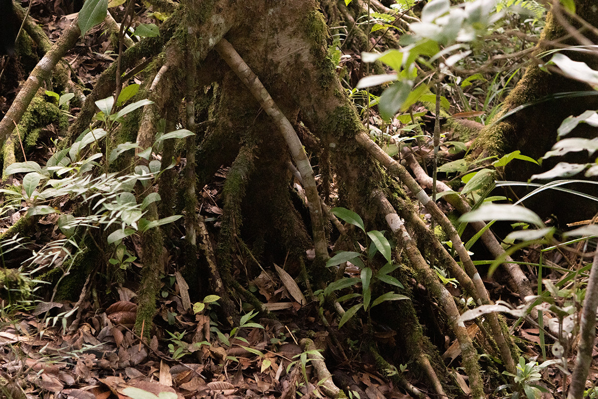
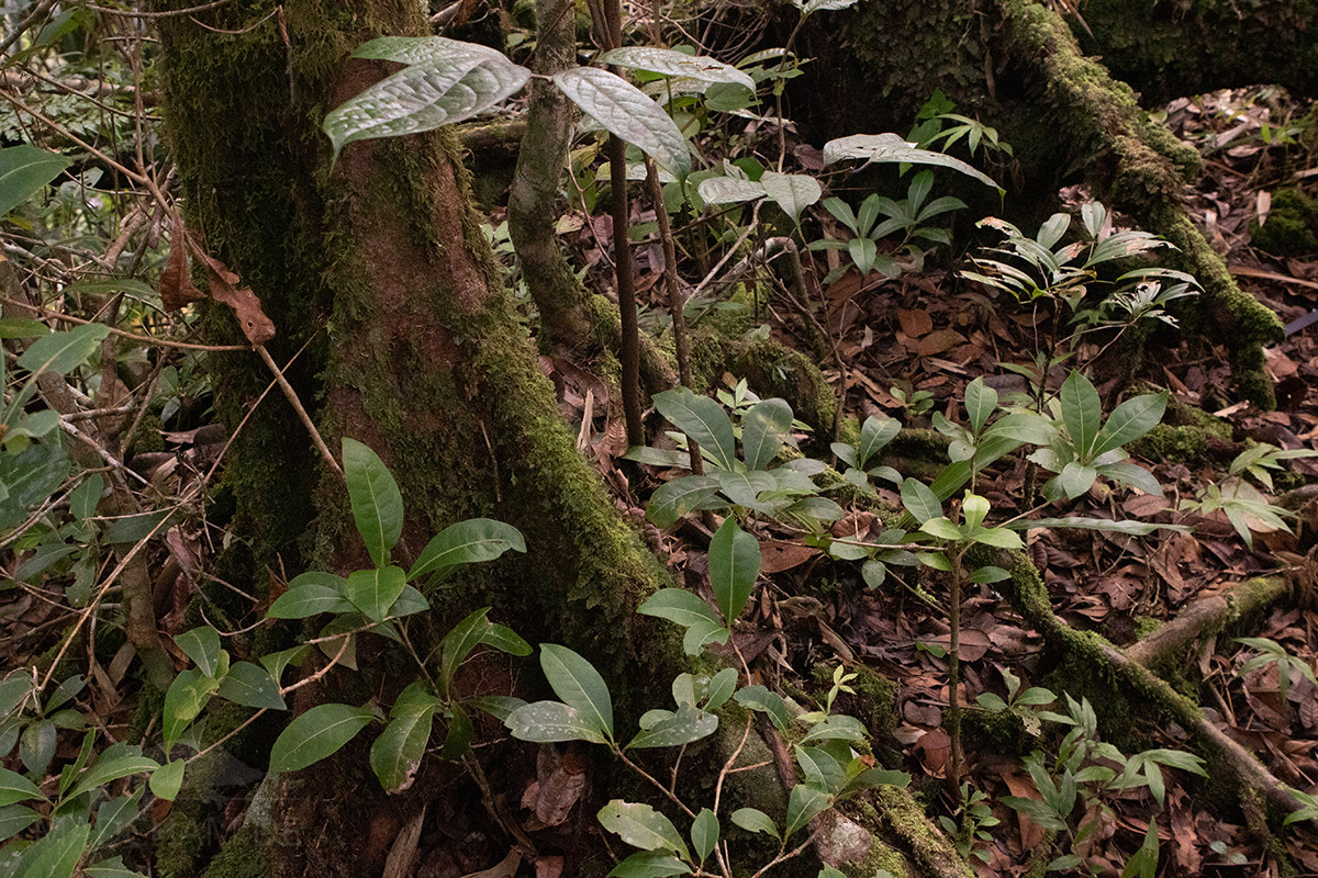
Habitat:
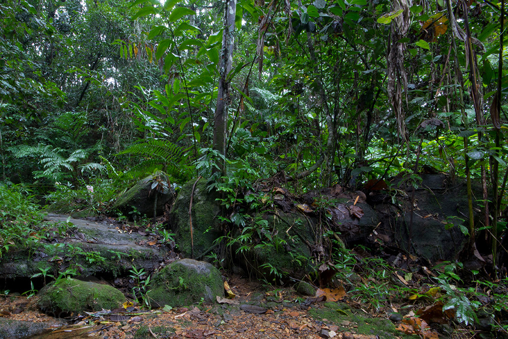
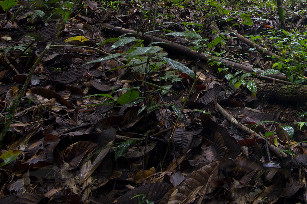
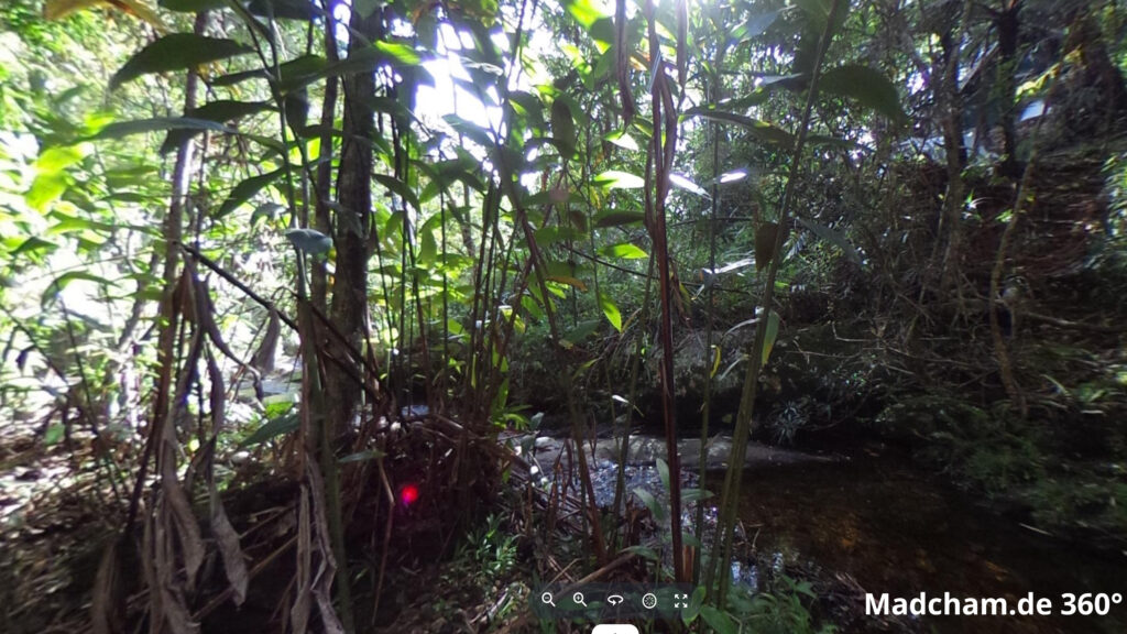
The following photos show extracts from the habitat of Brookesia tedi between Camp Marojejya and Simpona in Marojejy. The rainforest consists of giant jungle giants, slippery, mossy, round stones and very lush undergrowth. Ferns, lianas, and moss determine the picture. The chameleons can only be found with a very good search near tree roots and in dense foliage.
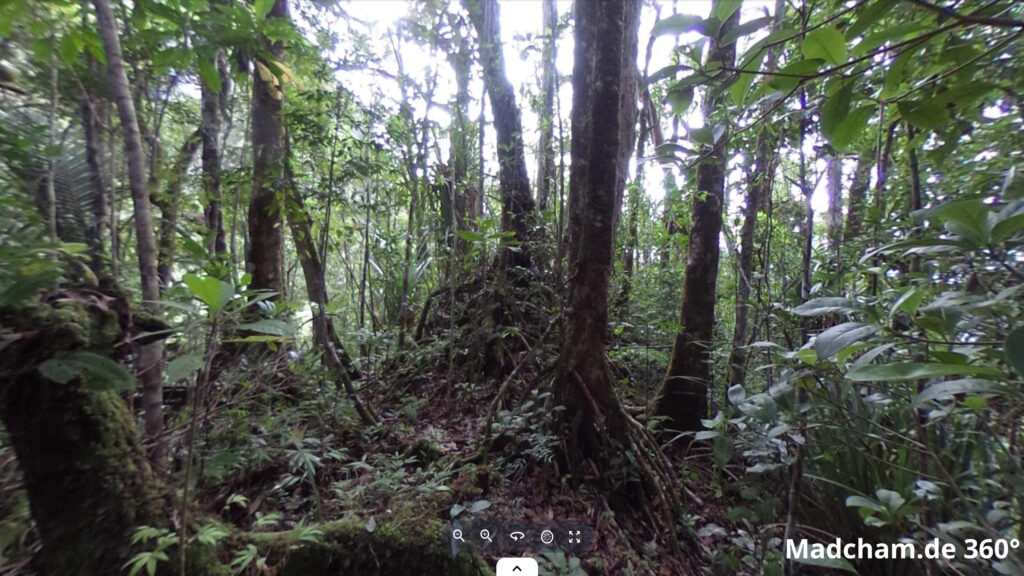
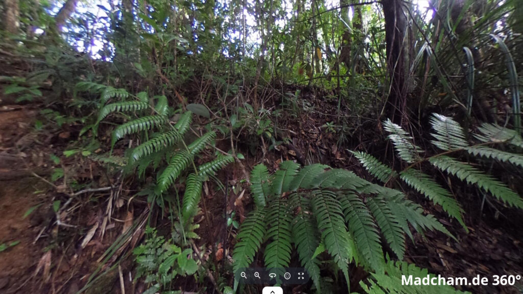
Below you will find 360° images of Marojejy that we took during the rainy season. If you click on the respective image, the pictures will open in an enlarged view in a separate window. You can use the mouse to rotate in all directions. You also have the option of running the images in full-screen mode. Have fun looking at them!


Das könnte dir auch gefallen


Follow us on Instagram

Most popular articles


Your travel specialist for Madagascar