2011-13 each 100 specimens, 2014-16 each 500 specimens, 2017 for the first time 1000 animals, 2018-2025 each 500 specimens for legal export
First description:
Brygoo & Domergue, 1969 ![]()
Origin of the species’ name:
Édouard-Raoul Brygoo (later working at the Natural History Museum in Paris, France) and Charles Antoine Domergue of the then Institut Pasteur in Antananarivo, Madagascar, named the species after the botanist Jean Thiel. Thiel had found most of the animals of the species in 1968 and brought them to Antananarivo.
Distribution:
Brookesia thieli is found in central-eastern Madagascar in the areas of Moramanga, Andasibe, Vohimana, and Anjozorobe. There is also a further population higher up in the north near Masoala. So far we have been able to find the animals in the rainforest of Andasibe-Mantadia National Park, Ranomafa National Park, and Anjozorobe.
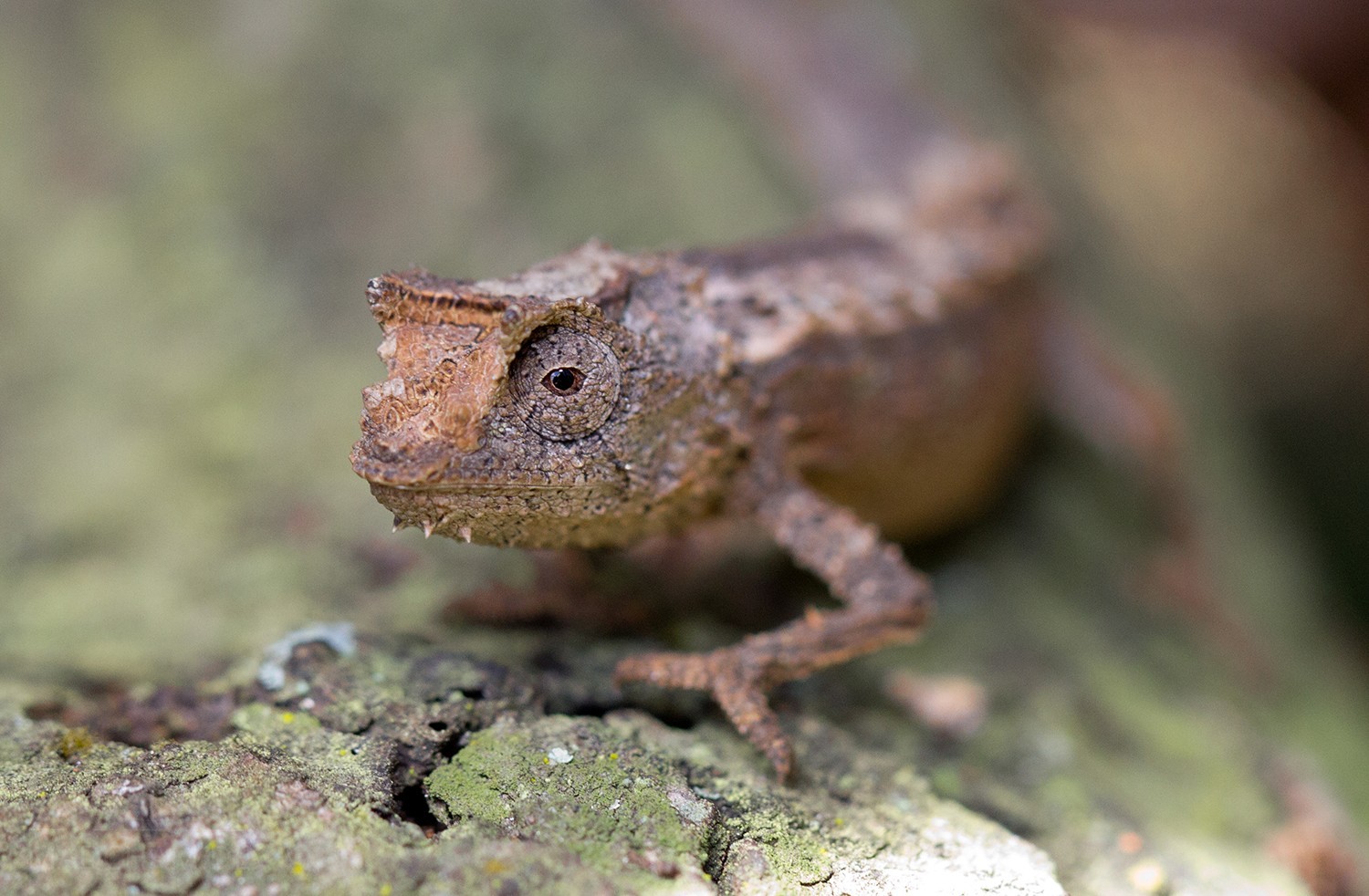
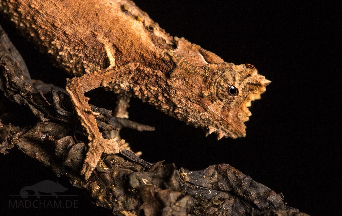
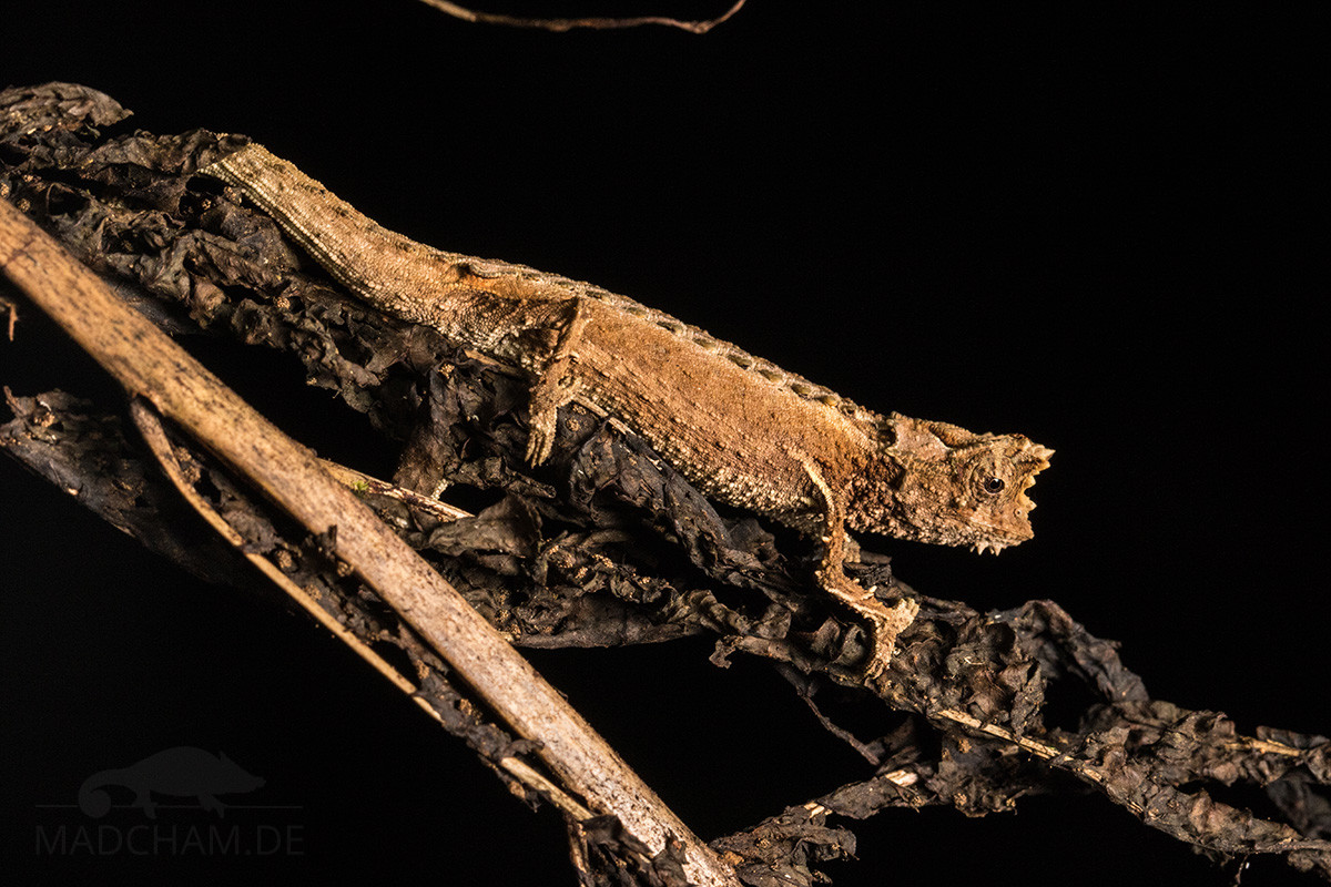
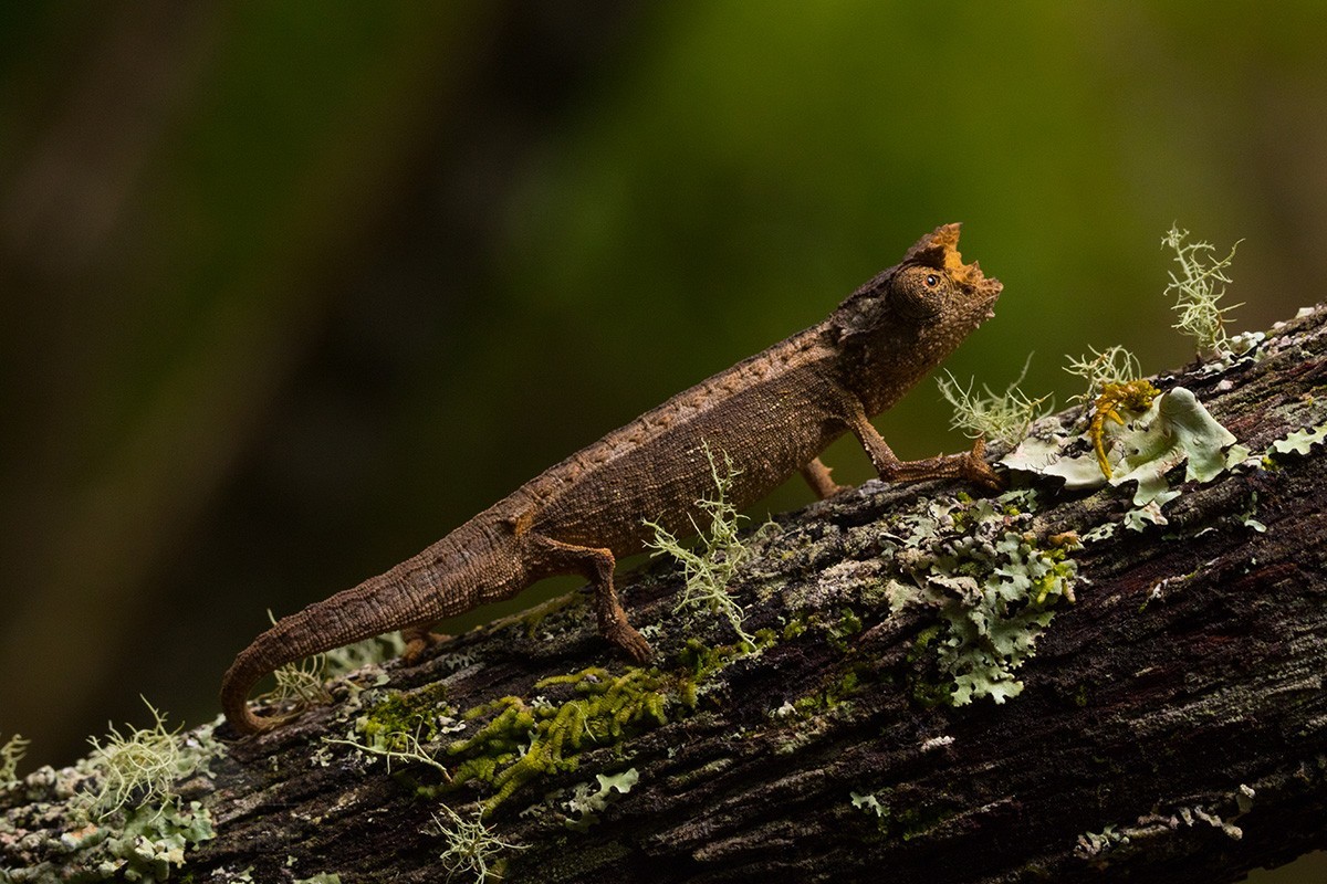
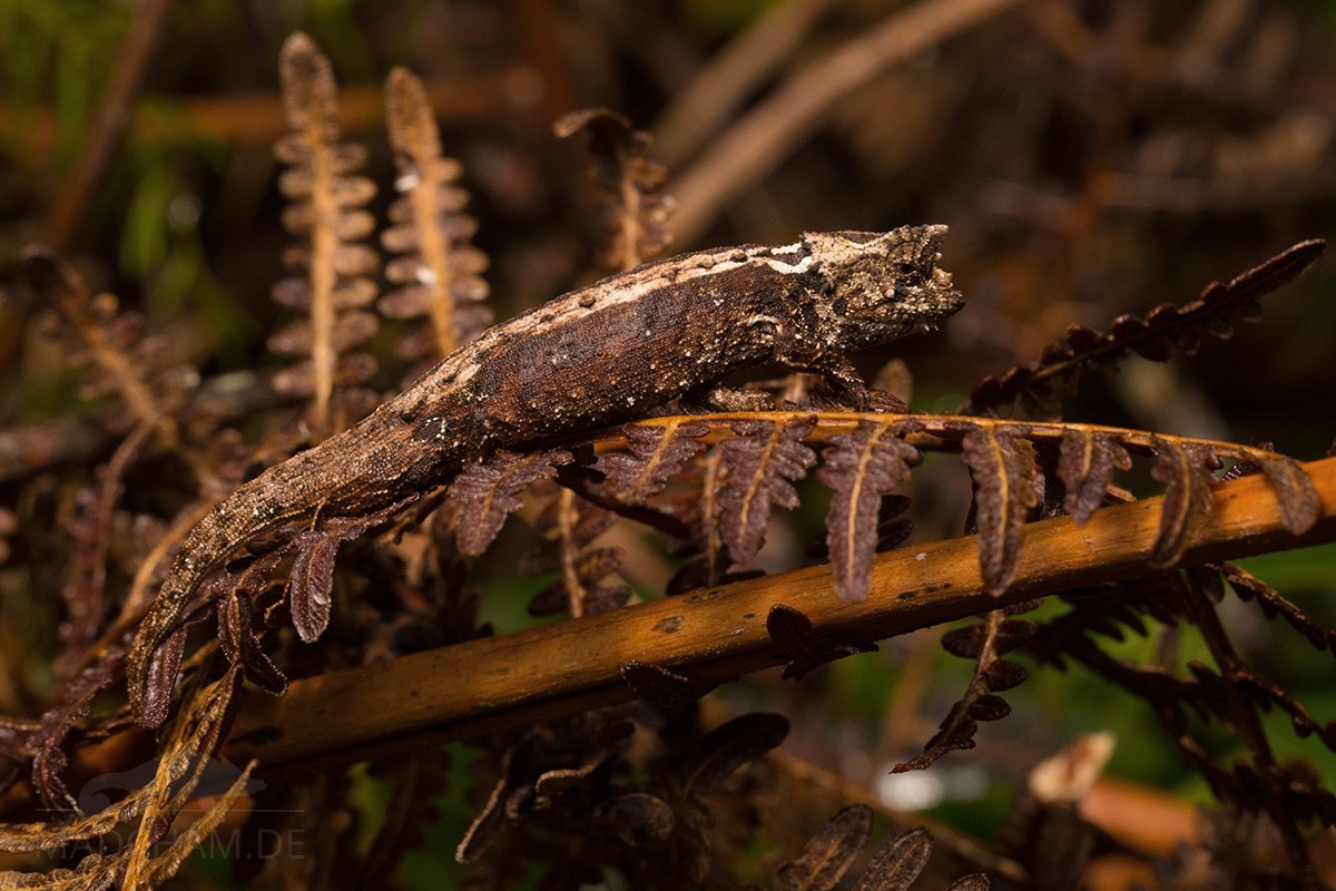
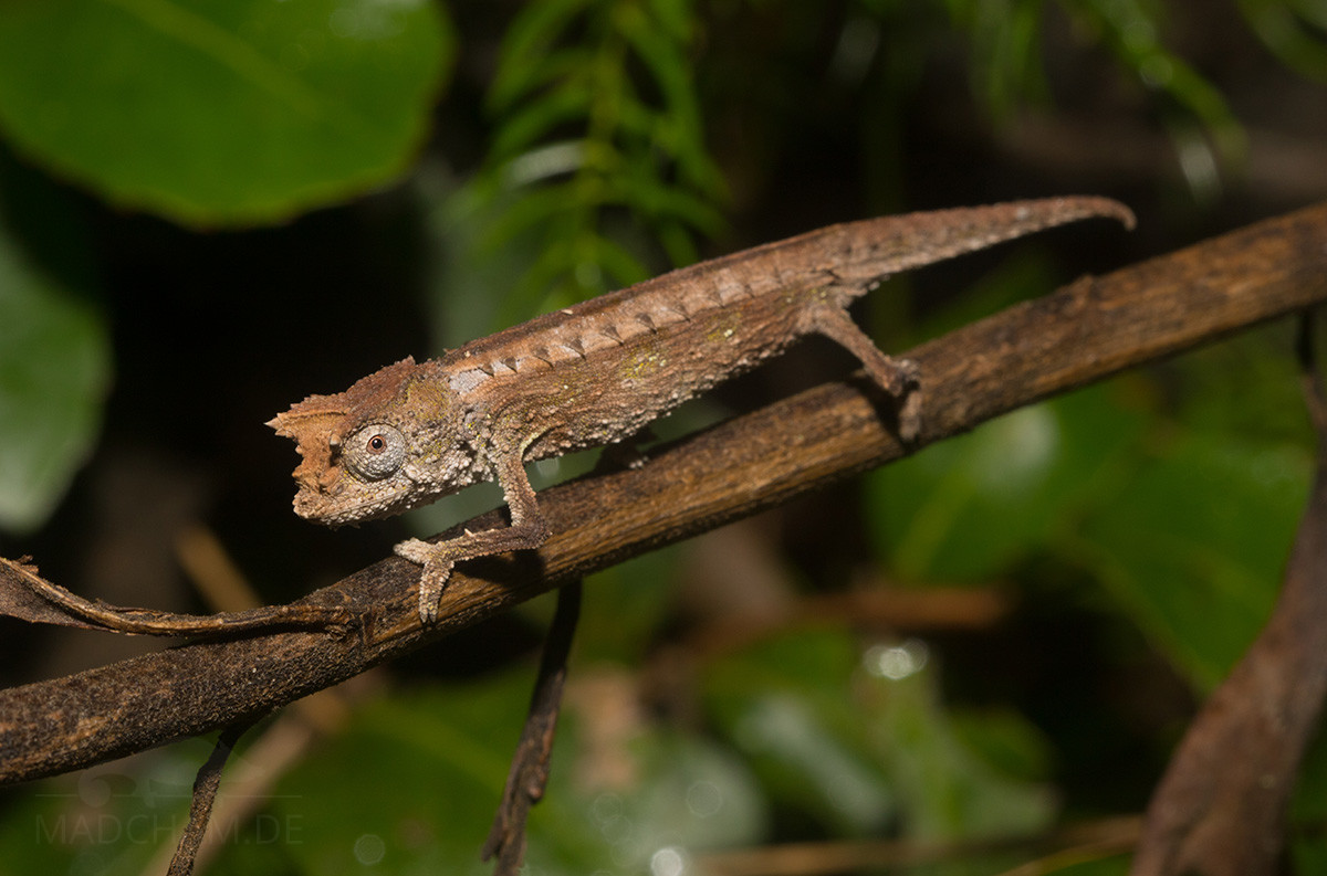
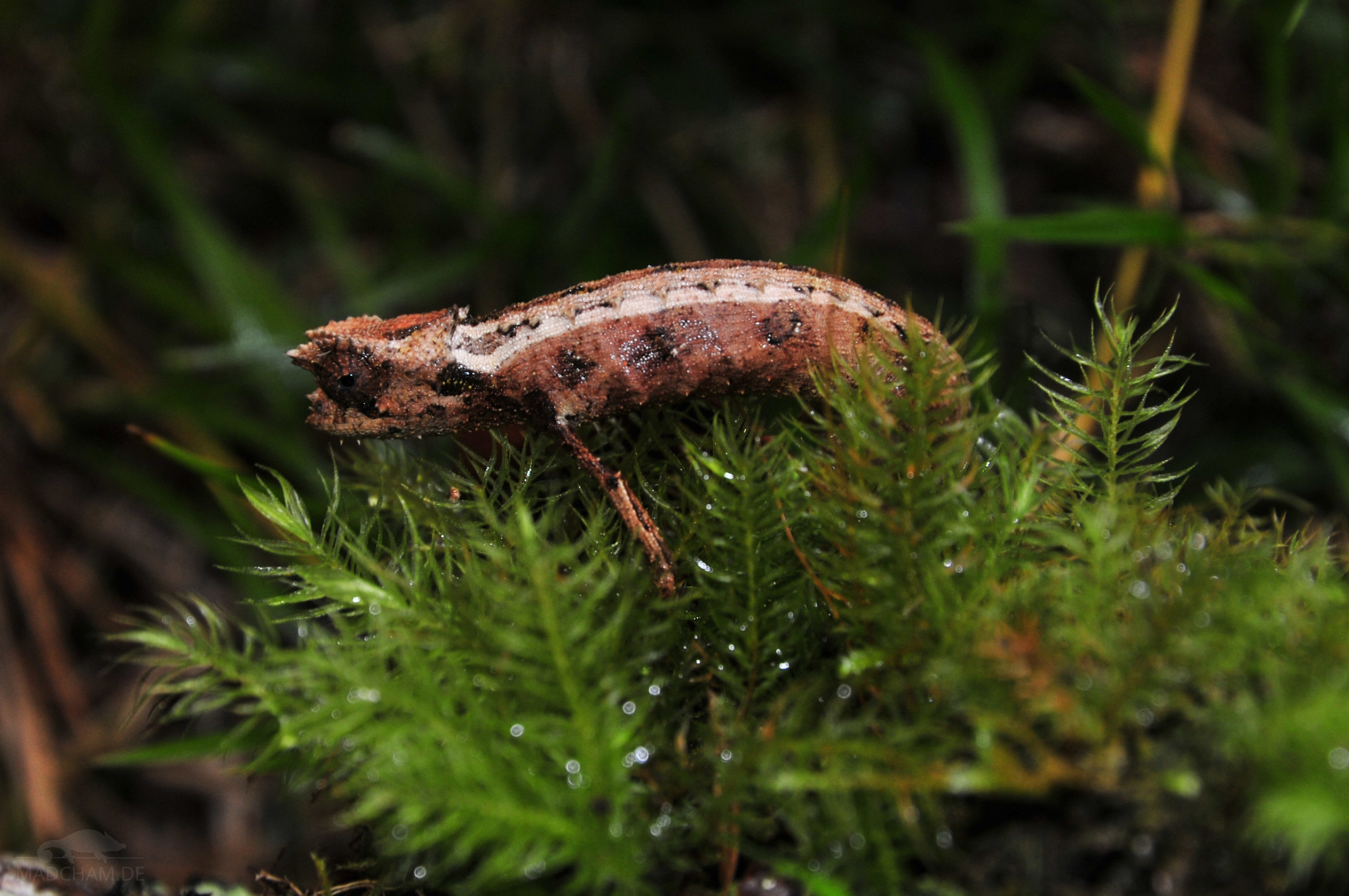
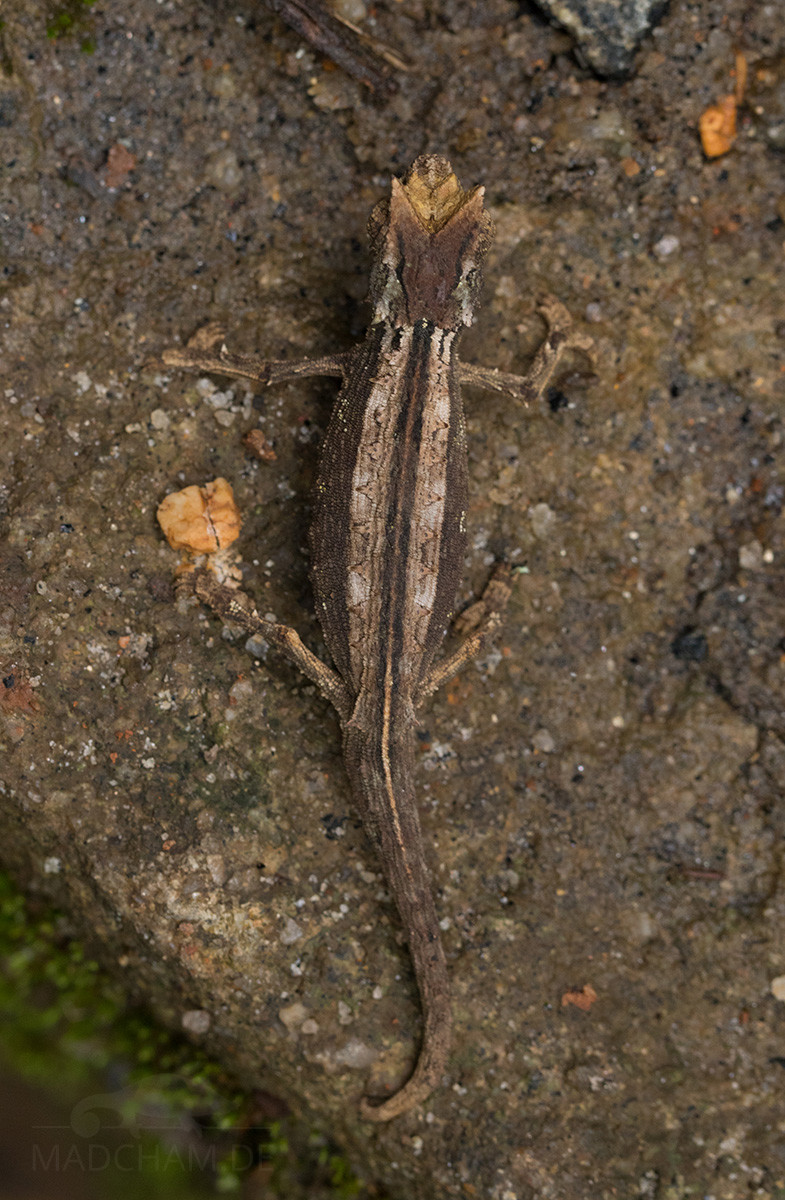
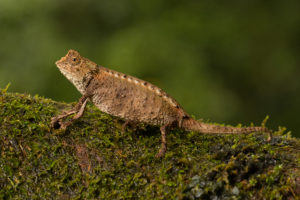
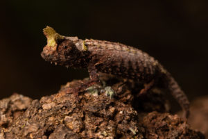
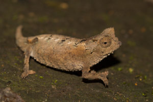
Appearance & size:
These leaf chameleons reach a maximum size of 73 mm. At the back, a row of eleven spinous processes runs on both sides, which continues over the tail. Both sexes have tubercles at the chin. The basic color of these animals are different shades of brown, most individuals have a light-colored back and darker sides and belly. The projection above the nose is well developed.

| Jan | Feb | Mar | Apr | May | Jun | Jul | Aug | Sep | Oct | Nov | Dec | |
| Average temperature | 23 | 24 | 23 | 23 | 22 | 19 | 19 | 19 | 20 | 21 | 22 | 23 |
| Minimum temperature | 20 | 20 | 20 | 19 | 18 | 15 | 15 | 15 | 15 | 16 | 18 | 19 |
| Maximum temperature | 27 | 27 | 27 | 27 | 25 | 23 | 23 | 23 | 24 | 25 | 26 | 27 |
| Rain days | 27 | 24 | 26 | 19 | 17 | 18 | 21 | 20 | 15 | 16 | 20 | 25 |
We have collected the data given above over several years with thermometers and hygrometers at the finding places of the chameleons. "Average temperature" means that values of a whole month have been calculated to one average value per month. For example all measured minimum temperature values of February have been calculated to one average minimum temperature for February. In plain language, this means single peak values of a day may be a little higher or lower than the average minimum and maximum temperatures. It is possible that a location has an average maximum temperature of 29°C, but one day during that month it had 33°C or even 35°C there.
Three examples of a daily course of temperatures in Andasibe in the rainy season can be found below. Both were recorded with data loggers in 2023.
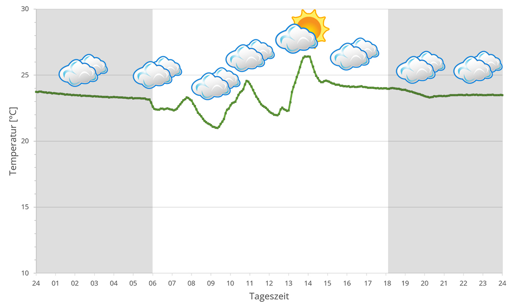
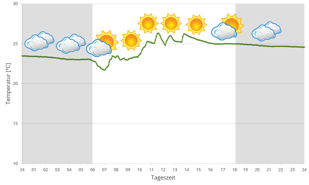
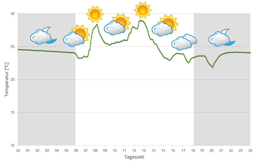
The region around Andasibe with the associated forests of Mantadia, Mitsinjo and Analamazaotra lie in the eastern highlands of Madagascar at altitudes between 900 and 1250 m above sea level. During the day, the temperature may sometimes exceed 25°C, but the thermometer rarely climbs above 30°C, or only in sunspots. At night, temperatures plummet, especially during the dry season. 10° to 15° degrees are the rule.
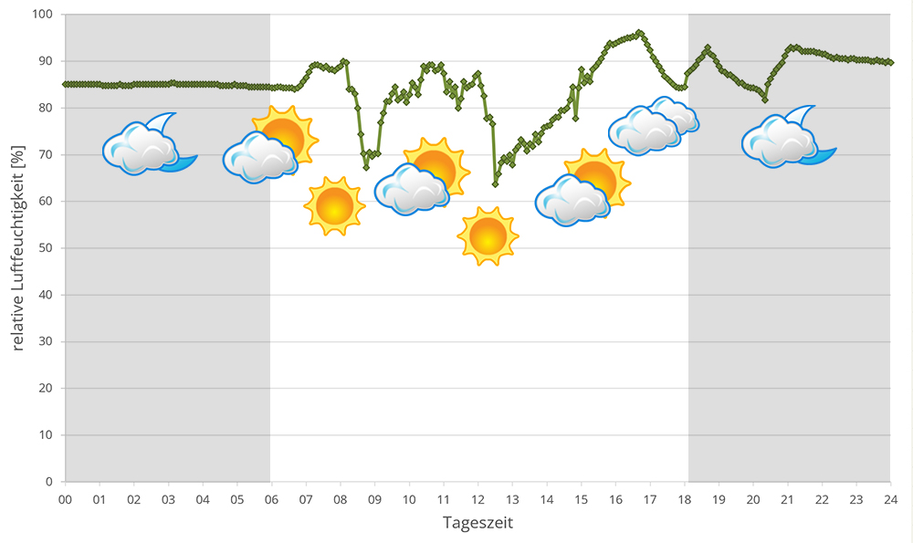
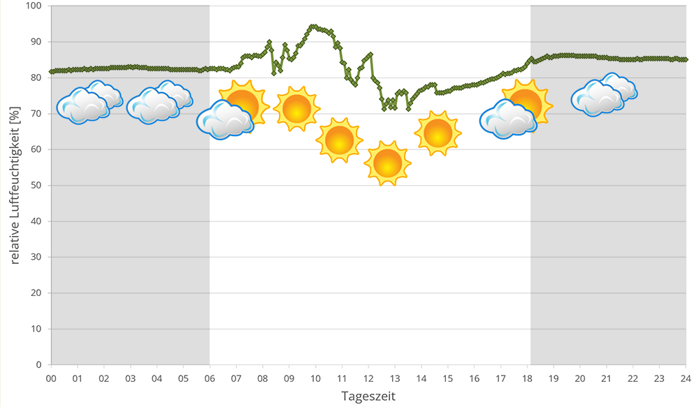
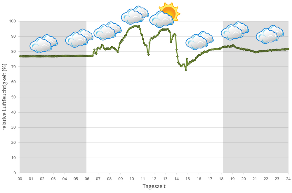
Humidity in the rainforests around Andasibe is high all year round. During the rainy season it rains extensively every day, sometimes the rain lasts for days. But the dry season is not massively different either, except that it has slightly cooler temperatures overall and reaches lower temperatures at night. It still rains at least every other day. Rain, high humidity and a drop in temperature at night are therefore the central points of Andasibe's climate. In 2023, we measured relative humidity with data loggers on different days in Andasibe in the rainy season, the data can be found below.
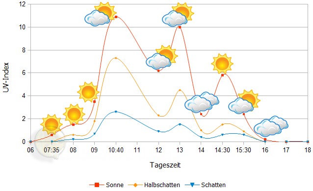
 Tageszeit = day time, Sonne = sun, Halbschatten = half shade, Schatten = shade
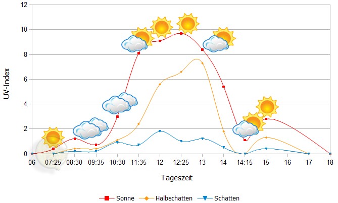
We have measured UVB data with a Solarmeter 6.5 in spring (March, April) at the peak of activity of chameleons in Madagascar. We always measured the values that a chameleon could maximally reach in its habitat.
| Jan | Feb | Mar | Apr | May | Jun | Jul | Aug | Sep | Oct | Nov | Dec | |
| Morning | 23,2 | 23,4 | 22,0 | 22,1 | 20,5 | 16,0 | 16,3 | 16,5 | 17,4 | 16,7 | 21,2 | - |
| Midday | 25,4 | 25,3 | 24,5 | 22,5 | 20,2 | 16,5 | 16,3 | 17,7 | 18,3 | 18,0 | 21,4 | - |
| Evening | 25,5 | 25,1 | 25,0 | 25,3 | 20,8 | 17,2 | 16,1 | 17,0 | 19,6 | 23,0 | 22,0 | - |
Between 21 March 2018 and 05 February 2019, we measured ground temperatures in the rainforest of Andasibe and surrounding areas (Analamazaotra, Andasibe, V.O.I.M.M.A. and Mitsinjo) about every other day - the table is the result of these measurements. Only in December no measurements were taken. detailed review can be found here. In total, we took 418 soil temperature measurements and measured an estimated 70 different locations in Andasibe and the surrounding area at a depth of 20 cm.
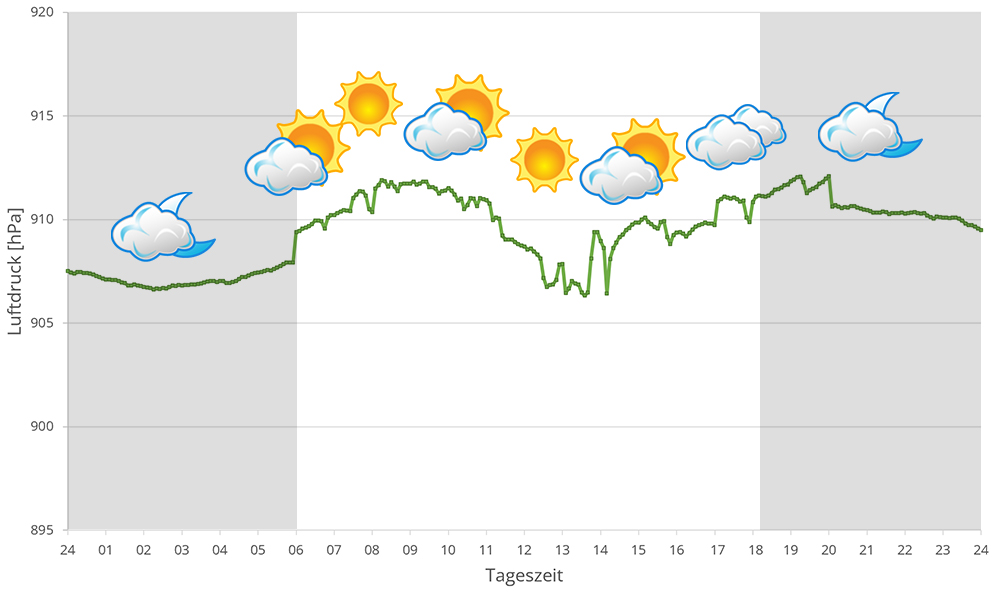
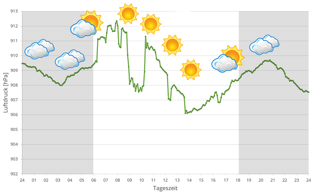
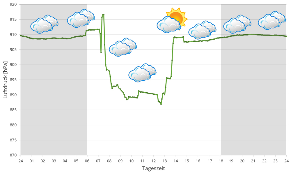
In 2023, in addition to other climate data, we also measured the air pressure at the locations we visited in Madagascar. The following data is from different days during the rainy season in Andasibe. On the X-axis is the time of day or night. In Madagascar, the day begins around 6 am, and night falls at 6 pm. The Y-axis shows the atmospheric pressure in hPa.
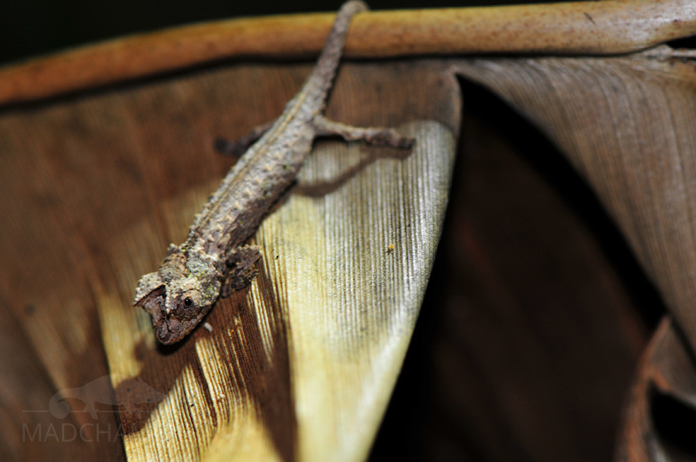
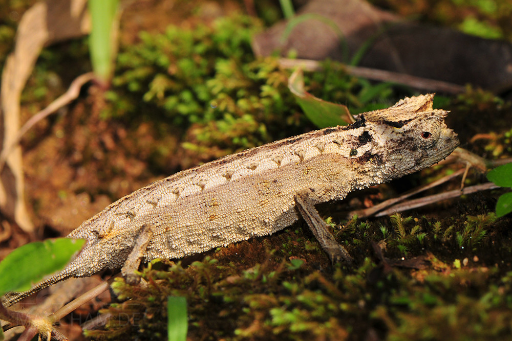
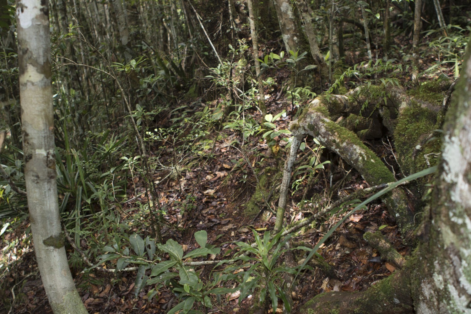
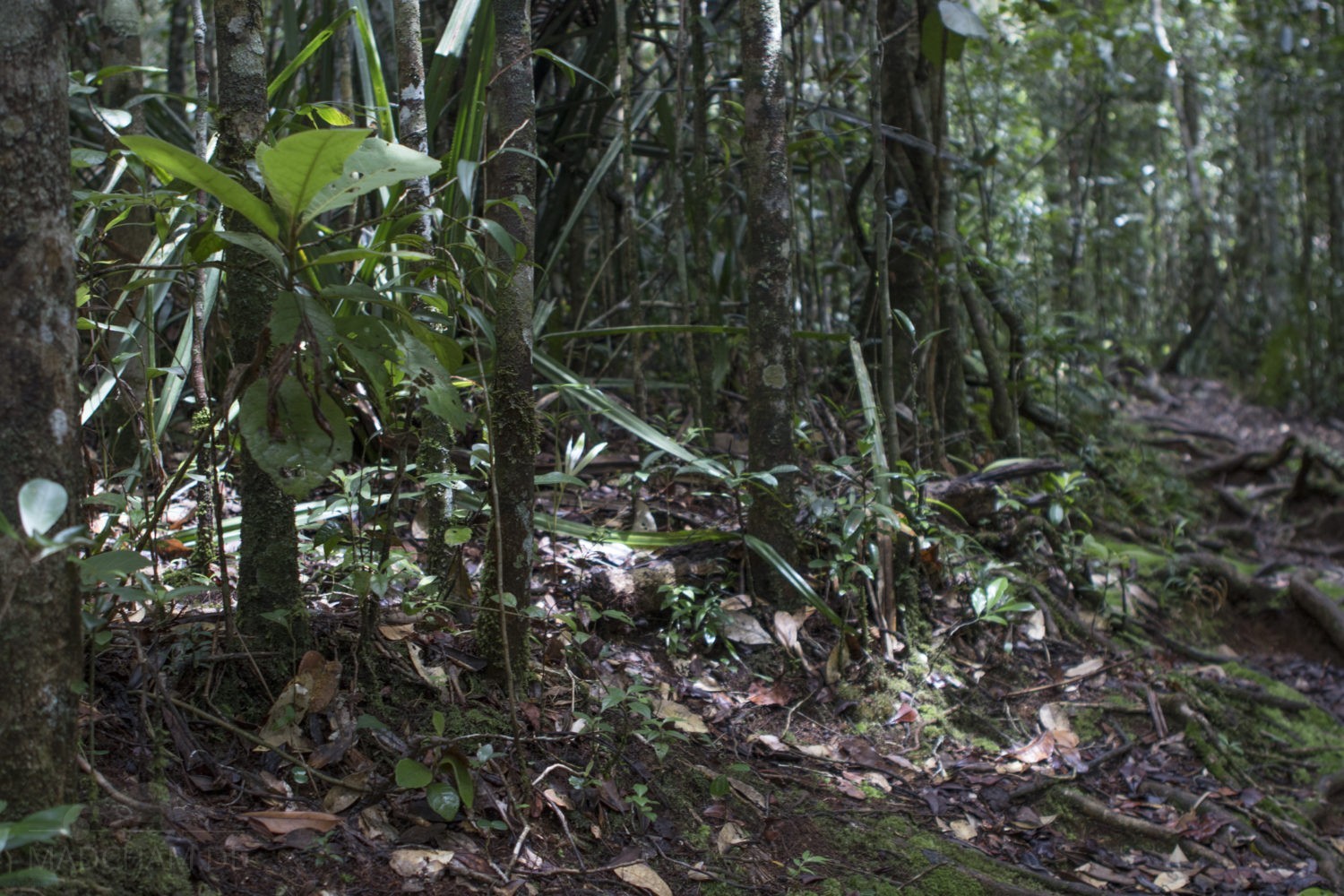
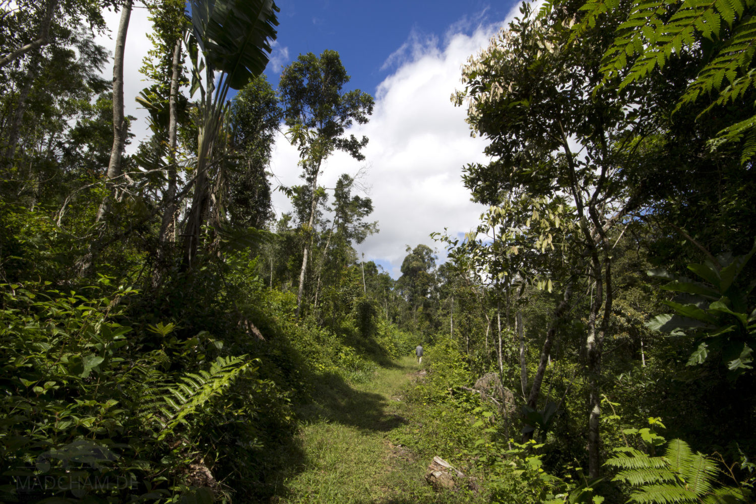
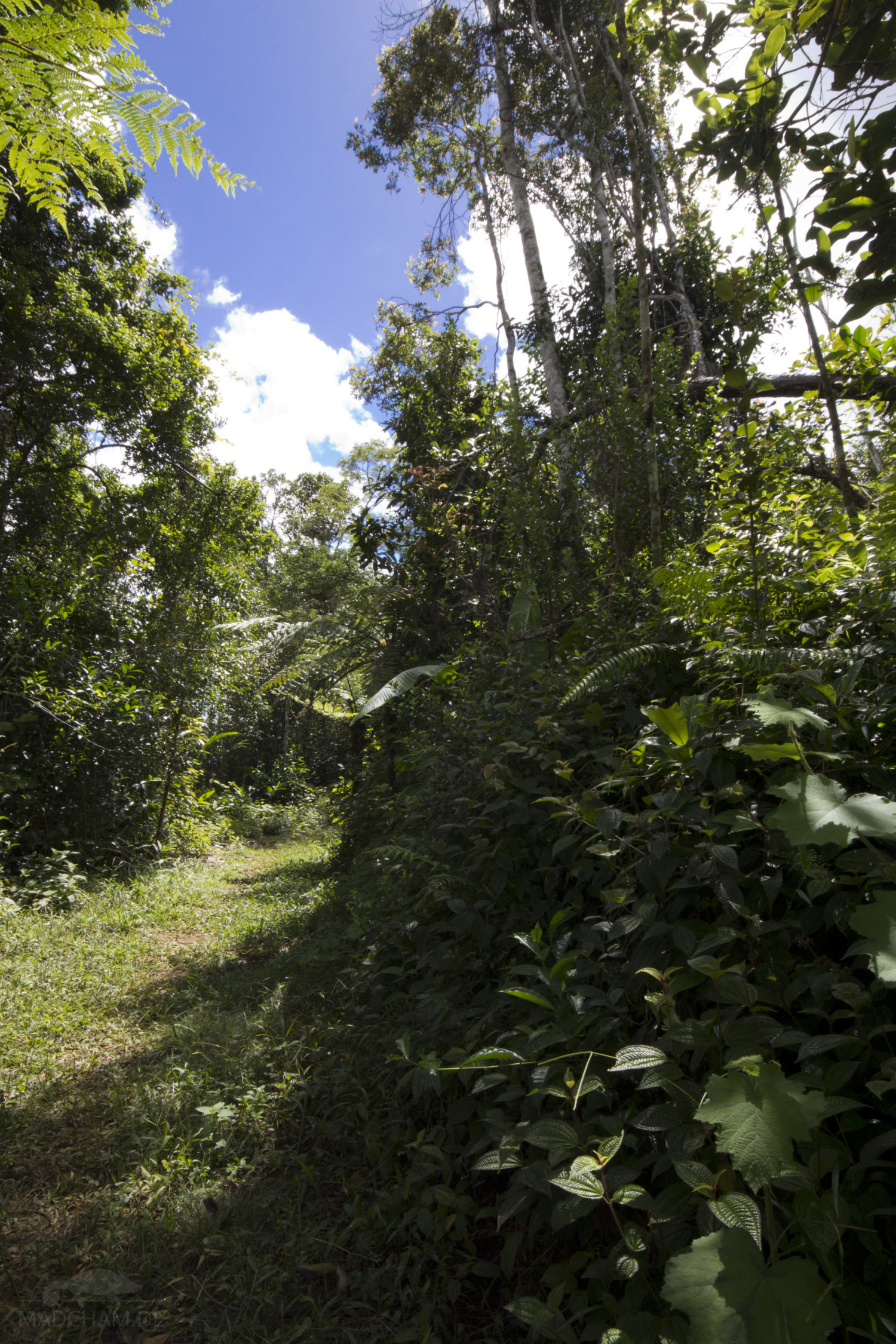
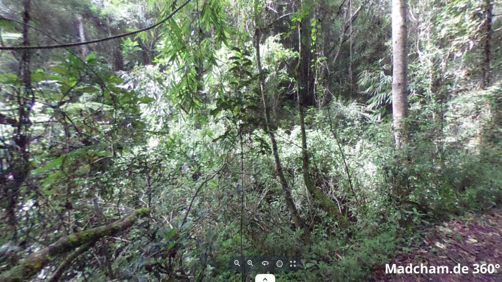
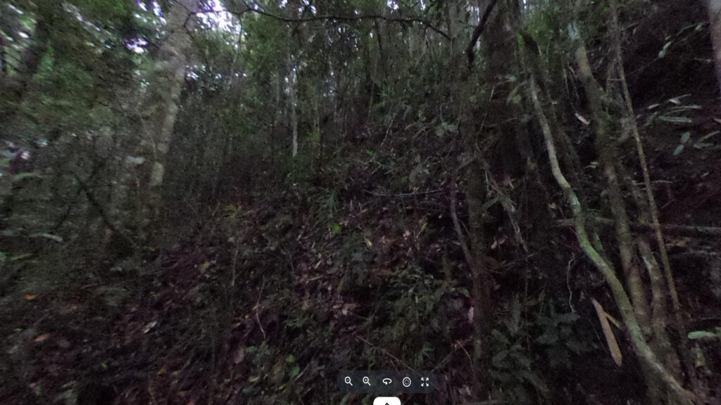
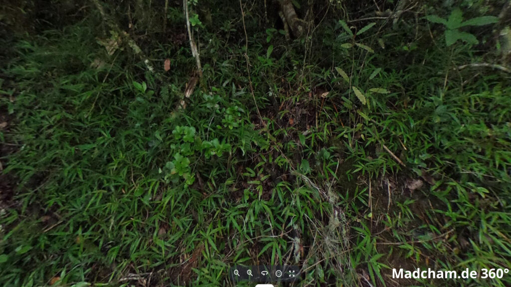
Habitat:
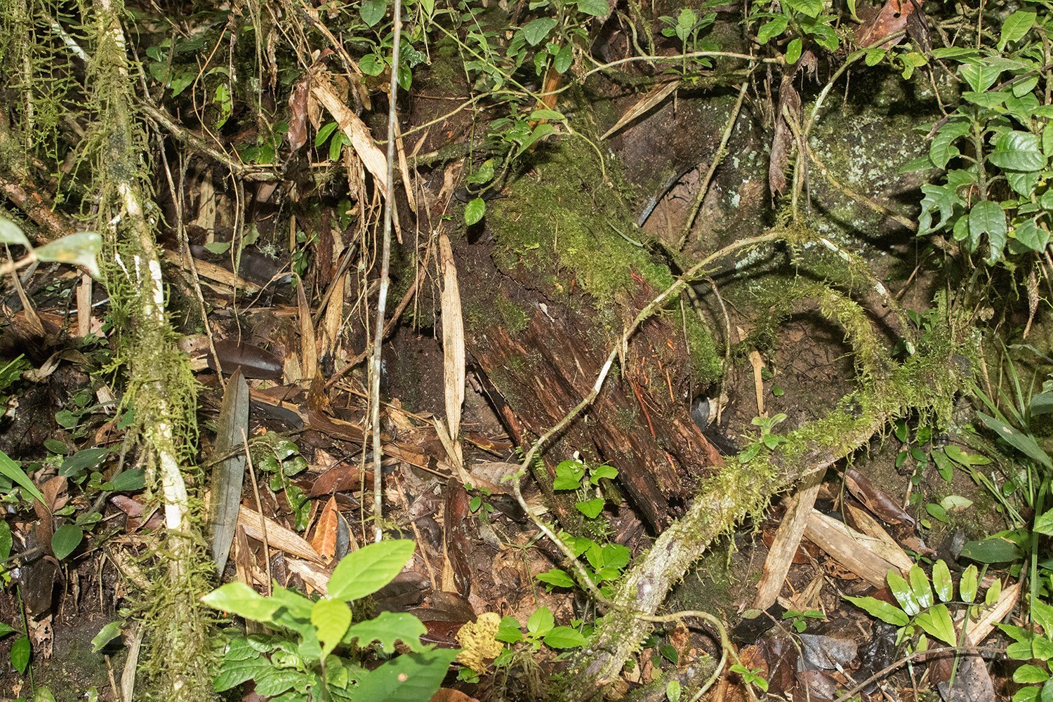
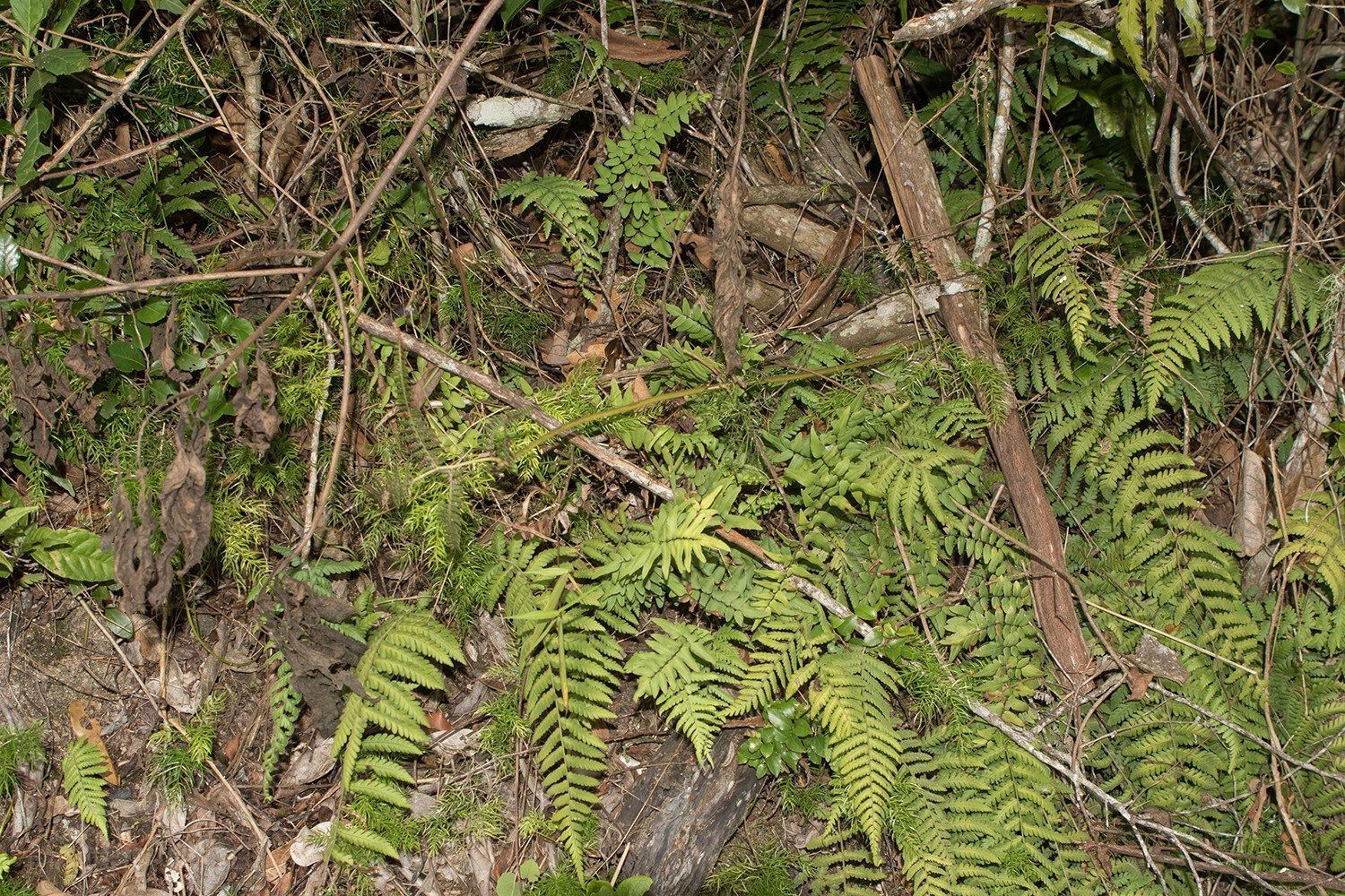
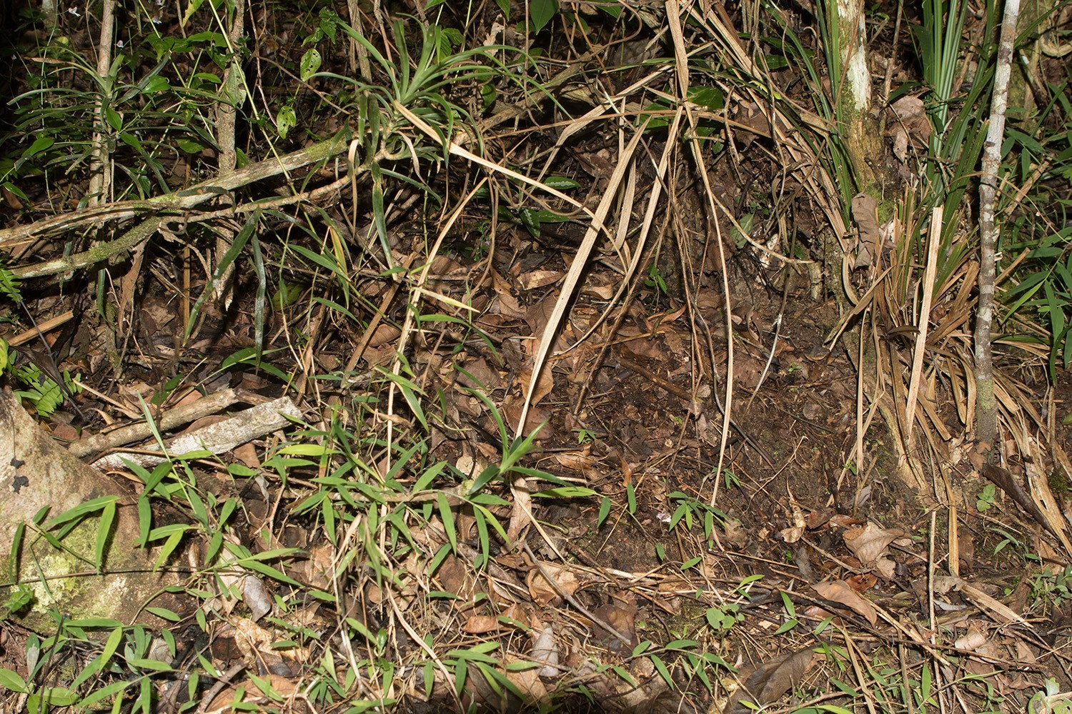
The following photos show extracts from the habitat of Brookesia thieli in Andasibe and finding sites in Anjozorobe. The species hides well in the undergrowth, which consists of many small plants, loose branches, and few fallen tree trunks. The animals live on the thick layer of leaves and on very low branches and branches of bushes. In Anjozorobe, Brookesia thieli lives mainly in microhabitats heavily overgrown with ferns.

Below you will find some 360° images from the rainforest of Anjozorobe that we took during the rainy season. They also include locations where the species has been found. If you click on the respective image, the pictures will open in an enlarged view in a separate window. You can use the mouse to rotate in all directions. You also have the option of viewing the images in full-screen mode. Enjoy!


Das könnte dir auch gefallen


Follow us on Instagram


Most popular articles


Your travel specialist for Madagascar