
no legal export possible
First description:
Raxworthy & Nussbaum, 2006 ![]()
Origin of the species name:
Christopher J. Raxworthy from the American Museum of Natural History, New York (USA) and Ronald A. Nussbaum from the University of Michigan, Ann Arbor (USA) borrowed the name of this chameleon species from English cryptic. It was intended to indicate the cryptic status of the species. Calumma crypticum had been counted among Calumma brevicorne for decades and despite the already optically visible differences – unrecognized as a separate species.
Distribution:
This species, also called blue-legged chameleon in English, only lives in the rainforest at elevations between 1000 and 1850 meters above sea level. Ranomafana, Andringitra and Andohahela national parks belong to their habitat as well as Tsaratanana massif and the area around Anjozorobe. You can find them best in the southern highlands in the forests around Ranomafana. Calumma crypticum prefers closed, dense forests as space to live. In 2016, we found animals in a region nearby Ambositra in the southern highlands for the first time. This population lives in a tiny, probably soon completely disturbed secondary forest with a size of less than 150 m². In 2017, only a single row of trees was still standing of it, and in 2019, only bushes were left. Due to a lack of habitat, this population will probably be gone before anyone can do research to do further examinations on these animals. According to literature, Calumma crypticum does not occur in this area.
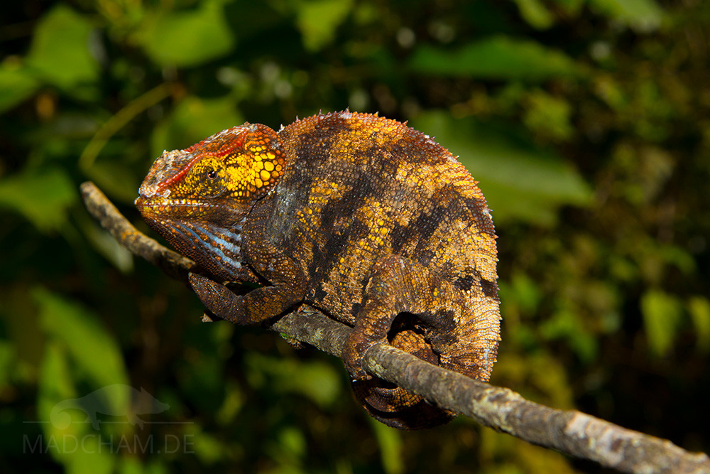
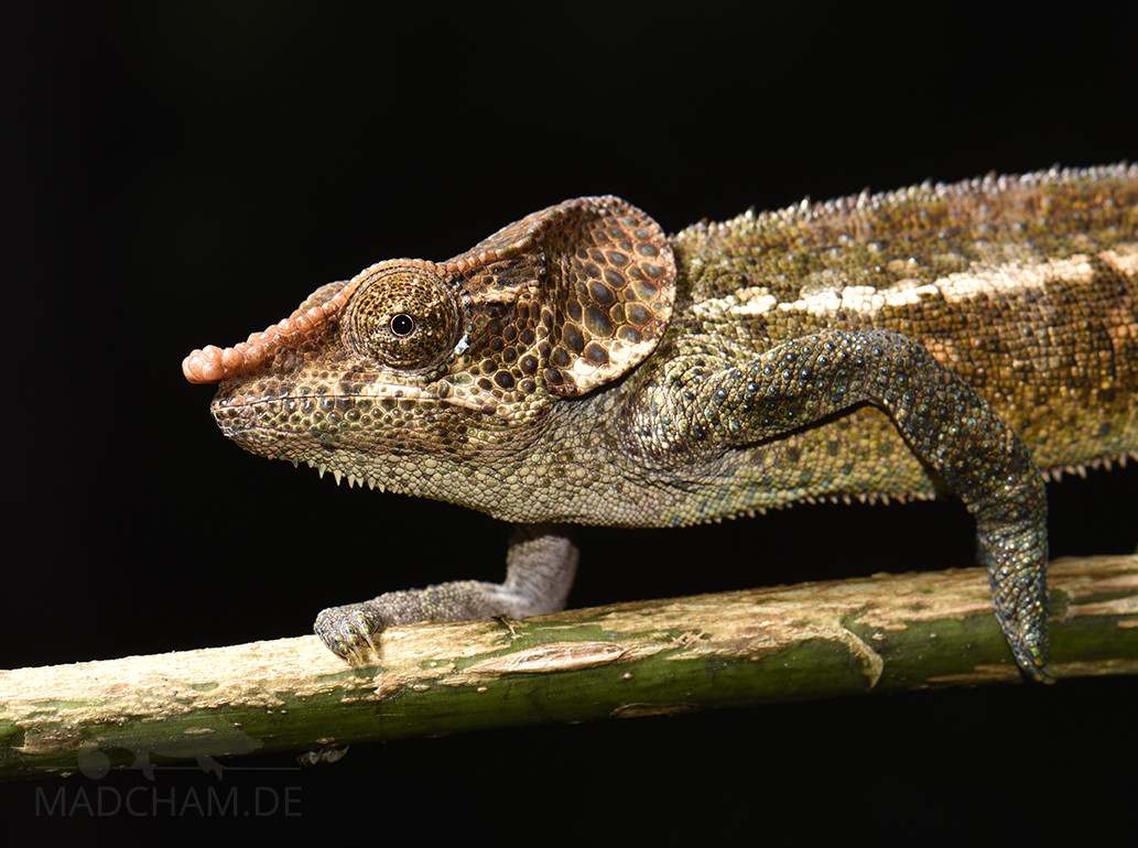
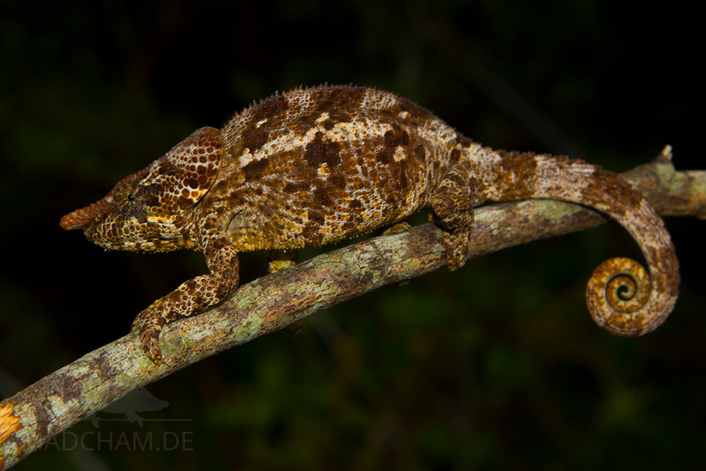
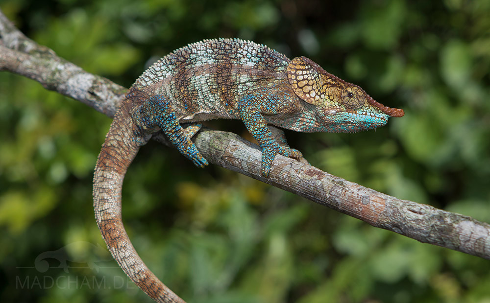
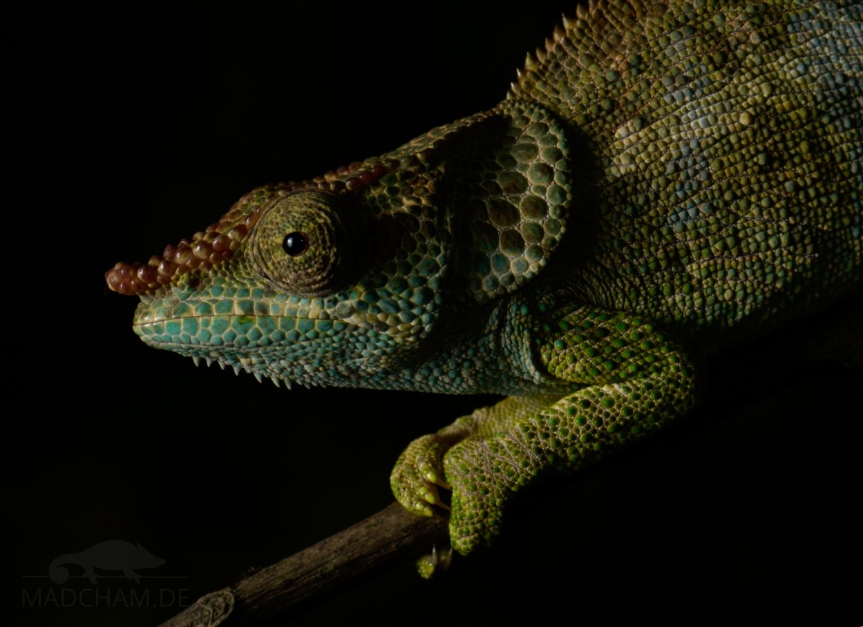
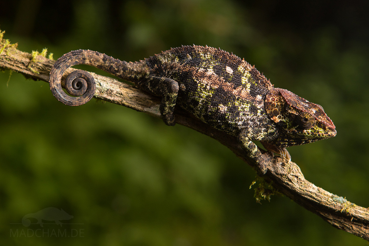
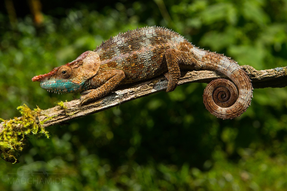
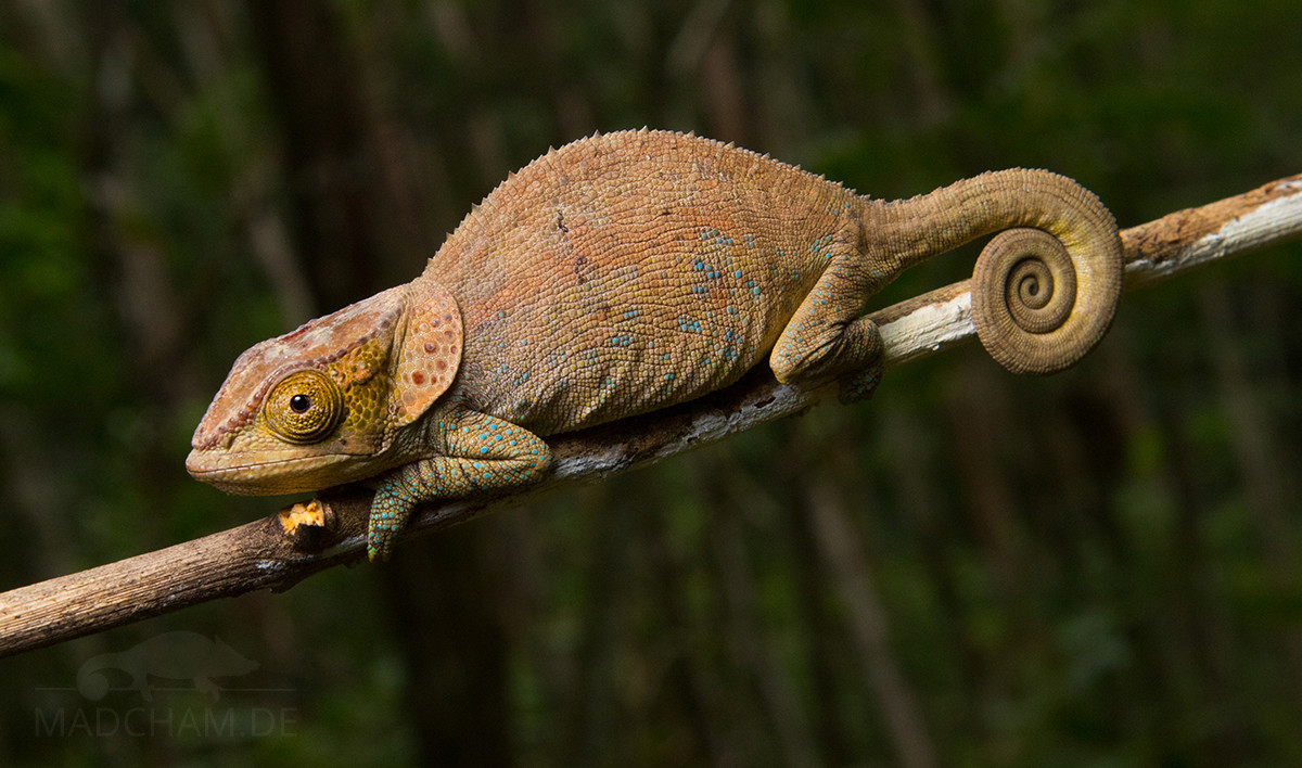
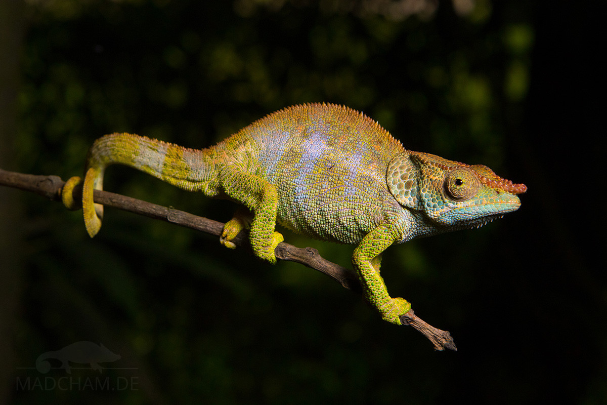
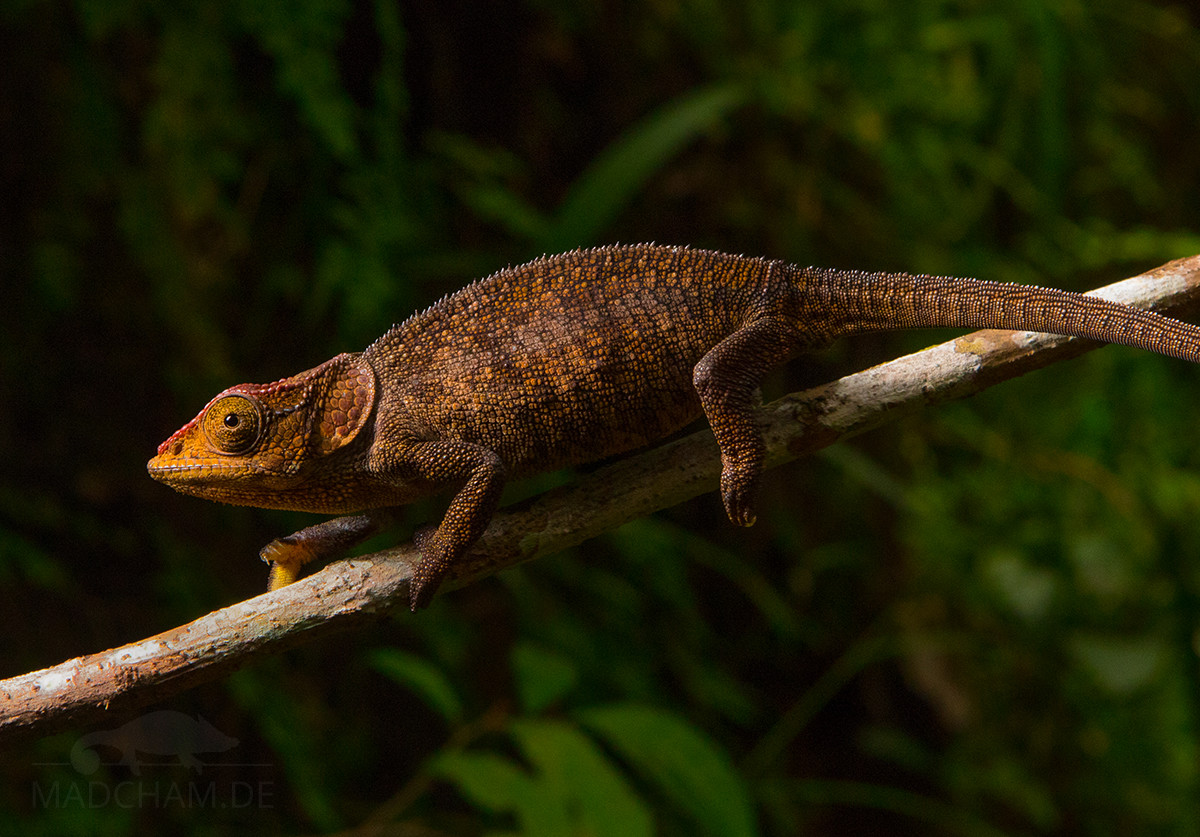
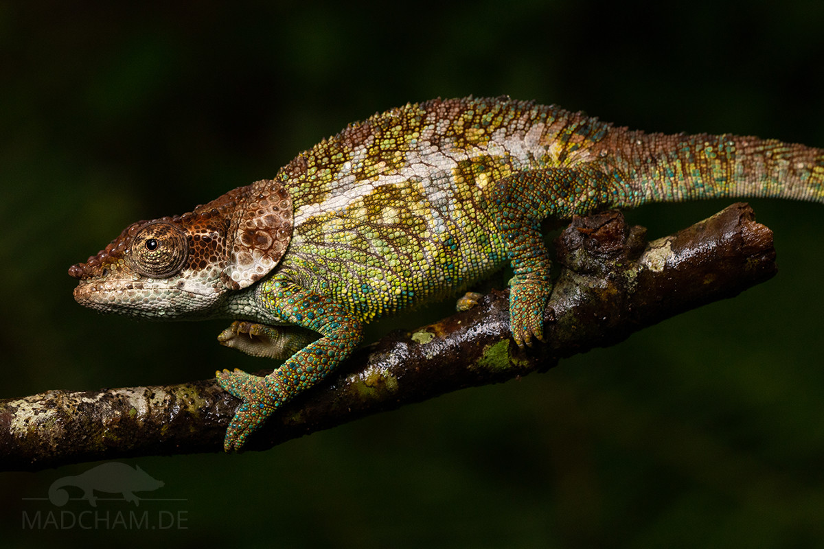
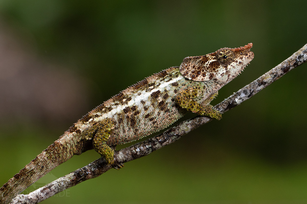
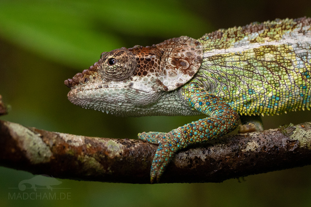
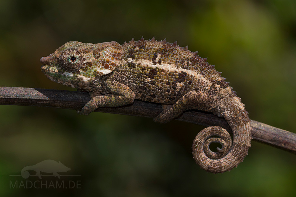
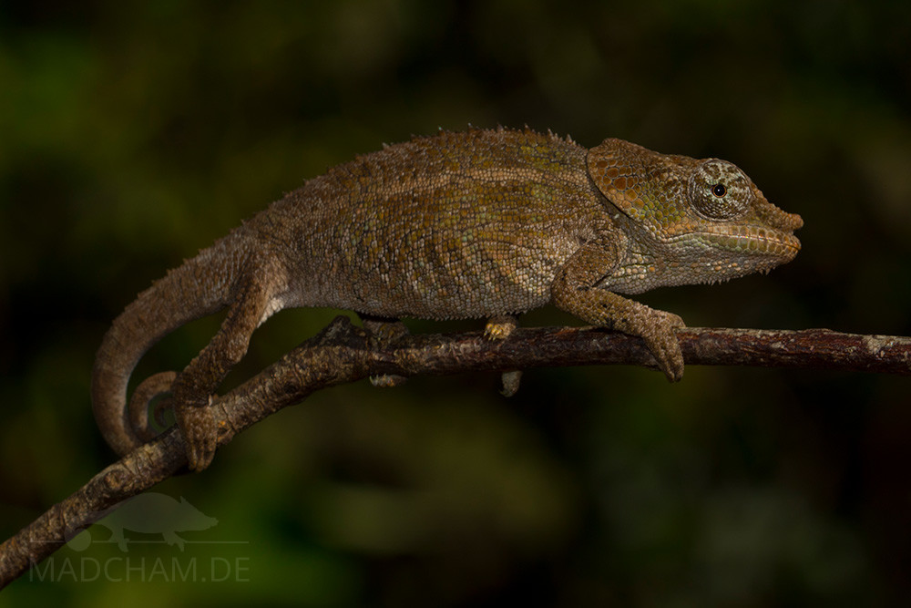
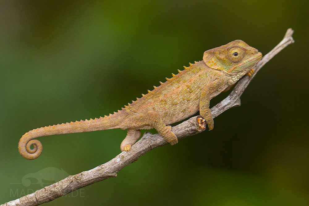
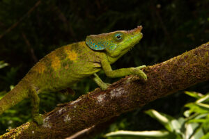
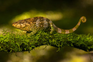
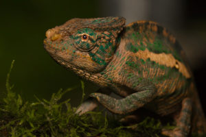
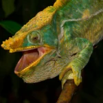
Appearance & size:
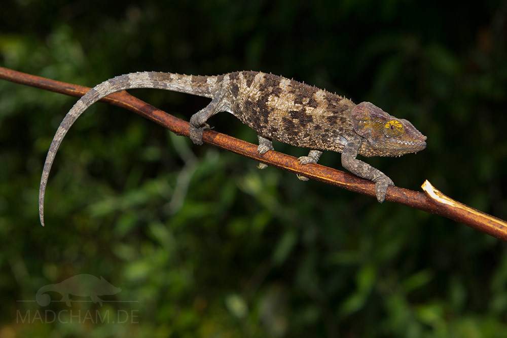
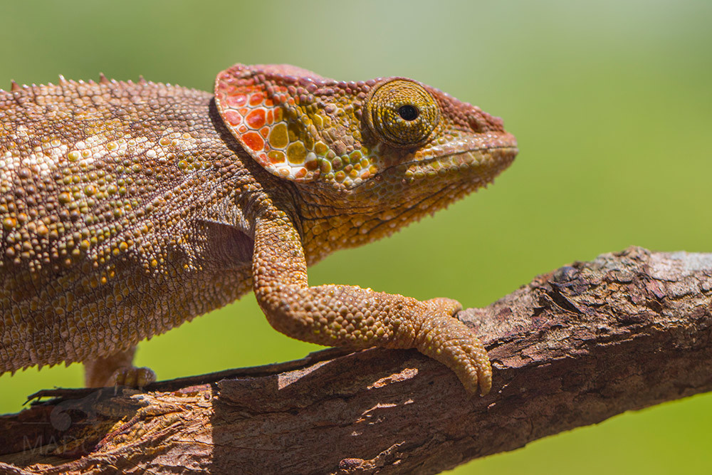
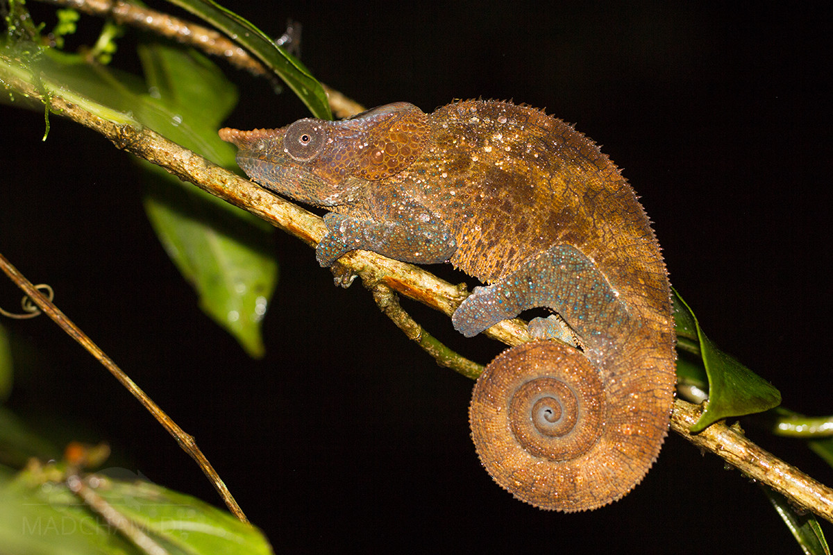
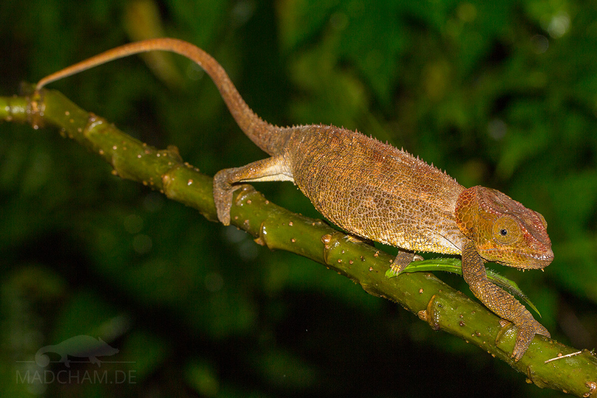
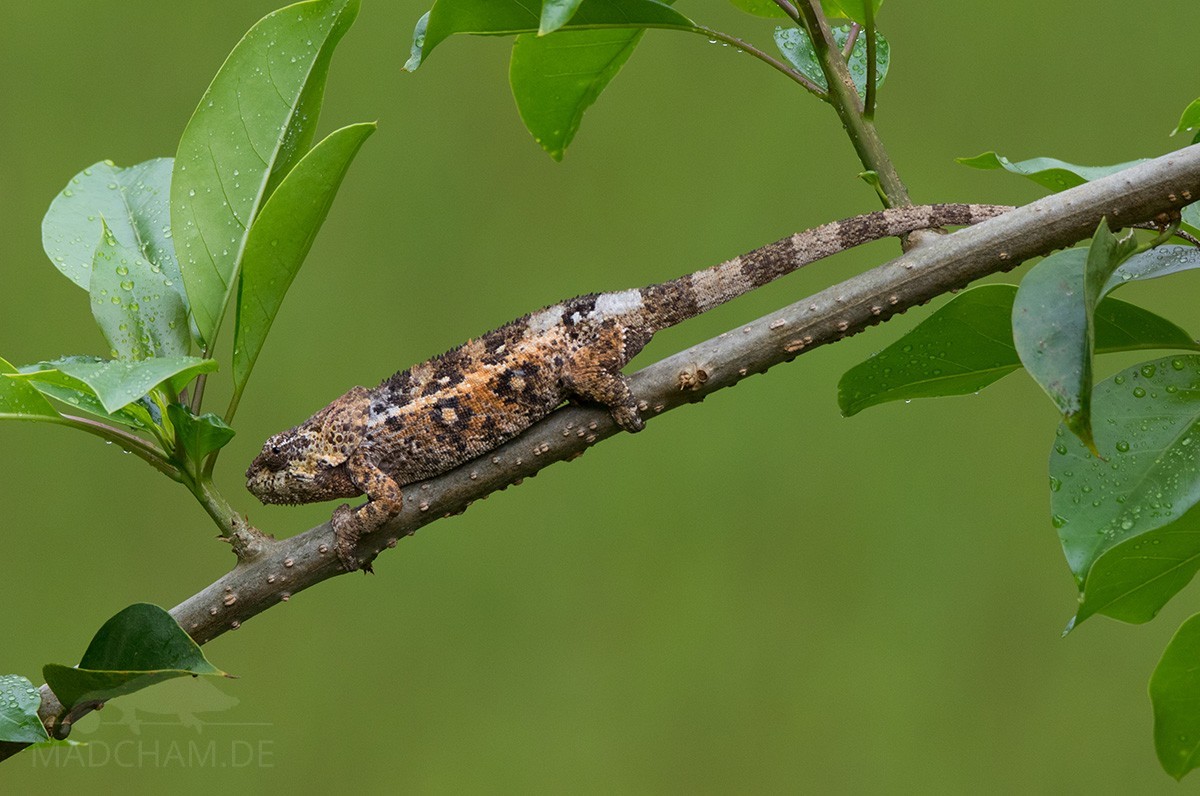
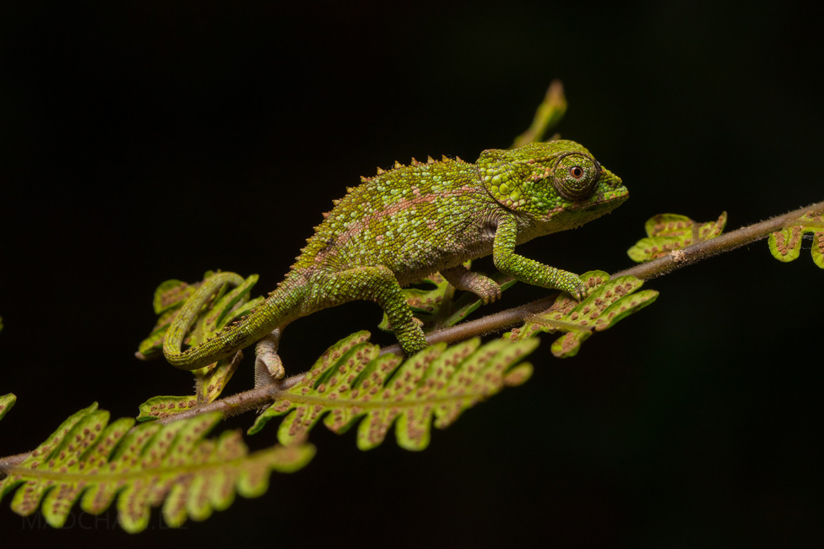
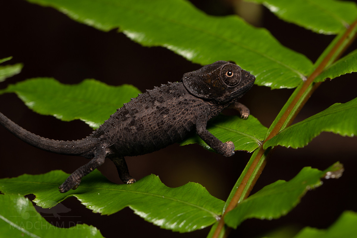
With a total length of approximately 40 cm in males, Calumma crypticum belongs to Madagascar’s larger chameleons. They look very similar to Calumma brevicorne: Males have distinct nose appendages that are laterally compressed, both genders wear distinct occipital lobes, and a dorsal crest with small cone scales. Males of Calumma crypticum are amazingly colorful, which makes them easy to distinguish from other species: The legs shine bright blue, and some individuals have blue accents along the whole body. Females are less conspicuous with their marbled brown color and yellow accents. The following pictures show some juveniles.
Weight table
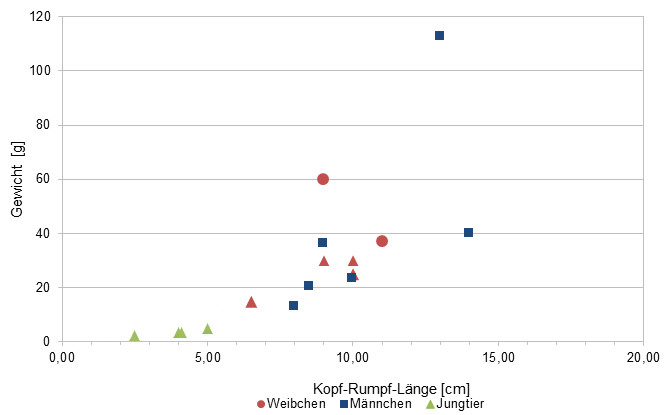
Gewicht = weight in grams, Kopf-Rumpf-Länge = snout-vent-length in cm, Jungtier = juvenile, Weibchen = female, Männchen = male
Since 2017, we measure the weights of Calumma crypticum that we find in Madagascar, of course only if practicable with calm animals (and working scales). Up to date, we have only a few weights. Over the long term, we want to get an average weight in proportion to the snout-vent-length (measured from the tip of the nose to the cloaca) from a large number of measurements for each Madagascan chameleon species. It is important to know that weights were all measured at the end of the rainy season when the chameleons have been having the highest food supply of the year. So our table may show the maximum weights of chameleons in Madagascar. Triangular symbols in females mean not pregnant, spherical symbols mean pregnant.
| Jan | Feb | Mar | Apr | May | Jun | Jul | Aug | Sep | Oct | Nov | Dec | |
| Average temperature | 23 | 24 | 23 | 23 | 21 | 19 | 19 | 19 | 20 | 21 | 22 | 23 |
| Minimum temperature | 20 | 20 | 20 | 19 | 18 | 15 | 15 | 15 | 15 | 16 | 18 | 19 |
| Maximum temperature | 27 | 27 | 27 | 27 | 25 | 23 | 23 | 23 | 24 | 25 | 26 | 27 |
| Rain days | 27 | 24 | 26 | 19 | 17 | 18 | 21 | 20 | 15 | 16 | 20 | 25 |
We have collected the data given above over several years with thermometers and hygrometers at the finding places of the chameleons. "Average temperature" means that values of a whole month have been calculated to one average value per month. For example all measured minimum temperature values of February have been calculated to one average minimum temperature for February. In plain language, this means single peak values of a day may be a little higher or lower than the average minimum and maximum temperatures. It is possible that a location has an average maximum temperature of 29°C, but one day during that month it had 33°C or even 35°C there.
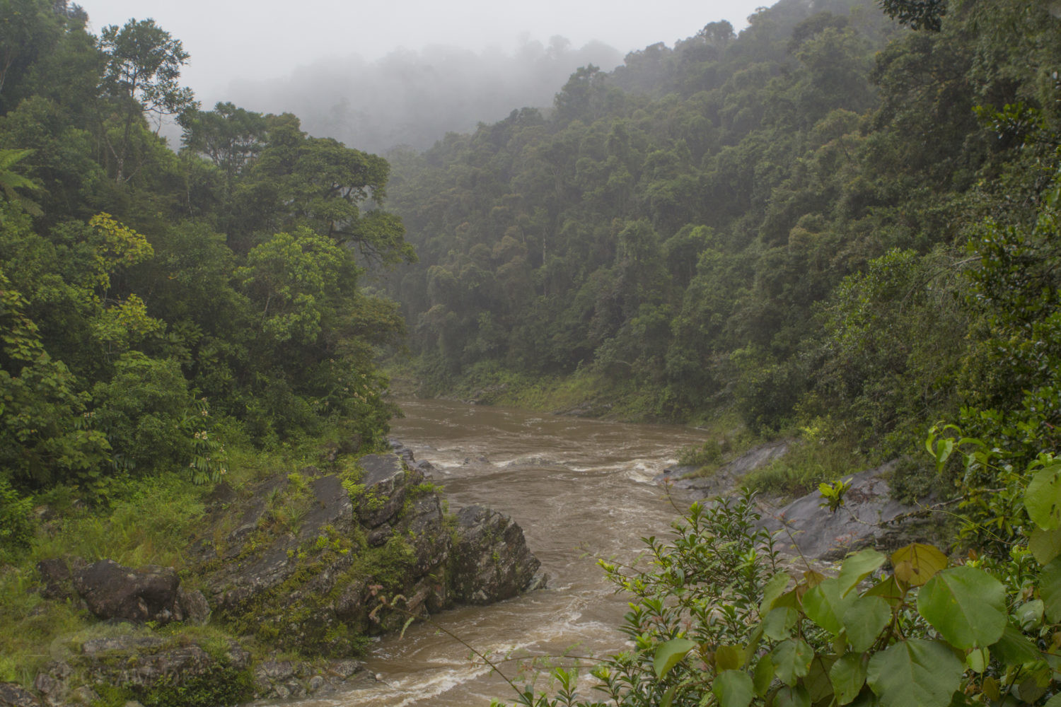
The rainforest of Ranomafana is located in Madagascar's southern highlands at elevations around 1000 m above sea level. Thus climate is generally cooler than e.g. on the coast or in the southwestern part of the island. Days reach temperatures around 25°C, rainy season may become a little warmer. Sunny places may get a little above 30°C sometimes. At night, temperature drops down to 20°C in rainy season and even lower to 15°C in dry season.
But "dry" season is very relative in Ranomafana, because the forest does not get dry at all. Never. It may rain less and precipitation is not lasting for days, but it is still rich enough to let ground and trees never dry completely. Key factors of Ranomafana's climate are high humidity and cool nights.
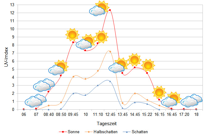
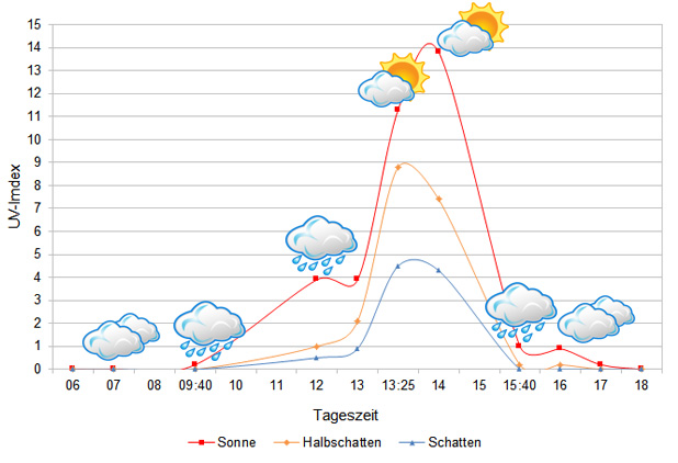
We have measured UVB data with a Solarmeter 6.5 in spring (March) at the peak of activity of chameleons in Madagascar. We always measured the values that a chameleon could maximally reach in its habitat.
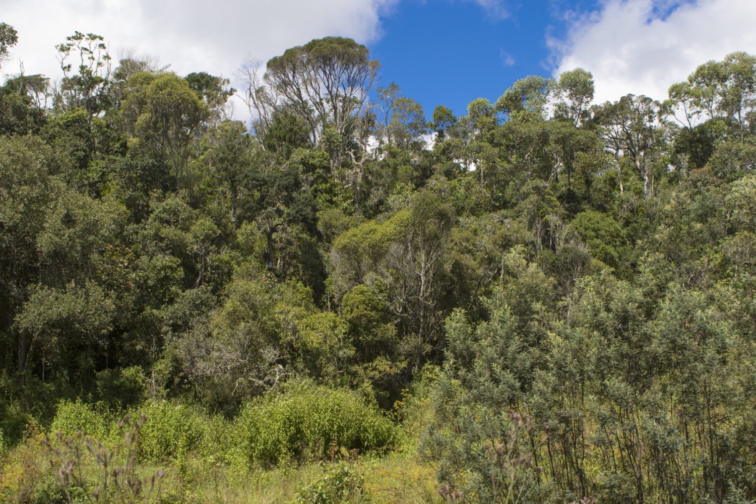
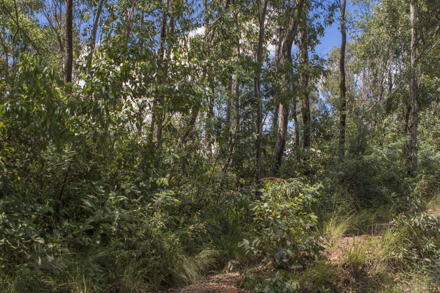
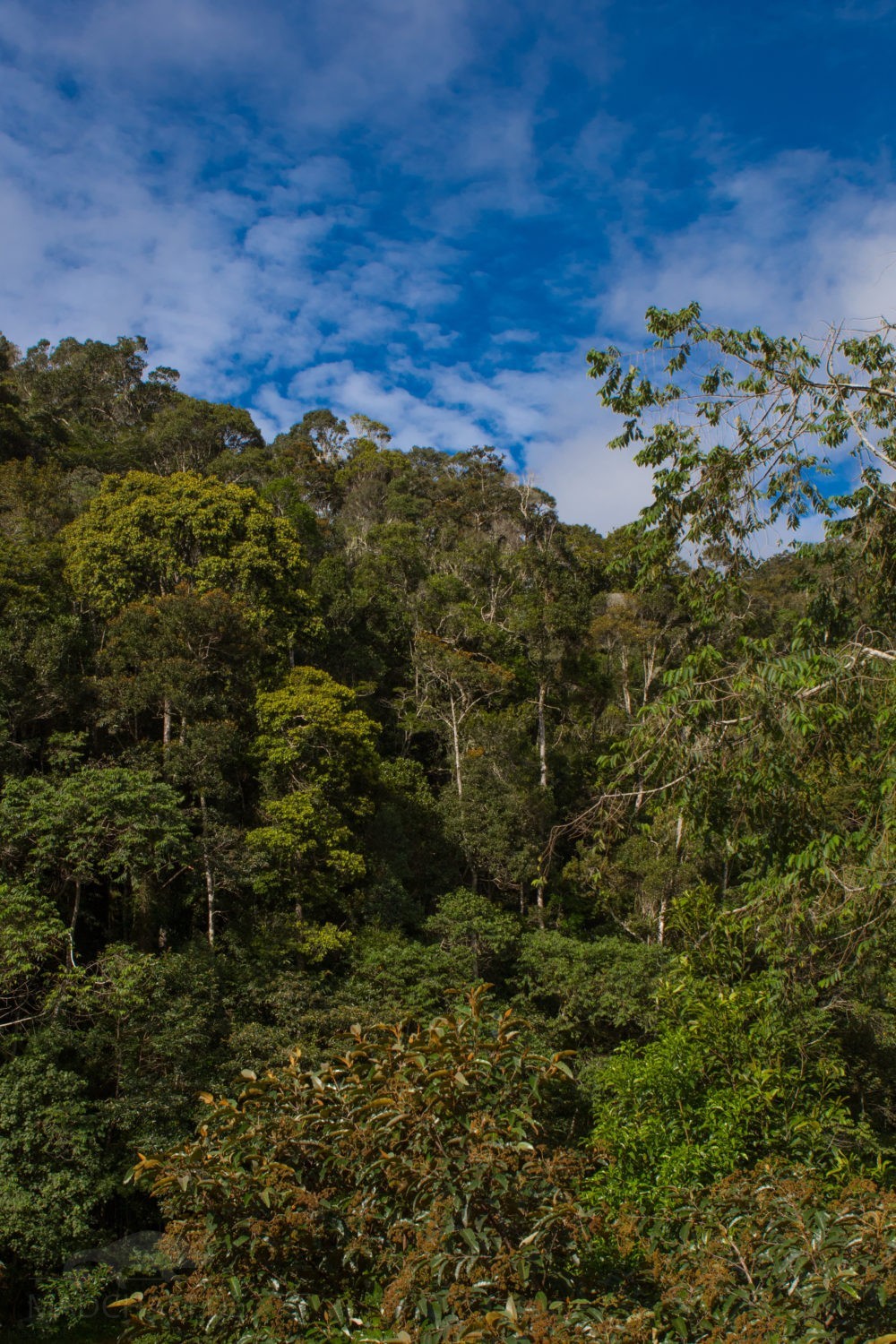
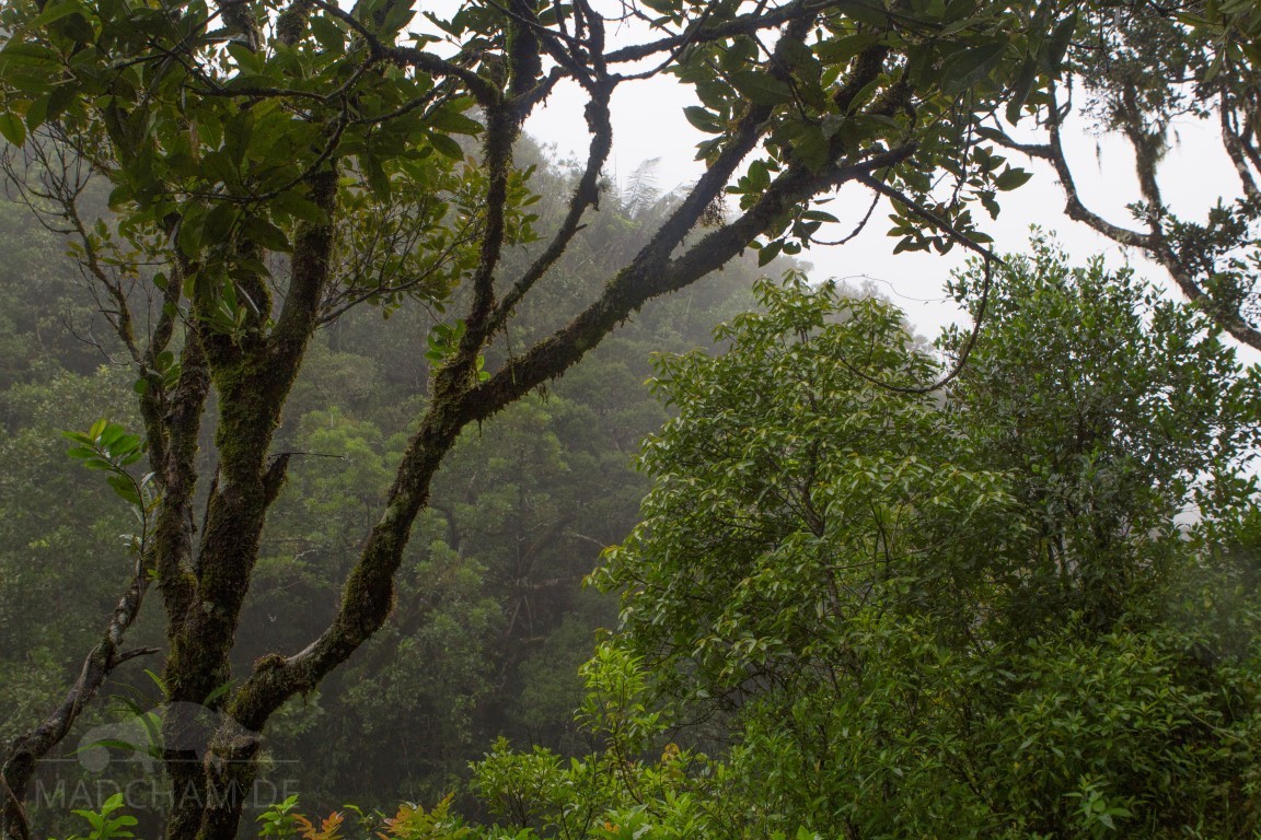
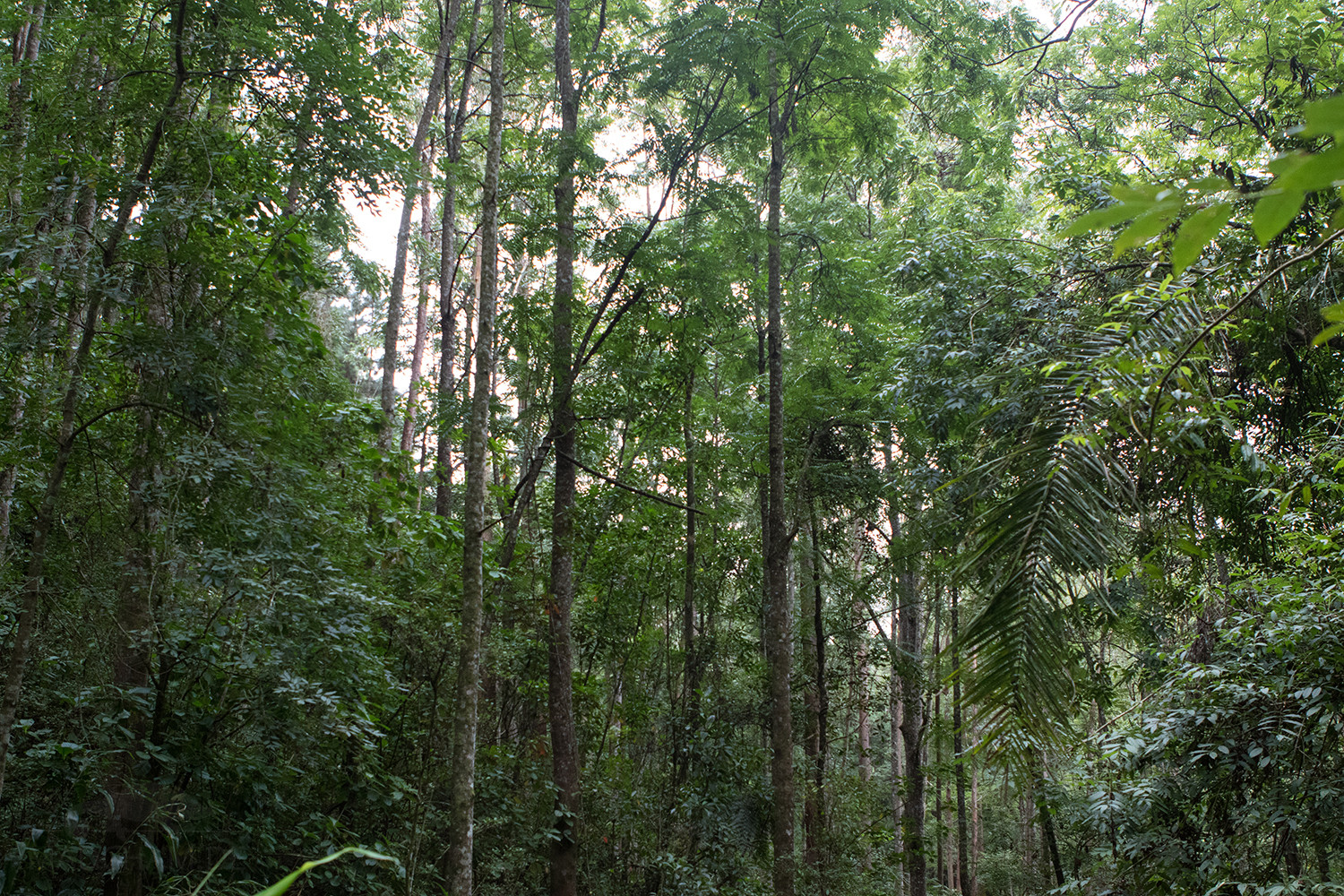
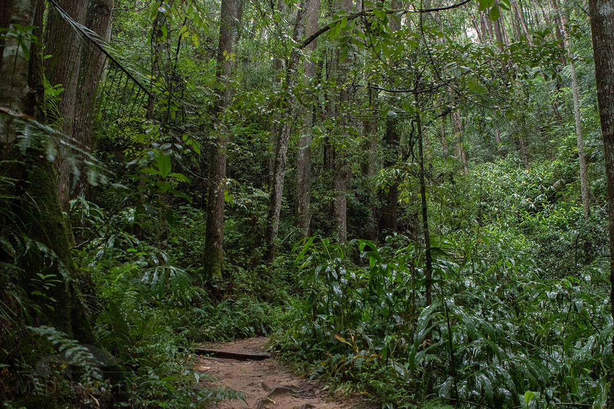
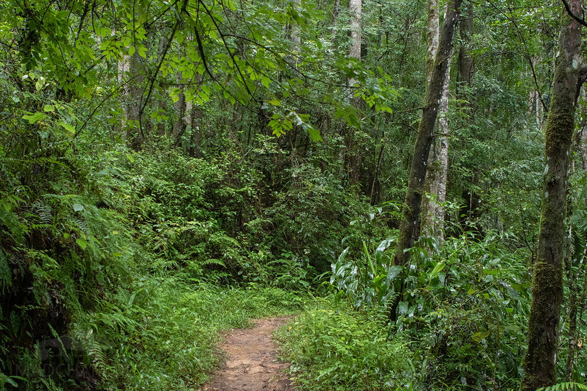
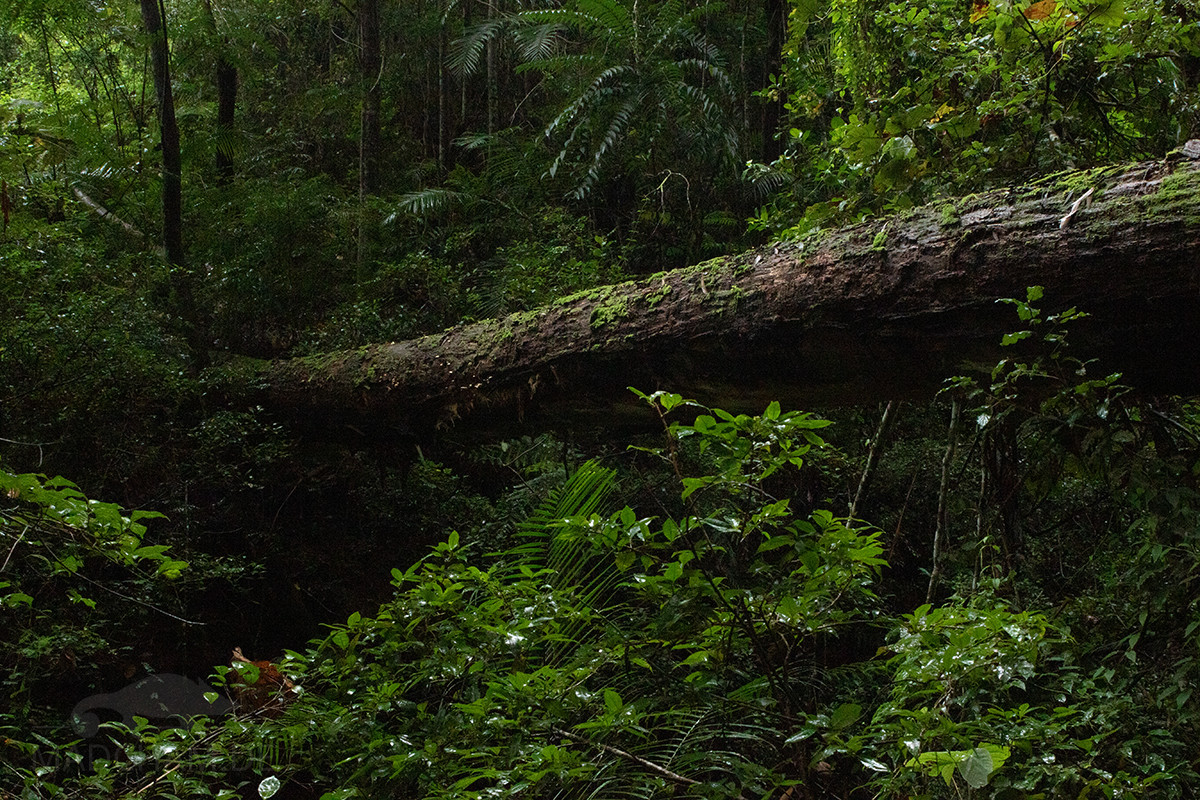
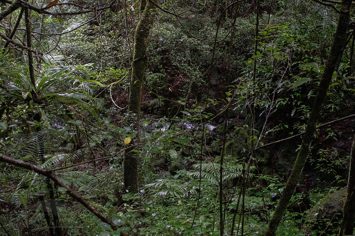
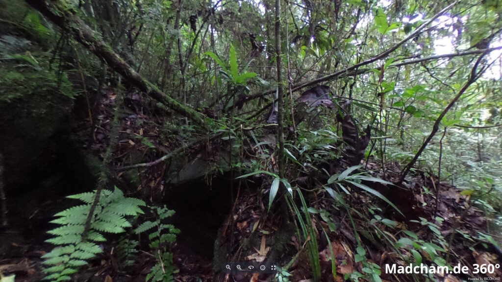
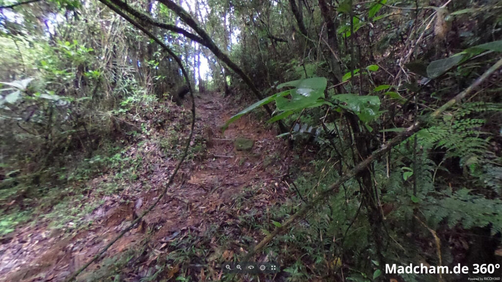
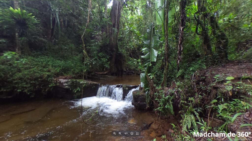
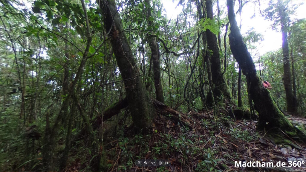
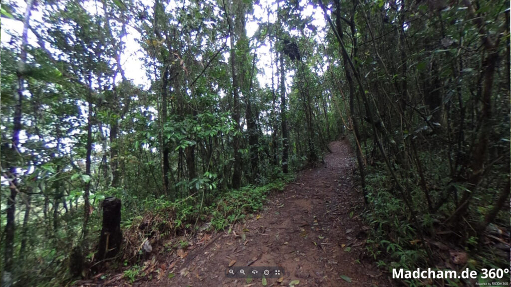
Habitat:
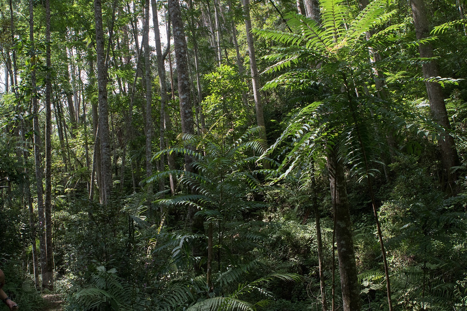
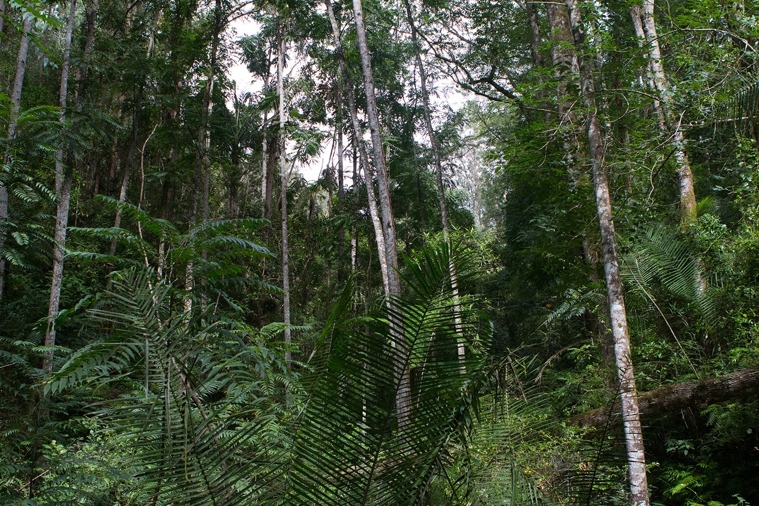
The following pictures show the habitat of Calumma crypticum near Ambositra as well as in Anjozorobe and Ranomafana. The finding place near Ambositra has been almost completely cut down in 2017. In Ranomafana, this species occurs in the intact rainforest with huge trees, lianas, and many ferns. The trees are quasi always moist and mossy overgrown. The forests extend over several canyons and are accordingly rocky, the soil is covered by foliage.
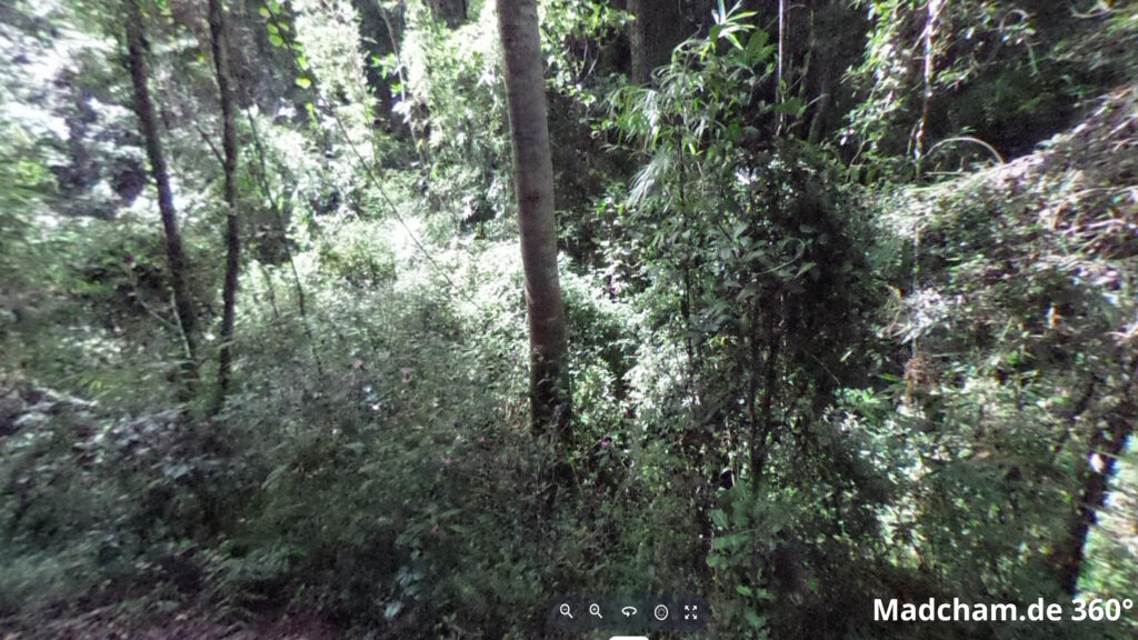
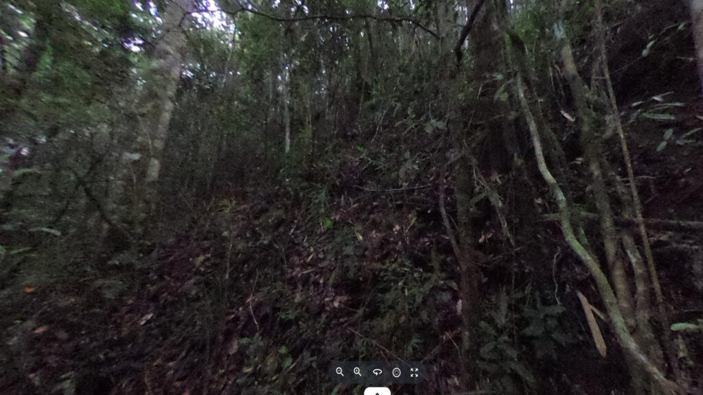
Below you will find some 360° images from the Anjozorobe and Ranomafana rainforests that we took during the rainy season. If you click on the respective image, the pictures will open in an enlarged view in a separate window. You can use the mouse to rotate in all directions. You also have the option of running the images in full-screen mode. Enjoy!


Das könnte dir auch gefallen


Follow us on Instagram

Most popular articles


Your travel specialist for Madagascar