no legal export possible
First description:
(Brygoo & Domergue, 1970) ![]()
Origin of the species name:
The zoologists Édouard-Raoul Brygoo and Charles Antoine Domergue worked at the Institut Pasteur in Antananarivo, Madagascar, and simply named the species after the closest place to its distribution area: the village of Belalanda north of Toliara.
Distribution:
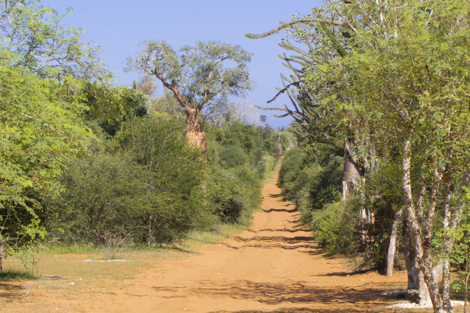
Furcifer belalandaensis lives in the dry residues of spiny forests at Madagascar’s southwest coast. The name-giving village Belalanda is located few kilometers north of Toliara (Tuléar). But the distribution area extends a little further north approximately until Morombe. Since the area has not many spiny forests left and the existing forest residues are not linked to each other, the population is isolated in parts and has big problems to reproduce. According to this fact, they are very rare and you can find Furcifer belalandaensis only by a highly intense search.
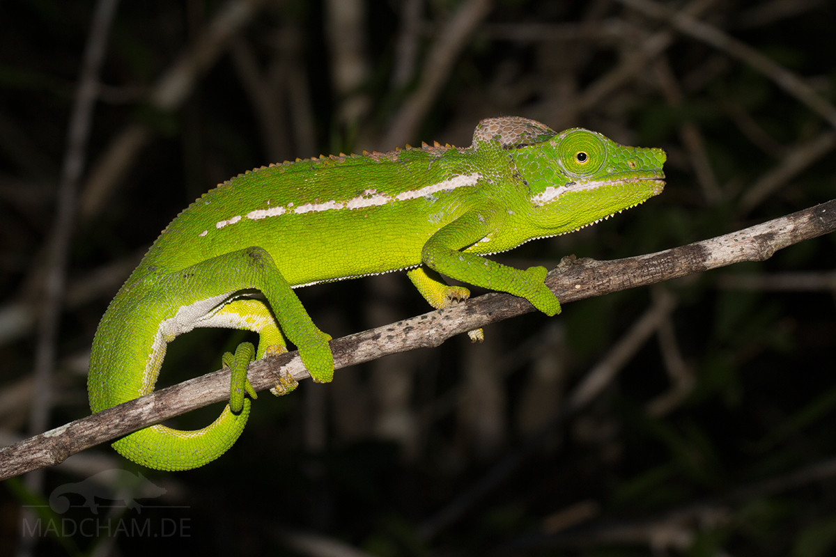
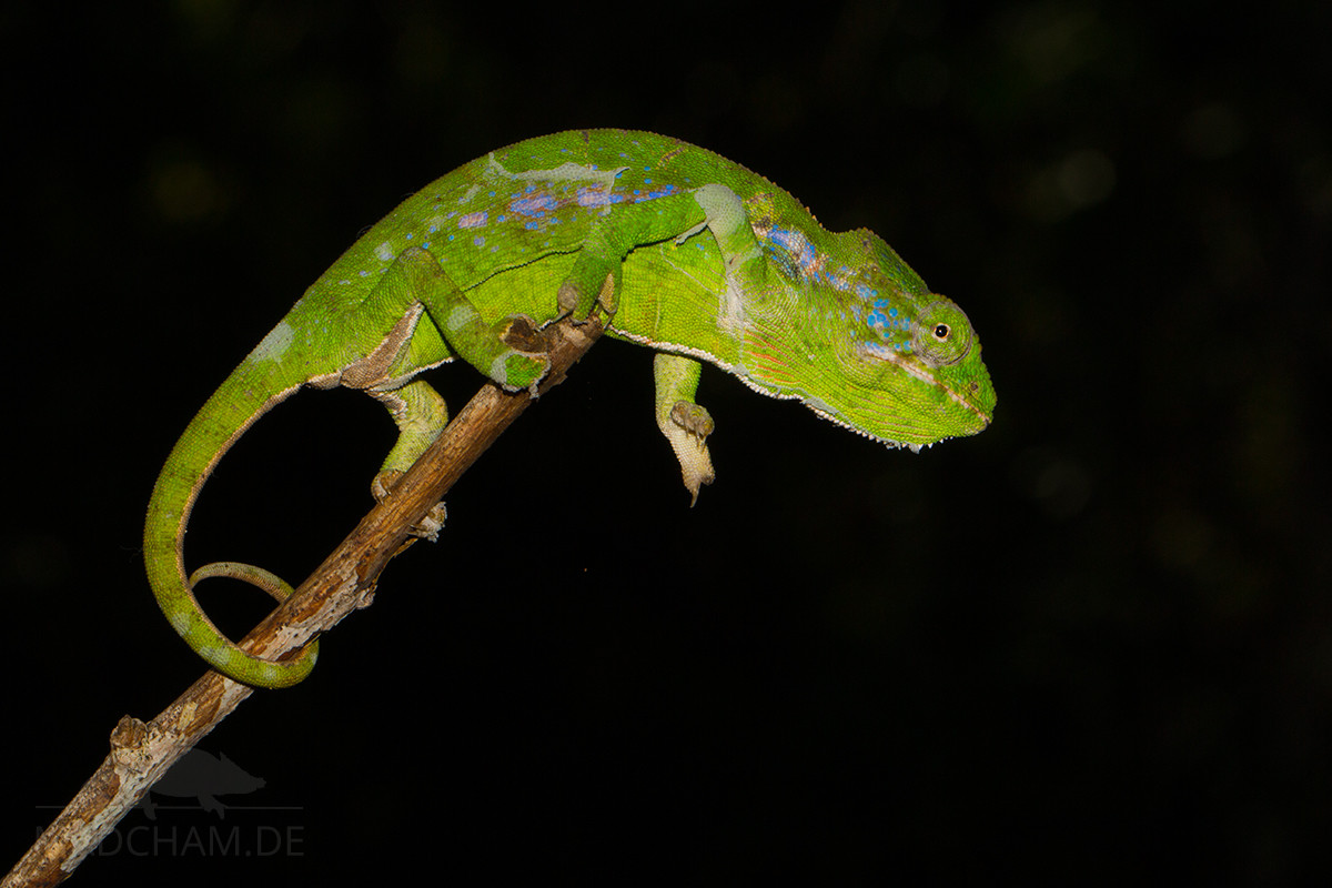
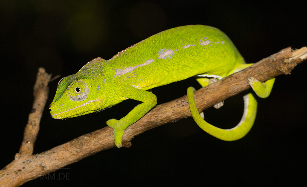
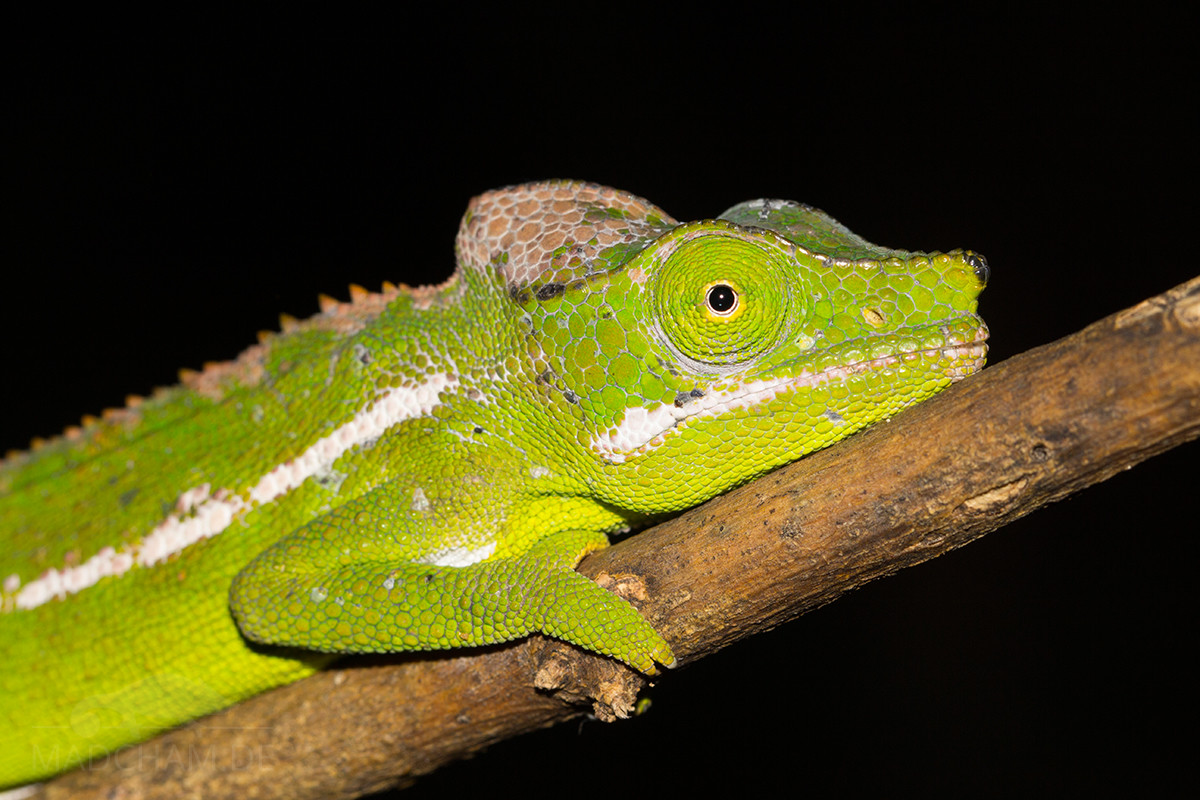
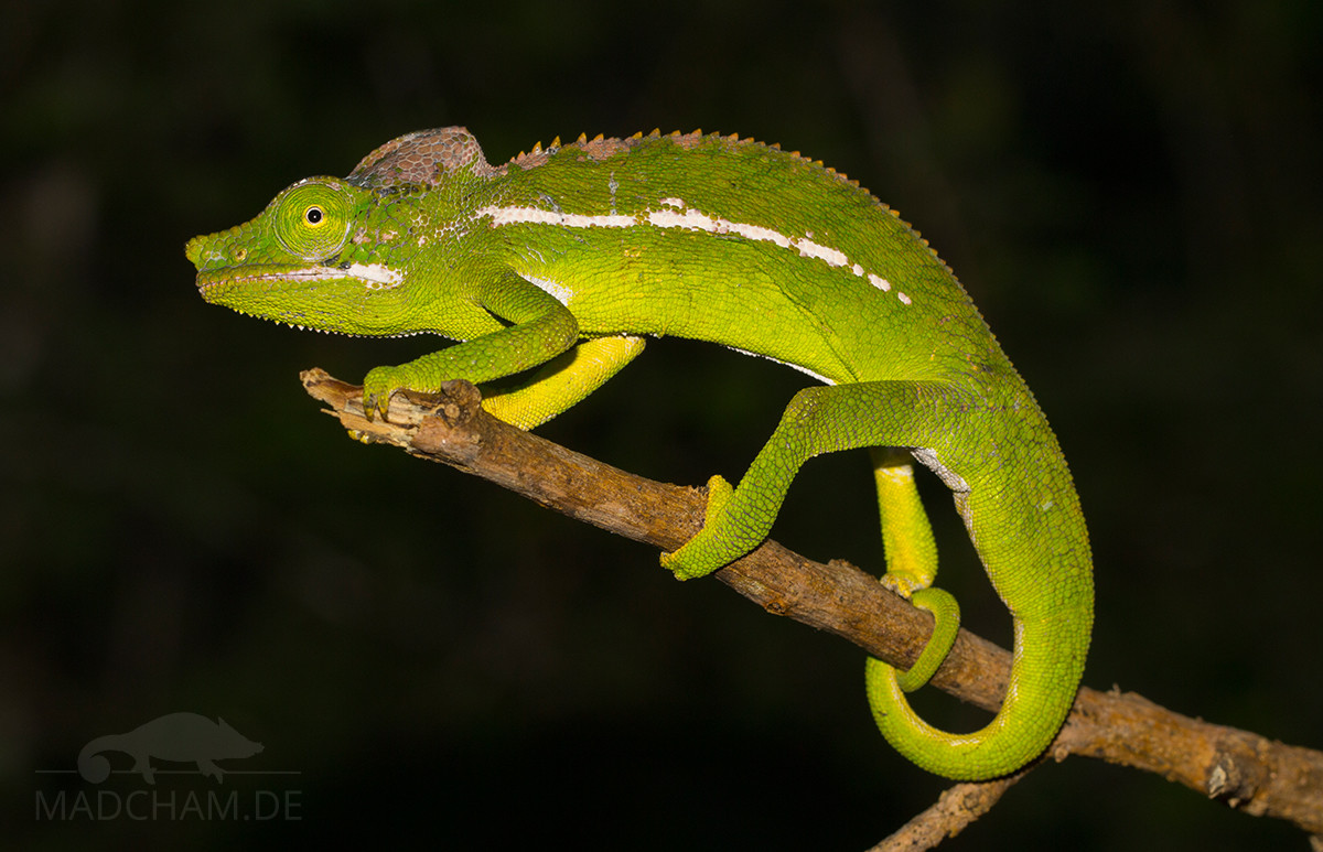
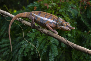
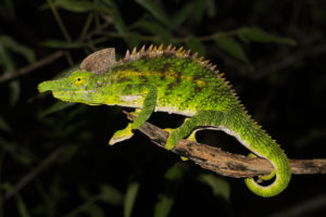
Appearance and size:
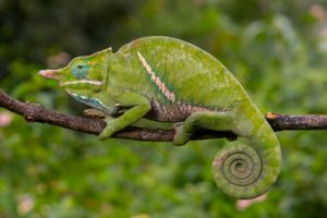
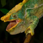
Males become 20 to 22 cm in total length, females stay a little smaller. Both genders wear a bright green coloration with a white, partially interrupted lateral stripe, a small nose appendage and white lips. Males have a slightly raised, whitish-beige colored helmet; females have a green helmet. The dorsal ridge of Furcifer belalandaensis consists of regular small cone scales, the females only have some in the anterior part of the dorsum. A white line reaches from the belly to the tip of the tail. Females may have pretty color accents along the lateral stripe.
Good to know:
In 2012, some people spread the idea this species might be a hybrid from Furcifer antimena and Furcifer verrucosus, because the species had not been seen for years. But still today, no scientific examinations were published to prove this thesis, so Furcifer belalandaensis is still a valid species. We do explicitly not share the opinion of this species being a hybrid.
| Jan | Feb | Mar | Apr | May | Jun | Jul | Aug | Sep | Oct | Nov | Dec | |
| Average temperature | 27 | 27 | 26 | 25 | 23 | 21 | 20 | 21 | 22 | 23 | 25 | 26 |
| Minimum temperature | 22 | 22 | 21 | 20 | 17 | 14 | 14 | 15 | 16 | 18 | 20 | 22 |
| Maximum temperature | 32 | 32 | 32 | 30 | 28 | 26 | 26 | 27 | 28 | 29 | 30 | 31 |
| Rain days | 13 | 12 | 7 | 5 | 4 | 4 | 3 | 3 | 3 | 4 | 7 | 12 |
We have collected the data given above over several years with thermometers and hygrometers at the finding places of the chameleons. "Average temperature" means that values of a whole month have been calculated to one average value per month. For example all measured minimum temperature values of February have been calculated to one average minimum temperature for February. In plain language, this means single peak values of a day may be a little higher or lower than the average minimum and maximum temperatures. It is possible that a location has an average maximum temperature of 29°C, but one day during that month it had 33°C or even 35°C there.
Climate in Toliara (Tuléar) and surroundings is mainly one thing: Hot. In rainy season, daily temperatures rise easily to more than 30°C. In sunny places, it may even get 45°C. This is the location to look for every shady place you can get. And although it is called "rainy" season, precipitation in the south is lean. In good years, it is raining every couple of days from November to February. In worse years, it is raining even less.
During dry season, temperatures drop a little, but it remains very warm. In the night, temperatuers in July and August may drop even to 15°C, but days reach temperatures over 25°C without a problem. This large temperature drop is typical for the area. The dry season has only shot and very few rainfall.
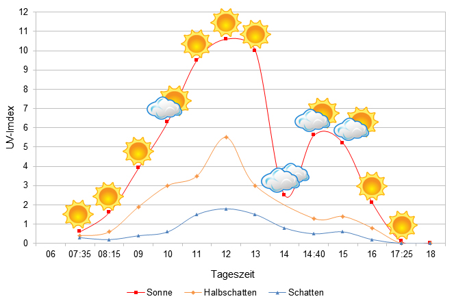
We have measured UVB data with a Solarmeter 6.5 in spring (end of March) at the peak of activity of chameleons in Madagascar. We always measured the values that a chameleon could maximally reach in its habitat.
Habitat:
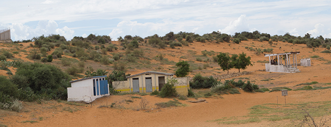
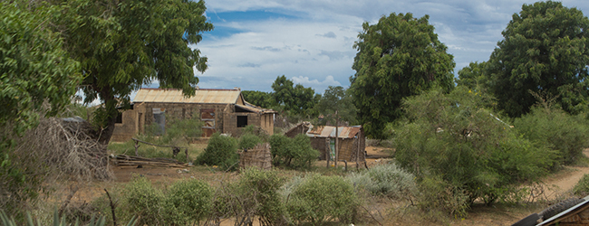
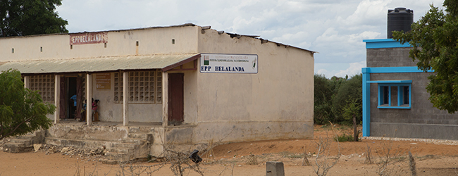
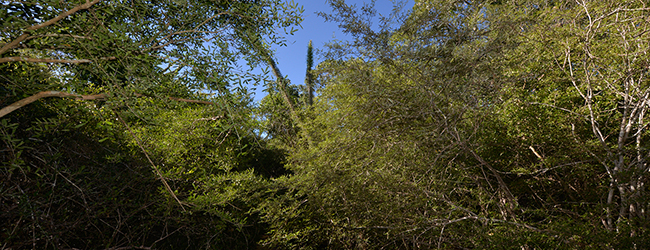
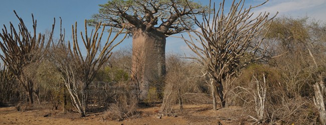
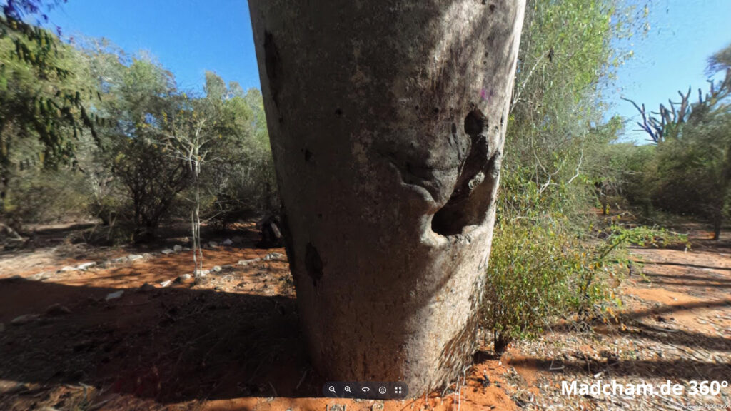
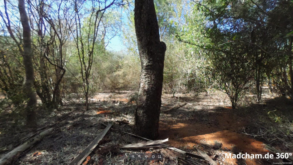
The environment of this species is enormously sparse. Meager spiny forests grow on red sandy ground, and those forests are eponymously really spine. The species does hardly occur in secondary vegetation, and is even hard to find in the residues of spiny forests of this area. During the rainy season, the spiny forest blooms and becomes green. As soon as the dry season begins, everything dries up quickly. Belalanda itself is a small village with wooden huts and some dilapidated stone houses. This chameleon’s habitat does not benefit from being close to the city of Toliara. Any wood is cut here. See some pictures from Belalanda and still intact habitats below.
Below you will find some 360° pictures from Ifaty north of Toliara, which we took during the rainy season. If you click on the respective image, the pictures will open in an enlarged view in a separate window. You can use the mouse to rotate in all directions. You also have the option of running the images in full-screen mode. Enjoy!

Das könnte dir auch gefallen


Follow us on Instagram

Most popular articles


Your travel specialist for Madagascar