2017-25 each year 150 animals released for legal export
First description:
(Brygoo & Domergue, 1968) ![]()
Origin of the species name:
The two zoologists Édouard-Raoul Brygoo and Charles Antoine Domergue of the Natural History Museum in Paris (France) named the species in honour of their assistant taxidermist Fernand Angel. Angel had already described various new species himself in the course of cataloguing all the existing chameleon preparations in the museum.
Distribution:
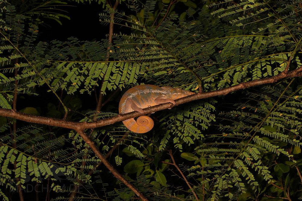
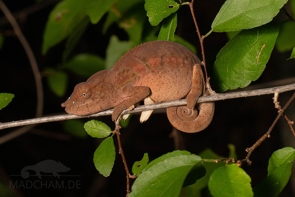
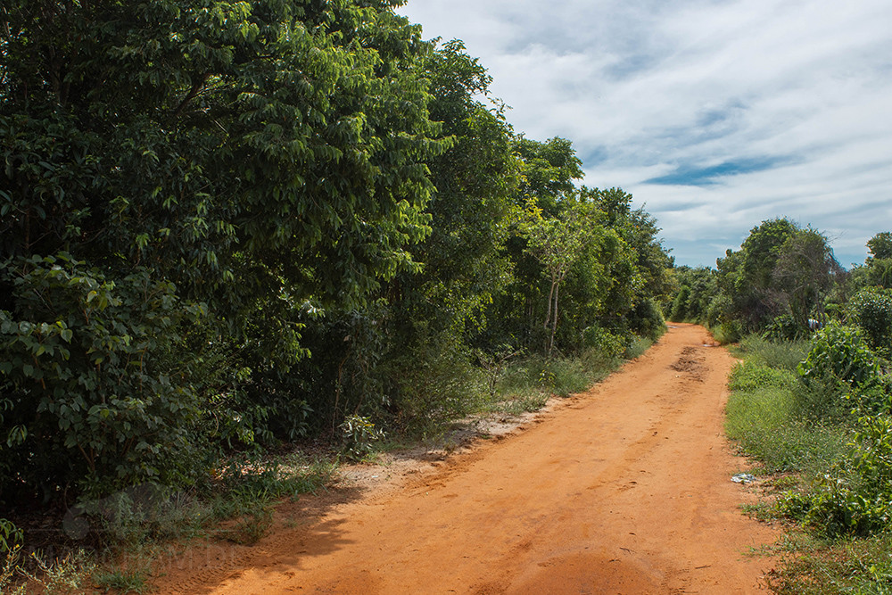
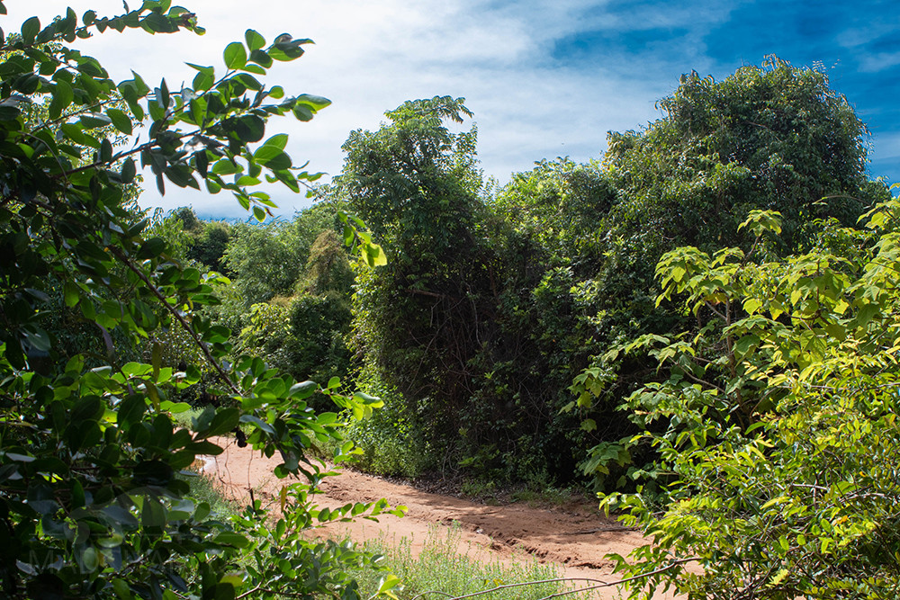
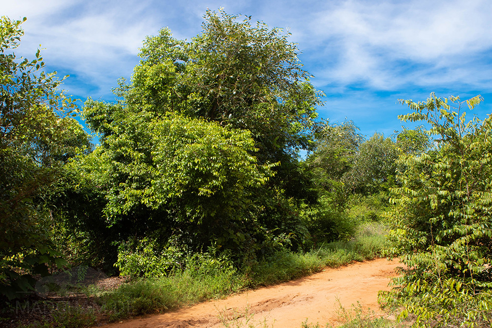
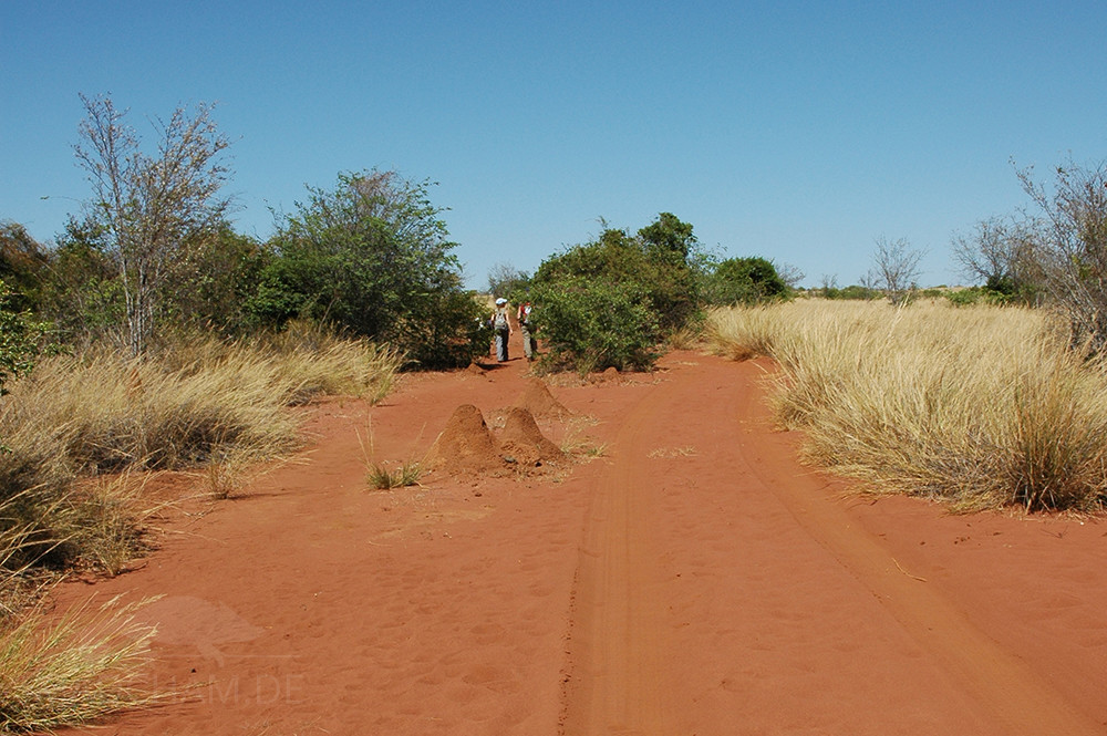
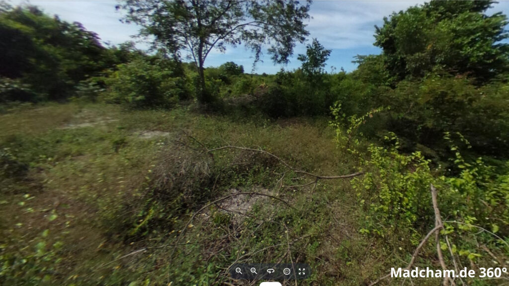
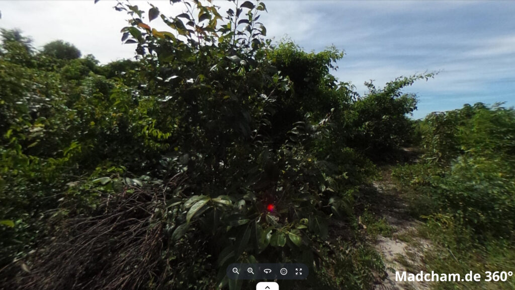
Furcifer angeli lives in the dry forests of northwest Madagascar. The distribution area ranges from the Ankarafantsika National Park to various forest remnants near Port-Bergé and Mahajanga on the west coast. The latter is not protected, which is why the few remaining dry forests are heavily threatened by deforestation and slash-and-burn clearing. Unfortunately, finding the species is not easy and we have already spent many hours in the heat without seeing Furcifer angeli. Only in certain, extremely small residual forests Furcifer angeli can be found in larger numbers during the rainy season. But as these forest remains are miles apart and in between, there are only savannah-like, cleared landscapes, it can be assumed that different Furcifer angeli populations, unfortunately, do not meet each other anymore.
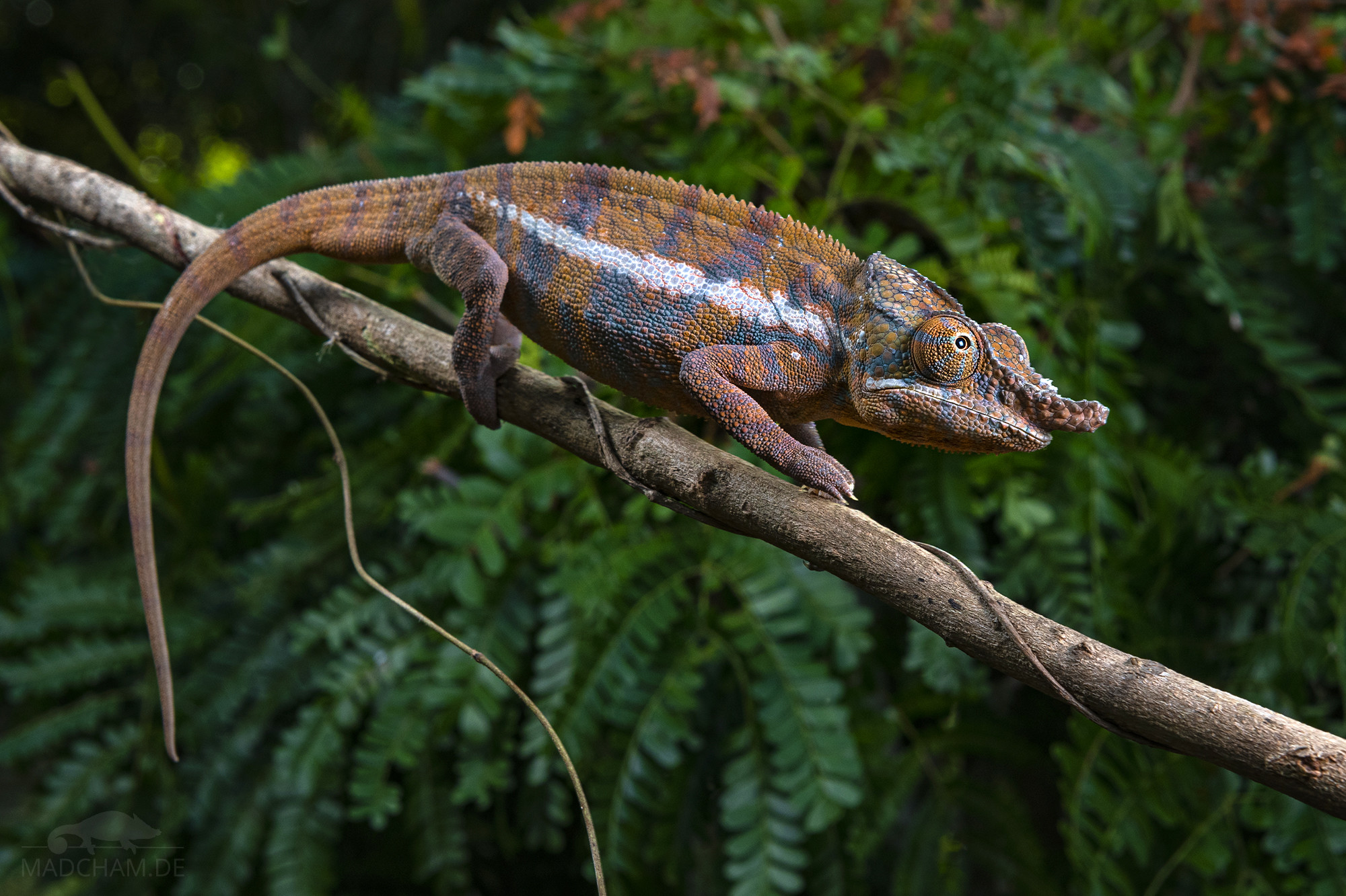
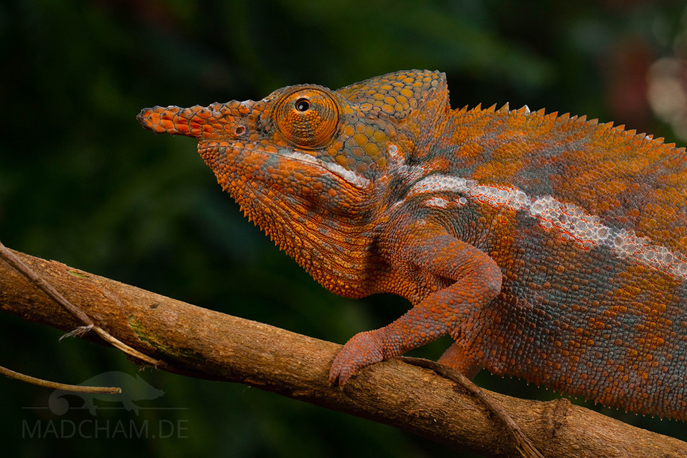
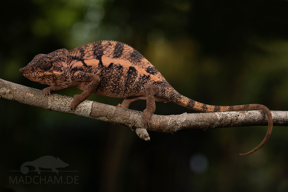
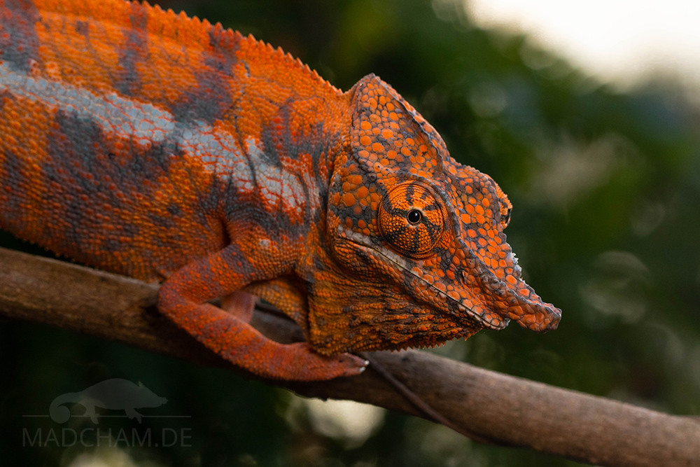
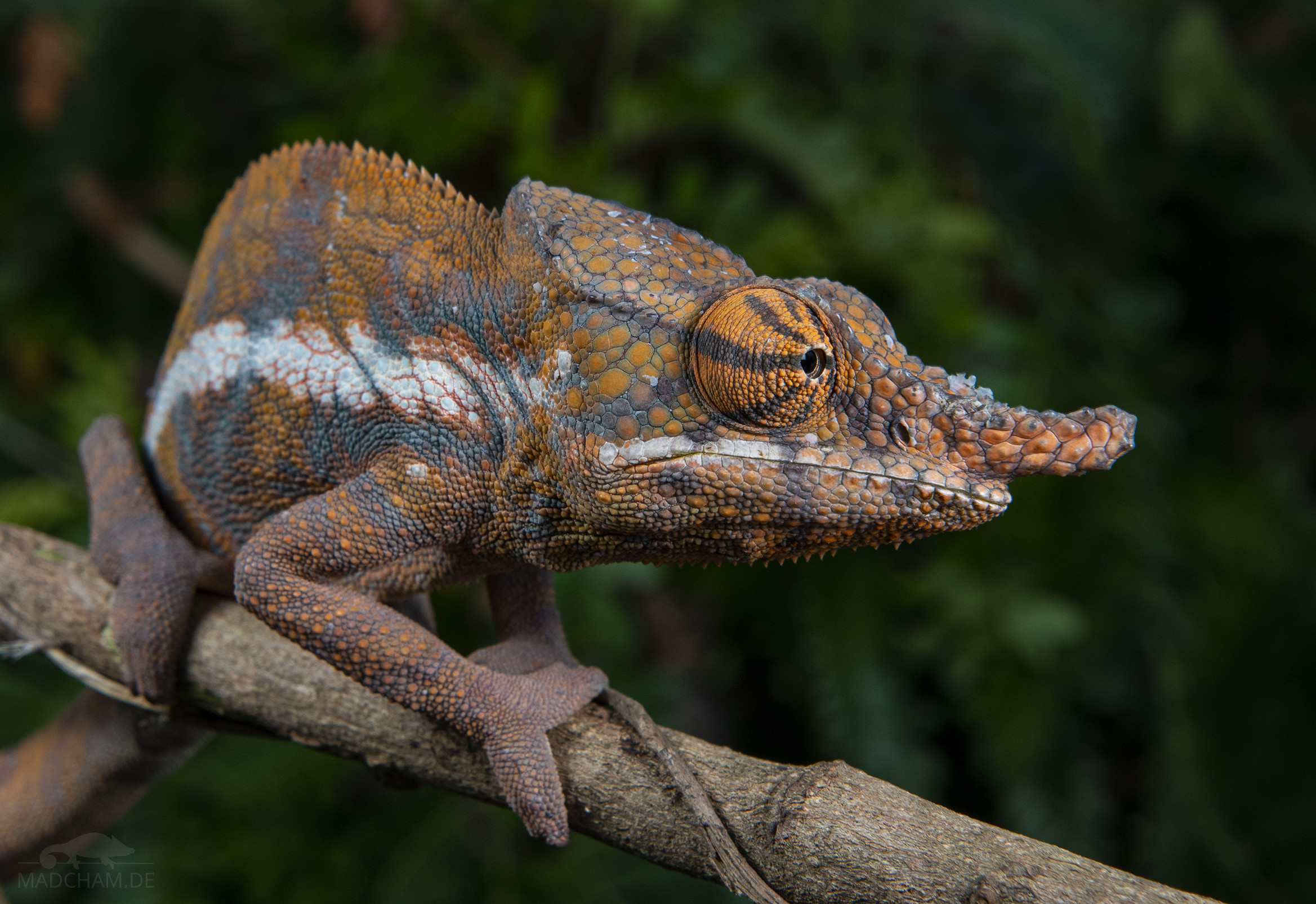
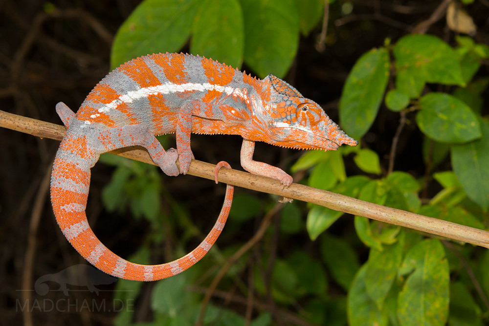
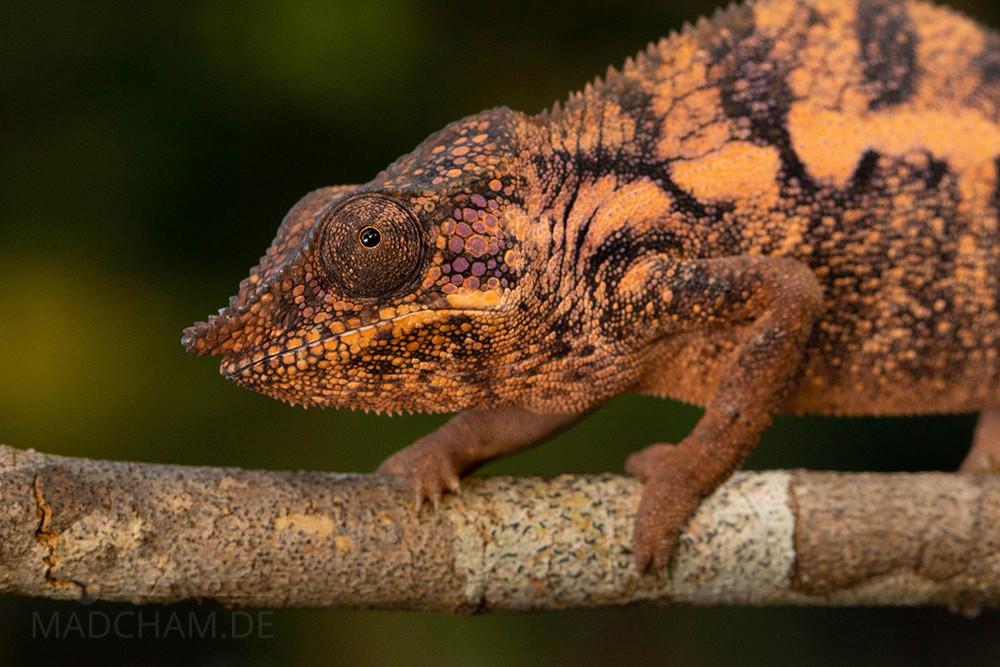
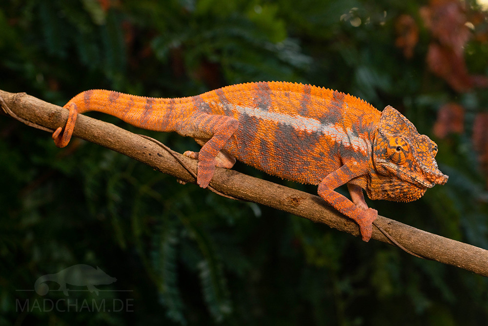
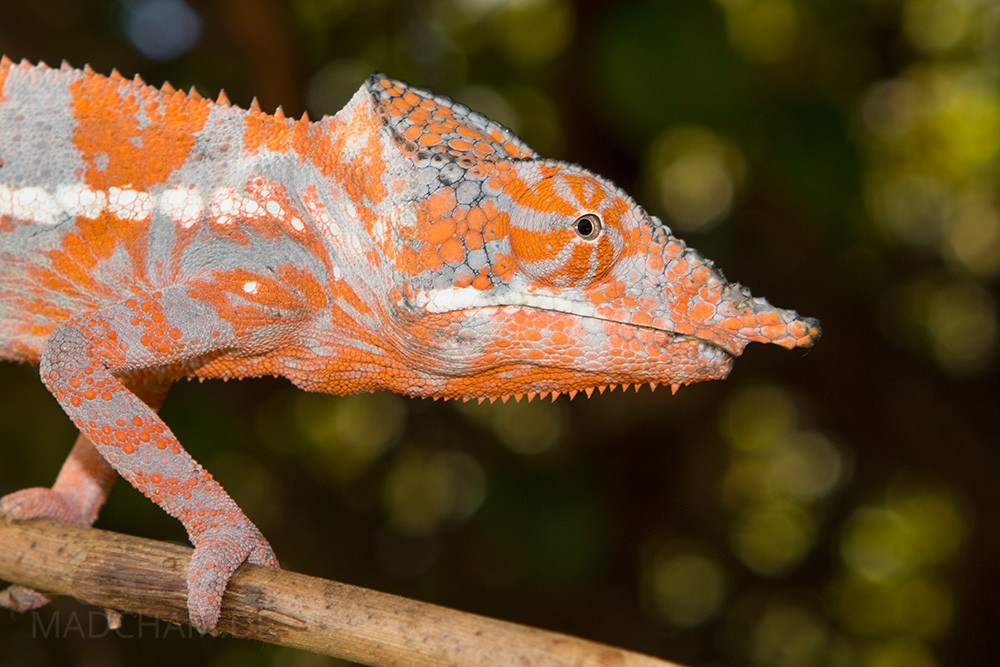
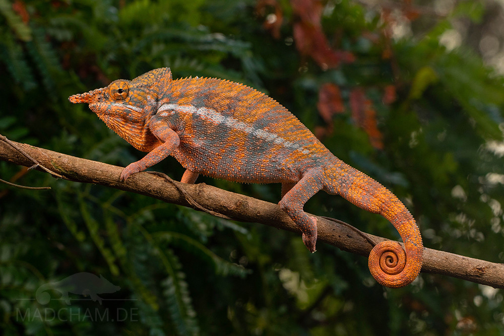
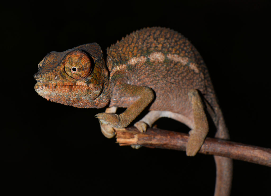
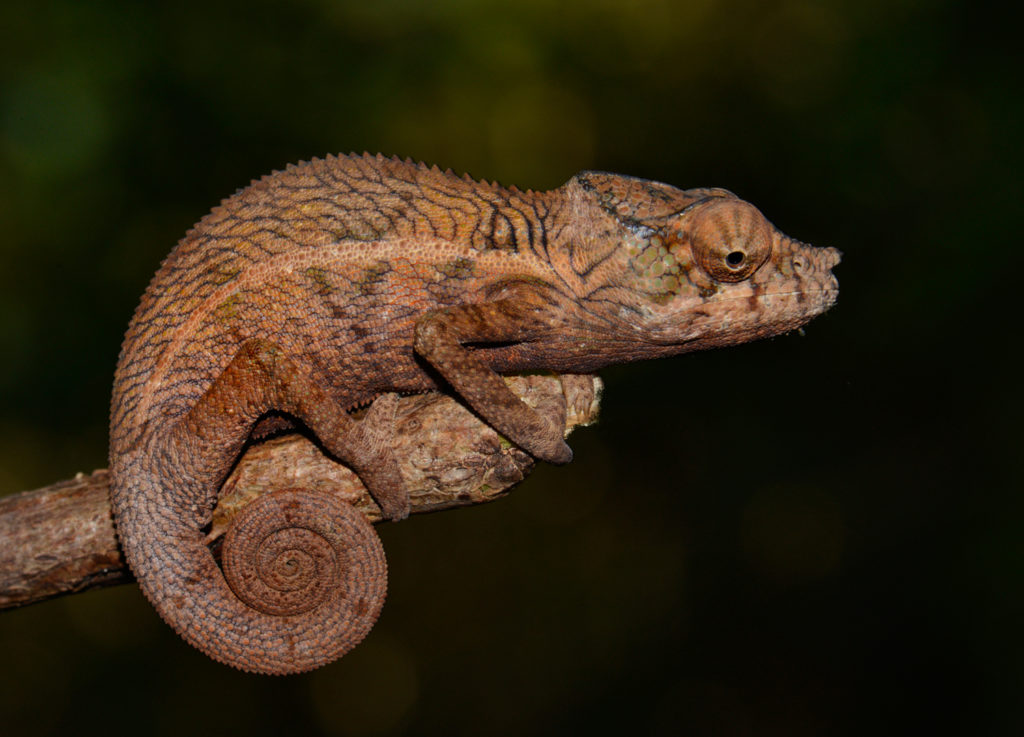
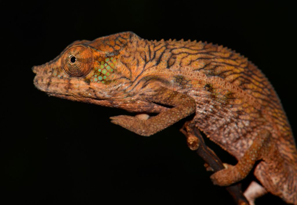
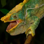
Appearance and size:
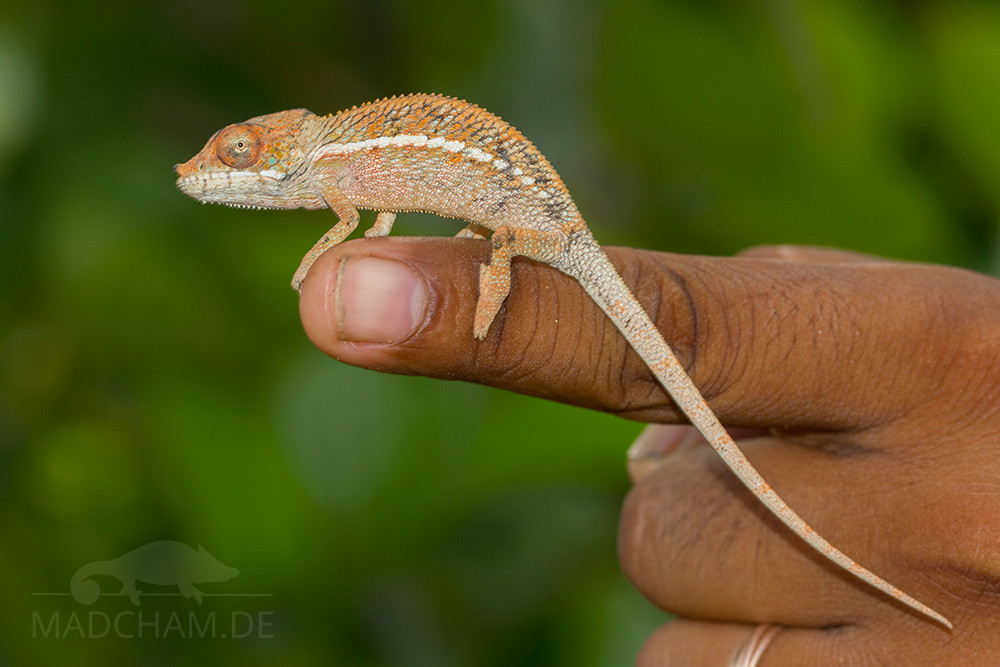
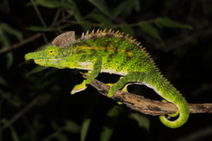
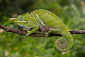
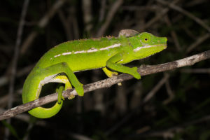
Male Furcifer angeli grow up to 42 cm long from the nose to the tip of the tail, the females remain considerably smaller with almost 30 cm. The species looks very similar to Furcifer pardalis, whose distribution range begins a little further north. However, Furcifer angeli has a longer nose and is far less spectacularly colored. The males are dirty orange colored with bluish-grey banding and partly burgundy red markings. When excited they show their most beautiful colors with bright orange. The females of Furcifer angeli are colored exactly like Furcifer pardalis pink to orange with black banding but have a slightly longer nose. Both sexes have white lips and a white lateral stripe as well as a dorsal crest. Gular and ventral crest exists, too, but they become more and more indistinct towards the tail.
| Jan | Feb | Mar | Apr | May | Jun | Jul | Aug | Sep | Oct | Nov | Dec | |
| Average temperature | 27 | 27 | 27 | 27 | 26 | 24 | 23 | 24 | 25 | 26 | 27 | 27 |
| Minimum temperature | 23 | 23 | 23 | 22 | 20 | 18 | 17 | 18 | 19 | 21 | 22 | 23 |
| Maximum temperature | 31 | 31 | 31 | 32 | 31 | 30 | 30 | 30 | 31 | 32 | 31 | 31 |
| Rain days | 25 | 24 | 19 | 8 | 4 | 4 | 6 | 6 | 4 | 6 | 12 | 21 |
We have collected the data given above over several years with thermometers and hygrometers at the finding places of the chameleons. "Average temperature" means that values of a whole month have been calculated to one average value per month. For example all measured minimum temperature values of February have been calculated to one average minimum temperature for February. In plain language, this means single peak values of a day may be a little higher or lower than the average minimum and maximum temperatures. It is possible that a location has an average maximum temperature of 29°C, but one day during that month it had 33°C or even 35°C there.
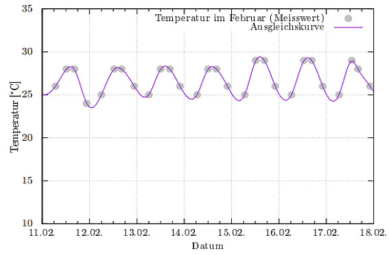
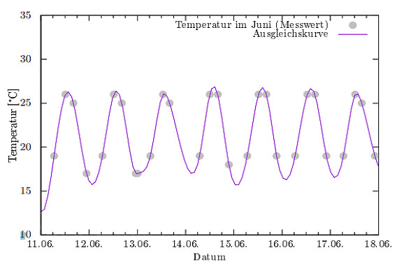
Several examples of daily temperatures in Ankarafantsika during the rainy season can be found below. They were recorded with data loggers in 2024.
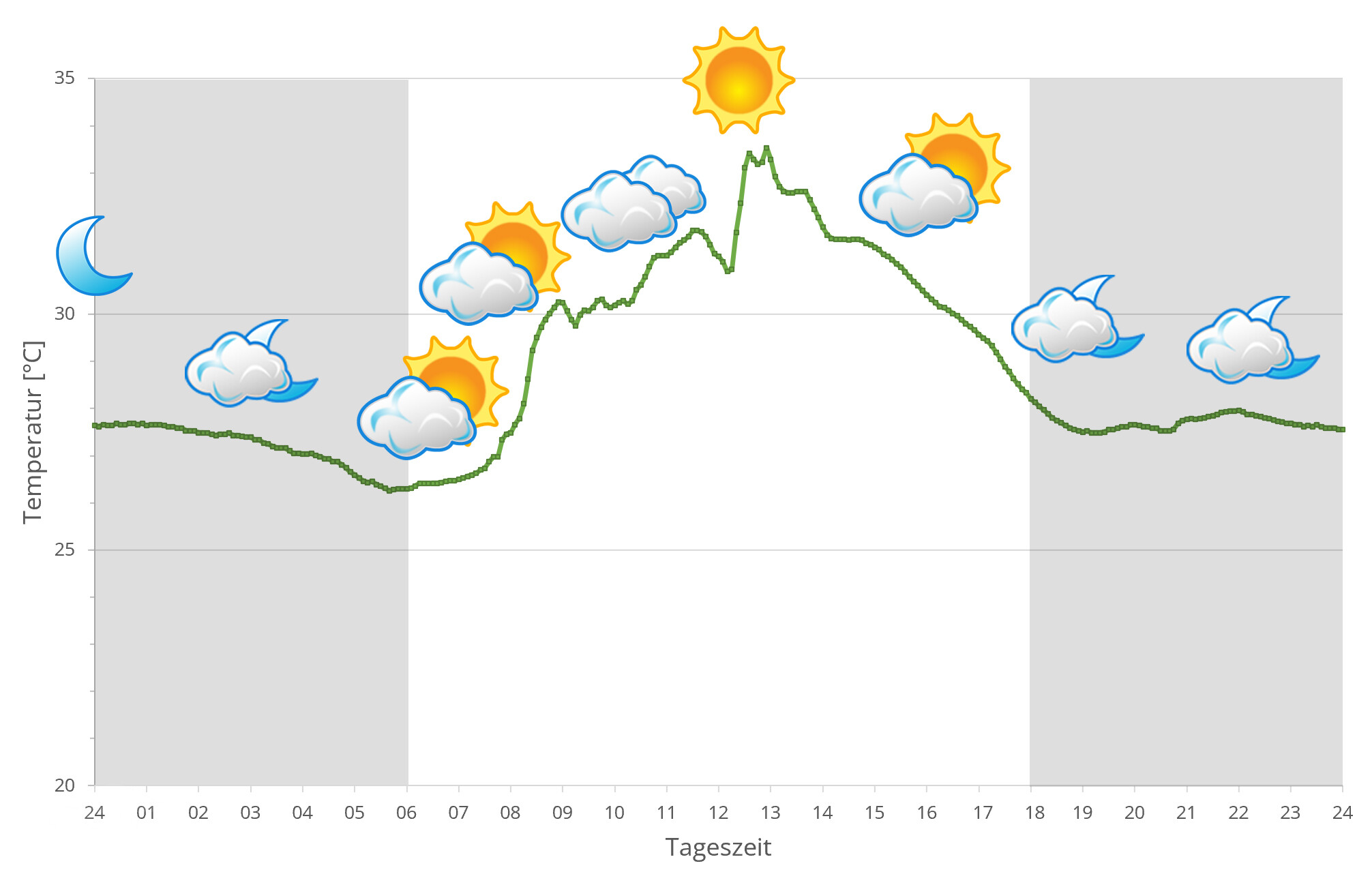
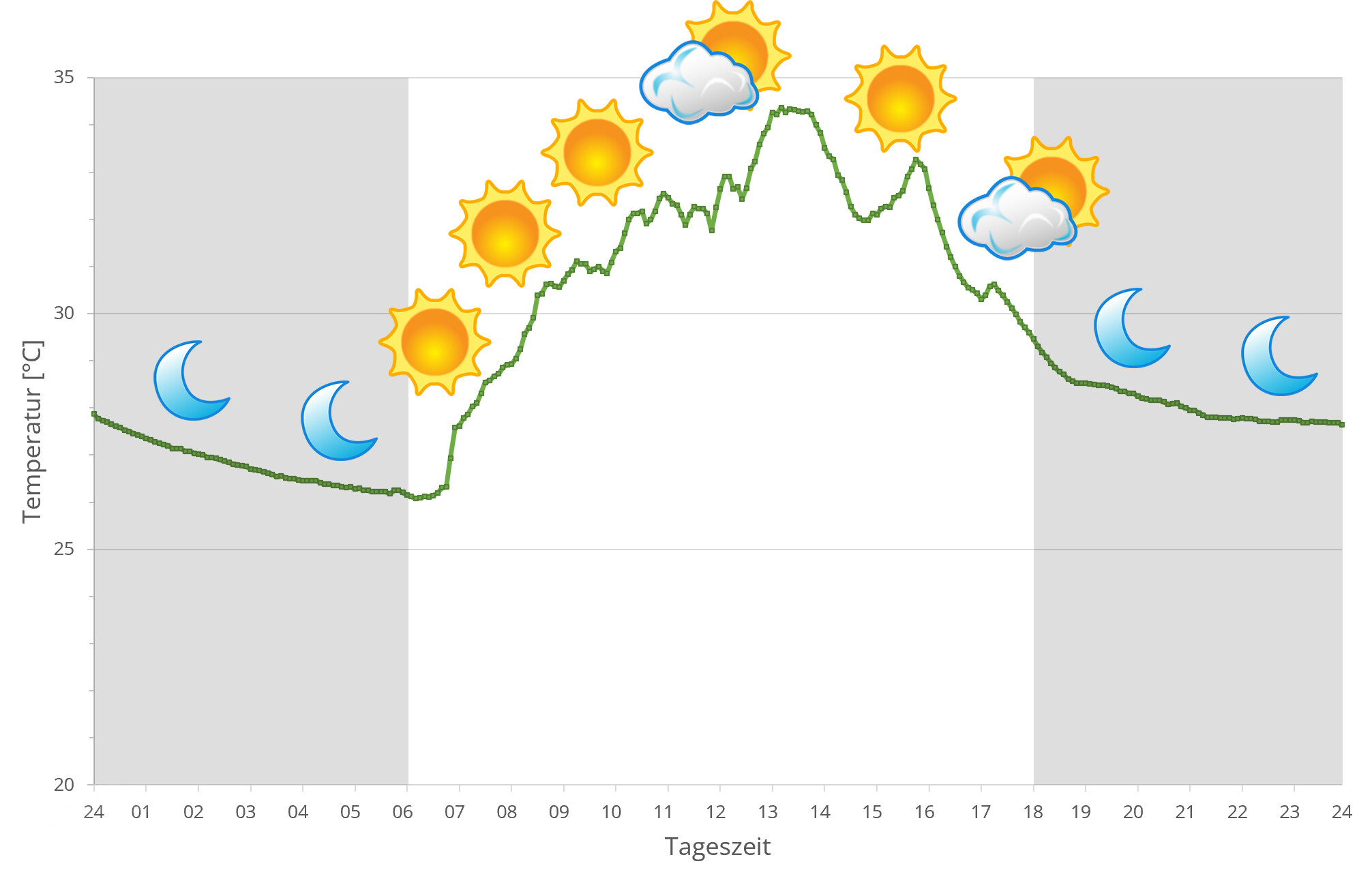
Climate in Ankarafantsika is hot and dry during most time of the year. Temperatures above 30°C during daytime are usual. Rainy season is rather short and only covers November until March. In this time, it is raining a lot and the whole forest blooms.
In April, the rainy season is over and precipitation is only measured few days per month. Many trees lose their leaves. There is morning dew and occasionally some rainfall, but that's it. During daytime, temperatures are a little lower than in rainy season, but temperatures still easily reach 25°C. At night, temperatures drop some degrees.
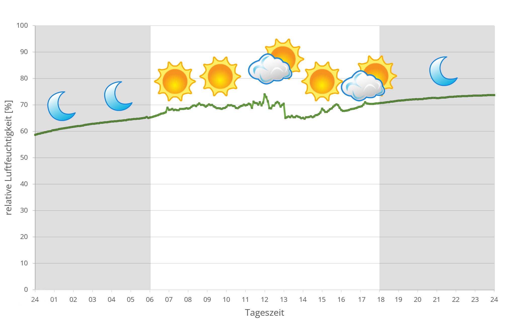
In 2024, we used data loggers to measure the relative humidity on several days in Masoala during the rainy season, the data can be found below.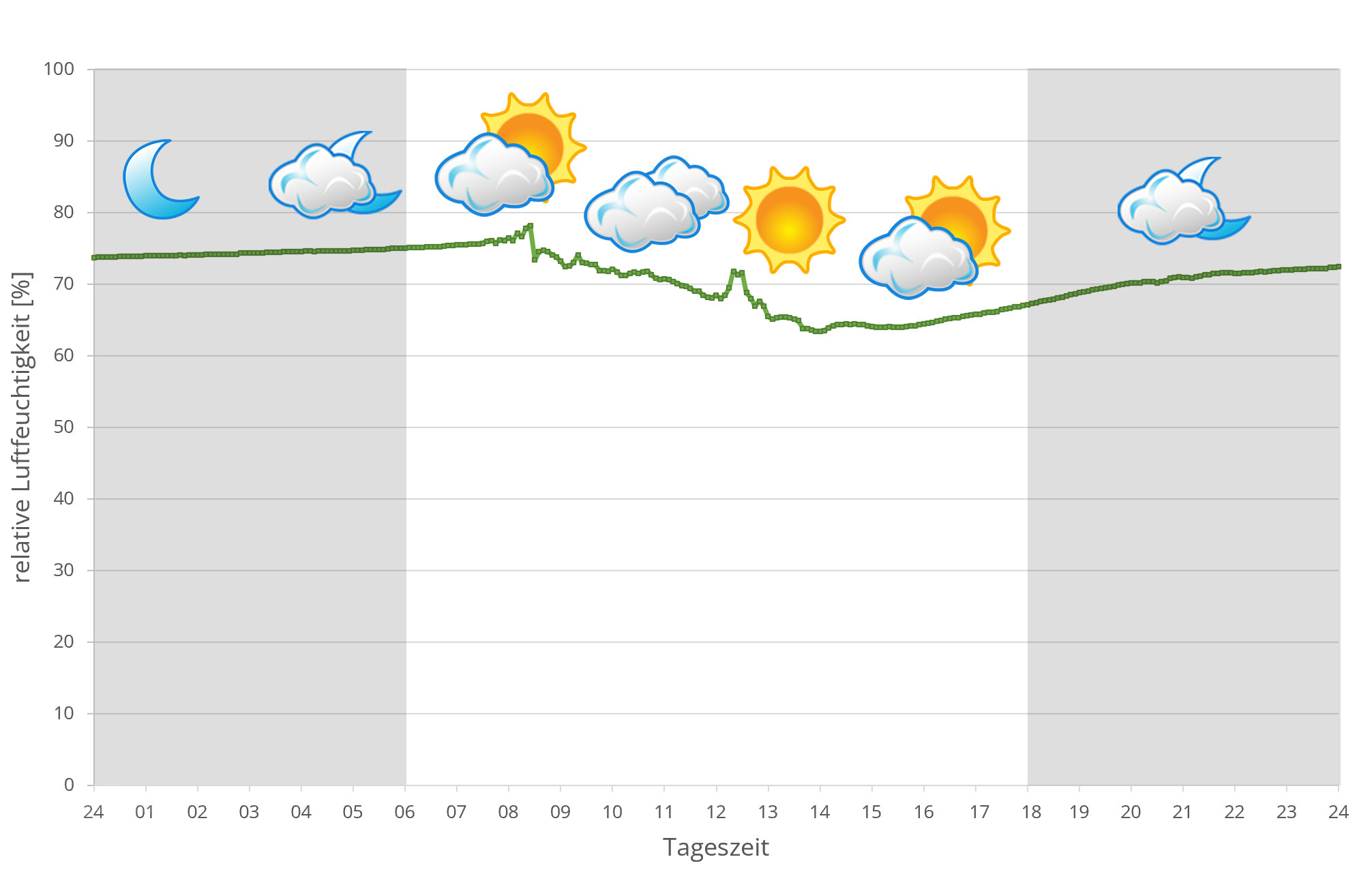
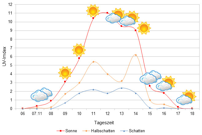
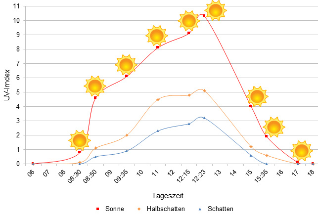 Tageszeit = day time, Sonne = sun, Halbschatten = half shade, Schatten = shade
We have measured UVB data with a Solarmeter 6.5 in spring (beginning of April) at the peak of activity of chameleons in Madagascar. We always measured the values that a chameleon could maximally reach in its habitat.
| Jan | Feb | March | Apr | May | Jun | Jul | Aug | Sep | Oct | Nov | Dec | |
| Morning | 24.9 | 26.1 | 25.6 | 24.2 | 22.6 | 19.2 | 18.4 | 19.5 | 22.3 | 21.8 | 22.9 | 22.7 |
| Midday | 28.2 | 28.7 | 26.9 | 26.1 | 25.6 | 25.8 | 25.8 | 26.5 | 31.7 | 28.8 | 28.6 | 28.5 |
| Afternoon | 28.3 | 28.1 | 27.2 | 26.1 | 26.1 | 25.3 | 25.5 | 26.8 | 30.8 | 28.5 | 28.1 | 27.8 |
| Night | 24.5 | 26.1 | 25.3 | 21.7 | 19.8 | 17.9 | 18.7 | 20.2 | 24.2 | 23.5 | 23.3 | 23.5 |
Between 01 April 2018 and 17 March 2019, we measured ground temperatures in the dry forest of Ankarafantsika daily - the table is the result of these measurements. A detailed discussion can be found here. In total, we made 1396 ground temperature measurements and measured an estimated 300 different locations in Ankarafantsika. The following graphs show the soil temperature profiles in Ankarafantsika at a depth of 20 cm in the wet season (February, left) and in the dry season (June, right):
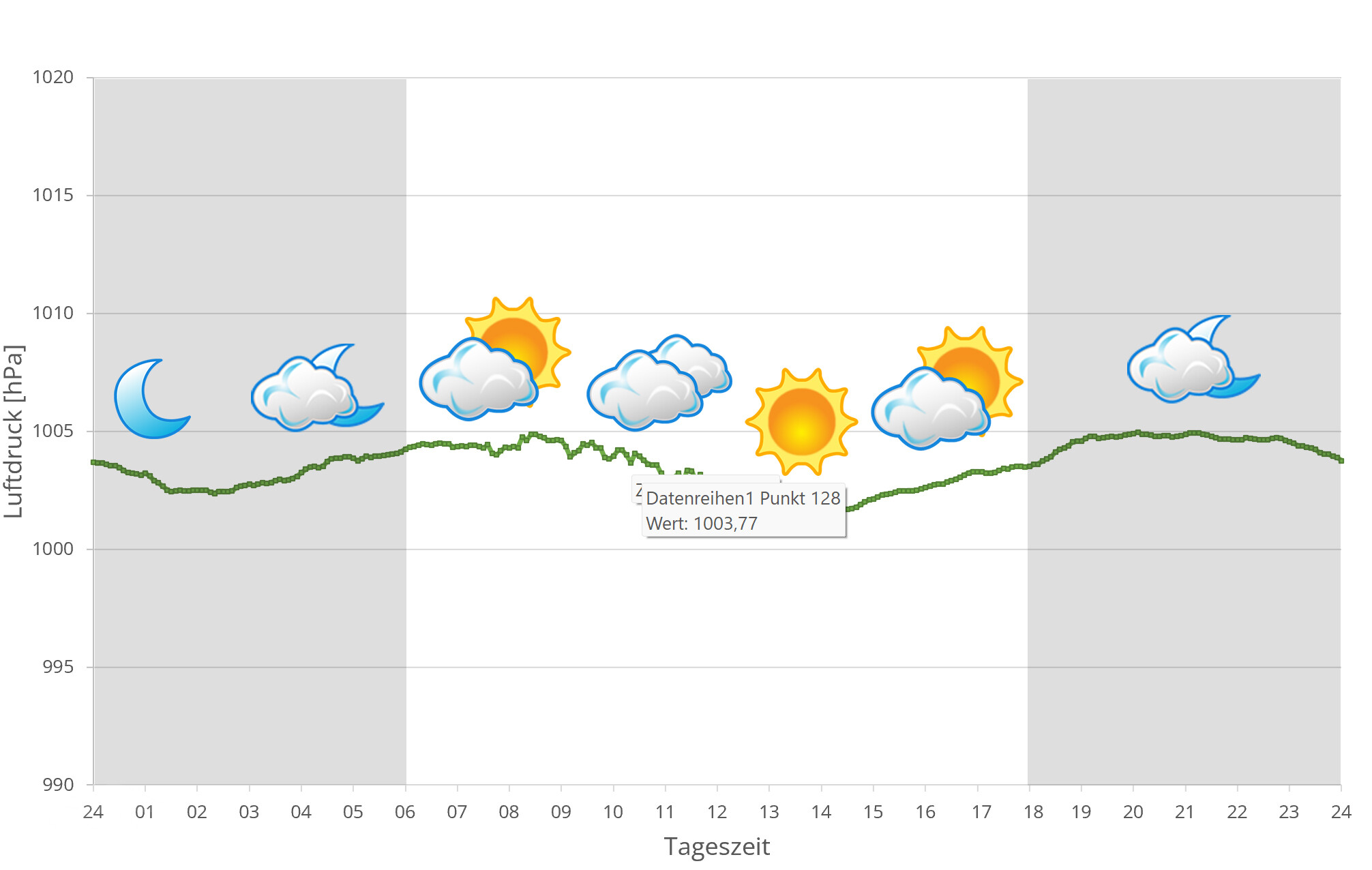
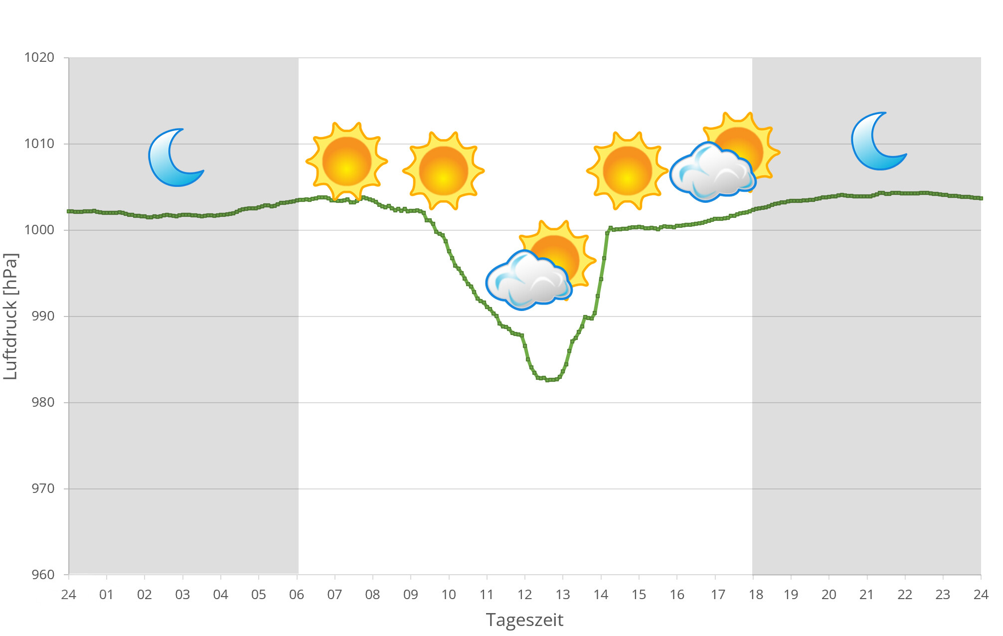
In 2024, we additionally to other climate data measured air pressure at the places we visited in Madagascar. The following data is from several days during the rainy season in Ankarafantsika. On the X-axis is the time of day or night. In Madagascar, the day begins at around 6 a.m. and night falls at 6 p.m. The Y-axis shows the atmospheric pressure in hPa.
| Jan | Feb | Mar | Avr | May | Jun | Jul | Aug | Sep | Oct | Nov | Dec | |
| Average temperature | 27 | 28 | 28 | 28 | 27 | 26 | 25 | 26 | 27 | 28 | 29 | 28 |
| Minimum temperature | 24 | 24 | 24 | 24 | 22 | 20 | 20 | 20 | 21 | 23 | 24 | 24 |
| Maximum temperature | 31 | 31 | 32 | 33 | 32 | 31 | 30 | 31 | 32 | 33 | 33 | 32 |
| Rain days | 26 | 23 | 26 | 17 | 3 | 2 | 1 | 1 | 2 | 14 | 21 | 25 |
The given data were measured and compiled by us within several years with thermo- and hygrometers directly at the finding places of the animals. "Average temperature" means that the values of an entire month were calculated to an average value, e.g. all measured minimum values of February were calculated to an average minimum value for February. This means in plain language that individual peak values of a day can be significantly higher or lower than the average minimum and maximum values. Thus, it is possible that although the average maximum is 29 degrees, it was 33°C or even 35°C warm on some days of the month.
The climate in Mahajanga is one thing above all: incredibly hot. You are actually always sweating, even if you do not move at all. Temperatures above 30°C are the rule during the day. At night, the temperatures during the rainy season only fall just below 25°C. But in the dry season this changes massively: then it gets really cold at night with temperatures around 18°C. The difference to the day is extremely noticeable in the dry season in Mahajanga.
Mahajanga has only a short rainy season from November to March when everything is green and blooming. In some years the rainy season is even shorter. With the dry season it becomes more and more difficult for animals to find water in Mahajanga - rainy days are the exception until October. Sun and heat are in abundance every day. The climate makes high demands on chameleons that want to survive.
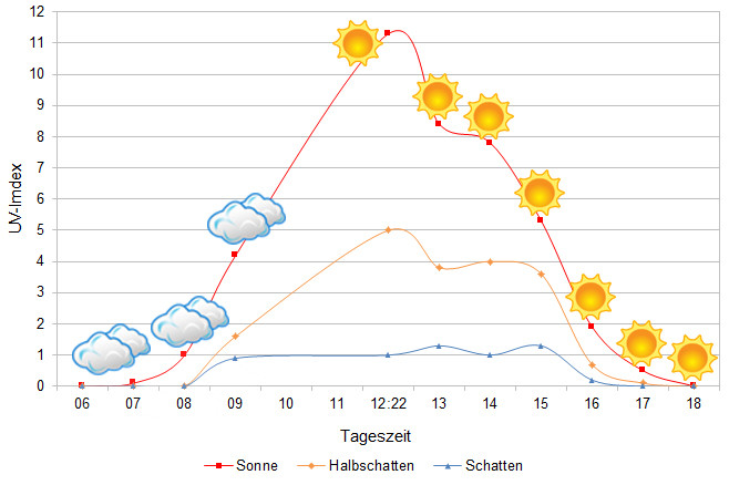
The UVB data were measured with a Solarmeter 6.5 in spring (March) at the highest activity time of the chameleons. The maximum values that could be achieved by the chameleon in the habitat were measured.
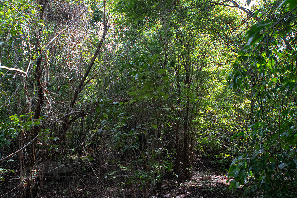
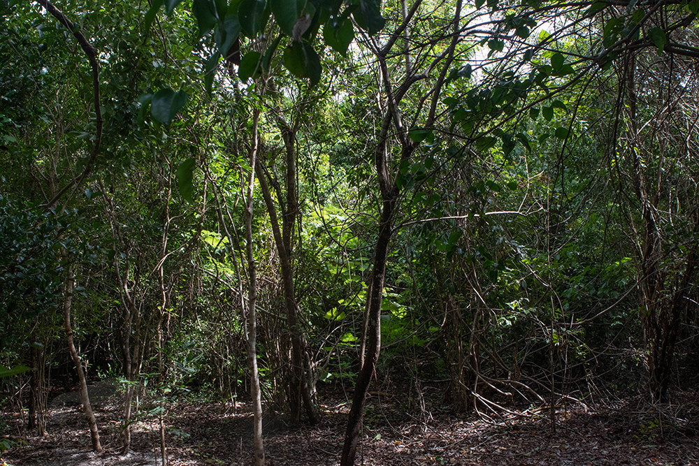
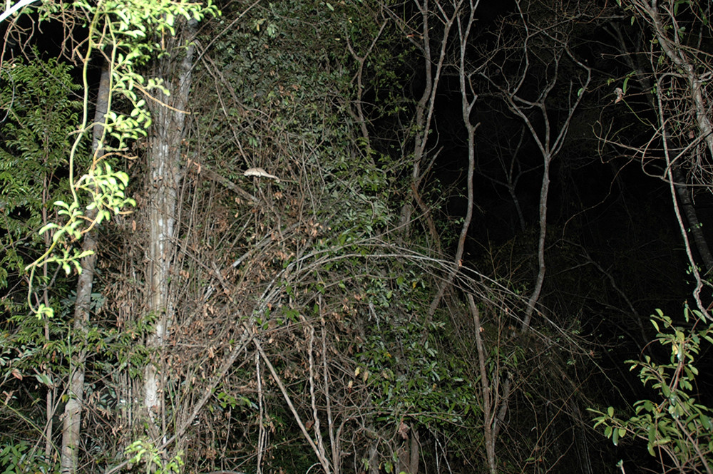
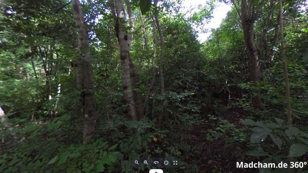
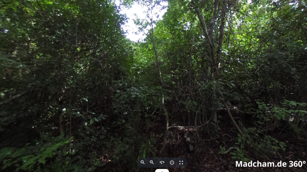
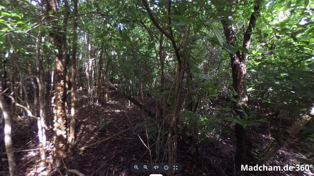
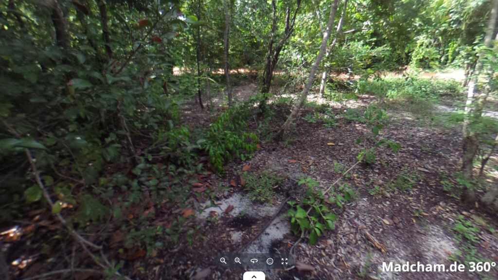
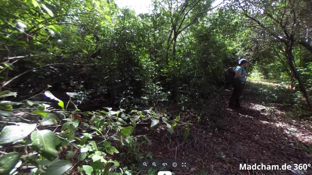
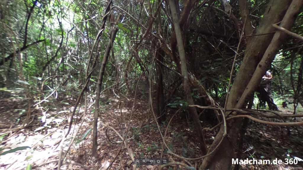
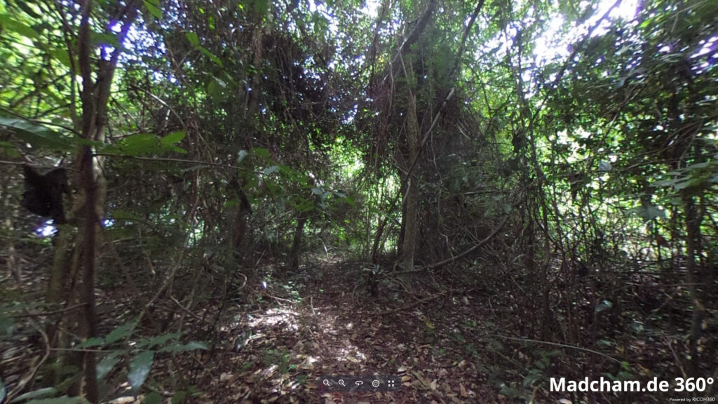
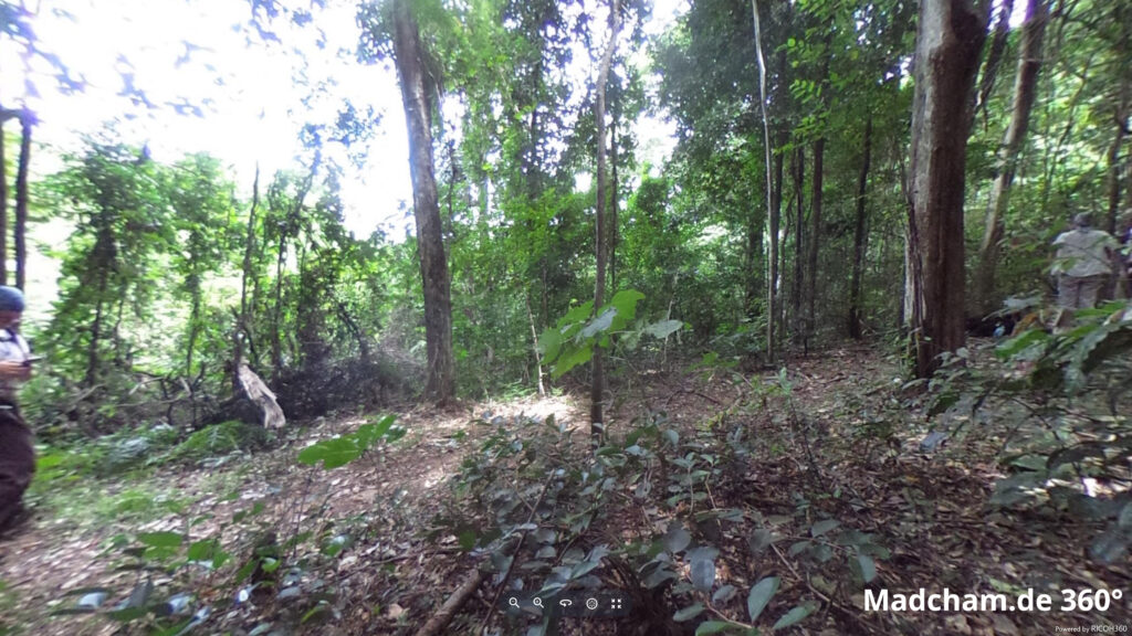
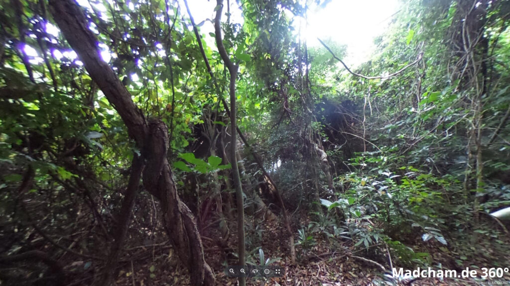
Habitat:
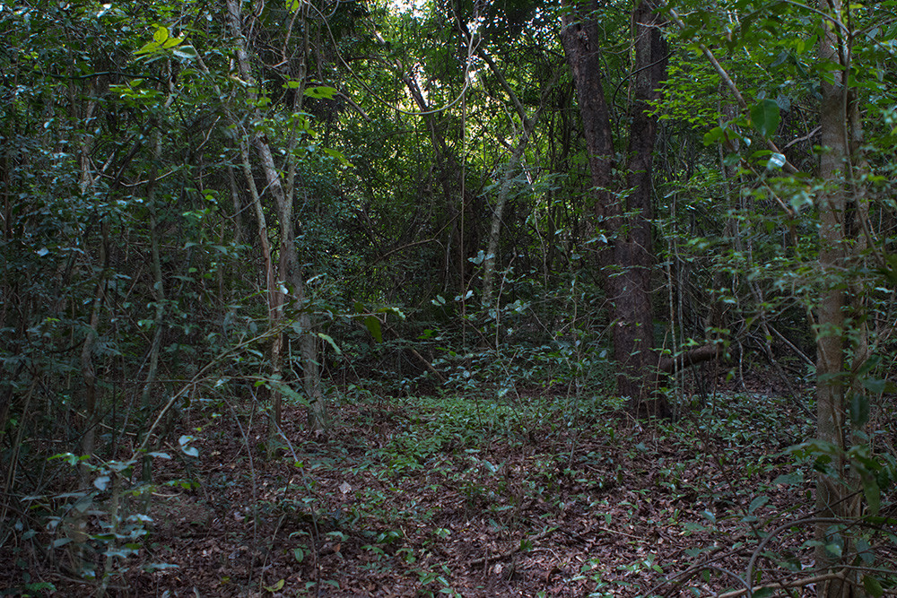
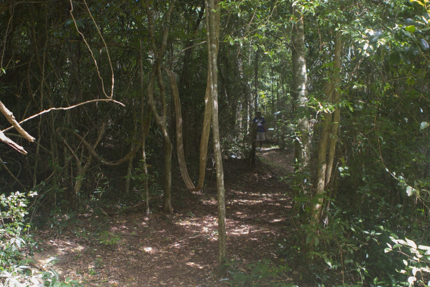
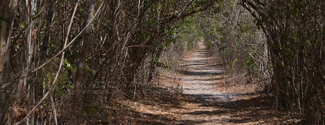
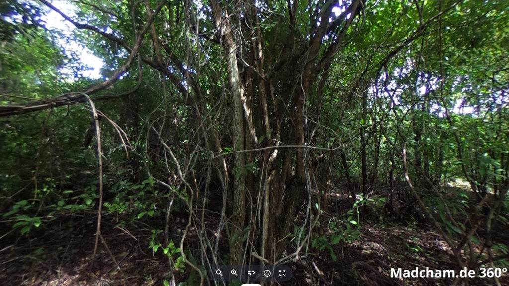
The species inhabits an old dry forest with large old trees and a lot of undergrowth in the Ankarafantsika National Park. The soil consists of a sand-earth mixture. In Mahajanga the habitat consists of a rather low forest with thin trees and lots of dense bushes. Furcifer angeli even uses adjacent secondary vegetation here. The soil in Mahajanga consists mainly of laterite. Both habitats have in common that they are only completely green during the rainy season. In the dry season most plants lose their leaves, streams dry out and survival becomes relatively difficult for chameleons.


Das könnte dir auch gefallen


Follow us on Instagram

Most popular articles


Your travel specialist for Madagascar