up to date no legal export possible
2011-16 each 1000 specimens under the old species name Furcifer lateralis major for legal export
First description:
(Brygoo, 1971)
Origin of the species name:
The French zoologist Édouard-Raoul Brygoo described the species at the Institute Pasteur in Antananarivo, Madagascar. He considered it to be a subspecies of the carpet chameleon and therefore called it Furcifer lateralis major, whereby the Latin word major (= big) should indicate the larger body size of the animals.
Distribution:
Furcifer major is native to Madagascar’s dry, hot south. Its distribution area reaches from the Mangoky river to Andringitra mountains, down to Faux Cap and Fort Dauphin. The inhabited altitudes are correspondingly variable: Furcifer major occurs a few meters above sea level as well as at about 1000 m above sea level. It lives in spiny forests, and sometimes even in residues of dry forests, e.g. in Zombitse-Vohibasia and Isalo national parks. Some years ago, someone claimed to have seen Furcifer major in the environment of Sambava in north Madagascar, an area completely contrary to its original habitat – we have never seen an individual of this species there.
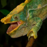
Appearance & size:
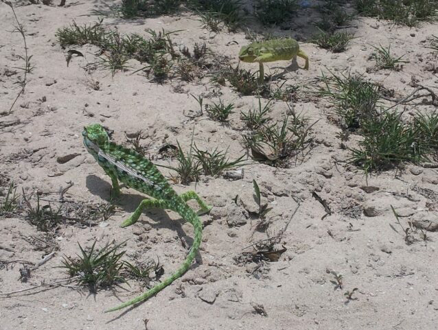
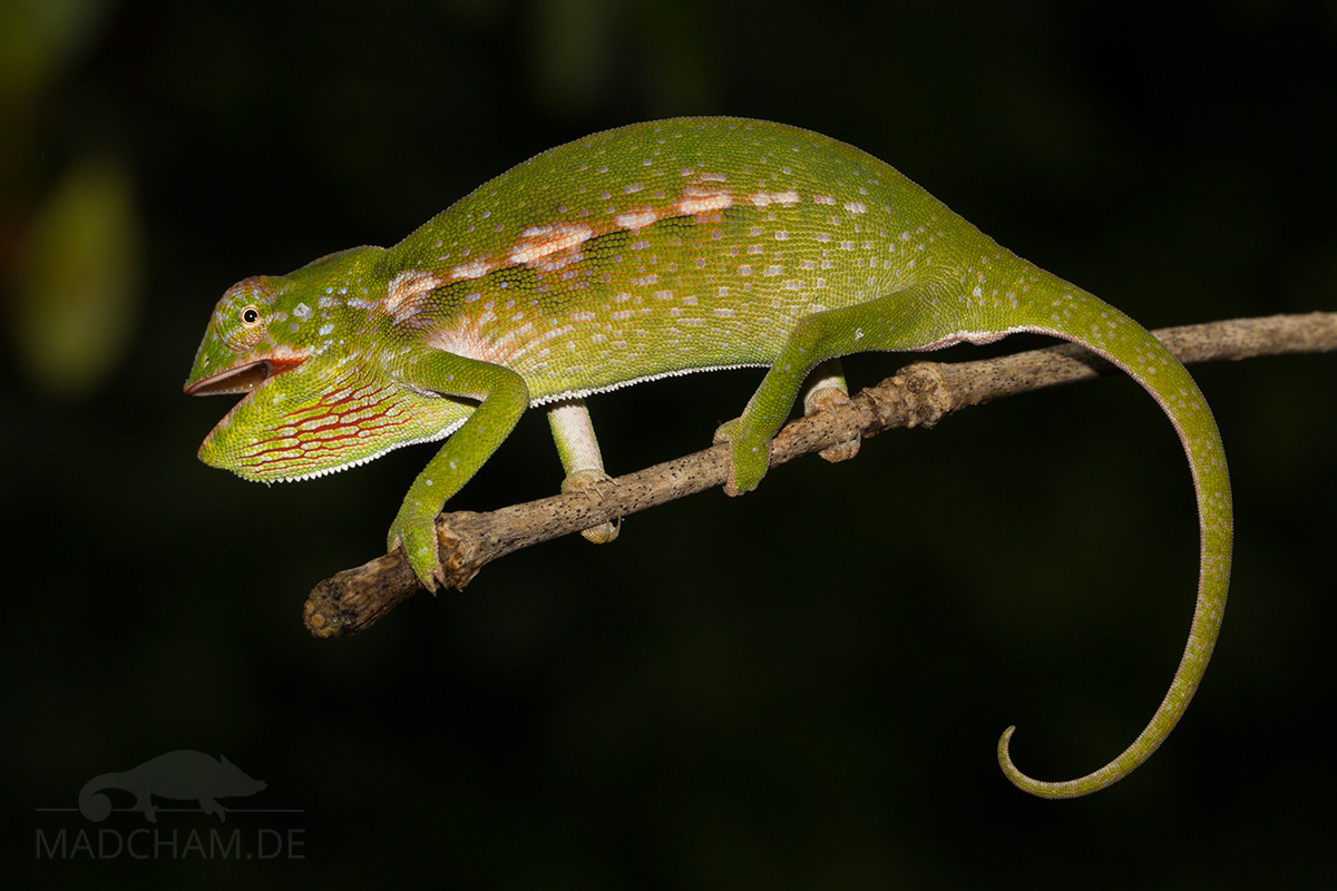
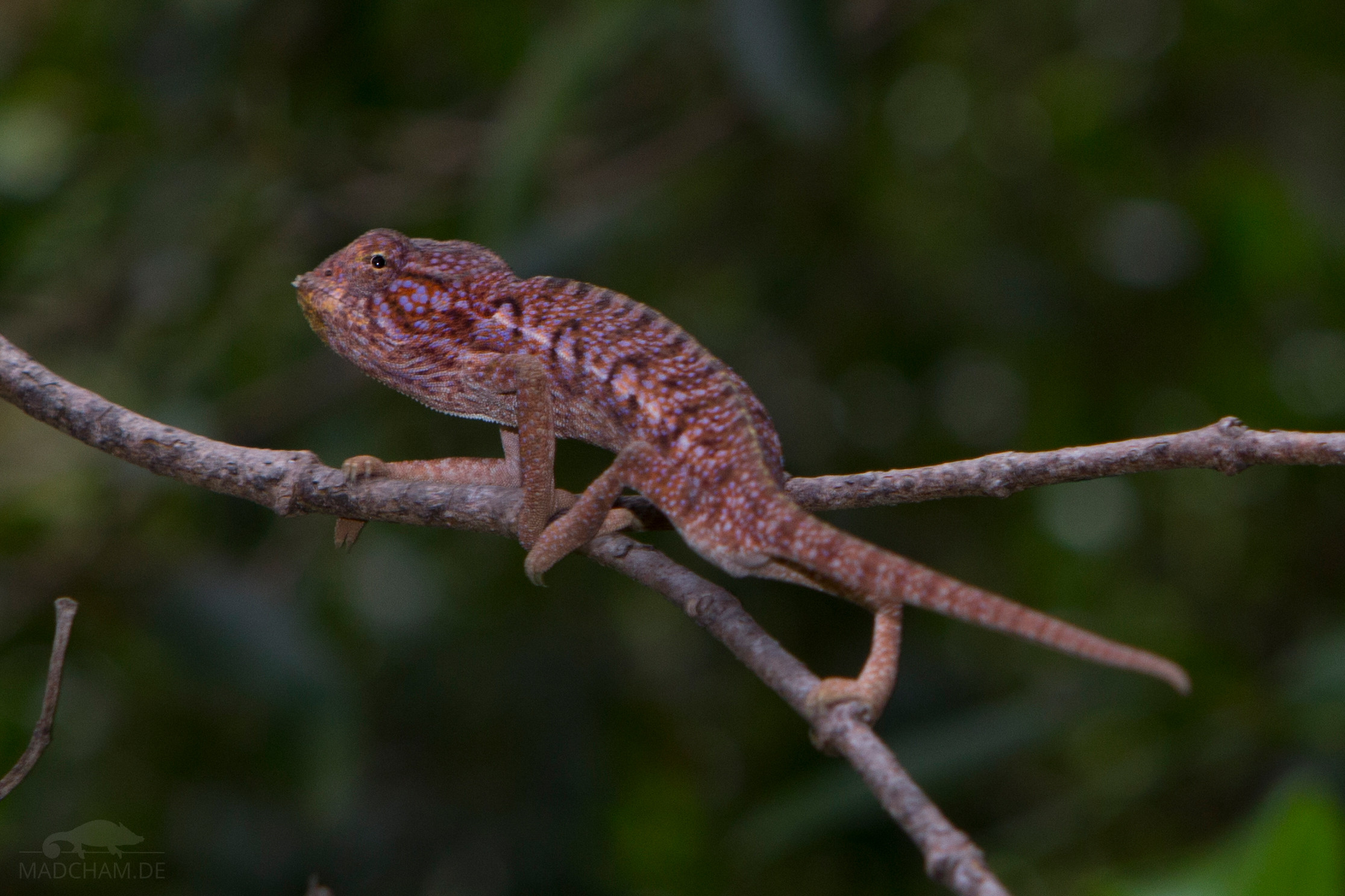
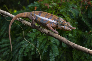
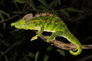
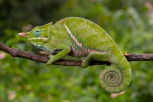
Two male Furcifer major meet near Toliara – unusual here: Both are on the ground, although the species lives mainly in shrubs and trees
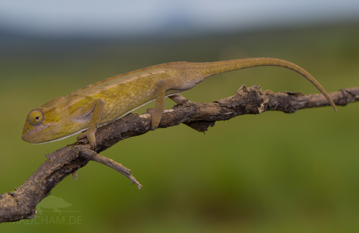
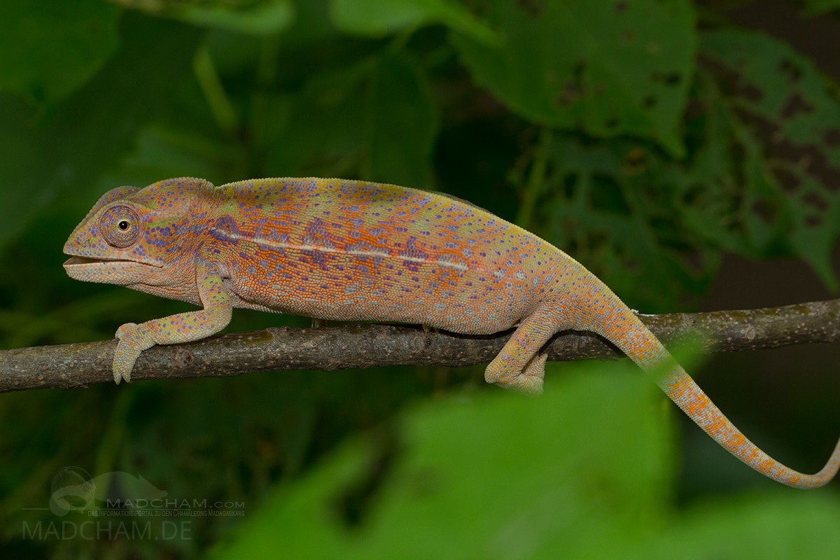
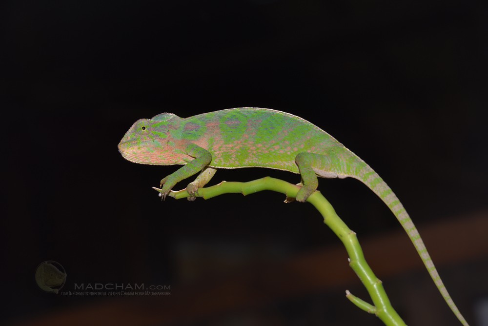
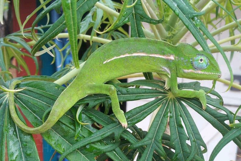
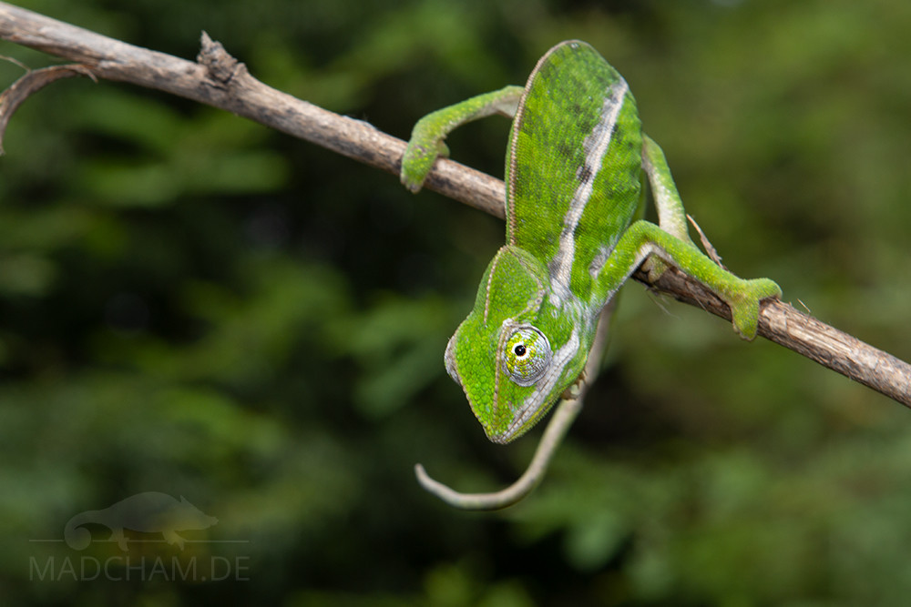
This species is uniformly grass green or pale green-colored, with white, sparsely interrupted lateral stripe (may even lack) and white markings all over the body. Females can be more colorful but still remain pale compared to other species. With a body length of approximately 11 cm, Furcifer major belongs to middle-sized chameleons but is larger than the similar species Furcifer lateralis and viridis. The parietal crest in both genders wears only 10 to 13 cone scales, and they lack axillary pits. The helmet is more developed than in Furcifer lateralis, but the snout is comparably short.
Good to know:
Until 2012, Furcifer major rated as subspecies of Furcifer lateralis, but has been stated to be an own species then. For some years, this species is bred in captivity in small numbers, but there are still often uncertainties between owners by identifying single individuals. It is questionable whether this confusion might have led to hybrids between Furcifer lateralis and major in captivity.
| Jan | Feb | Mar | Apr | May | Jun | Jul | Aug | Sep | Oct | Nov | Dec | |
| Average temperature | 27 | 27 | 26 | 25 | 23 | 21 | 20 | 21 | 22 | 23 | 25 | 26 |
| Minimum temperature | 22 | 22 | 21 | 20 | 17 | 14 | 14 | 15 | 16 | 18 | 20 | 22 |
| Maximum temperature | 32 | 32 | 32 | 30 | 28 | 26 | 26 | 27 | 28 | 29 | 30 | 31 |
| Rain days | 13 | 12 | 7 | 5 | 4 | 4 | 3 | 3 | 3 | 4 | 7 | 12 |
We have collected the data given above over several years with thermometers and hygrometers at the finding places of the chameleons. "Average temperature" means that values of a whole month have been calculated to one average value per month. For example all measured minimum temperature values of February have been calculated to one average minimum temperature for February. In plain language, this means single peak values of a day may be a little higher or lower than the average minimum and maximum temperatures. It is possible that a location has an average maximum temperature of 29°C, but one day during that month it had 33°C or even 35°C there.
Climate in Toliara (Tuléar) and surroundings is mainly one thing: Hot. In rainy season, daily temperatures rise easily to more than 30°C. In sunny places, it may even get 45°C. This is the location to look for every shady place you can get. And although it is called "rainy" season, precipitation in the south is lean. In good years, it is raining every couple of days from November to February. In worse years, it is raining even less.
During dry season, temperatures drop a little, but it remains very warm. In the night, temperatuers in July and August may drop even to 15°C, but days reach temperatures over 25°C without a problem. This large temperature drop is typical for the area. The dry season has only shot and very few rainfall.
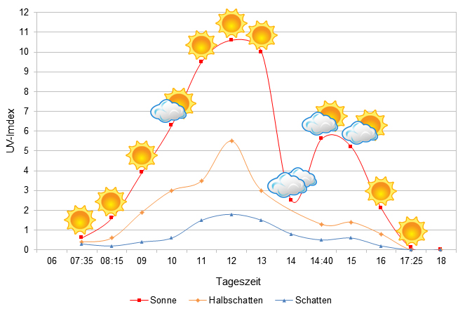
We have measured UVB data with a Solarmeter 6.5 in spring (end of March) at the peak of activity of chameleons in Madagascar. We always measured the values that a chameleon could maximally reach in its habitat.
Habitat:
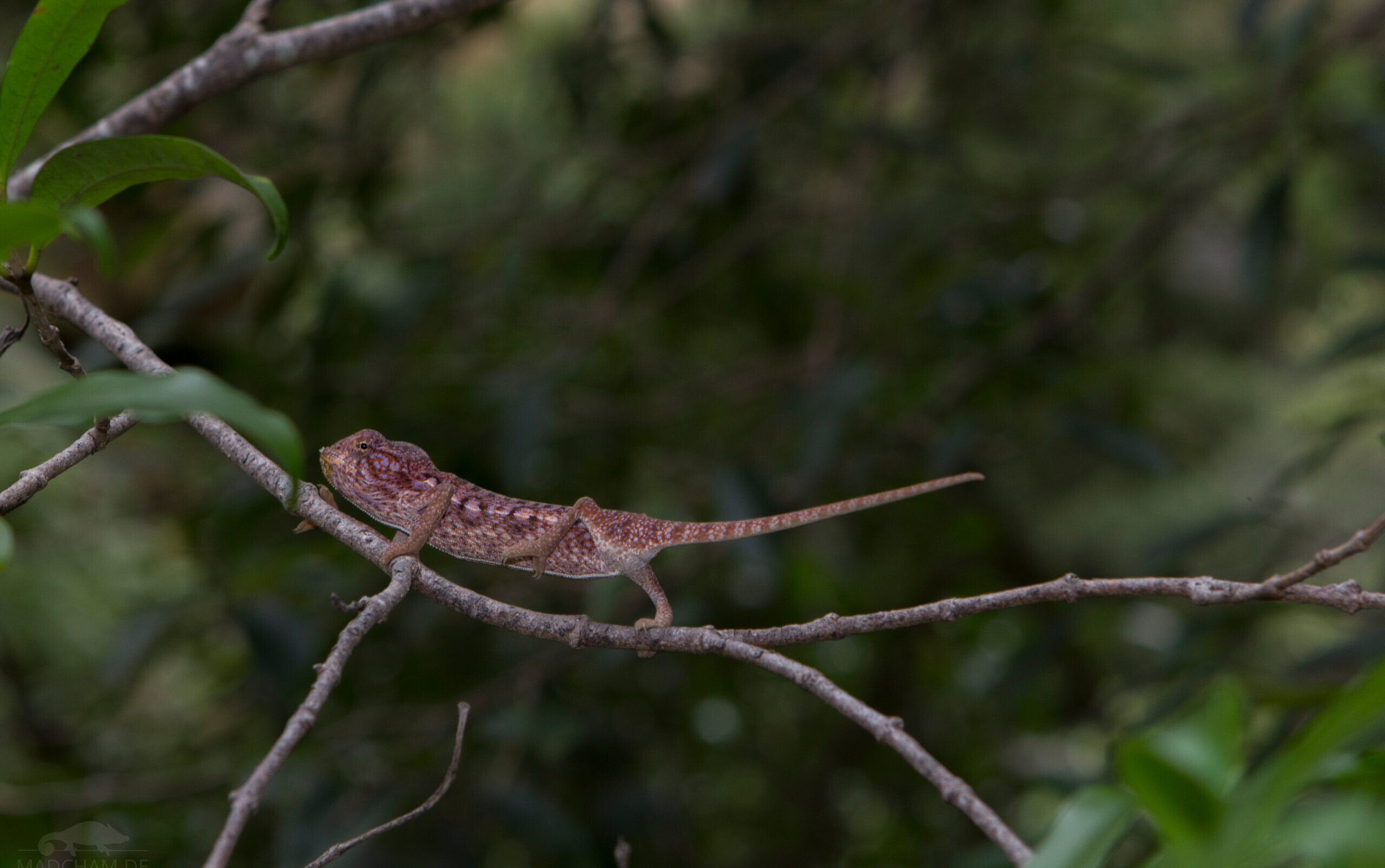
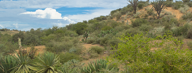
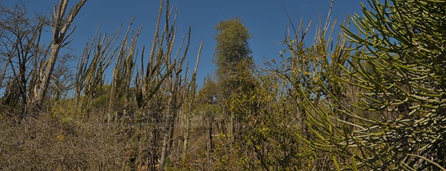
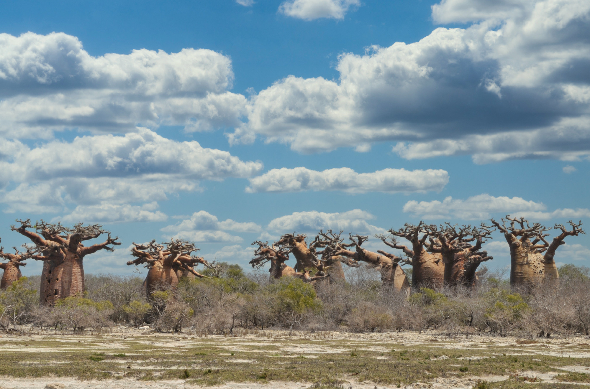
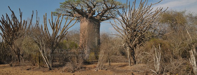
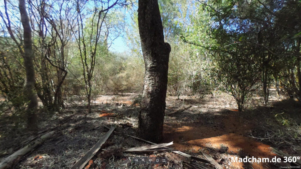
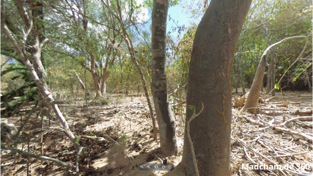
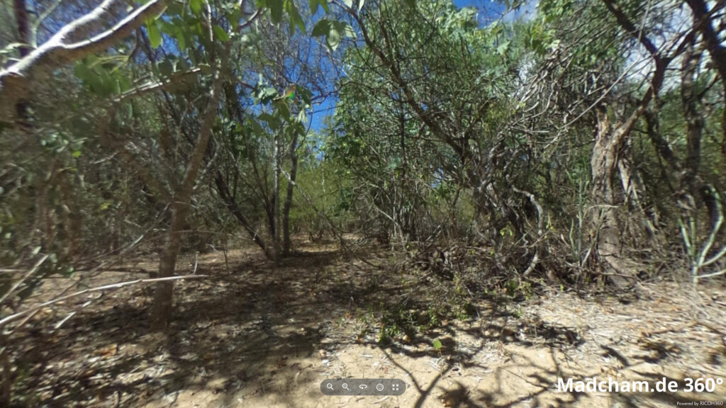
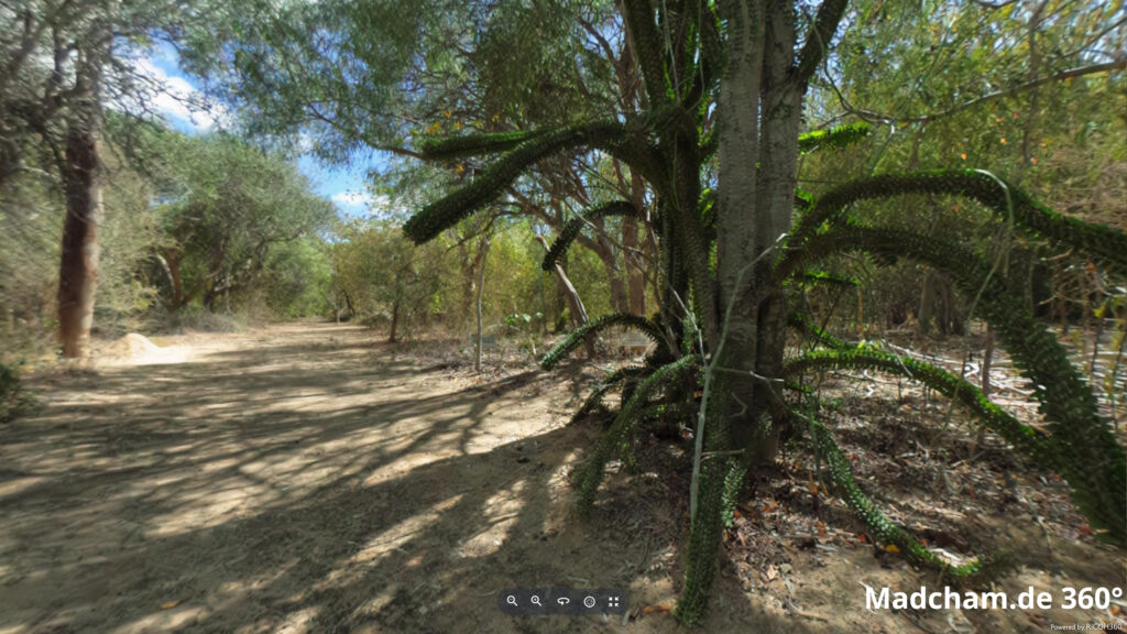
The habitat of Furcifer major is very various. In Isalo, you can find them in savannas with low bushes and lots of zebu grass. In Zombitse-Vohibasia, they inhabit a large dry forest with Baobabs, old trees and lots of undergrowth. Around Toliara (Tuléar) they mainly live in secondary vegetation, in shrubs and bushes on sandy dunes. They use as well as spiny forest. All these habitats share very dense vegetation with lots of small twigs. Furthermore, the whole habitat is only green during the rainy season for a few months of the year. The rest of the year, the grass is sparse and the habitat becomes very dry.
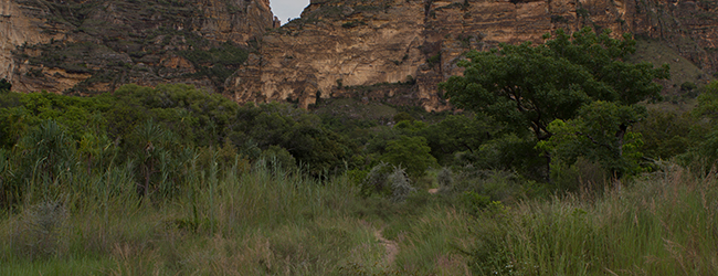
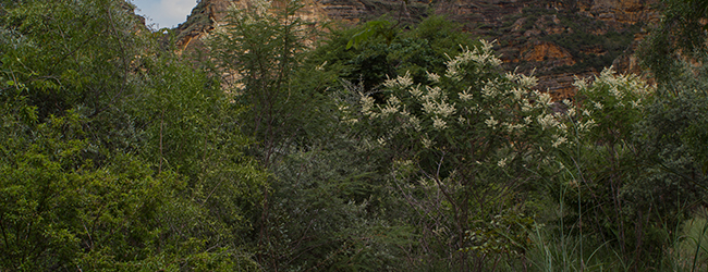
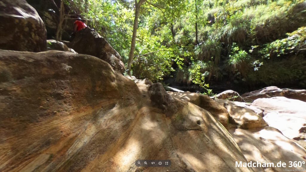
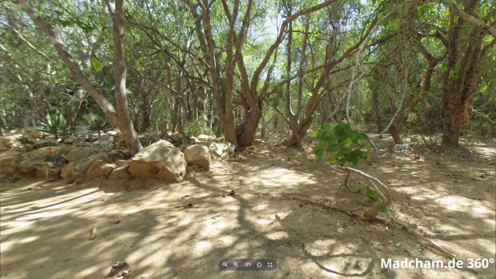
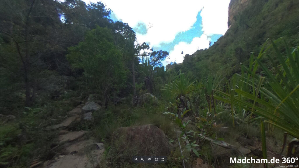
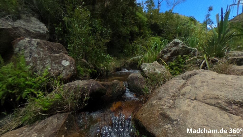
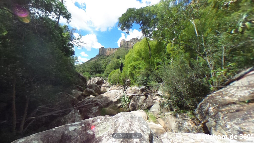
Below you will find some 360° images from Antsokay and Ifaty not far from Toliara as well as from the Namaza Canyon in Isalo. The pictures were taken during the rainy season. If you click on the respective image, the pictures open in an enlarged view in a separate window. You can use the mouse to rotate in all directions. You also have the option of running the images in full-screen mode. Enjoy!
Das könnte dir auch gefallen


Follow us on Instagram

Most popular articles


Your travel specialist for Madagascar