

Distribution of the local form Vohimarina :
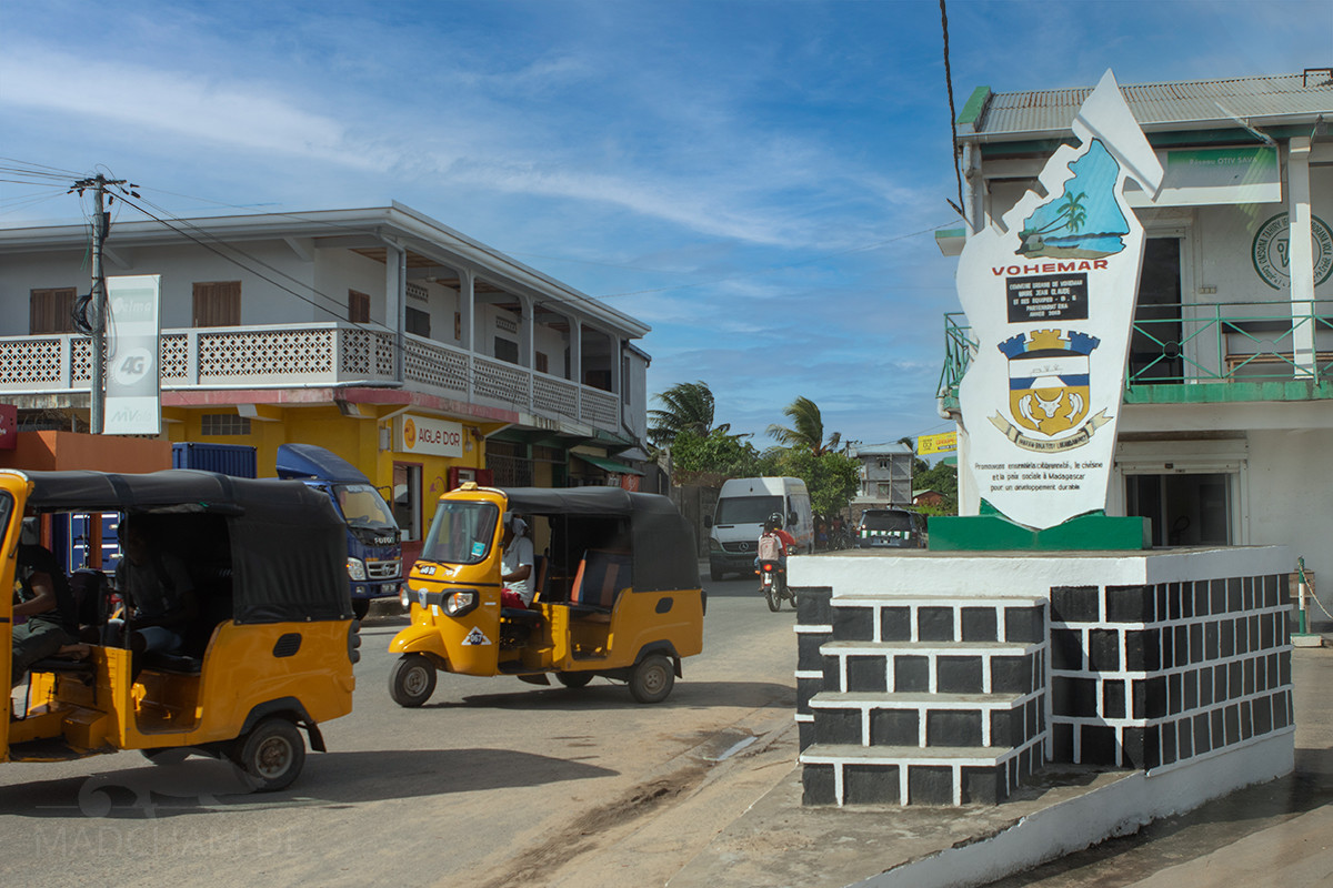
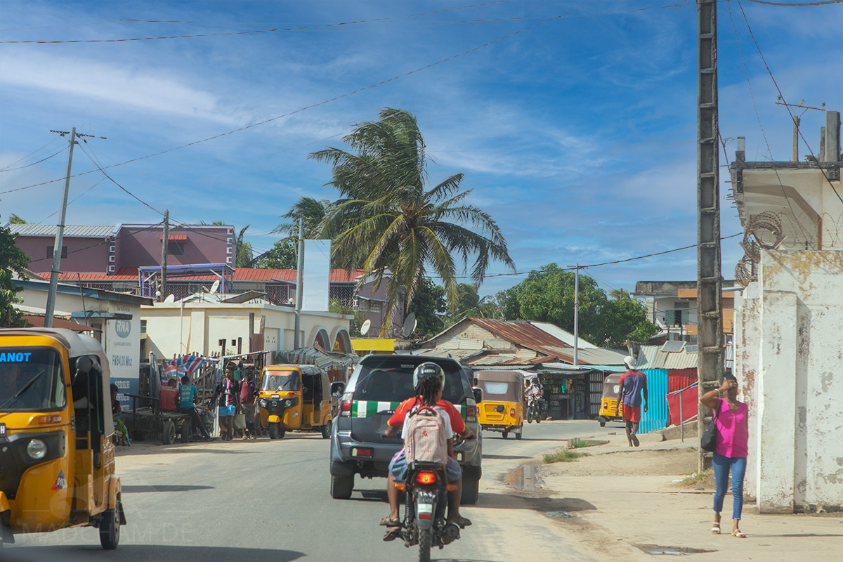
Vohimarina, better known by its French name Vohémar, is a city on the northeast coast of Madagascar. With a population of around 15,000, it is one of the larger cities in the Sava region. In colonial times, the town was called Iharana in Malagasy, but this name is now only used for the area surrounding the town. Vohémar has an important harbor and an airport that has not been functioning for a long time. The city can only be reached by land from Ambilobe via the RN5a, which was renovated in 2022. Alternatively, you can fly to Sambava on a very small plane and drive to Vohémar from the south via the RN5a. The people here live mainly from fieldwork and fishing. Rice, cassava and peanuts are grown, and there are also very many zebus in the area.
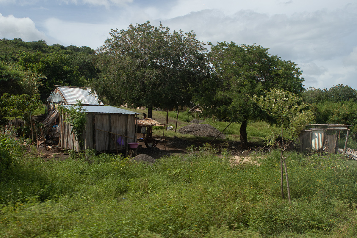
Panther chameleons are found here in open landscapes between fields and in bushy secondary vegetation. Primary rainforest or dry forest no longer exists near Vohimarina. Rice fields and wide, flat grasslands with bushes and low trees against a mountain backdrop characterize the plains between Vohémar and Daraina. Herds of zebu are everywhere. Somewhat lusher vegetation is present along the rivers, with larger and older trees along narrow strips.
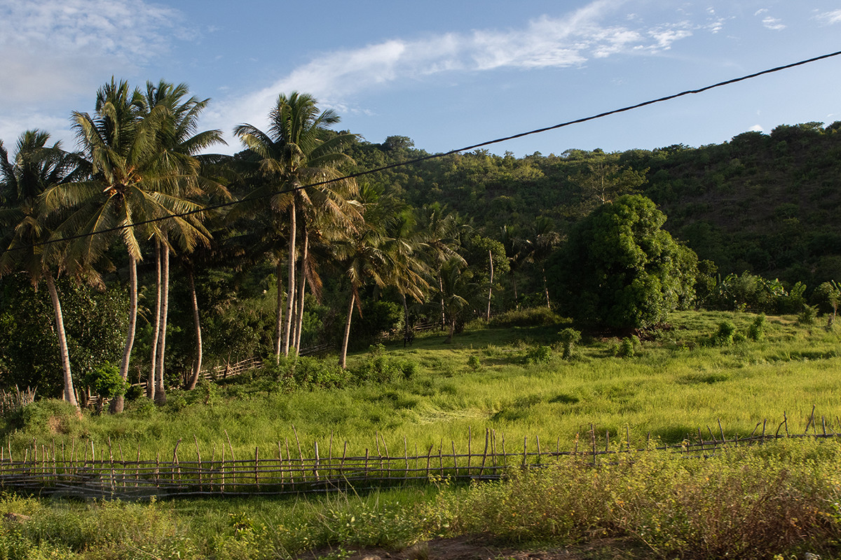
Panther chameleons of the Vohémar local form are, surprisingly, found as far north-west as Loky Manambato near Daraina. The nearest remnant of protected dry forest is also located there, a good 50 km away. This is particularly surprising because Manambato river actually separates the two areas. It is just as unusual that the local form can also be found as far as 45 km south of Vohémar, namely in the small gallery forest of Bobangira. The region is actually separated from Vohémar by Fanambana river. Nevertheless, the panther chameleons in Loky Manambato, Vohémar and Bobangira look identical and show hardly any variation. South of Bobangira and north of Sambava flows Bemarivo river, which appears to mark the actual boundary with the Sambava local form.
Appearance of the local form:
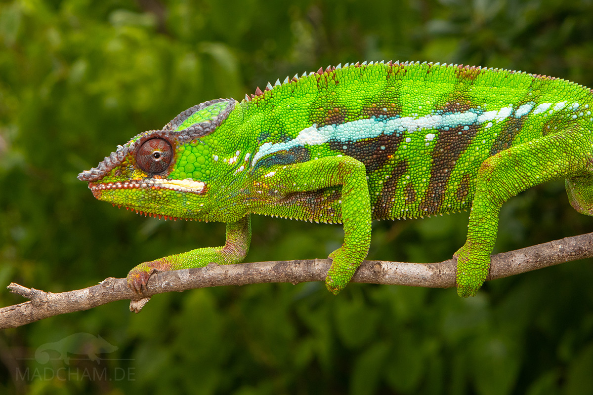
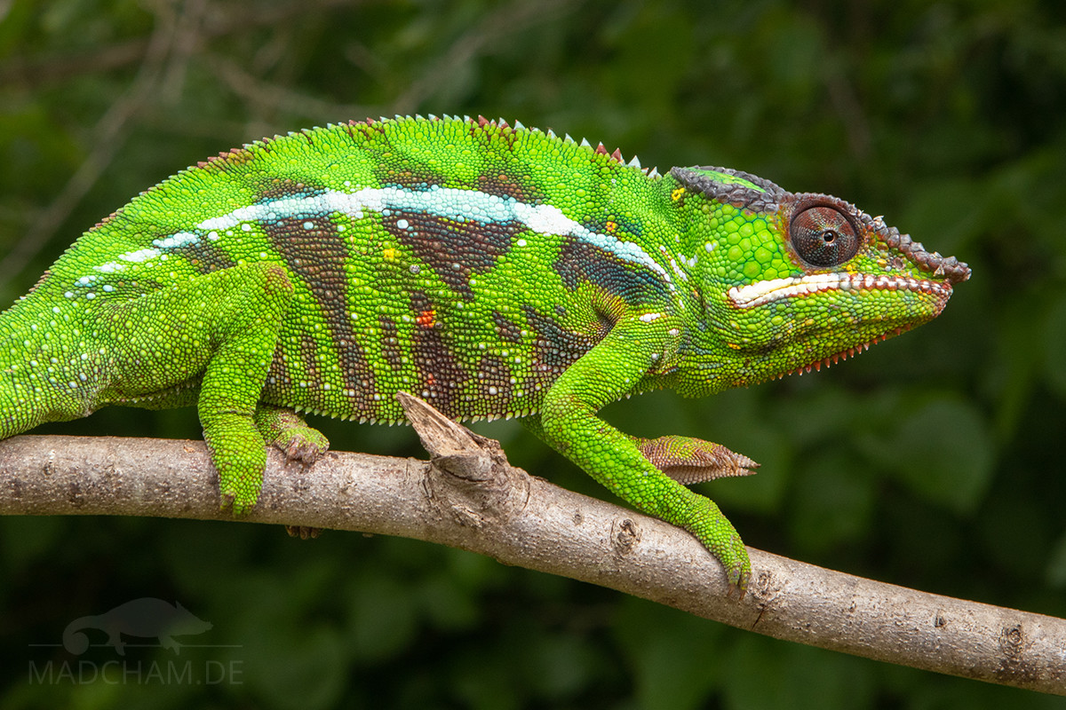
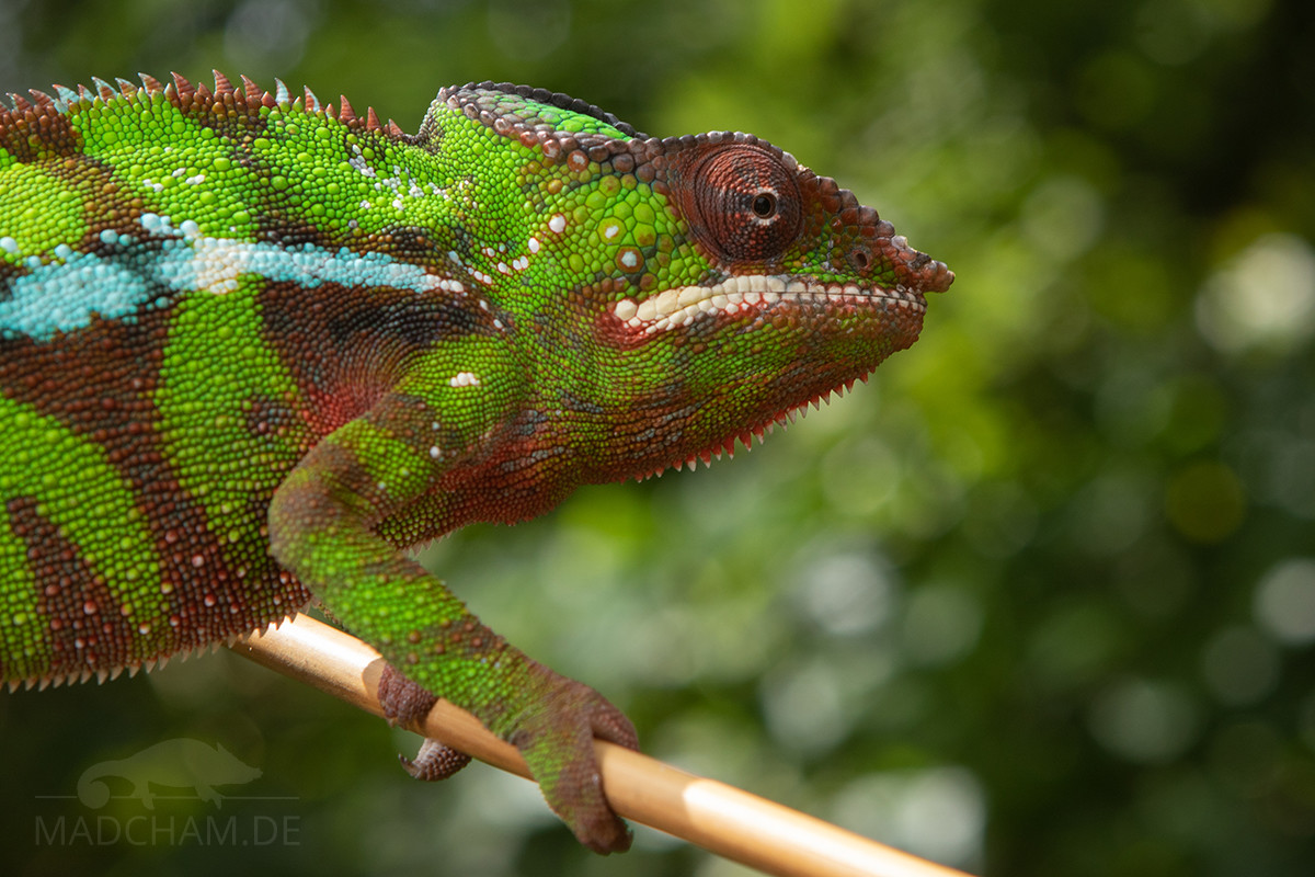
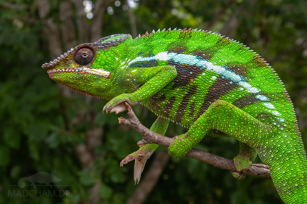
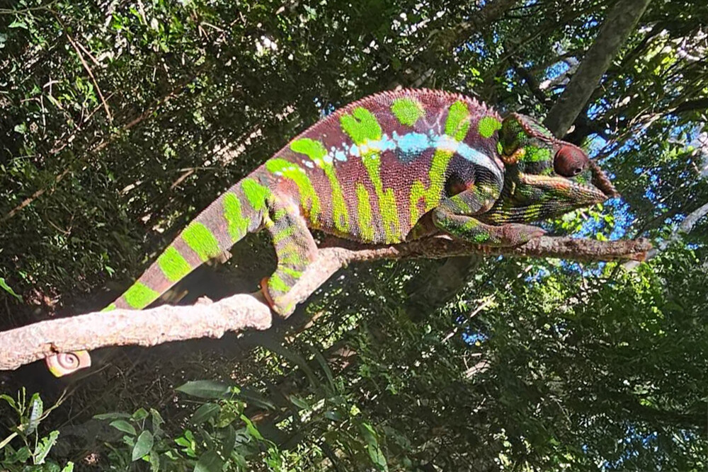
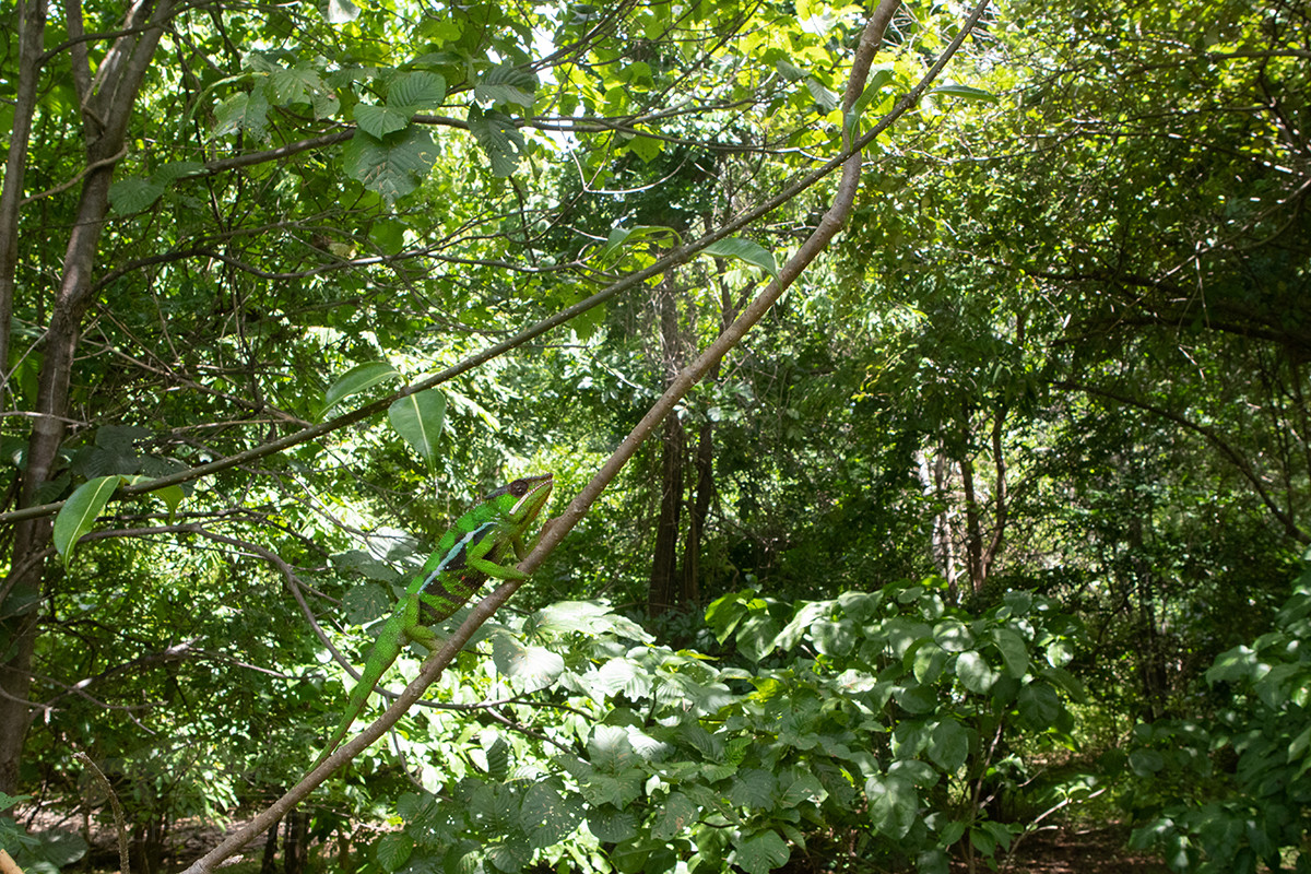
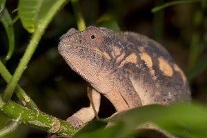
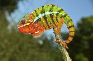
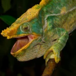
The males of Furcifer pardalis here are light green with dark red banding, some of which are almost burgundy-red. In contrast to the neighboring local form Sambava the head of the males here is green, not red. Only the eyelids are colored red. The throat region may have red tints in some animals. The animals of the local form Vohémar look extremely similar to the local form Ankarana East despite some distance.
| Jan | Feb | Mar | Apr | May | Jun | Jul | Aug | Sep | Oct | Nov | Dec | |
| Average temperature | 28 | 27 | 26 | 26 | 25 | 24 | 23 | 23 | 23 | 25 | 27 | 28 |
| Minimum temperature | 25 | 25 | 24 | 24 | 23 | 22 | 21 | 20 | 21 | 23 | 24 | 25 |
| Maximum temperature | 30 | 30 | 30 | 29 | 27 | 26 | 25 | 25 | 26 | 27 | 29 | 30 |
| Rain days | 16 | 13 | 12 | 6 | 3 | 2 | 2 | 2 | 1 | 1 | 2 | 10 |
The data given were measured and compiled by us within one year with thermo- and hygrometers in Vohémar. "Average temperature" means that the values of an entire month were calculated to an average value, e.g. all measured minimum values of a month were calculated to an average minimum value for February. This means in plain language that individual peak values of a day can be significantly higher or lower than the average minimum and maximum values. So it is possible that while the average maximum is 29 degrees, it was 33°C or even 35°C on some days of the month.
Vohémar is located directly on the Indian Ocean in a bay, so the climate is very warm all year round. In the rainy season, it is correspondingly scorching hot in Vohémar, temperatures over 30°C in the shade are the rule. Extensive rainfalls and thunderstorms provide a sultry heat like in a steam bath.
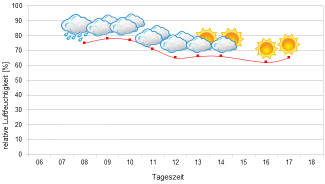
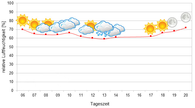
During the dry season, on the other hand, it gets really dusty in Vohémar and rain falls only from time to time. Key factors in Vohémar are certainly both the great heat and the dryness during the dry season, which is rather untypical for the east coast. In 2022, we measured relative humidity on various days during the rainy season, and the data can be found below.
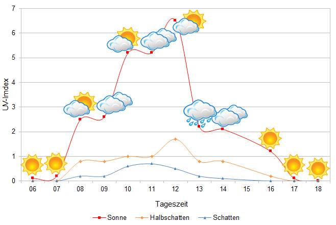 Tageszeit = daytime, UV-Index = UV index, Sonne = sun, Halbschatten = half shade, Schatten = shade
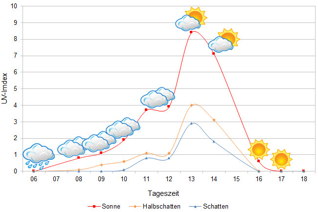
The UVB data were measured with a Solarmeter 6.5 in spring (April) just after the highest activity time of the chameleons. In each case, the maximum values achievable for the chameleon in the habitat were measured.
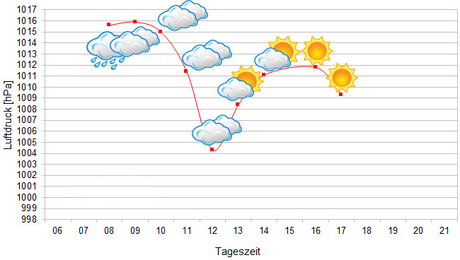
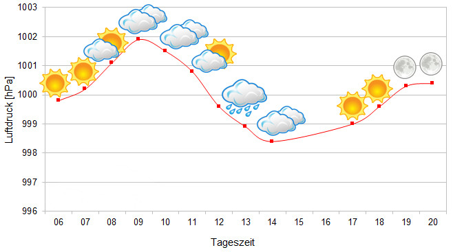
Since 2022, in addition to other climate data, we have also been measuring air pressure at the locations we visit in Madagascar. The following data are from different days during the rainy season. On the X-axis is the time of day or night. In Madagascar, the day begins around 6 a.m., and night falls at 6 p.m. The Y-axis shows the atmospheric pressure in hPa.
Habitat:
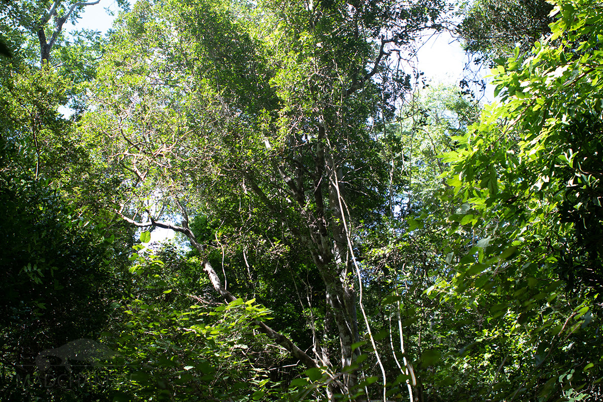
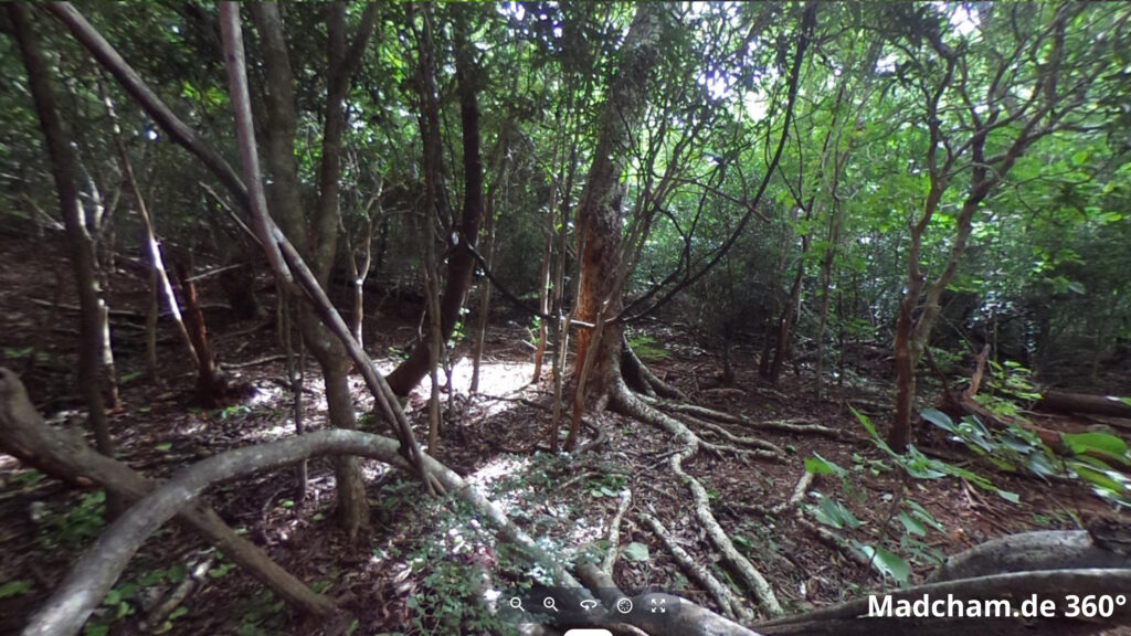
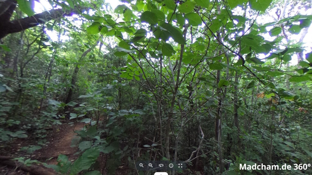
Panther chameleons live around Vohémar in open landscapes. Vohémar lies directly on the sea, so the soil is a mixture of sand and laterite. Between Vohémar and Loky Manambato there are mainly savannahs with isolated low trees and many bushes distributed in gentle hills. At the edge of the mountains, which become more towards the center of the country, there are a few dry remnant forests and some gallery forests along smaller rivers. Loky Manambato, on the other hand, is a still intact small dry forest. The tree population is rather young and not very high, but there is plenty of strongly branched undergrowth. The soil here is interspersed with rocks and consists almost entirely of laterite.


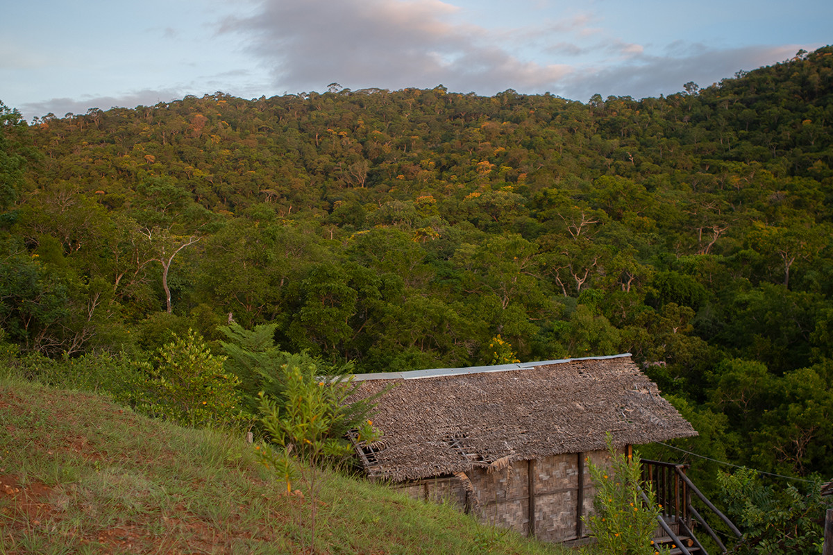
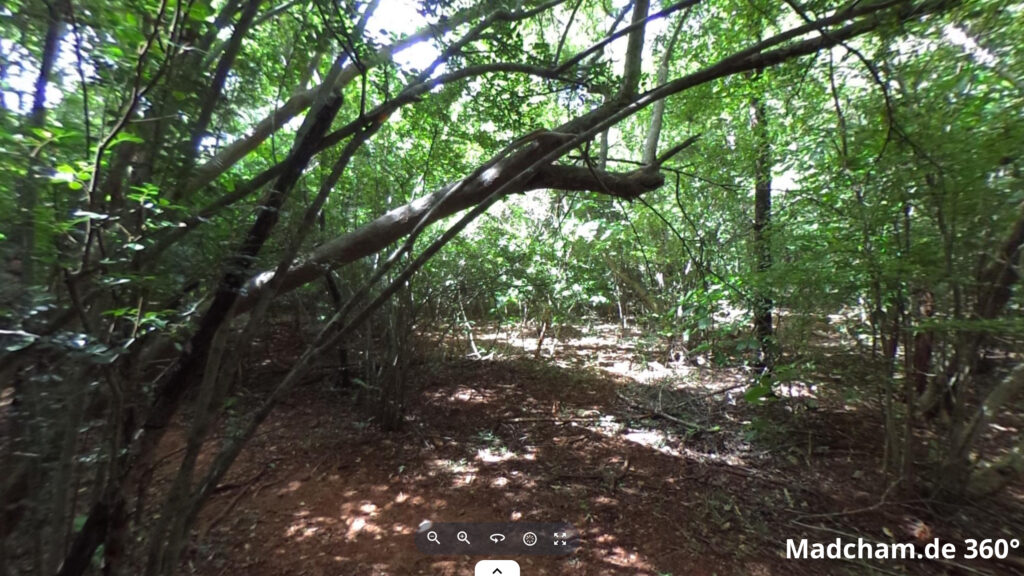
Below you will find some 360° pictures from the dry forest of Loky Manambato, which we took during the rainy season. If you click on the respective image, the pictures will open in an enlarged view in a separate window. You can use the mouse to rotate in all directions. You also have the option of running the images in full-screen mode. Have fun looking at them!


Das könnte dir auch gefallen


Follow us on Instagram

Most popular articles


Your travel specialist for Madagascar