

no legal export possible
First description:
(Gray, 1831)
Origin of the species name:
The English zoologist John Edward Gray was very brief in his description of this chameleon species: it consists of just keywords instead of a coherent sentence. In 1831 Gray was busy cataloging the reptile collection of the zoological department of the British Museum in London (Great Britain). One may assume that Gray borrowed the name of the chameleon species from the Latin cucullare. It means “hood” in English and probably describes the “hooded”, large occipital lobes of these chameleons.
Distribution:
The habitat of Calumma cucullatum extends from the eastern foothills of the central highlands of Madagascar of Vohidrazana to the evergreen rainforests of the Masoala National Park. Preference is given to dense rainforest areas. This type of chameleon is extremely difficult to find. Our finds are limited to the west of Masoala National Park and a small area near Vohidrazana.
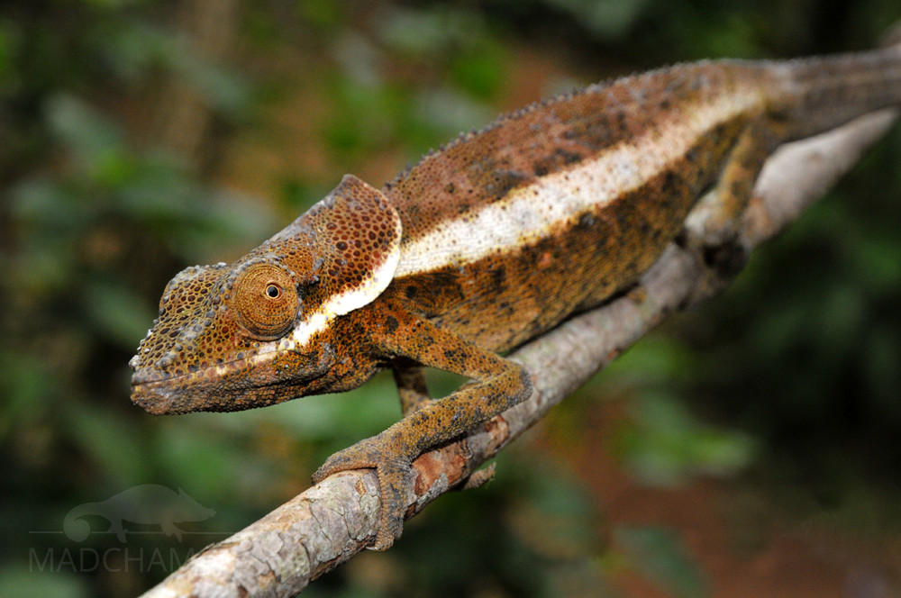
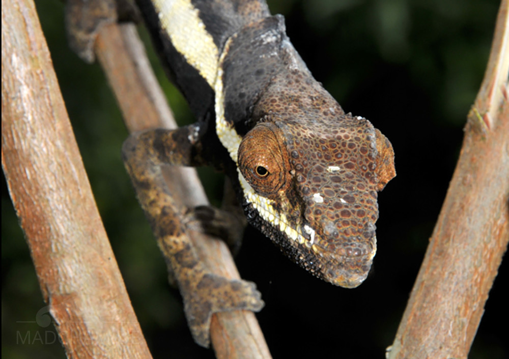
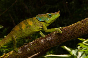
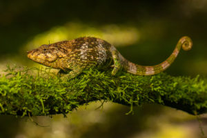
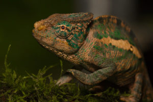
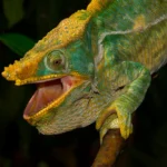
Appearance & size:
Calumma cucullatum is one of the larger chameleons with a total length of 31 to 38 cm. At the casque, they wear large occipital lobes connected at the upper base. They can be spread when excited to look more impressive. With some males, the rust ridge ends in two small snub noses. The dorsal crest alternately shows small and greatly enlarged conical scales, which are lacking in the throat and on the belly. The males are reddish-brown or grey and show a broad lateral stripe in stress, which extends from the corners of the mouth to the tail. The eyelids and a stain behind the shoulder are dyed blacks. The females are brown-green and shimmer yellowish at the throat and in the shoulder area.
| Jan | Feb | Mar | Apr | May | Jun | Jul | Aug | Sep | Oct | Nov | Dec | |
| Average temperature | 23 | 24 | 23 | 23 | 22 | 19 | 19 | 19 | 20 | 21 | 22 | 23 |
| Minimum temperature | 20 | 20 | 20 | 19 | 18 | 15 | 15 | 15 | 15 | 16 | 18 | 19 |
| Maximum temperature | 27 | 27 | 27 | 27 | 25 | 23 | 23 | 23 | 24 | 25 | 26 | 27 |
| Rain days | 27 | 24 | 26 | 19 | 17 | 18 | 21 | 20 | 15 | 16 | 20 | 25 |
We have collected the data given above over several years with thermometers and hygrometers at the finding places of the chameleons. "Average temperature" means that values of a whole month have been calculated to one average value per month. For example all measured minimum temperature values of February have been calculated to one average minimum temperature for February. In plain language, this means single peak values of a day may be a little higher or lower than the average minimum and maximum temperatures. It is possible that a location has an average maximum temperature of 29°C, but one day during that month it had 33°C or even 35°C there.
Three examples of a daily course of temperatures in Andasibe in the rainy season can be found below. Both were recorded with data loggers in 2023.
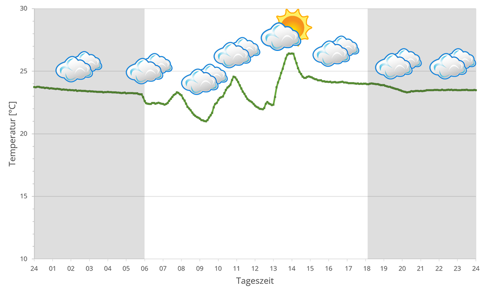
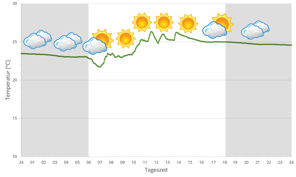
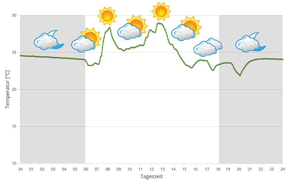
The region around Andasibe with the associated forests of Mantadia, Mitsinjo and Analamazaotra lie in the eastern highlands of Madagascar at altitudes between 900 and 1250 m above sea level. During the day, the temperature may sometimes exceed 25°C, but the thermometer rarely climbs above 30°C, or only in sunspots. At night, temperatures plummet, especially during the dry season. 10° to 15° degrees are the rule.
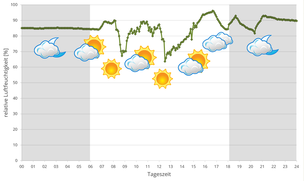
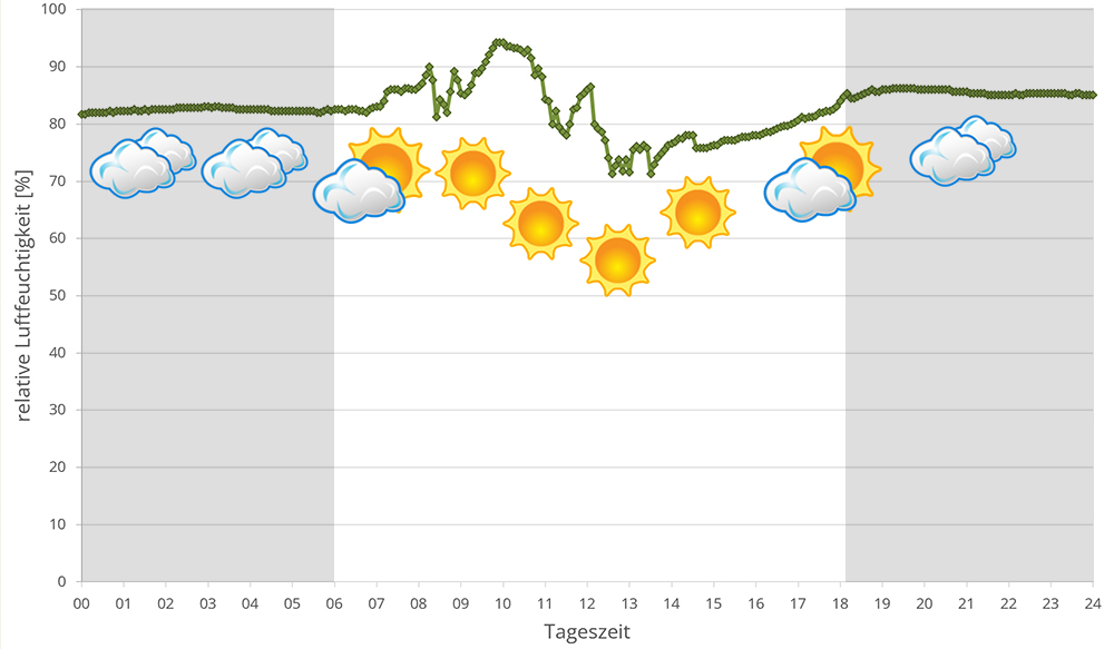
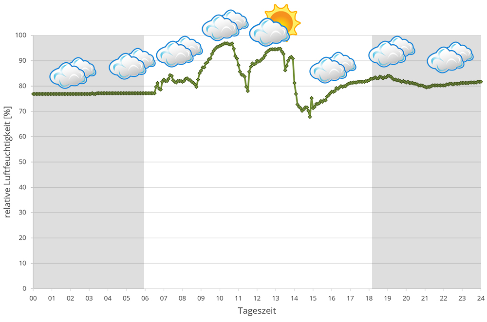
Humidity in the rainforests around Andasibe is high all year round. During the rainy season it rains extensively every day, sometimes the rain lasts for days. But the dry season is not massively different either, except that it has slightly cooler temperatures overall and reaches lower temperatures at night. It still rains at least every other day. Rain, high humidity and a drop in temperature at night are therefore the central points of Andasibe's climate. In 2023, we measured relative humidity with data loggers on different days in Andasibe in the rainy season, the data can be found below.
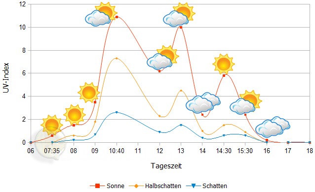
 Tageszeit = day time, Sonne = sun, Halbschatten = half shade, Schatten = shade
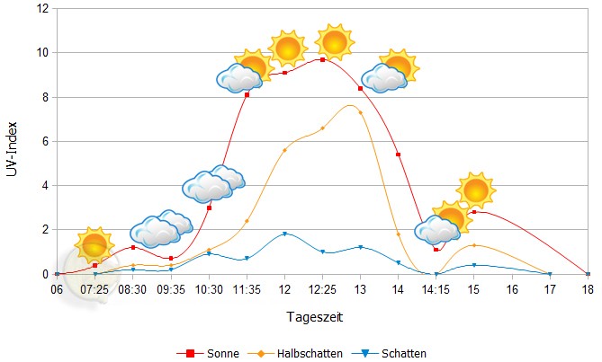
We have measured UVB data with a Solarmeter 6.5 in spring (March, April) at the peak of activity of chameleons in Madagascar. We always measured the values that a chameleon could maximally reach in its habitat.
| Jan | Feb | Mar | Apr | May | Jun | Jul | Aug | Sep | Oct | Nov | Dec | |
| Morning | 23,2 | 23,4 | 22,0 | 22,1 | 20,5 | 16,0 | 16,3 | 16,5 | 17,4 | 16,7 | 21,2 | - |
| Midday | 25,4 | 25,3 | 24,5 | 22,5 | 20,2 | 16,5 | 16,3 | 17,7 | 18,3 | 18,0 | 21,4 | - |
| Evening | 25,5 | 25,1 | 25,0 | 25,3 | 20,8 | 17,2 | 16,1 | 17,0 | 19,6 | 23,0 | 22,0 | - |
Between 21 March 2018 and 05 February 2019, we measured ground temperatures in the rainforest of Andasibe and surrounding areas (Analamazaotra, Andasibe, V.O.I.M.M.A. and Mitsinjo) about every other day - the table is the result of these measurements. Only in December no measurements were taken. detailed review can be found here. In total, we took 418 soil temperature measurements and measured an estimated 70 different locations in Andasibe and the surrounding area at a depth of 20 cm.
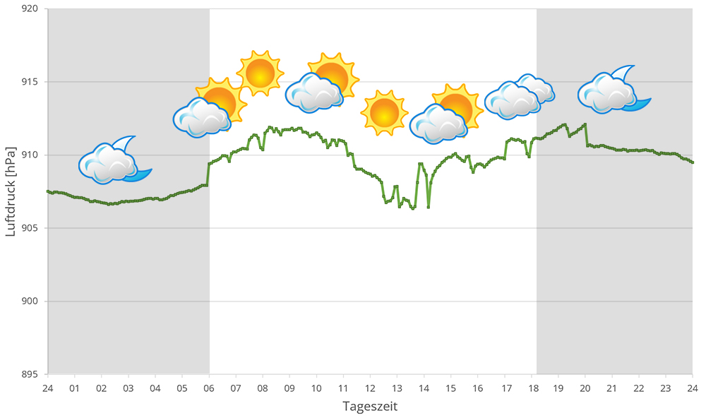
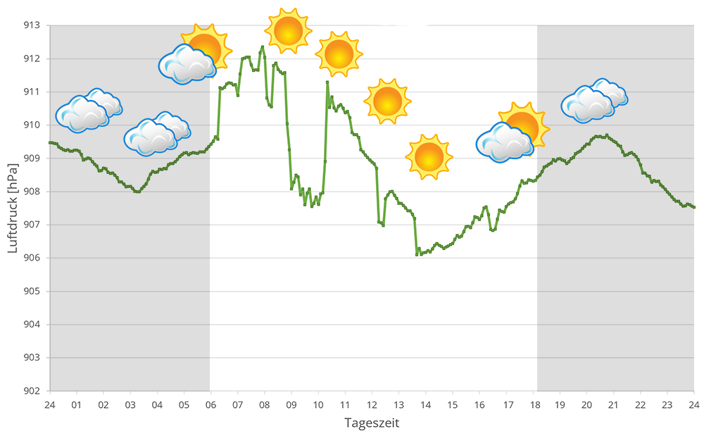
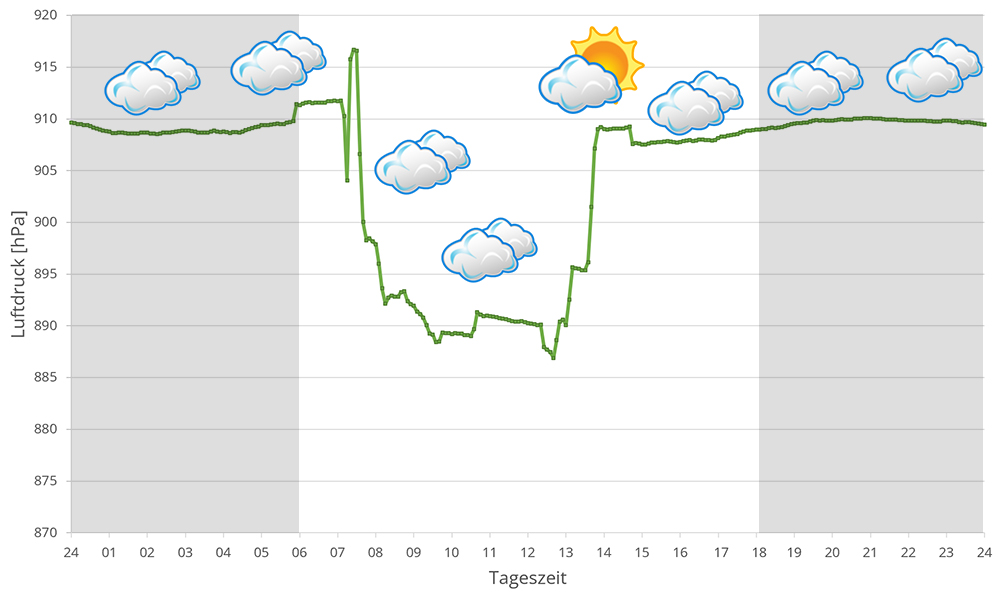
In 2023, in addition to other climate data, we also measured the air pressure at the locations we visited in Madagascar. The following data is from different days during the rainy season in Andasibe. On the X-axis is the time of day or night. In Madagascar, the day begins around 6 am, and night falls at 6 pm. The Y-axis shows the atmospheric pressure in hPa.
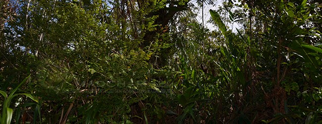
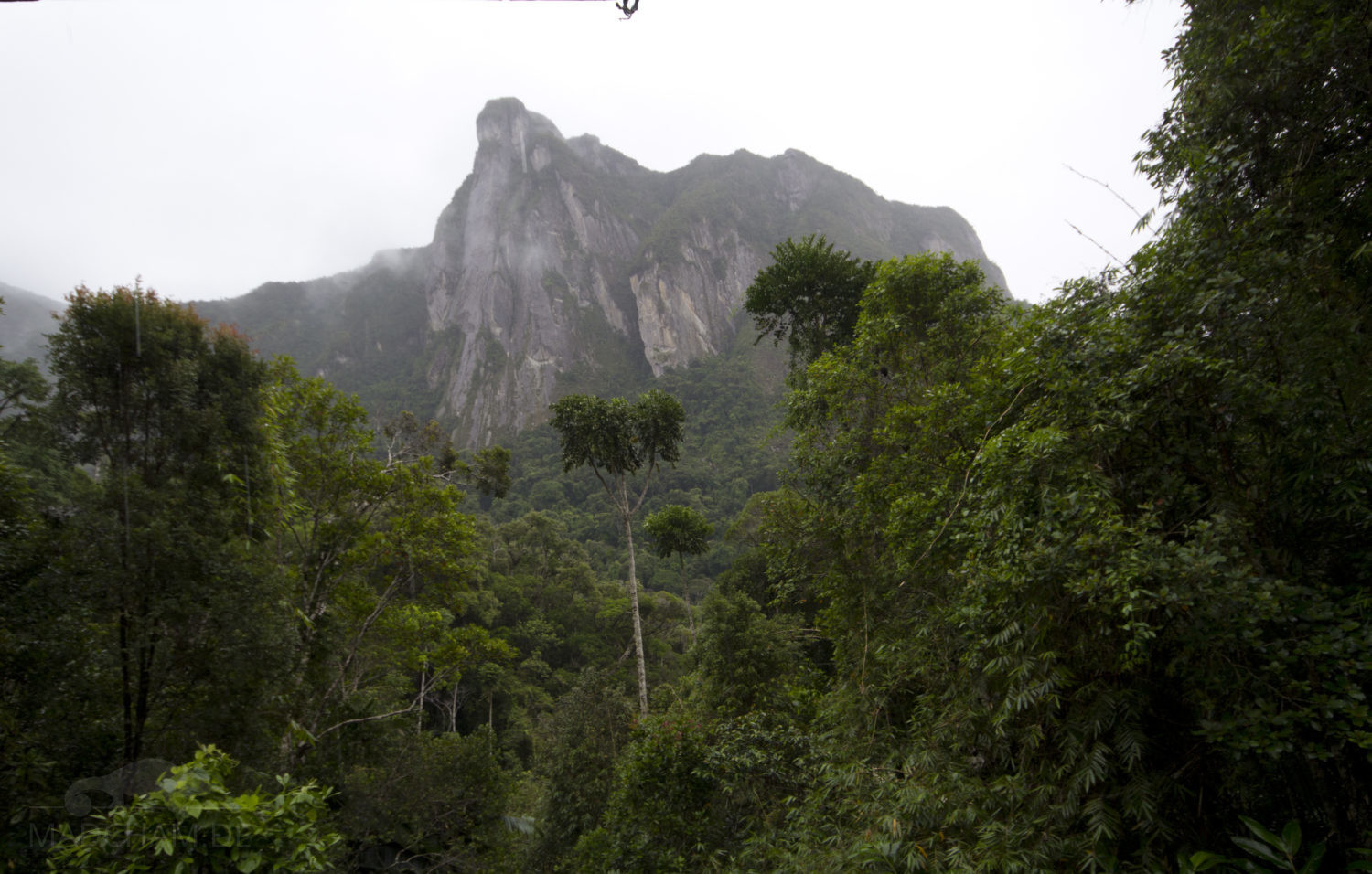
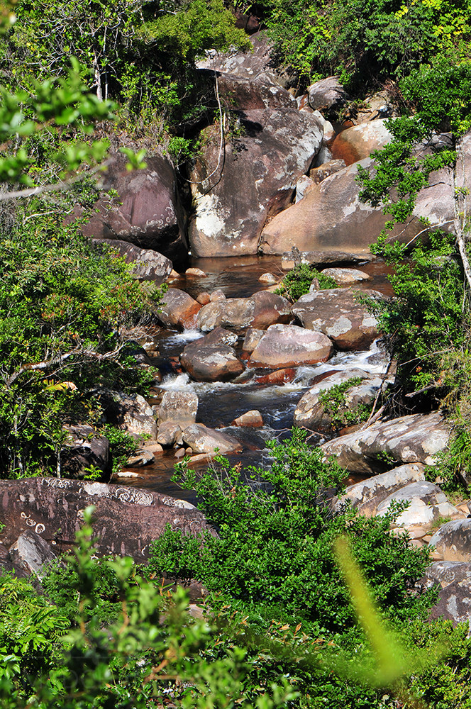
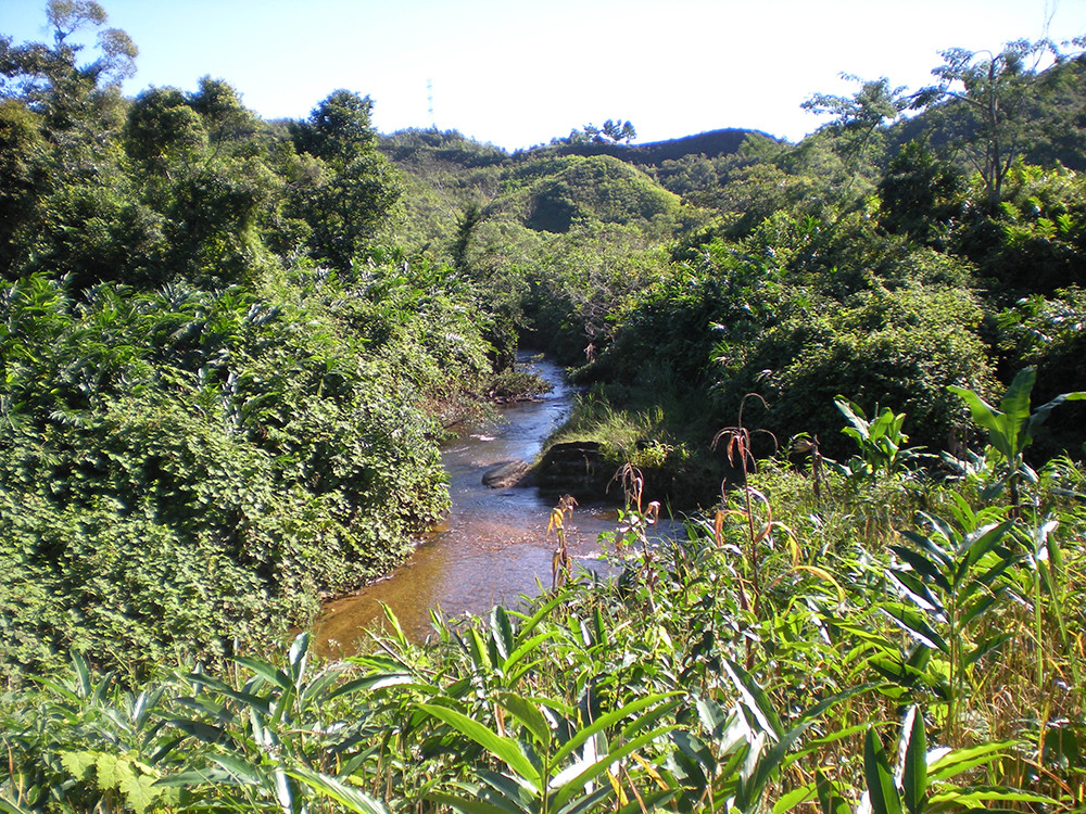
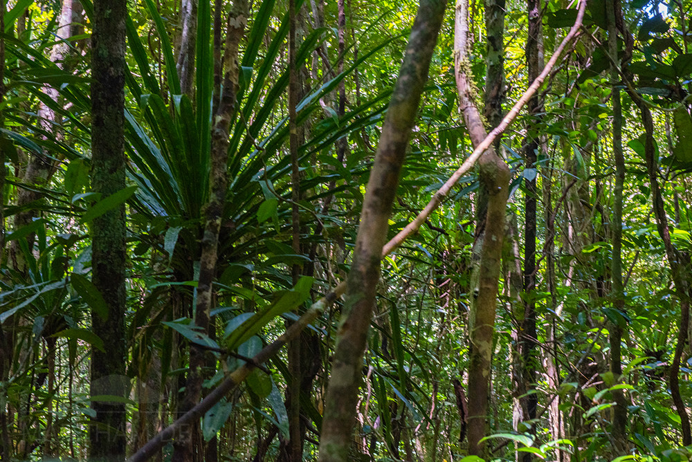
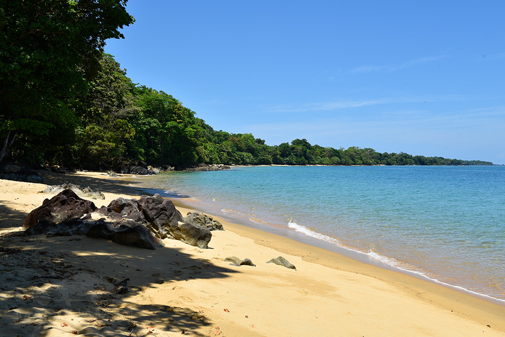
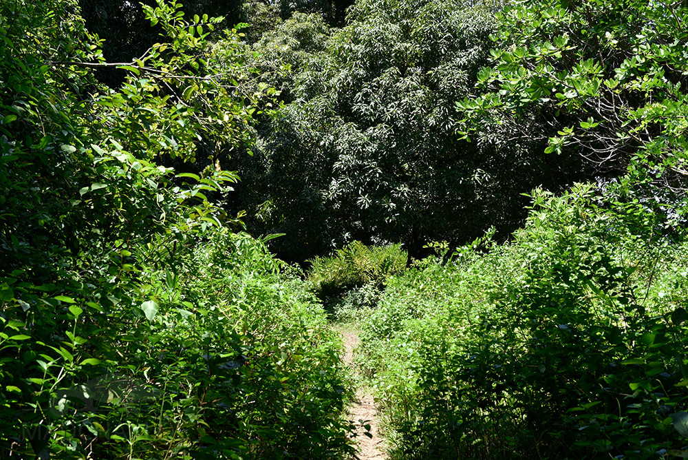
Habitat:
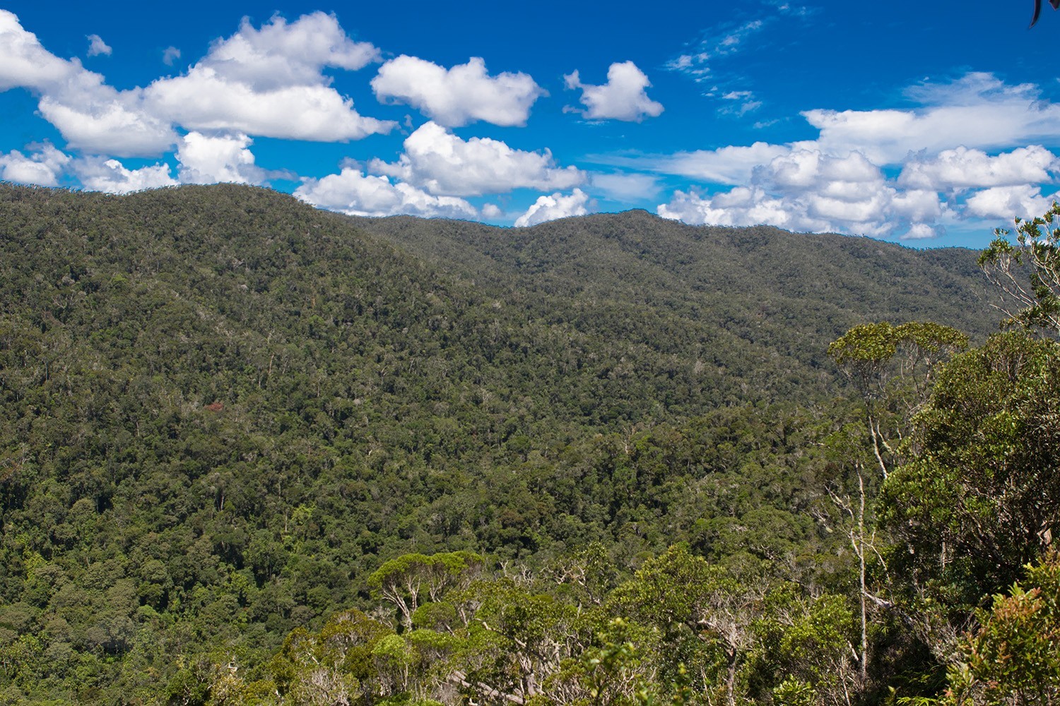
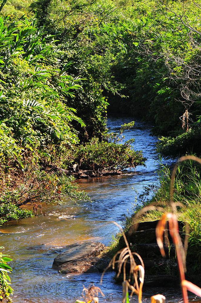
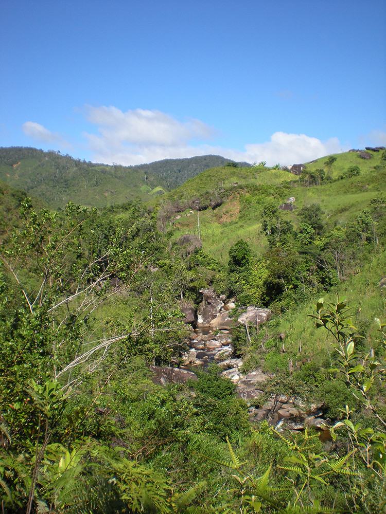
The following photos show parts of the habitat of Calumma cucullatum in Vohidrazana and Marojejy. The forest area of Vohidrazana, where the animals still occur, is located on a very steep slope and is difficult to access. It is full of secondary vegetation with thin trees and lots of bushes.


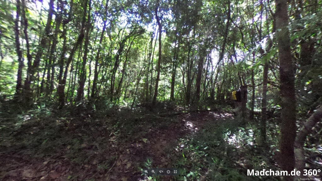
Below you will find some 360° images from the area around Vohidrazana and in Marojejy that we took during the rainy season. If you click on the respective image, the pictures will open in an enlarged view in a separate window. You can use the mouse to rotate in all directions. You also have the option of running the images in full-screen mode. Have fun looking at them!


Das könnte dir auch gefallen


Follow us on Instagram

Most popular articles


Your travel specialist for Madagascar