Distribution of the local form:
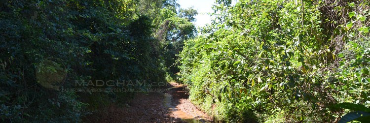
Cap Est (French name for Cape East) is located on the east coast of Madagascar in the immediate vicinity of Masoala National Park. It is not a village, but the name of the easternmost tip of Madagascar, simply an uninhabited piece of land. The area consists of secondary vegetation, remnants of littoral forests, and mangroves. The nearest village is a little south of Cap Est and is called Ambodirafia. Cap Est is bordered to the north by the Onive River. Cap Est lies only slightly above sea level.
Coastal villages, rice fields as well as their direct surroundings (and thus also Cap Est) do not officially belong to the Masoala National Park – despite the fact that many huts and rice fields were and still are built illegally. However, the area belongs to a so-called buffer zone. In this buffer zone, there are, among other things, rules for logging, the creation of new rice fields, and the catching of wildlife. Originally, the buffer zone was intended to prevent the local people from losing their livelihood despite the establishment of a national park. In addition, this peripheral area with permitted logging was intended to ensure that less logging would occur within the park boundaries themselves. In fact, today the actual park boundary is difficult to discern on the ground, as there is a smooth transition from cleared land areas with secondary vegetation to the rainforest.
Cap Est is difficult to access, which is why hardly any travelers ever get to see it. To get there, one currently has to fly to Sambava on a Twin Otter, drive from there to Antalaha by off-road vehicle, and then negotiate an off-road dirt road to Ambodirafia. Ecotourism activities of Masoala National Park are limited to the western side of the park in Antongil Bay. In the area of Cap Est, there is little to be seen of it, any tourist infrastructure does not exist. In addition, there is still frequent illegal logging of rosewood in the area within the national park boundaries. The small harbors in the villages near Cap Est are used to ship the illegal cargo unnoticed. Due to its exposed location, Cap Est is hit by cyclones every year around the turn of the year.
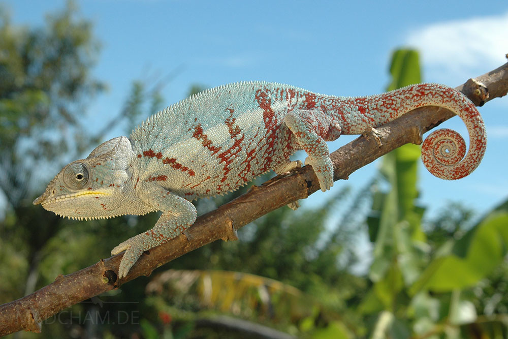
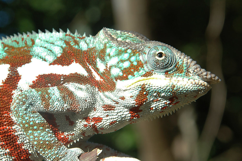
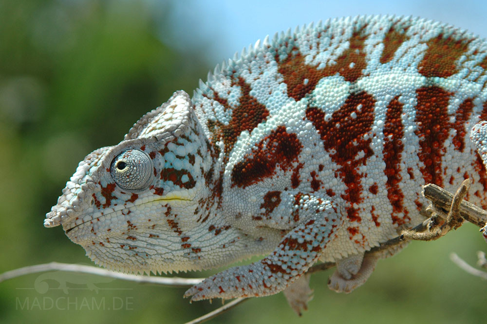
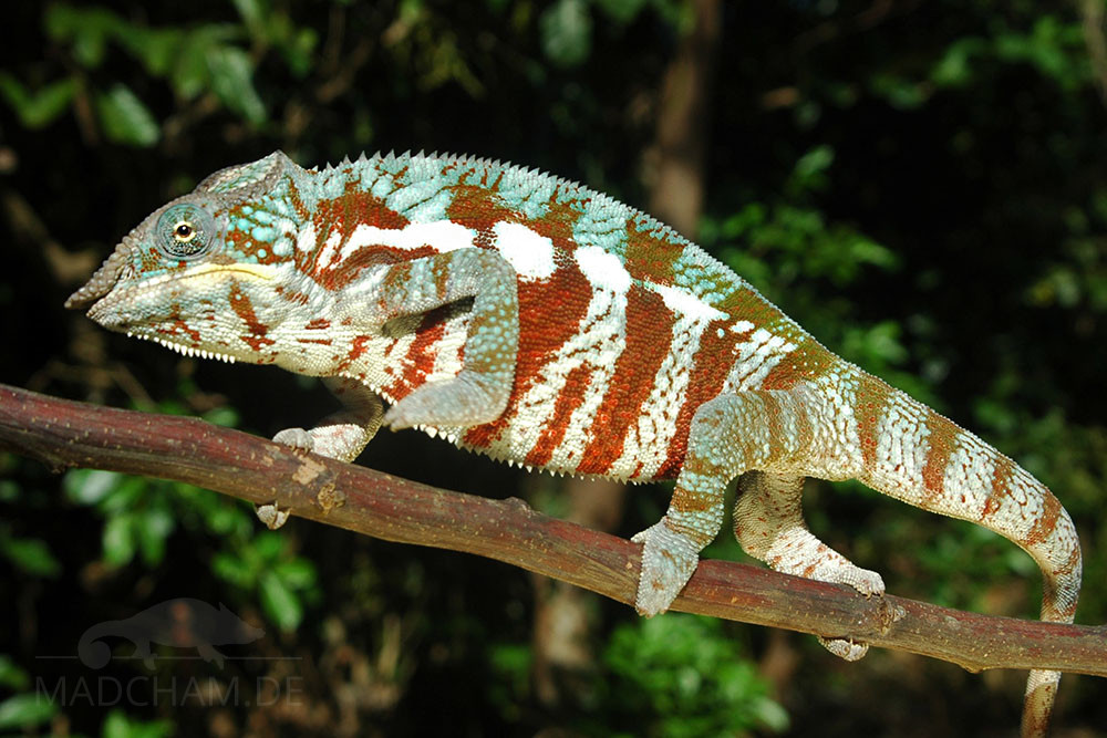
Appearance of the local form:
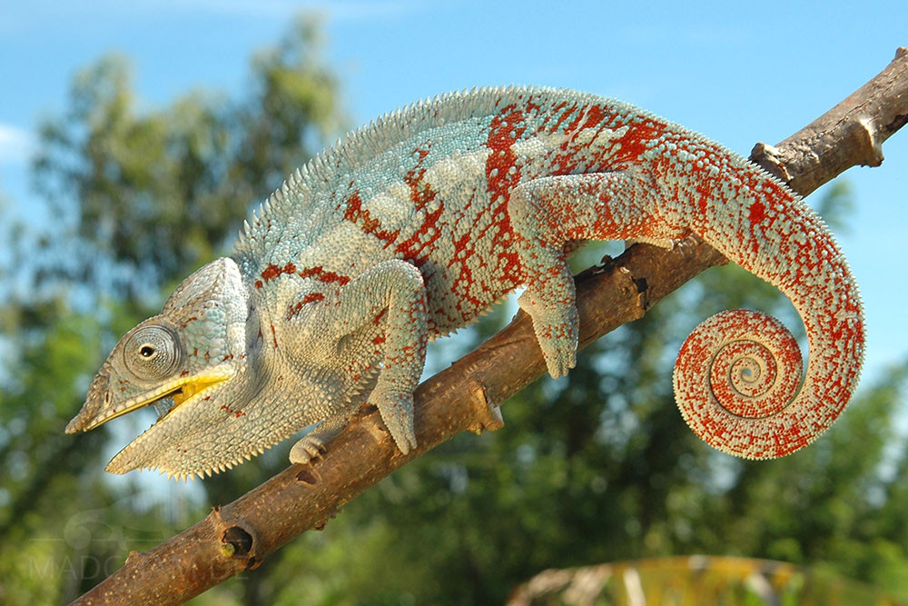
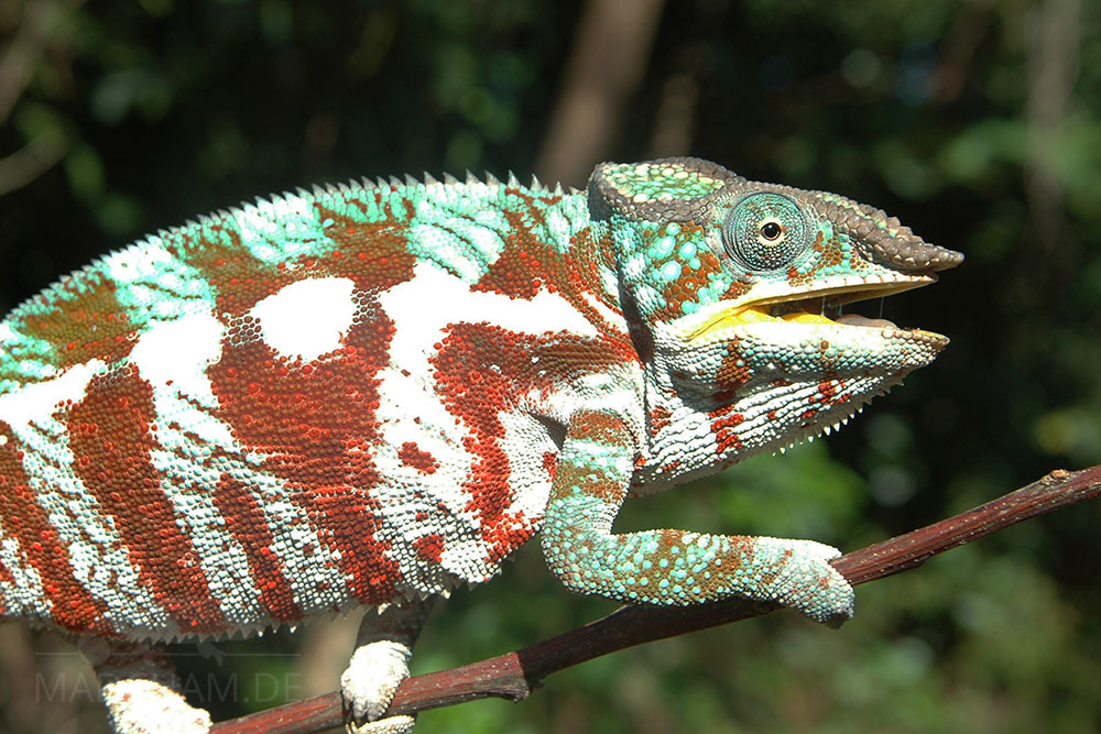
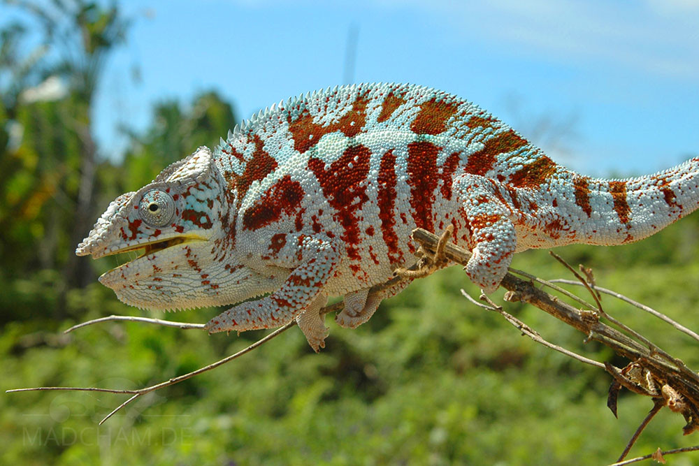
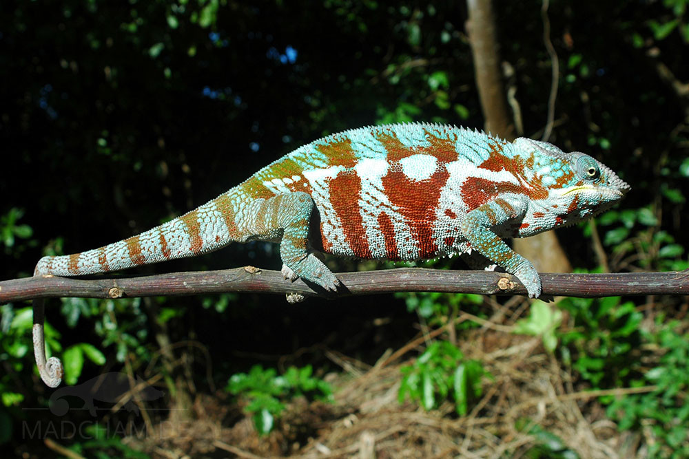
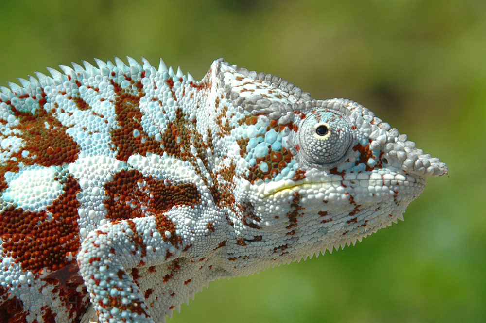
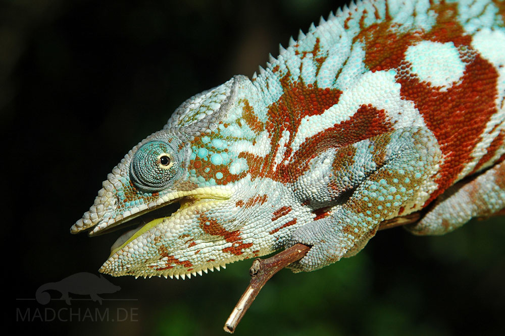
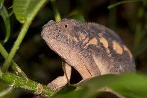
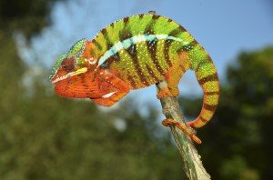
Due to its isolated location, a very color-faithful local form of the panther chameleon is found at Cap Est: the males are white with deep red banding. The white areas have partly dove-blue tints. Some animals have significantly more white and light blue than others. The female panther chameleons look here like everywhere else on Madagascar. The local form Cap Est bears no resemblance to the panther chameleons found in Masoala National Park, despite its proximity.
Weight table
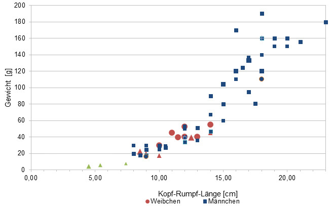
Gewicht = weight in grams, Kopf-Rumpf-Länge = snout-vent-length in cm, Weibchen = females, Männchen = males
Since 2015, we have been measuring the weights of chameleons found by us in Madagascar, as far as the animals (and our scales) participate. In the long term, we aim to obtain an average weight in relation to snout-vent-length (measured from the tip of the nose to the cloaca) for each species from as many measurements as possible. It is important to know that all weights were measured towards the end of the rainy season (= best food supply), so these should be maximum weights on Madagascar. Triangular symbols in females mean not pregnant, round symbols mean pregnant. In Furcifer pardalis, contrary to our original assumption, it has so far turned out that there are no serious differences in the ratio of SVL to weight between the individual local forms.
| Jan | Feb | Mar | Apr | May | Jun | Jul | Aug | Sep | Oct | Nov | Dec | |
| Average temperature | 24 | 25 | 25 | 24 | 24 | 23 | 21 | 20 | 21 | 22 | 23 | 24 |
| Minimum temperature | 20 | 21 | 20 | 20 | 18 | 17 | 16 | 16 | 17 | 17 | 19 | 20 |
| Maximum temperature | 28 | 29 | 28 | 27 | 25 | 25 | 25 | 25 | 25 | 27 | 27 | 28 |
| Rain days | 26 | 23 | 25 | 19 | 17 | 18 | 21 | 21 | 16 | 17 | 20 | 24 |
We have collected the data given above over several years with thermometers and hygrometers at the finding places of the chameleons. "Average temperature" means that values of a whole month have been calculated to one average value per month. For example all measured minimum temperature values of February have been calculated to one average minimum temperature for February. In plain language, this means single peak values of a day may be a little higher or lower than the average minimum and maximum temperatures. It is possible that a location has an average maximum temperature of 29°C, but one day during that month it had 33°C or even 35°C there.
Several examples of a daily pattern of temperatures in Masoala in the rainy season are given below. They were recorded with data loggers in 2023.
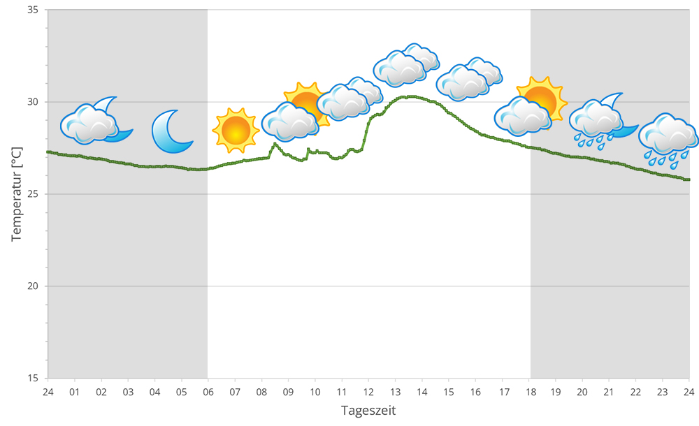
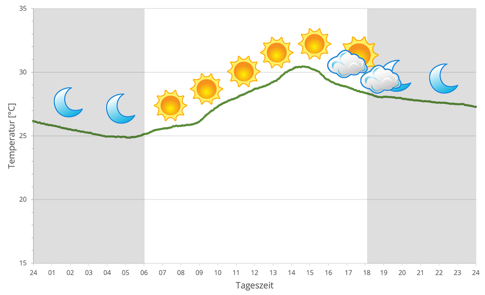
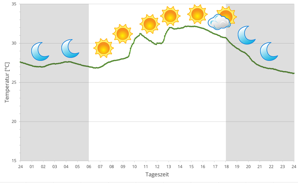
Masoala's rainforest is located at the coast with broad side to Antongil bay which behaves more like an open sea concerning climate. Accordingly, spring brings cyclones each year. During rainy season, it rains very intensively on a daily base. But also dry season is not really dry but has regular precipitation.
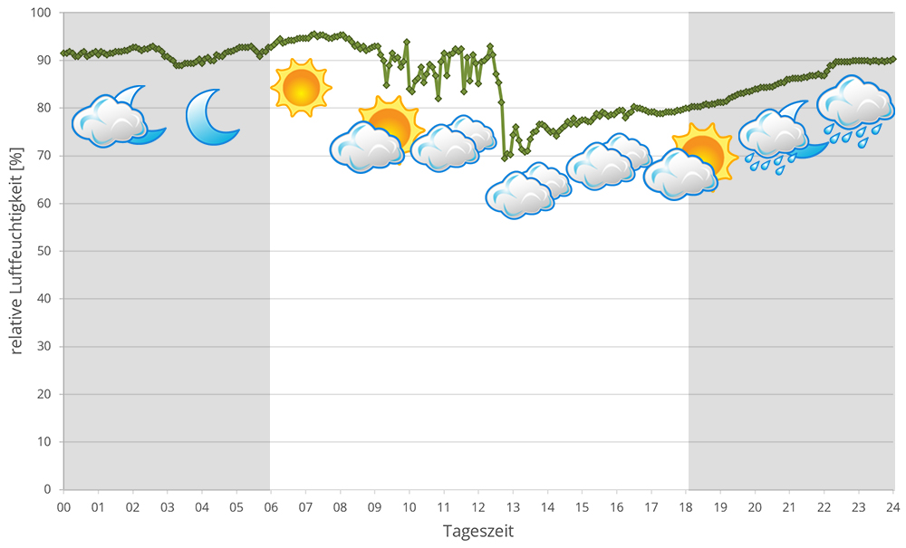
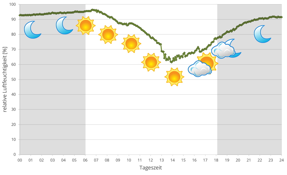
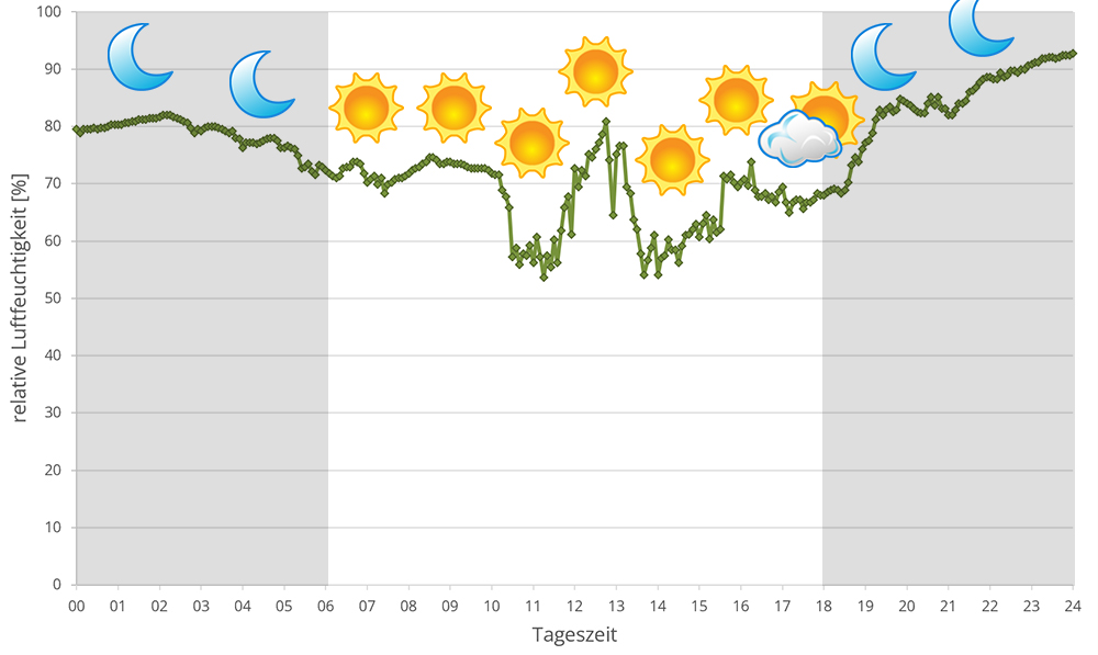
From October to April it is warmer than usual in Masoala, with temperatures reaching over 30°C in sunny spots. At night, temperatures drop only slightly. The rest of the year, from May to September inclusive, it is different: at night, during the dry season, temperatures plummet to 16°C at night, while at night it is still Mediterranean warm. In 2023 we measured relative humidity with data loggers on several days in Masoala during the rainy season, the data can be found below.
 Tageszeit = day time, Sonne = sun, Halbschatten = half shade, Schatten = shade
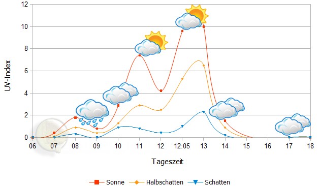
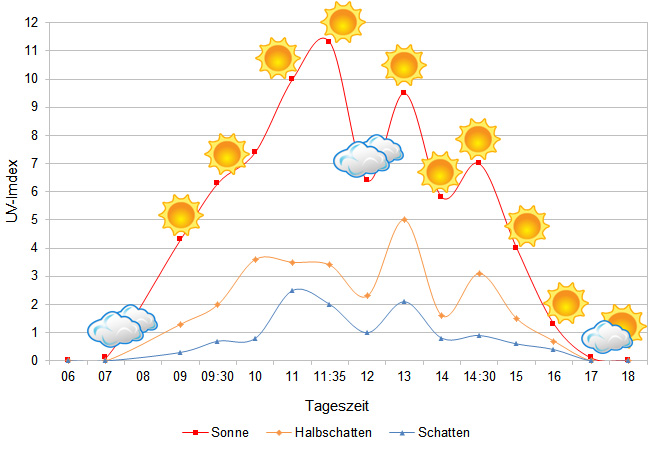
We have measured UVB data with a Solarmeter 6.5 in spring (end of March) at the peak of activity of chameleons in Madagascar. We always measured the values that a chameleon could maximally reach in its habitat.
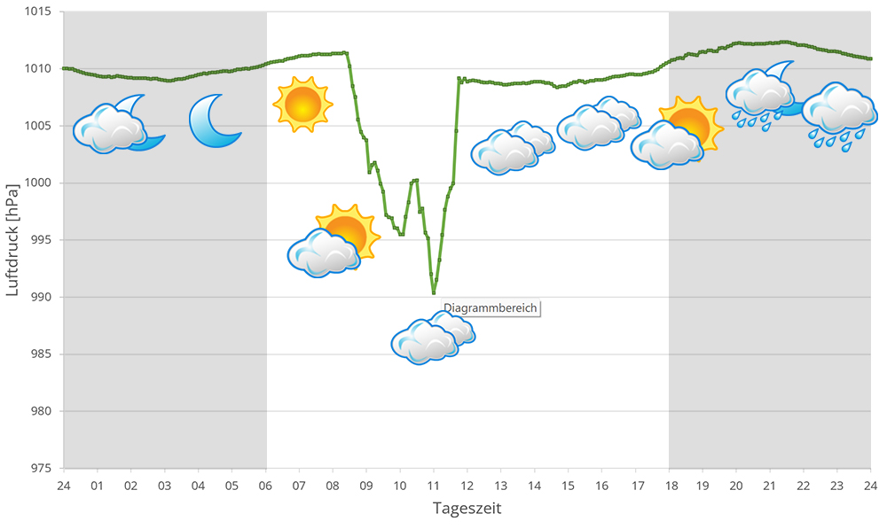
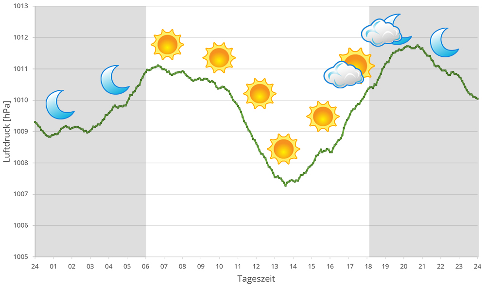
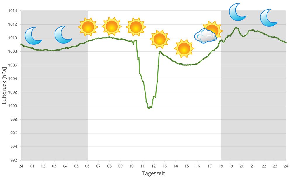
In 2023, in addition to other climate data, we also measured the air pressure at the places we visited in Madagascar. The following data is from several days during the rainy season in Masoala. The X-axis shows the time of day or night. In Madagascar, the day begins around 6 am, and night falls at 6 pm. The Y-axis shows the atmospheric pressure in hPa.
Habitat:
The habitat of the panther chameleons here consists mainly of secondary vegetation. Banana plants, palm trees, and a lot of bushes with countless climbing plants form a dense green. The laterite and earthy sandy soil is thickly covered with foliage and undergrowth. Large trees are found mainly in the direction of the National Park. The land area of Cap Est passes directly into the beach on the Indian Ocean. Panther chameleons are found less near the beach than in banana plantations and overgrown scrub around rice fields.
Das könnte dir auch gefallen


Follow us on Instagram

Most popular articles


Your travel specialist for Madagascar