Distribution of the local form Mananara:
On Madagascar’s east coast, directly across from Masoala national park at Antongil bay, there is Mananara Nord national park. It belongs to Analanjirofo region and is only accessible by boat from Maroantsetra. The national park consists of about 144 km² of rainforest and maritime area, including the three islands Nosy Antafana, Nosy Rangontsy, and Nosy Hely. Thus it is the second-largest UNESCO biosphere reserve of Madagascar. Due to its remote location, travelers hardly come here, and the difficult journey there plays its part, too. Sadly, up to date, it is almost impossible to travel to Mananara. There is no experienced local guide there and without one, you are not allowed to visit a national park. Mananara is separated from the neighbouring local form Maroansetra by several rivers.
Appearance of the local form:
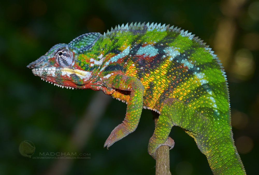
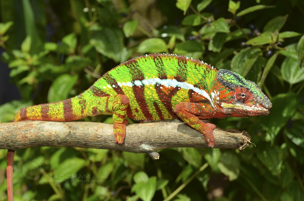
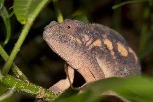
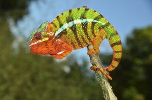
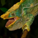
The male panther chameleons here have a green ground colour with dark banding and orange accents on the head and belly. Older males show much more red on the head and limbs, and red banding on a green-yellow background. The local form Mananara thus strongly resembles the neighbouring local form Maroansetra, especially in younger male panther chameleons.
Weight table
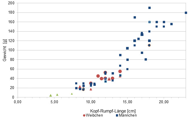
Gewicht = weight in grams, Kopf-Rumpf-Länge = snout-vent-length in cm, Weibchen = females, Männchen = males
Since 2015 we have been measuring the weights of chameleons we have found in Madagascar, as far as the animals (and our scales) are participating. So far there are only a few weights, in the long term an average weight in relation to the snout-vent-length It is important to know that all weights were measured towards the end of the rainy season (= best food supply), so they are probably maximum weights in Madagascar. Triangular symbols in females do not mean pregnant, round symbols mean pregnant. In the case of Furcifer pardalis, contrary to our original assumption, there have been no serious differences in the ratio of SVL to the weight of the individual local forms.
| Jan | Feb | Mar | Apr | May | Jun | Jul | Aug | Sep | Oct | Nov | Dec | |
| Average temperature | 24 | 25 | 24 | 24 | 23 | 21 | 20 | 20 | 21 | 22 | 23 | 24 |
| Minimum temperature | 20 | 21 | 20 | 20 | 18 | 17 | 16 | 16 | 17 | 17 | 19 | 20 |
| Maximum temperature | 28 | 29 | 28 | 27 | 25 | 25 | 25 | 25 | 25 | 27 | 27 | 28 |
| Rain days | 26 | 23 | 25 | 19 | 17 | 18 | 21 | 21 | 16 | 17 | 20 | 24 |
We have collected the data given above over several years with thermometers and hygrometers at the finding places of the chameleons. "Average temperature" means that values of a whole month have been calculated to one average value per month. For example all measured minimum temperature values of February have been calculated to one average minimum temperature for February. In plain language, this means single peak values of a day may be a little higher or lower than the average minimum and maximum temperatures. It is possible that a location has an average maximum temperature of 29°C, but one day during that month it had 33°C or even 35°C there.
The rainforest of Mananara is located at the edge of Antongil bay which is behaving more like an open sea concerning climate. Accordingly, there are often heavy cyclones in spring. During rainy season, it rains daily and very intensively. But also dry season has regular precipitation.
From October to April, it is warmer in Mananara with temperatures above 30°C in sunny places. In the night, temperatures drop a little, but only in dry season fall down to 15°C. High humidity and moderate warmth are the key factors of this region.
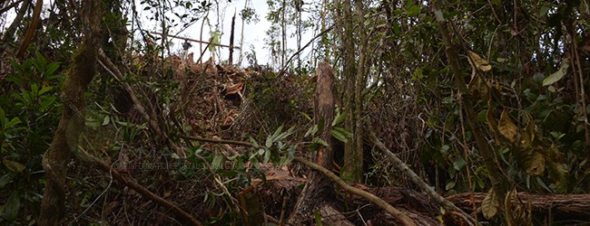
Habitat:
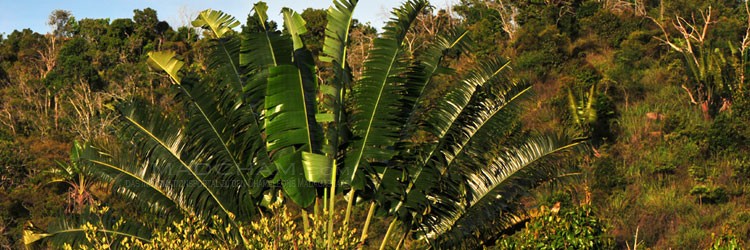
Mananara North consists of a rainforest with rocks overgrown with moss, many lianas, huge trees, and very dense undergrowth. In the immediate vicinity of the town, mainly secondary vegetation is found. The soil is very sandy, in keeping with its location directly on a sea bay.
Das könnte dir auch gefallen


Follow us on Instagram

Most popular articles


Your travel specialist for Madagascar