

Distribution of the local form Nosy Komba:
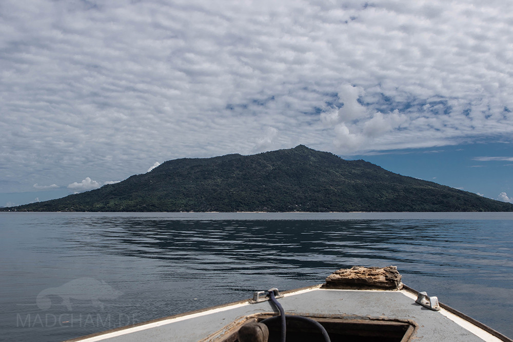
Nosy Komba is an island in the northwest of Madagascar. It is located in close proximity to the islands Nosy Be and Nosy Tanikely directly opposite the coastal town Ankify. Actually the former volcanic island is called Nosy Ambariovato, but because of the tame lemurs living there, it has been called Nosy Komba (akomba is Malagasy for lemur) for years. The island is almost circular and has a diameter of about eight kilometers.
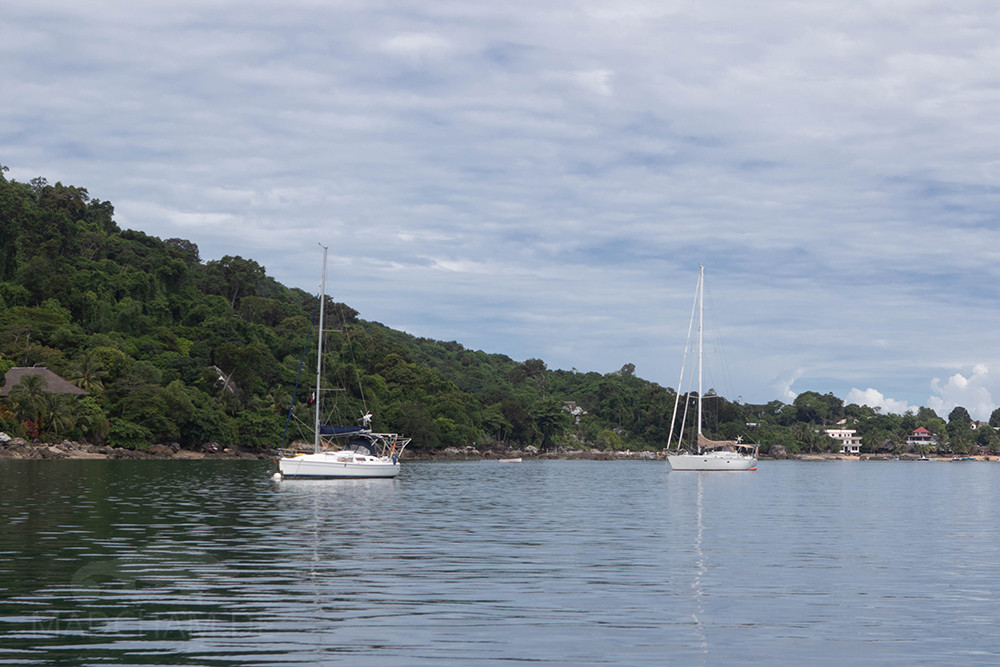
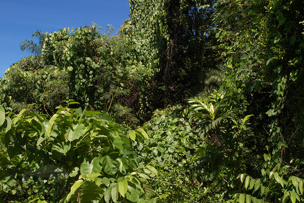
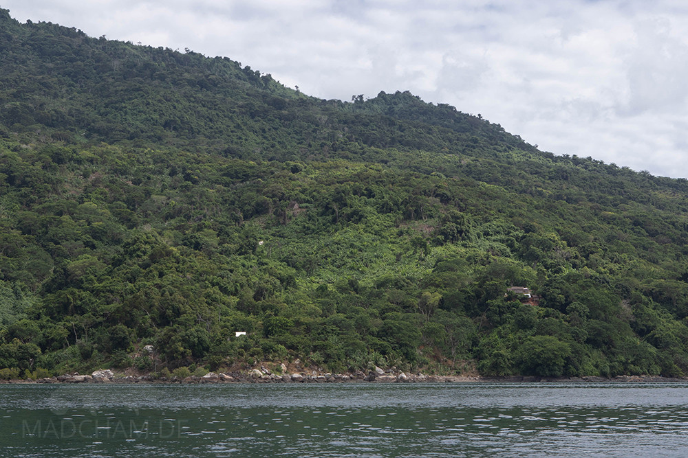
Nosy Komba is relatively well developed for tourism due to its proximity to Nosy Be, in contrast to many other areas of Madagascar. The largest village on the island, Ampangorina, lives from its small harbor and the countless souvenir shops, which make up almost half of the huts. An actually protected forest also exists on Nosy Komba, but only covers 0.6 km². The panther chameleons here live almost everywhere on the island, mostly in secondary vegetation.
Appearance of the local form:
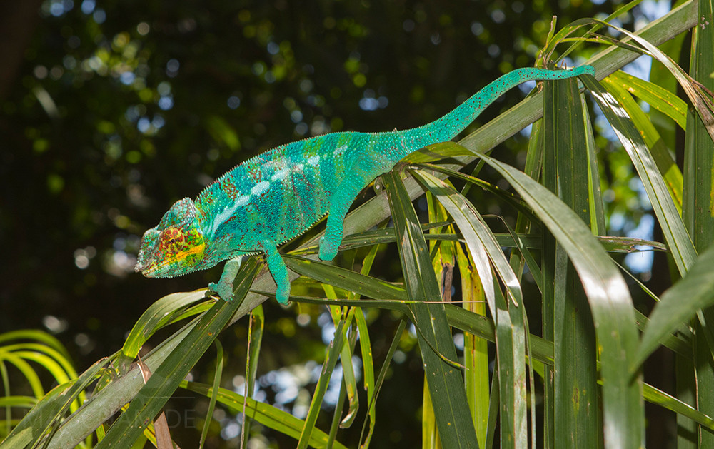
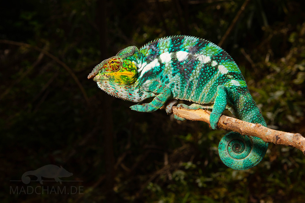
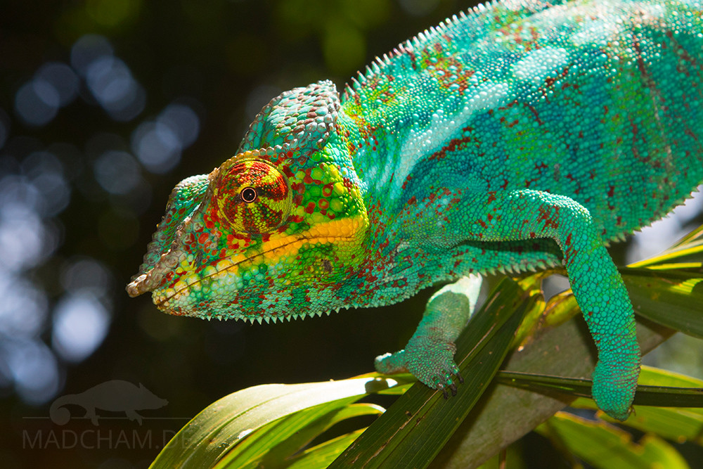
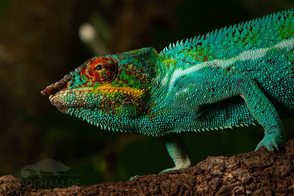
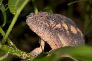
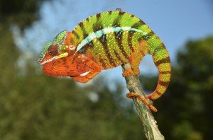
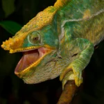
The local form of Nosy Komba looks similar to the neighboring local form of Nosy Be. However, the panther chameleon males on Nosy Komba are more uniform in color. They wear a turquoise blue ground color with light green bands, under stress, the turquoise blue bands become almost black. The eyelids have red stripes, the corners of the mouth are strongly yellow. All the animals we have found on Nosy Komba so far show bright red spots all over the body – but the individual characteristics vary.
Weight table
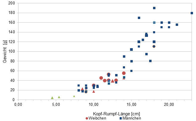
Since 2015, we have been measuring the weights of chameleons found by us in Madagascar, as far as the animals (and our scales) can deal with it. We hope to be able to read an average weight in relation to snout-vent-length (measured from the tip of the nose to the cloaca) for each species from as many measurements as possible. It is important to know that all weights were measured towards the end of the rainy season (= best food supply), so it should be maximum weights on Madagascar. Triangular symbols in females mean not pregnant, round symbols mean pregnant. In Furcifer pardalis it has turned out so far, contrary to our original assumption, that there are no serious differences in the ratio of SVL to weight between the individual local forms.
| Jan | Feb | Mar | Avr | May | Jun | Jul | Aug | Sep | Oct | Nov | Dec | |
| Average temperature | 26 | 26 | 25 | 24 | 22 | 20 | 20 | 20 | 21 | 23 | 24 | 26 |
| Minimum temperature | 22 | 22 | 21 | 19 | 16 | 16 | 15 | 15 | 16 | 18 | 20 | 21 |
| Maximum temperature | 31 | 31 | 30 | 30 | 28 | 26 | 25 | 25 | 27 | 28 | 29 | 30 |
| Rain days | 24 | 22 | 20 | 13 | 9 | 7 | 7 | 8 | 9 | 11 | 15 | 20 |
The given data were measured and compiled by us within several years with thermo- and hygrometers directly at the finding places of the animals. "Average temperature" means that the values of an entire month were calculated to an average value, e.g. all measured minimum values of a month were calculated to an average minimum value for February. This means in plain language that individual peak values of a day can be significantly higher or lower than the average minimum and maximum values. It is therefore possible that although the average maximum is 29 degrees, it was 33°C or even 35°C warm on some days of the month.
The climate on the islands off Madagascar's northwest coast is very warm all year round. Temperatures above 30°C occur regularly. At night the temperatures in the rainy season fall only slightly below 25°C, during the dry season they drop considerably lower down to 15°C, and even lower on a daily basis.
During the rainy season it rains very abundantly and a lot. From April to October it stays mostly dry and sunny on the islands, but still rains from time to time. Therefore it never gets completely dry on the islands and the vegetation remains green all year round.
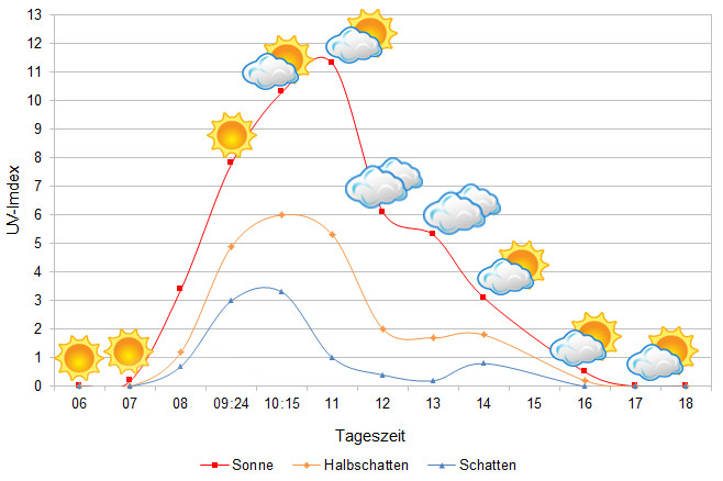
The UVB data were measured with a Solarmeter 6.5 in spring (March) at the highest activity time of the chameleons. The maximum values to be achieved by the chameleon in the habitat were measured.
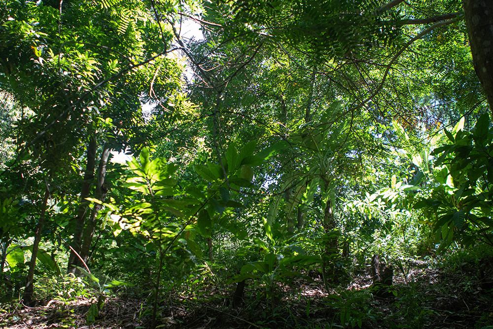
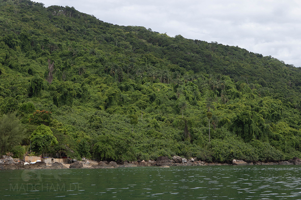
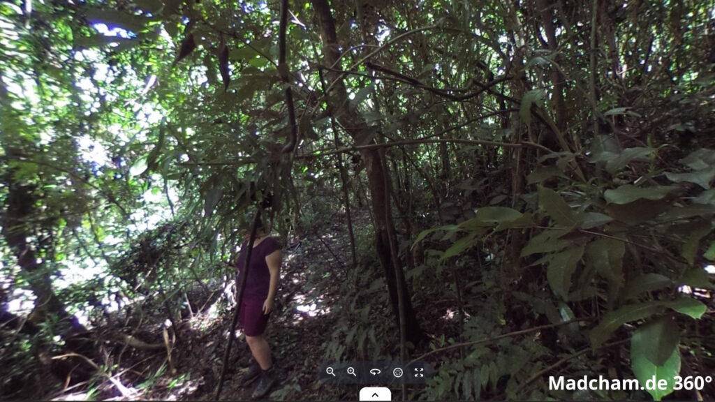
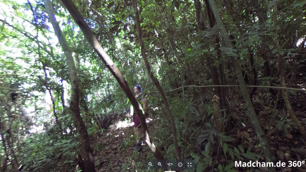
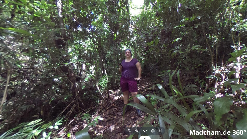
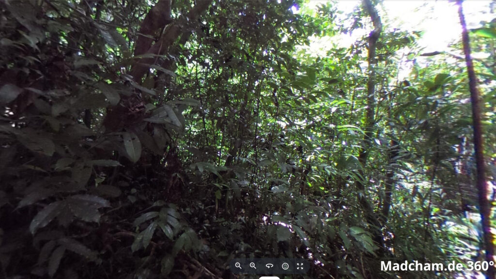
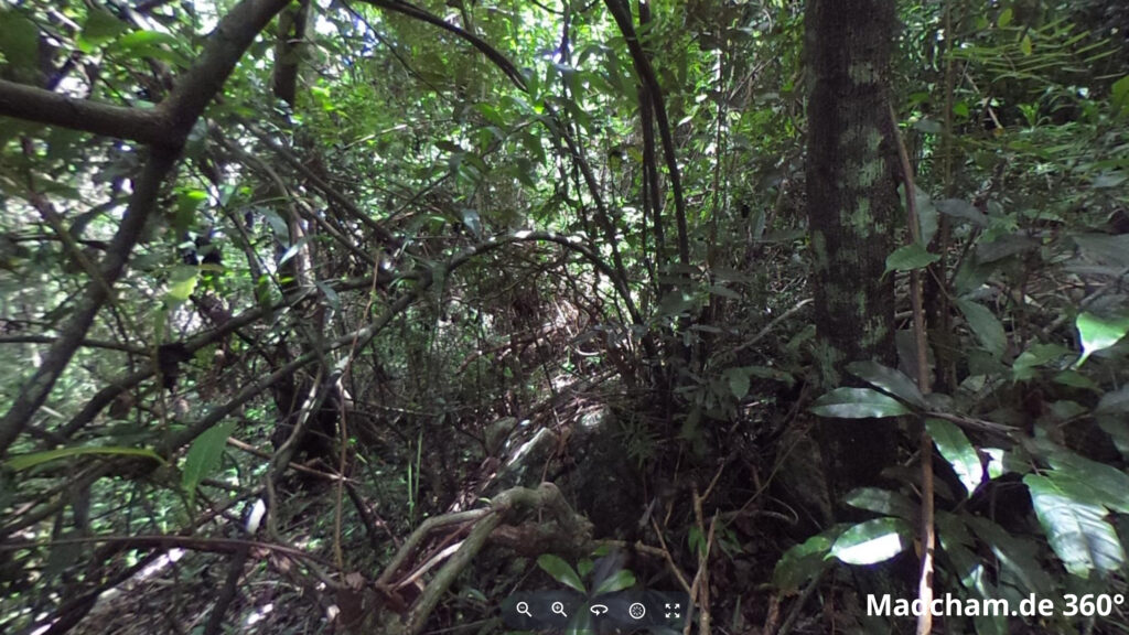
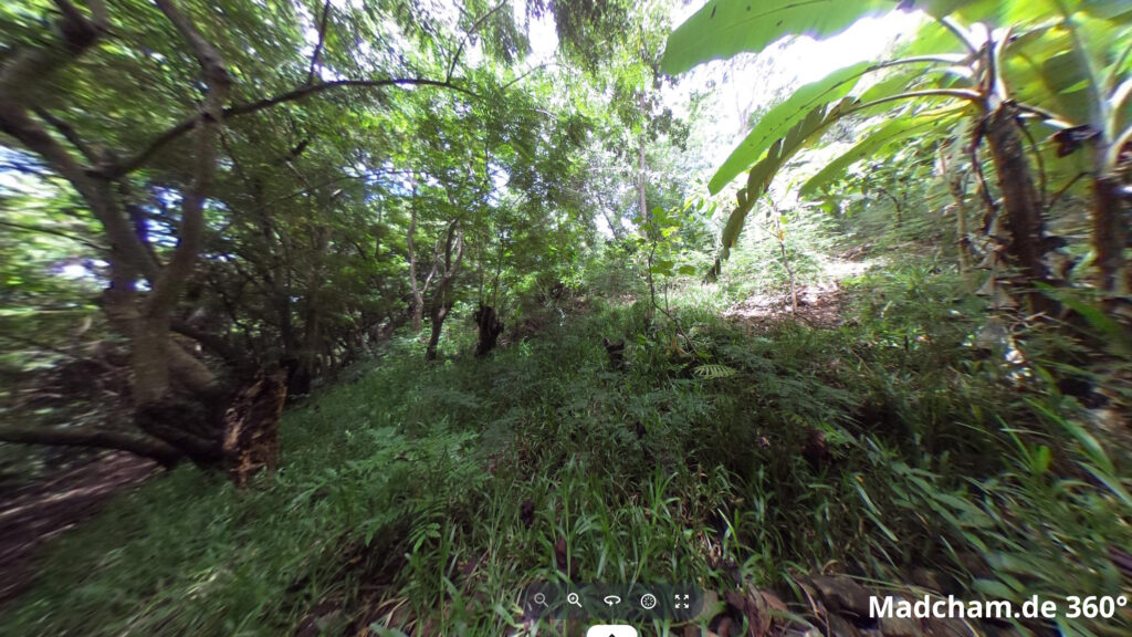
Habitat:
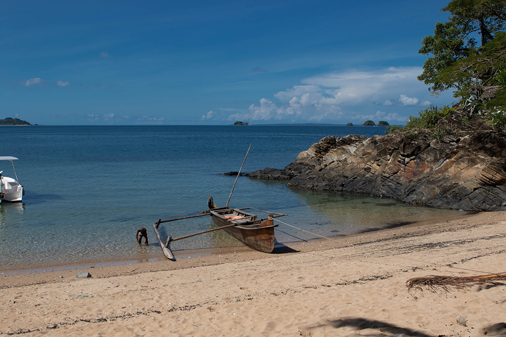
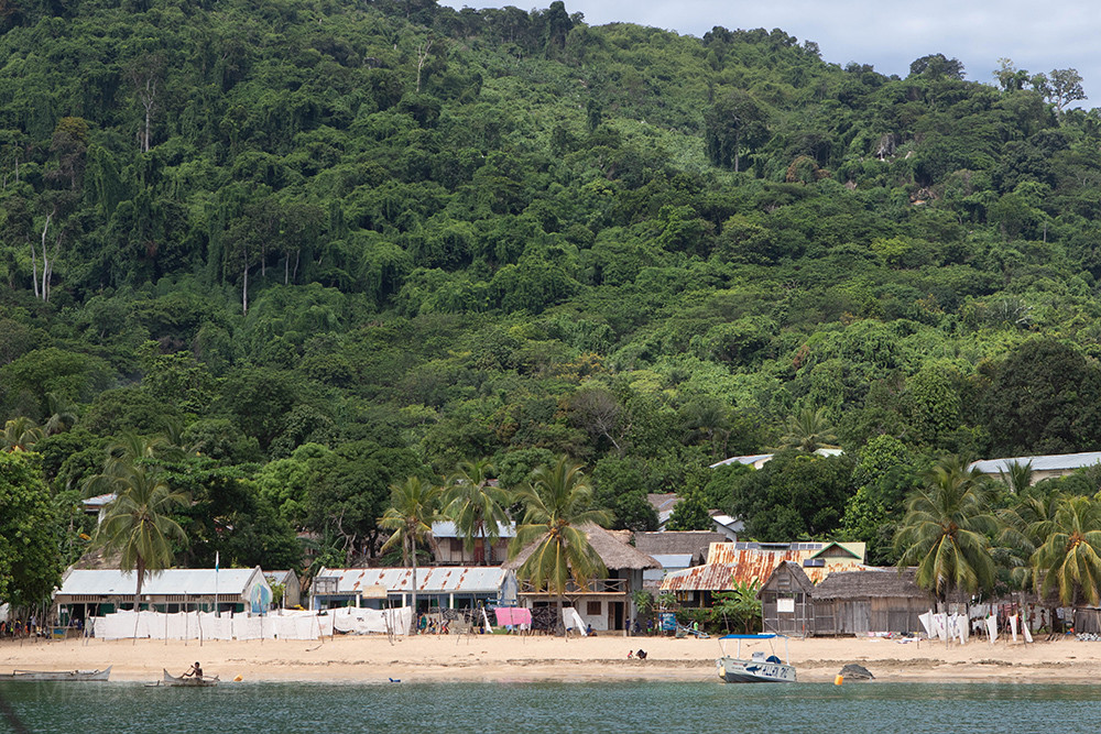
The main habitat of the panther chameleons here is secondary vegetation. The following pictures show different parts of the island, Ampangorina and the habitat of Furcifer pardalis on Nosy Komba.
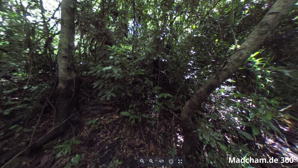
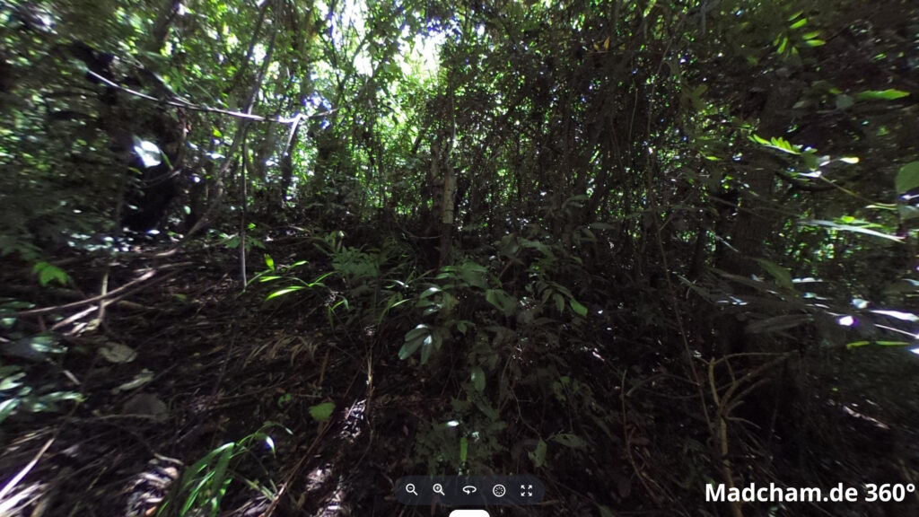
Below you will find 360° images of Nosy Komba that we took during the rainy season. Several are from locations where this local form is found. If you click on the respective image, the pictures will open in an enlarged view in a separate window. You can use the mouse to rotate in all directions. It is also possible to run the images in full screen mode. Have fun looking at them!
Das könnte dir auch gefallen


Follow us on Instagram

Most popular articles


Your travel specialist for Madagascar